- Tennessee State Route 5
Infobox road
state=TN
type=Dual
route=5
alternate_name=U.S. Highway 45 , U.S. Highway 45W
maint=TDOT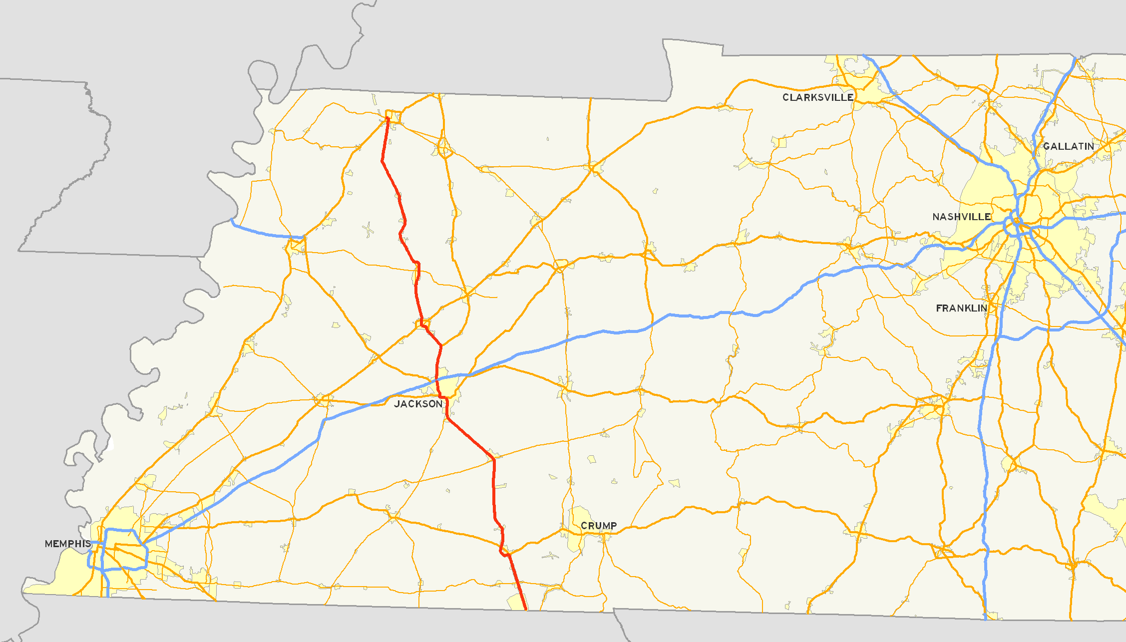
length_mi=120
length_round=2
length_ref= [http://www.tdot.state.tn.us/materials/pavement/Documents/Region4(All%20Counties)(PROTECTED).xls TDOT Region 4 Pavement Condition Data] ]
established=1917
direction_a=South
starting_terminus= State Line
junction=
direction_b=North
ending_terminus=
counties=McNairy, Chester, Madison, Gibson, Obion
cities=Selmer, Henderson, Jackson, Humboldt, Trenton, Union City
previous_type=Dual
previous_route=4
next_type=Dual
next_route=6
commons=galleryState Route 5 (abbreviated SR 5) is a major south-north
highway inWest Tennessee . SR 5 is 120 miles long and, except for the section north of Union City, is overlapped with US 45 & 45W.Route description
SR 5 is the hidden designation for US 45 and US 45W for most of the highway's length through the state. SR 5 at its southern terminus is a 4-lane, divided,
limited-access expressway and is designated as a primarystate highway . In contrast, the northern terminus is quite rural in nature and exists as a two-lane secondary state highway. SR 5 follows Highland Avenue through the City ofJackson, Tennessee and US 45 Business throughHumboldt, Tennessee . AtUnion City, Tennessee , SR 5 becomes a fully-signed secondary highway and follows First Street and Main Street through the city. At its junction with US 51, SR 5 continues along Main Street and becomes a primary state highway which overlapsTennessee State Route 22 . At Lake Drive in Union City,Tennessee State Route 22 turns west towardSamburg, Tennessee . SR 5 past Lake Drive is signed as a secondary state highway and continues north toward the state line. The signed portion of SR 5 exists entirely withinObion County, Tennessee and is approximately 7.8 miles in length.Tennessee Department of Transportation [http://www.tdot.state.tn.us/Maps/county/default.htm County Maps] and [http://www.tdot.state.tn.us/Maps/city/ City Maps] ]Counties traversed
SR 5 traverses the following counties (south to north) shown in the table below.
Counties traversed by State Route 5 County miles kilometers McNairy 28.17 45.34 Chester 9.74 15.68 Madison 26.29 42.31 Gibson 32.46 52.24 Obion 23.34 37.56 History
Several old alignments (most are two-lane) of SR 5 exist throughout the state with the most notable examples being near the
Mississippi state line, a section of old highway 45 between Bethel Springs and Selmer,Tennessee State Route 367 through Trenton, and a long stretch of old highway between Trenton and Rutherford.Originally, SR 5 north of Trenton followed a much different route from the current alignment. From Trenton, SR 5 bent to the northeast, following the old Dresden Road as far as Greenfield, where it turned north and roughly followed the present-day SR 43. As evidenced by road maps published by the National Map Company and Rand McNally, sometime between 1927 and 1935, SR 5 was rerouted to follow the former SR 41 north to Kenton and on to Union City.
Future
TDOT has proposed widening SR 5 in Obion County as part of The 2008-2010 Transportation Improvement Program. Right-of-way acquisition will begin in FY 2008 on a section of SR 5 from Troy Station Road to Allie Campbell Road and in FY 2010 for the section between Allie Campbell Road and SR 22. This will leave a two-lane section of SR 5 from
Rutherford, Tennessee to a point just north of theObion River . [ [http://www.tdot.state.tn.us/roadprojects/2007 TDOT 2008-2010 Transportation Improvement Program] ] [ [http://ww2.tdot.state.tn.us/public/2005/1003-0405gibson-obion.pdf Project # 66008-1227-14 Notice of Highway Corridor Public Meeting - US 45W/SR-5] ]Major intersections
References
Wikimedia Foundation. 2010.