- Tennessee State Route 18
Infobox road
state=TN
type=TN
route=18
alternate_name=
maint=TDOT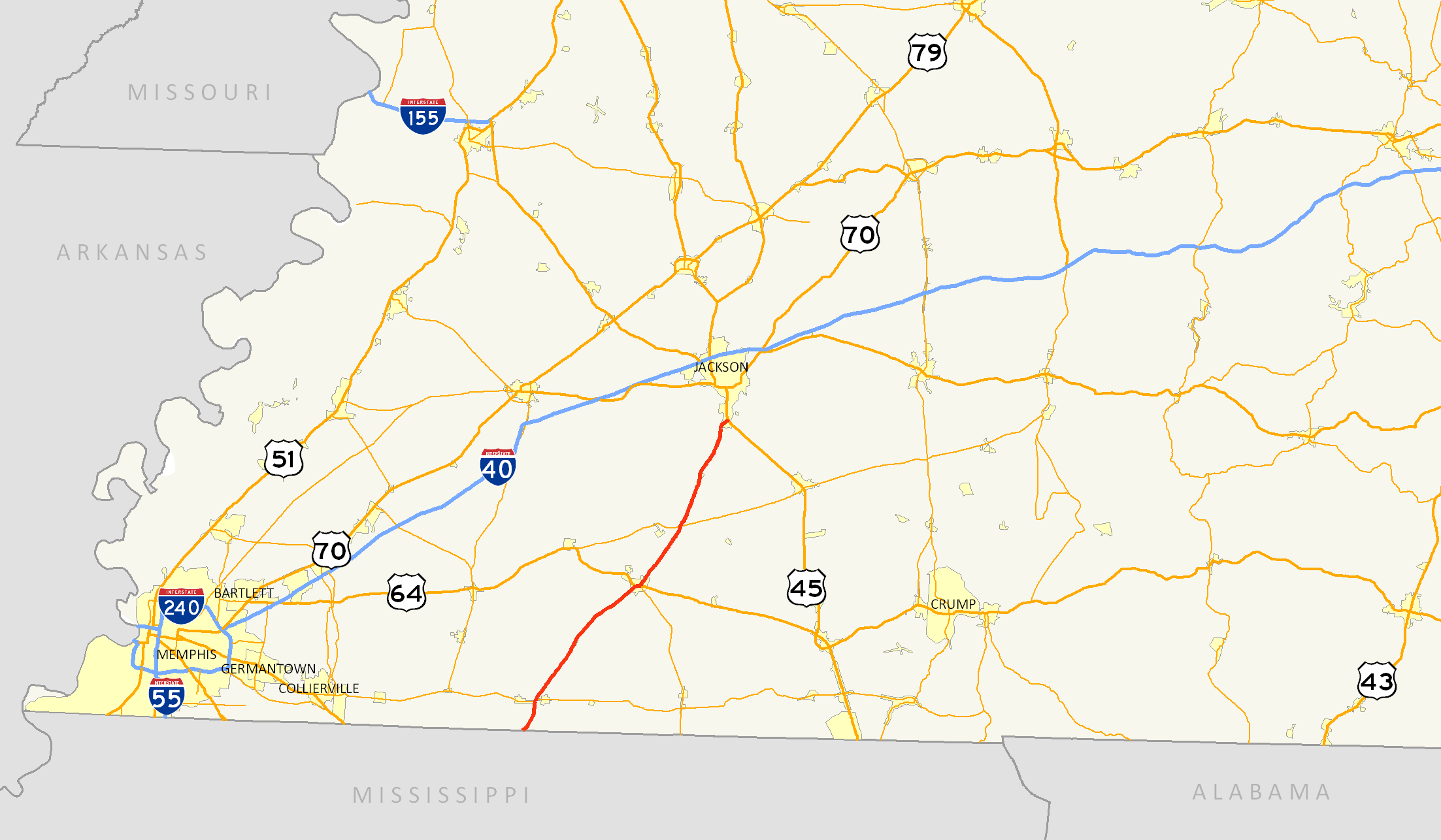
length_mi=46.35
length_round=2
length_ref= [http://www.tdot.state.tn.us/materials/pavement/Documents/Region4(All%20Counties)(PROTECTED).xls TDOT Region 4 Pavement Condition Data] ]
established=
direction_a=South
starting_terminus=jct|state=MS|MS|7 atMississippi State Line
junction=jct|state=TN|US|64 at Bolivar
direction_b=North
ending_terminus=jct|state=TN|US|45 at Jackson
counties=Fayette, Hardeman, Madison
cities=La Grange, Grand Junction, Bolivar, Medon, Jackson
previous_type=Secondary
previous_route=17
next_type=US
next_route=19State Route 18 (abbreviated SR 18) is a primary
state highway in south-centralWest Tennessee . SR 18 is a two-lane facility throughout the majority of its length through the state with the exception being inBolivar, Tennessee . SR 18 has a short concurrency with US 64 and also with SR 125 at Bolivar.Route description
Fayette County
Tennessee Department of Transportation [http://www.tdot.state.tn.us/Maps/county/default.htm County Maps] and [http://www.tdot.state.tn.us/Maps/city/ City Maps] ]
SR 18 begins in extreme southeastern Fayette County inWest Tennessee at the northernterminus ofMississippi Highway 7 [http://www.gomdot.com/maps/County_maps/Benton.pdf MDOT Benton County, MS Highway Map] ] as a rural two lane route. This route continues in a northeasterly direction through rural Fayette County and briefly overlaps SR 57 at the community of La Grange near the Hardemancounty line .Hardeman County
At Bolivar, SR 18 continues its northeasterly trek through the city as Tennessee Street and is also overlapped withUS 64 . SR 18 is a four-lane undivided highway while overlapped with US 64 and passes nearby the site of theWestern State Mental Health Institute on the western outskirts of the city. At the Hardeman County Courthouse, SR 18 breaks away from US 64 and turns left on North Main Street. Also at this location, SR 125 begins a 3.12 mile hidden overlap with SR 18 at the courthouse. Outside the Bolivarcity limits , SR 18/SR 125 continue north through theHatchie River bottoms before reaching the community of Shandy. At Shandy, the SR 18 & SR 125 overlap ends with SR 125 turning north on Silerton Road towardChickasaw State Park . SR 18 in northern Hardeman County traverses sparsely populated farmland and swampland and intersects with SR 138 and SR 100. The junction of SR 18 & SR 100 is a grade-separateddiamond interchange where SR 18 expands briefly to a four-lane divided highway. North of this intersection, SR 18 resumes its northbound routing towards Jackson as a rural two-lane highway.Madison County
SR 18 continues as a two-lane route through rural southwestern Madison County and passes through the community of Medon and Malesus just south of the Jackson city limits. In Jackson, the route ends at an expansive signalized intersection withUS 45 and hidden SR 5, known locally as South Highland Avenue.Counties traversed
SR 18 traverses the following counties, south to north, shown in the table below.
Counties traversed by State Route 18 County miles kilometers Fayette 5.54 8.92 Hardeman 30.98 49.86 Madison 9.83 15.82 History
Little has changed along SR 18 since its designation as a state route. Prior to 1981, SR 18 had one alternate route near Grand Junction which was originally signed as State Route 18Acite encyclopedia|year=1981-1982|title=1981 Tennessee Official Transportation Map|encyclopedia=|publisher=Tennessee Department of Transportation|location=Nashville, Tennessee] . This entire route was renamed to what is now known as
Tennessee State Route 368 .SR 18 roughly follows the original route of the
Mississippi Central Railroad .Future
In Hardeman County, an
Environmental Impact Statement is currently underway to determine the feasibility of widening SR 18 from its current two-lane status to a divided four-lane highway [http://www.tdot.state.tn.us/sr18/ Tennessee Department of Transportation, SR 18 Improvement Website] ] . This work is part of a larger effort by TDOT to widen SR 18 from Bolivar north to Jackson as directed in House Joint Resolution 16 of the 98thTennessee General Assembly [http://www.tdot.state.tn.us/sr18/docs/resolution16.pdf 98th Tennessee General Assembly, House Joint Resolution No. 16, 1993] ] .Major intersections
External links
* [http://www.tdot.state.tn.us Tennessee Department of Transportation]
References
Wikimedia Foundation. 2010.