- Crossville, Tennessee
-
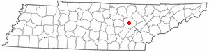
Crossville, Tennessee — City — Cumberland County Courthouse in Crossville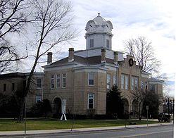 Location of Crossville, Tennessee
Coordinates: 35°57′15″N 85°1′53″W / 35.95417°N 85.03139°WCoordinates: 35°57′15″N 85°1′53″W / 35.95417°N 85.03139°W Country United States State Tennessee County Cumberland Government - Mayor J.H. Graham III Area - Total 15.1 sq mi (39.1 km2) - Land 14.7 sq mi (38.2 km2) - Water 0.4 sq mi (0.9 km2) Elevation 1,854 ft (565 m) Population (2000) - Total 8,981 - Density 609.2/sq mi (235.2/km2) Time zone Central (CST) (UTC-6) - Summer (DST) CDT (UTC-5) Area code(s) 931 FIPS code 47-18540[1] GNIS feature ID 1306203[2] Crossville is a city in and the county seat of Cumberland County, Tennessee, United States.[3] The population was 10,795 at the 2010 Census.
Contents
Geography
Crossville is located at 35°57′15″N 85°1′53″W / 35.95417°N 85.03139°W (35.954221, -85.031267)[4]. The city is situated atop the Cumberland Plateau amidst the headwaters of the Obed River, which slices a scenic gorge north of Crossville en route to its confluence with the Emory River to the northeast. Crossville is roughly halfway between the plateau's eastern escarpment along Walden Ridge and its western escarpment along the Highland Rim. Several small lakes are located on the outskirts of Crossville, including Lake Tansi to the south, Lake Holiday to the west, and Byrd Lake at nearby Cumberland Mountain State Park. The average elevation of Crossville is approximately 1,890 feet (576 m) above sea level.
Crossville developed at the intersection of two major stage roads by which settlers moved through the area. The roads were gradually widened, improved and turned into paved roads. Two major federal highways: U.S. Route 70, which traverses Tennessee from east to west, and U.S. Route 127, which traverses Tennessee from north to south, now roughly follow the old routes. Interstate 40, which runs roughly parallel to US-70, passes through the northern part of Crossville. Crossville is approximately 30 miles (48 km) east of Cookeville, 70 miles (110 km) north of Chattanooga and 70 miles (110 km) west of Knoxville.
According to the United States Census Bureau, the city has a total area of 15.1 square miles (39 km2), of which, 14.7 square miles (38 km2) of it is land and 0.3 square miles (0.78 km2) of it (2.32%) is water.
Demographics
 Crossville has long been a great crossroads of East and Middle Tennessee
As of the census[1] of 2000, there were 8,981 people, 3,795 households, and 2,440 families residing in the city. The population density was 609.2 people per square mile (235.2/km²). There were 4,268 housing units at an average density of 289.5 per square mile (111.8/km²). The racial makeup of the city was 97.02% White, 0.14% African American, 0.23% Native American, 0.35% Asian, 0.04% Pacific Islander, 1.04% from other races, and 1.18% from two or more races. Hispanic or Latino of any race were 2.43% of the population.
There were 3,795 households out of which 27.4% had children under the age of 18 living with them, 45.2% were married couples living together, 15.5% had a female householder with no husband present, and 35.7% were non-families. 31.3% of all households were made up of individuals and 13.1% had someone living alone who was 65 years of age or older. The average household size was 2.25 and the average family size was 2.79.
In the city the population was spread out with 22.6% under the age of 18, 9.3% from 18 to 24, 26.5% from 25 to 44, 21.8% from 45 to 64, and 19.9% who were 65 years of age or older. The median age was 38 years. For every 100 females there were 85.0 males. For every 100 females age 18 and over, there were 81.5 males.
The median income for a household in the city was $25,796, and the median income for a family was $33,207. Males had a median income of $26,735 versus $20,217 for females. The per capita income for the city was $18,066. About 21.7% of families and 24.6% of the population were below the poverty line, including 36.2% of those under age 18 and 20.6% of those age 65 or over.
Recent population estimates show the population of Crossville around 11,498 in 2008.
History
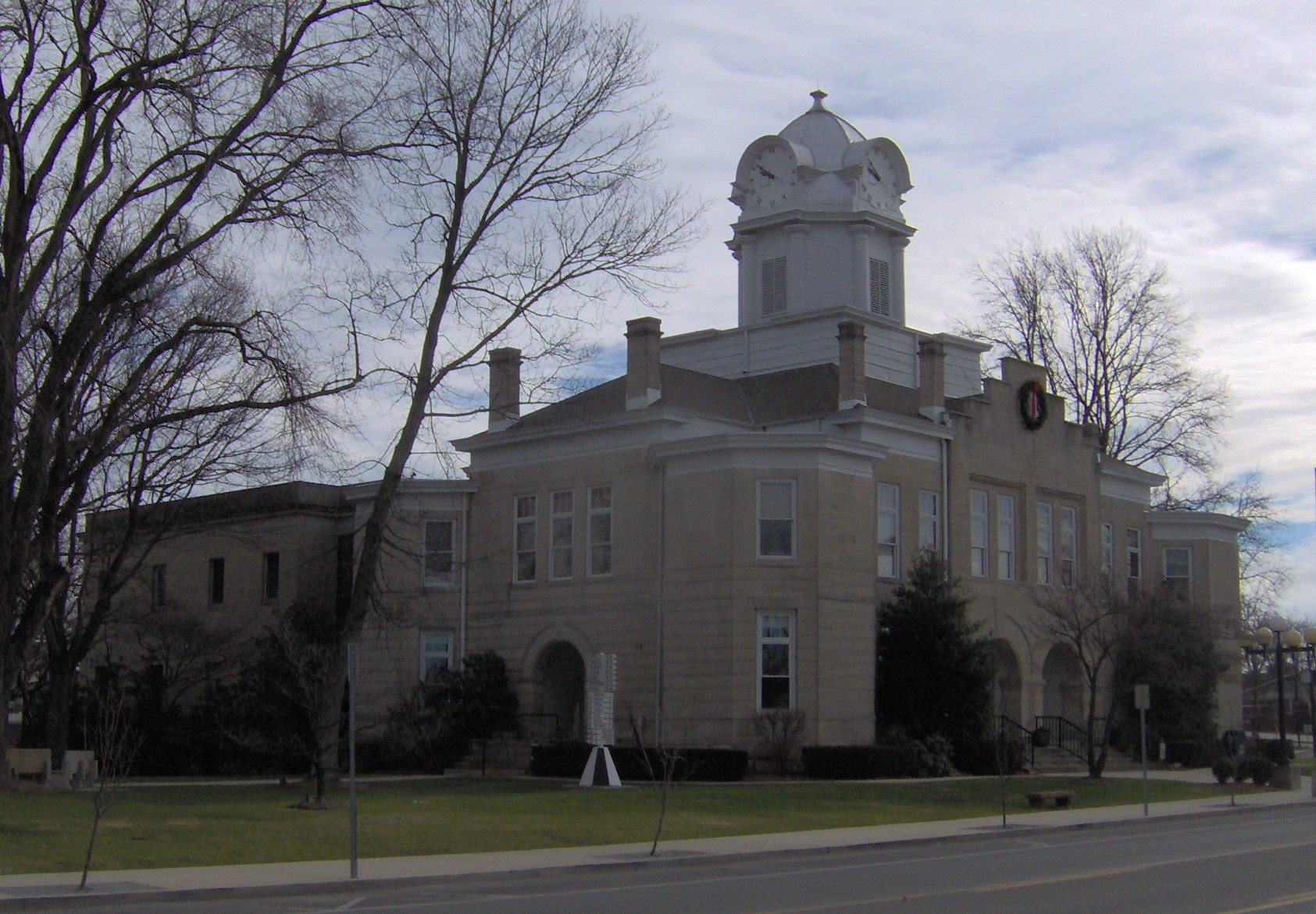
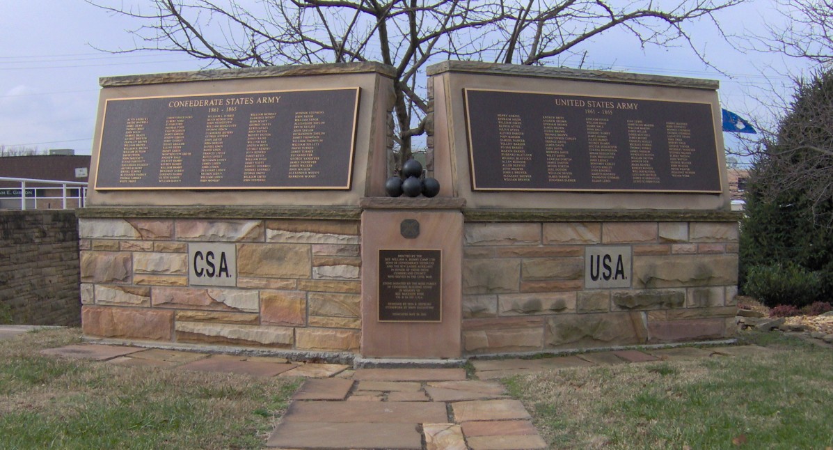
 Cumberland County Civil War memorial in Crossville, listing Confederate veterans (left) and Union veterans (right)
Crossville developed at the intersection of a branch of the Great Stage Road, which connected the Knoxville area with the Nashville area, and the Kentucky Stock Road, a cattle drovers' path connecting Middle Tennessee with Kentucky and later extending to Chattanooga. These two roads are roughly paralleled by modern US-70 and US-127, respectively.[5][6]
Around 1800, an early European-American settler named Samuel Lambeth opened a store at this junction, and the small community that developed around it became known as Lambeth's Crossroads. The store was located at what has become the modern intersection of Main Street and Stanley Street, just south of the courthouse. By the time a post office was established in the 1830s, the community had taken the name of "Crossville." In the early 1850s, James Scott, a merchant from nearby Sparta, purchased the Lambeth store and renamed it Scott's Tavern.[7]
When Cumberland County was formed in 1856, Crossville, being nearest the center of the county, was chosen as county seat. Scott donated the initial 40 acres (160,000 m2) for the erection of a courthouse and town square.[8]
Crossville and Cumberland County suffered rampant pillaging throughout the Civil War as the well-developed roads made the area accessible to both occupying Union and Confederate forces and bands of renegade guerrillas. With divided communities and families, there was vicious guerrilla warfare, and residents suffered as if there were major battles in the area.[9] The county was divided throughout the conflict, sending a roughly equal number of troops to both sides.[10]
After World War I, US 40 helped connect the town and area to markets for its produce and goods. Additional highways built after World War II improved transportation in the region.[10]
During the Great Depression, the federal government's Subsistence Homestead Division initiated a housing project south of Crossville known as the Cumberland Homesteads. The project's purpose was to provide small farms for several hundred impoverished families. The project's recreational area would later become the nucleus for Cumberland Mountain State Park.[10]
Points of interest
- The United States Chess Federation moved its corporate offices to Crossville from New Windsor, New York in 2005, reportedly to reduce labor costs.
- Highway 127 Corridor Sale. Promoted as the world's largest yard sale, held annually in August.
- The Cumberland County Playhouse is the only major non-profit professional performing arts resource in rural Tennessee, and one of the 10 largest professional theaters in rural America. It serves more than 165,000 visitors annually with two indoor and two outdoor stages, young audience productions, a comprehensive dance program, a concert series and touring shows.
- Crossville bills itself as "the golf capital of Tennessee" featuring 12 courses. Stonehenge, Heatherhurst Crag, Heatherhurst Brae, Deer Creek, River Run, Four Seasons, The Bear Trace, Dorchester, Mountain Ridge, Renegade, Druid Hills, and Lake Tansi.
- TAP Publishing Co.[11] was created in 1937 by Cosby Harrison with the first publication, that is still being published today, Trade-A-Plane. Over the years TAP Publishing has created and published other products that can be found nationwide and even internationally, such as; Rock & Dirt, Rock & Dirt en Espanol, Tradequip, weatherTAP, and NextTruck Online.
- The Cumberland County Fair, held every August.
- Until recently, a free-speech zone on the Cumberland County courthouse lawn was the site of several unofficial displays, including a statue of the Flying Spaghetti Monster, an Iraq and Afghanistan Soldier's Memorial, a miniature Statue of Liberty, chainsaw carvings of a nativity scene, Jesus carrying the cross, and monkeys and bears.[12] As of April 30, 2008 the lawn is no longer a free-speech zone due largely to the controversy caused by the Flying Spaghetti Monster statue.[13]
Notable people
- Mandy Barnett - Country music singer and actress born in Crossville.[14]
- Julie Ann Emery - Actress born and raised here.[15]
- Stormi Henley - Miss Teen USA 2009.[16]
- Earl Lloyd - First African-American to play in an NBA basketball game
- Michael Sims - Acclaimed nonfiction writer.[17]
- Michael Turner - comic book artist, born in Crossville. President of the entertainment company Aspen MLT.
References
- ^ a b "American FactFinder". United States Census Bureau. http://factfinder.census.gov. Retrieved 2008-01-31.
- ^ "US Board on Geographic Names". United States Geological Survey. 2007-10-25. http://geonames.usgs.gov. Retrieved 2008-01-31.
- ^ "Find a County". National Association of Counties. http://www.naco.org/Counties/Pages/FindACounty.aspx. Retrieved 2011-06-07.
- ^ "US Gazetteer files: 2010, 2000, and 1990". United States Census Bureau. 2011-02-12. http://www.census.gov/geo/www/gazetteer/gazette.html. Retrieved 2011-04-23.
- ^ Helen Bullard and Joseph Krechniak, Cumberland County's First Hundred Years (Crossville, Tenn.: Centennial Committee, 1956), 22-26
- ^ The WPA Guide to Tennessee (Knoxville: University of Tennessee Press, 1986), 442. Originally compiled by the Federal Writers' Project of the Works Project Administration as Tennessee: A Guide to the State, and published in 1939.
- ^ Bullard and Krechniak, Cumberland County's First Hundred Years, 180-188.
- ^ Bullard and Krechniak, Cumberland County's First Hundred Years, 180-188.
- ^ Larry H. Whiteaker, "Civil War", Tennessee Encyclopedia of Culture and History, 2009, accessed 7 November 2011
- ^ a b c G. Donald Brookhart, "Cumberland County", Tennessee Encyclopedia of Culture and History, 2009, accessed 7 November 2011
- ^ http://www.tappublishing.com
- ^ Gary Nelson, Flying Spaghetti Monster takes up residence at county courthouse, Crossville Chronicle, March 24, 2008
- ^ Gary Nelson, "Courthouse No Longer Hosting Free Speech Displays." The Crossville Chronicle, 15 April 2008. Retrieved: 10 July 2008.
- ^ http://www.mandybarnett.com/
- ^ http://www.julieannemery.com/
- ^ http://www.missuniverse.com/missteenusa/news/view/41
- ^ http://www.michaelsimsbooks.com/
External links
Municipalities and communities of Cumberland County, Tennessee County seat: CrossvilleCities Crab Orchard | Crossville

Town Unincorporated
communitiesCategories:- Cities in Tennessee
- Historic trails and roads in the United States
- Populated places in Cumberland County, Tennessee
- County seats in Tennessee

Wikimedia Foundation. 2010.