- National Register of Historic Places listings in Bristol, Virginia
-
This list includes properties and districts listed on the National Register of Historic Places in Bristol, Virginia. Click the "Map of all coordinates" link to the right to view a Google map of all properties and districts with latitude and longitude coordinates in the table below.[1]
-
- This National Park Service list is complete through NPS recent listings posted November 10, 2011.[2]
[3] Landmark name [4] Image Date listed Location City or town Summary 1 Bristol Commercial Historic District May 22, 2003 Roughly along State, Piedmont, Moore, Shelby, Bank, Progress, 5th, 6th, 7th, and 8th Sts.
36°35′38″N 82°11′03″W / 36.593889°N 82.184167°WBristol 2 Bristol Railroad Station November 28, 1980 State and Washington Sts.
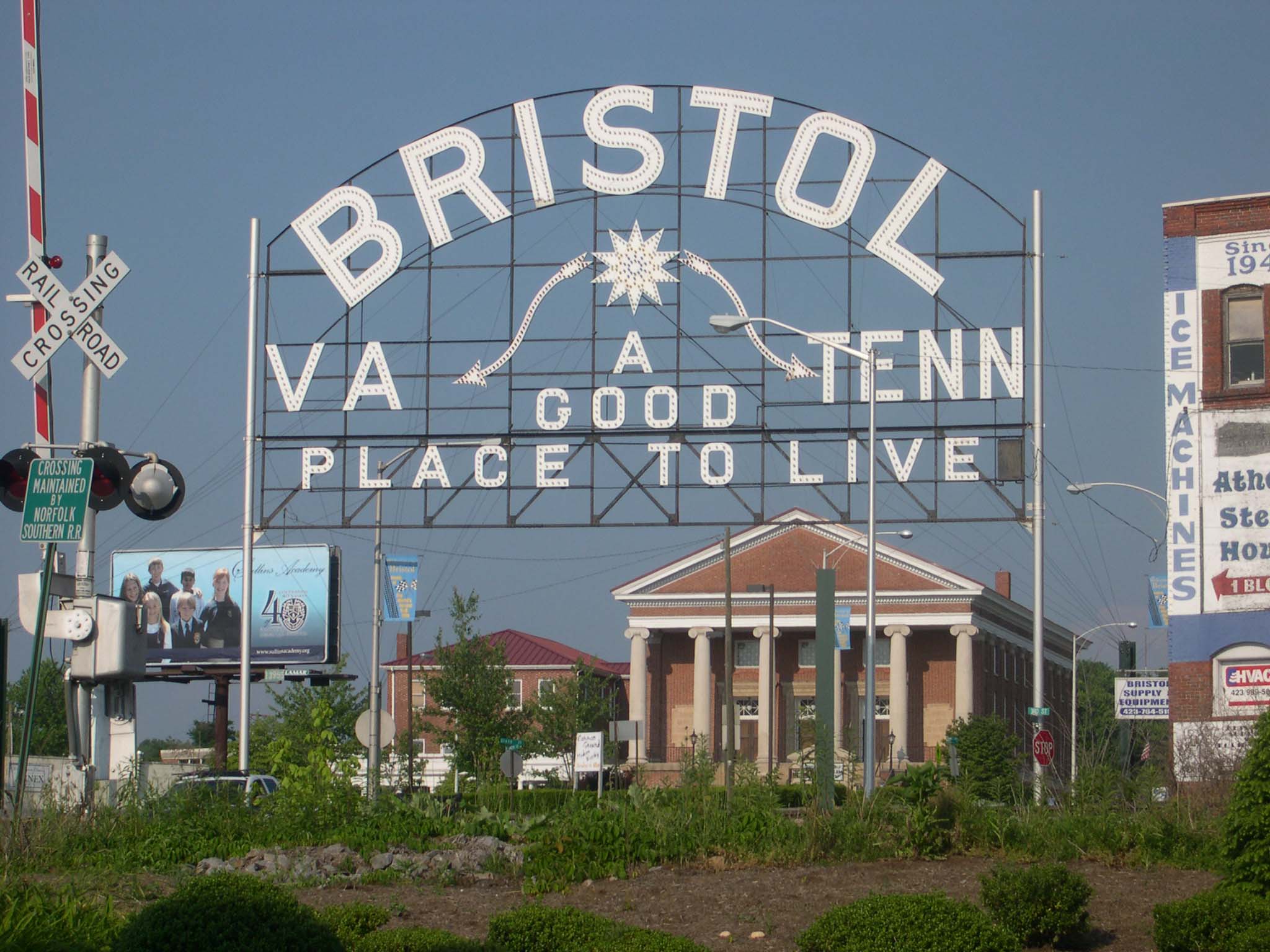
36°35′44″N 82°10′47″W / 36.595556°N 82.179722°WBristol 3 Bristol Virginia-Tennessee Slogan Sign 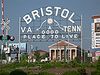
September 8, 1988 E. State St.
36°35′40″N 82°10′45″W / 36.594444°N 82.179167°WBristol 4 Douglass School February 2, 2005 711 Oakview Ave.
36°36′33″N 82°10′31″W / 36.609167°N 82.175278°WBristol 5 East Hill Cemetery March 28, 2011 East State Street at Georgia Avenue
36°35′39″N 82°10′16″W / 36.594167°N 82.171111°WBristol American Civil War-era cemetery with sections for Confederate soldiers and veterans as well as a small section for African American burials;[5] straddles the Tennessee-Virginia border and is also listed in the National Park Service NRIS database in Bristol, Tennessee 6 Euclid Avenue Historic District May 10, 2006 Along Sect. of Arlington, Euclid, Fairmount, Glenway, Highland, Lawrence, Piedmont Aves., Chester, Grove, Lindsey
36°36′17″N 82°11′07″W / 36.604722°N 82.185278°WBristol 7 King-Lancaster-McCoy-Mitchell House July 29, 1994 54 King St.
36°35′50″N 82°11′14″W / 36.597222°N 82.187222°WBristol 8 Virginia High School February 21, 1997 501 Piedmont Ave.
36°36′17″N 82°11′01″W / 36.604722°N 82.183611°WBristol 9 Virginia Hill Historic District November 27, 2002 Sections of Moore, Lee, Russell, Clinton, Spencer, W. Mary and Buchanan Sts.
36°36′04″N 82°11′26″W / 36.601111°N 82.190556°WBristol 10 Virginia Intermont College October 4, 1984 Moore and Harmeling Sts.
36°36′18″N 82°10′35″W / 36.605°N 82.176389°WBristol See also
- National Register of Historic Places listings in Virginia
- National Register of Historic Places listings in Washington County, Virginia
- List of National Historic Landmarks in Virginia
References
- ^ The latitude and longitude information provided in this table was derived originally from the National Register Information System, which has been found to be fairly accurate for about 99% of listings. For about 1% of NRIS original coordinates, experience has shown that one or both coordinates are typos or otherwise extremely far off; some corrections may have been made. A more subtle problem causes many locations to be off by up to 150 yards, depending on location in the country: most NRIS coordinates were derived from tracing out latitude and longitudes off of USGS topographical quadrant maps created under the North American Datum of 1927, which differs from the current, highly accurate WGS84 GPS system used by Google maps. Chicago is about right, but NRIS longitudes in Washington are higher by about 4.5 seconds, and are lower by about 2.0 seconds in Maine. Latitudes differ by about 1.0 second in Florida. Some locations in this table may have been corrected to current GPS standards.
- ^ "National Register of Historic Places: Weekly List Actions". National Park Service, United States Department of the Interior. Retrieved on November 10, 2011.
- ^ Numbers represent an ordering by significant words. Various colorings, defined here, differentiate National Historic Landmark sites and National Register of Historic Places Districts from other NRHP buildings, structures, sites or objects.
- ^ "National Register Information System". National Register of Historic Places. National Park Service. . http://nrhp.focus.nps.gov/natreg/docs/All_Data.html.
- ^ "East Hill Cemetery Brochure". [{Bristol, Tennessee]]: Bristol Historical Association. http://www.bristolhistoricalassociation.com/docs/East%20Hill%20Cemetery%20Brochure.pdf. Retrieved April 14, 2011.
U.S. National Register of Historic Places Topics Lists by states Alabama • Alaska • Arizona • Arkansas • California • Colorado • Connecticut • Delaware • Florida • Georgia • Hawaii • Idaho • Illinois • Indiana • Iowa • Kansas • Kentucky • Louisiana • Maine • Maryland • Massachusetts • Michigan • Minnesota • Mississippi • Missouri • Montana • Nebraska • Nevada • New Hampshire • New Jersey • New Mexico • New York • North Carolina • North Dakota • Ohio • Oklahoma • Oregon • Pennsylvania • Rhode Island • South Carolina • South Dakota • Tennessee • Texas • Utah • Vermont • Virginia • Washington • West Virginia • Wisconsin • WyomingLists by territories Lists by associated states Other Categories:- Bristol, Virginia
- National Register of Historic Places in Virginia
- Virginia-related lists
-
Wikimedia Foundation. 2010.