- Downtown Torrington Historic District
-
Downtown Torrington Historic District
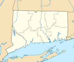

Location: Roughly bounded by Church and Alvord Sts., Center Cemetery, Willow St., E. Main St., Litchfield St., and Prospect St., Torrington, Connecticut Coordinates: 41°48′7″N 73°7′17″W / 41.80194°N 73.12139°WCoordinates: 41°48′7″N 73°7′17″W / 41.80194°N 73.12139°W Area: 56 acres (23 ha) Architect: Hunt,William E.; Et al. Architectural style: Late 19th And 20th Century Revivals, Late Victorian, Modern Movement Governing body: Local NRHP Reference#: 88002978[1] Added to NRHP: December 22, 1988 The Downtown Torrington Historic District is a 56-acre (23 ha) historic district in Torrington, Connecticut that was listed on the National Register of Historic Places (NRHP) in 1988. It includes examples of Late 19th and 20th Century Revivals, Late Victorian, and Modern Movement architecture.[1]
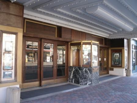
 Warner Theatre
It includes the town's Warner Theatre and the Fyler-Hotchkiss Estate which are individually listed on the NRHP. Overall, in 1988, it included 71 contributing buildings, 2 contributing sites and 4 contributing objects.[1]
A walking tour of the district designed by the Torrington Historical Society visits 21 properties.[2]
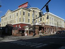 Yankee Pedlar
The district includes what was originally the Conley Hotel in 1891, now the Yankee Pedlar.[3]
The Lyons Garage is one contributing property.
References
- ^ a b c "National Register Information System". National Register of Historic Places. National Park Service. 2009-03-13. http://nrhp.focus.nps.gov/natreg/docs/All_Data.html.
- ^ Nutmeg Conservancy for the Arts and Torrington Historical Society. "A Walking Tour of Downtown Torrington's National Register Historic District". Torrington Historical Society.
- ^ William E. Devlin and John Herzan (May, 1988). "National Register of Historic Places Registration: Downtown Torrington Historic District". National Park Service. http://pdfhost.focus.nps.gov/docs/NRHP/Text/88002978.pdf. and Accompanying 20 photos, from January, 1988 (captions on p. 20-21 of text document)
U.S. National Register of Historic Places Topics Lists by states Alabama • Alaska • Arizona • Arkansas • California • Colorado • Connecticut • Delaware • Florida • Georgia • Hawaii • Idaho • Illinois • Indiana • Iowa • Kansas • Kentucky • Louisiana • Maine • Maryland • Massachusetts • Michigan • Minnesota • Mississippi • Missouri • Montana • Nebraska • Nevada • New Hampshire • New Jersey • New Mexico • New York • North Carolina • North Dakota • Ohio • Oklahoma • Oregon • Pennsylvania • Rhode Island • South Carolina • South Dakota • Tennessee • Texas • Utah • Vermont • Virginia • Washington • West Virginia • Wisconsin • WyomingLists by territories Lists by associated states Other Categories:- Historic districts in Connecticut
- Historic districts in Litchfield County, Connecticut
- Connecticut Registered Historic Place stubs


Wikimedia Foundation. 2010.