- Obsidian Cliff
-
Obsidian Cliff
 Obsidian Cliff
Nearest city: Gardiner, Montana Coordinates: 44°49′08″N 110°43′40″W / 44.8189°N 110.7278°WCoordinates: 44°49′08″N 110°43′40″W / 44.8189°N 110.7278°W Area: 3,580 acres (14.5 km2)[1] Architectural style: No Style Listed Governing body: NATIONAL PARK SERVICE NRHP Reference#: 96000973 Significant dates Added to NRHP: June 19, 1996[2] Designated NHL: June 19, 1996[3] Obsidian Cliff, also known as 48YE433, was an important source of lithic materials for prehistoric peoples in Yellowstone National Park near Gardiner, Montana. The cliff was named by Philetus Norris, the second park superintendent in 1878.[4] It was declared a National Historic Landmark in 1996.[1][3]
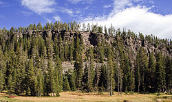
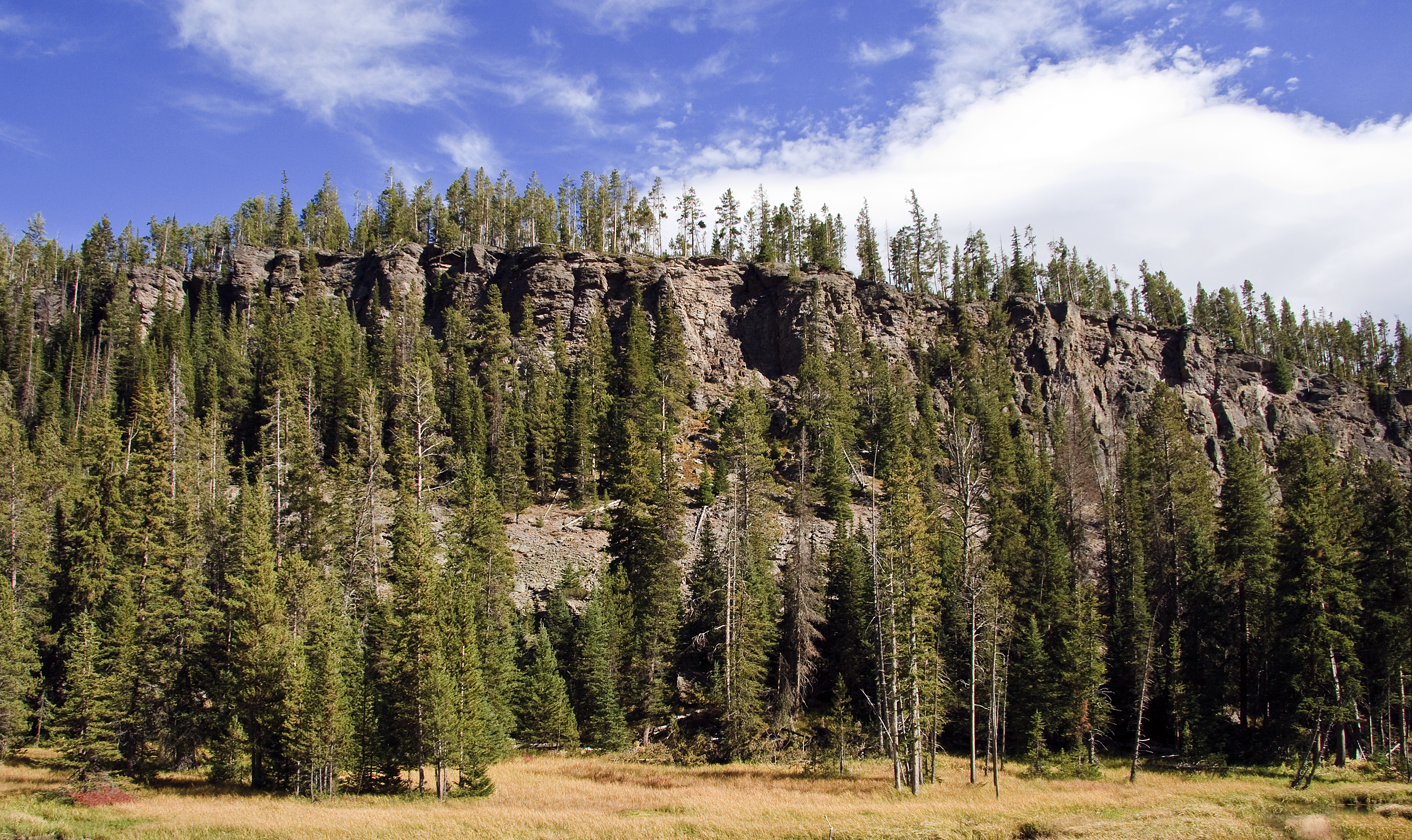
The cliff was formed from thick rhyolite lava flow that occurred about 180,000 years ago. The vertical columns are cooling fractures that formed as the thick lava flow cooled and crystallized. The flow consists of obsidian, a dark volcanic glass. The obsidian is most abundant at the base of the cliff and slowly tapers off to larger concentrations of pumice at the top. Obsidian from this site was first quarried here about 12,000 years ago. Early natives of North America placed a high value on the obsidian that came from this cliff as well as other similar obsidian deposits in the area because numerous tools could be fashioned from obsidian - most popularly knives, spear/arrow tips, and other sharp edged objects. In fact, obsidian was so sought after in early America (before the time of Columbus) that it was traded as far away as Mexico and Guatemala, and Ohio and Canada.
Many studies have been done on the composition of the obsidian from Obsidian Cliff and how the obsidian from Obsidian Cliff was distributed. This research has provided evidence of the direction and extent of prehistoric trade networks.[5]
It is located about 13 miles (21 km) south of Mammoth Hot Springs, on the east side of the Mammoth-Norris section of the Grand Loop Road.[1] The Obsidian Cliff Kiosk, just north, is also listed on the National Register.
Notes
- ^ a b c Ann M. Johnson, Leslie B. Davis, and Stephen A. Aaberg (January 28, 1993). National Historic Landmark Nomination: Obsidian CliffPDF (32 KB). National Park Service and Accompanying nine photos, from 1884, 1889, 1920 and 1989PDF (32 KB)
- ^ "National Register Information System". National Register of Historic Places. National Park Service. 2007-01-23. http://nrhp.focus.nps.gov/natreg/docs/All_Data.html.
- ^ a b "Obsidian Cliff". National Historic Landmark summary listing. National Park Service. http://tps.cr.nps.gov/nhl/detail.cfm?ResourceId=2195&ResourceType=Site. Retrieved 2008-02-29.
- ^ Whittlesey, Lee (1988). Yellowstone Place Names. Helena, MT: Montana Historical Society Press. pp. 114. ISBN 0917298152.
- ^ Kenneth P. Cannon (1993). "Paleoindian Use of Obsidian in the Greater Yellowstone Area New evidence of the mobility of early Yellowstone people" (PDF). Yellowstone Science 1 (4): 6–9. http://www.greateryellowstonescience.org/sites/default/files/references/YS_1_4_Cannon.pdf. Retrieved 2011-10-15.
External links
- Obsidian Cliff National Historic Landmark at the Wyoming State Historic Preservation Office
National Register of Historic Places in Yellowstone National Park National Historic Landmarks Norris, Madison, and Fishing Bridge Museums | Obsidian Cliff | Old Faithful Inn
National Historic Landmark District Other historic districts Other properties Fishing Bridge Museum | Lake Hotel | Lamar Buffalo Ranch | Madison Museum | Mammoth Hot Springs Historic District | Norris Museum/Norris Comfort Station | Obsidian Cliff Kiosk | Queen's Laundry Bath House | US Post Office-Yellowstone Main
U.S. National Register of Historic Places Topics Lists by states Alabama • Alaska • Arizona • Arkansas • California • Colorado • Connecticut • Delaware • Florida • Georgia • Hawaii • Idaho • Illinois • Indiana • Iowa • Kansas • Kentucky • Louisiana • Maine • Maryland • Massachusetts • Michigan • Minnesota • Mississippi • Missouri • Montana • Nebraska • Nevada • New Hampshire • New Jersey • New Mexico • New York • North Carolina • North Dakota • Ohio • Oklahoma • Oregon • Pennsylvania • Rhode Island • South Carolina • South Dakota • Tennessee • Texas • Utah • Vermont • Virginia • Washington • West Virginia • Wisconsin • WyomingLists by territories Lists by associated states Other Historic structures and other attractions in the Mammoth Hot Springs areaStructures and History Fort Yellowstone • Mammoth Hot Springs Historic District • North Entrance Road Historic District • Obsidian Cliff Kiosk • Roosevelt Arch • U.S. Post Office (Yellowstone National Park)
Geography and Geology Antler Peak • Bunsen Peak • Clagett Butte • Electric Peak • Gallatin Range • Gardiner, Montana • Gardner River • Gray Peak • Kingman Pass • Joseph Peak • Mammoth Hot Springs • Mount Everts • Obsidian Cliff • Sepulcher Mountain Sheepeater Cliff • Terrace Mountain • Yellowstone RiverList of Yellowstone National Park related articles
 Media related to Mammoth Hot Springs at Wikimedia Commons
 State of Wyoming
Topics - Governors
- Delegations
- Geography
- Government
- History
- People
- Visitor Attractions
- State Symbols
- Radio Stations
Society - Crime
- Demographics
- Economy
- Education
- Politics
Regions Cities Counties Categories:- Landforms of Yellowstone National Park
- Rock formations in Wyoming
- Volcanism of Wyoming
- Native American history
- Pre-state history of Wyoming
- National Historic Landmarks in Wyoming
- Geography of Park County, Wyoming
- Wyoming Registered Historic Place stubs
- Wyoming stubs
Wikimedia Foundation. 2010.