- Natrona County, Wyoming
-
For other uses, see Natrona (disambiguation).
Natrona County, Wyoming 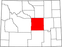
Location in the state of Wyoming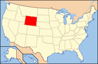
Wyoming's location in the U.S.Founded 1888 Seat Casper Largest city Casper Area
- Total
- Land
- Water
5,376 sq mi (13,924 km²)
5,340 sq mi (13,831 km²)
36 sq mi (93 km²), 0.67%Population
- (2010)
- Density
75,450
14/sq mi (5/km²)Time zone Mountain: UTC-7/-6 Website www.natronacounty-wy.gov Natrona County is a county located in the U.S. state of Wyoming. As of the 2010 census, the population was 75,450. Its county seat is Casper[1]. It is included in the Casper, Wyoming metropolitan statistical area which encompasses all of Natrona County. The center of population of Wyoming is located in Natrona County, in the town of Alcova.[2]
Contents
History
The first settlement occurred in the Casper area in the late 19th century.[3] Natrona County was created by the legislature of the Wyoming Territory on March 9, 1888.[4] The land for Natrona County was ceded from Carbon County
Natrona County was named for the deposits of natron that are found in the area.[5] In 1909, Natrona County gained land from Fremont County. The boundaries were adjusted slightly in 1911 and 1931, and at that point the county gained its present outline.
Geography
According to the U.S. Census Bureau, the county has a total area of 5,376 square miles (13,920 km2), of which 5,340 square miles (13,800 km2) is land and 36 square miles (93 km2) (0.67%) is water.
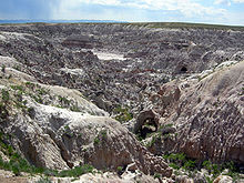
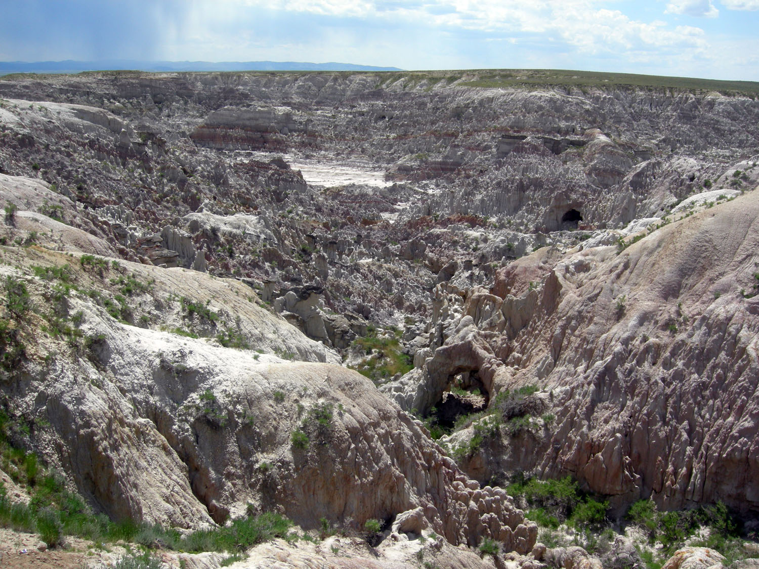
Geographic features
- Casper Mountain
- Devil's Gate
- Hell's Half Acre
- Independence Rock
- Martin's Cove
- Teapot Rock
Adjacent counties
- Johnson County - (north)
- Converse County - (east)
- Carbon County - (south)
- Fremont County - (west)
- Washakie County - (northwest)
National protected areas
- Medicine Bow National Forest (part)
- Pathfinder National Wildlife Refuge (part)
Major Highways
 Interstate 25
 U.S. Highway 20
 U.S. Highway 26
 U.S. Highway 87
 Wyoming Highway 220
Government
Natrona County is governed by the Board of County Commissioners who meet in the county seat of Casper.
The board consists of five members who are each is elected to a four-year term, which is staggered so not more than three commissioners are elected at the same time. Elections for the County Commissioners occur at the General Election every two years.
Current commissioners are:
- Rob Hendry (Chairman) - Republican
- Ed Opella (Vice-Chairman) - Republican
- Matt Keating - Republican
- Barb Peryam - Republican
- Terry Wingerter - Democrat
Demographics
Historical populations Census Pop. %± 1890 1,094 — 1900 1,785 63.2% 1910 4,766 167.0% 1920 14,635 207.1% 1930 24,272 65.8% 1940 23,858 −1.7% 1950 31,437 31.8% 1960 49,623 57.8% 1970 51,264 3.3% 1980 71,856 40.2% 1990 61,226 −14.8% 2000 66,533 8.7% 2010 75,450 13.4% As of the census[6] of 2000, there were 66,533 persons, 26,819 households, and 17,754 families residing in the county. The population density was 12 people per square mile (5/km²). There were 29,882 housing units at an average density of 6 per square mile (2/km²). The racial makeup of the county was 94.15% White, 0.76% Black or African American, 1.03% Native American, 0.42% Asian, 0.04% Pacific Islander, 1.92% from other races, and 1.68% from two or more races. 4.90% of the population were Hispanic or Latino of any race. 24.6% were of German, 11.6% English, 11.3% American and 11.2% Irish ancestry according to Census 2000.
There were 26,819 households out of which 32.20% had children under the age of 18 living with them, 51.40% were married couples living together, 10.60% had a female householder with no husband present, and 33.80% were non-families. 27.50% of all households were made up of individuals and 9.40% had someone living alone who was 65 years of age or older. The average household size was 2.42 and the average family size was 2.95.
In the county the population was distributed as follows: 26.00% under the age of 18, 10.10% from 18 to 24, 27.90% from 25 to 44, 23.30% from 45 to 64, and 12.70% who were 65 years of age or older. The median age was 36 years. For every 100 females there were 97.70 males. For every 100 females age 18 and over, there were 95.00 males.
The median income for a household in the county was $36,619, and the median income for a family was $45,575. Males had a median income of $33,524 versus $21,374 for females. The per capita income for the county was $18,913. About 8.70% of families and 11.80% of the population were below the poverty line, including 16.20% of those under age 18 and 7.20% of those age 65 or over.
Populated places
Cities
Towns
Census-designated places
Other communities
See also
Footnotes
- ^ "Find a County". National Association of Counties. http://www.naco.org/Counties/Pages/FindACounty.aspx. Retrieved 2011-06-07.
- ^ [1]
- ^ Casper Wyoming history
- ^ Long, John H. (2006). "Wyoming: Individual County Chronologies". Wyoming Atlas of Historical County Boundaries. The Newberry Library. http://historical-county.newberry.org/website/Wyoming/documents/WY_Individual_County_Chronologies.htm#Individual_County_Chronologies. Retrieved 2011-09-06.
- ^ Urbanek, Mae (1988). Wyoming Place Names. Missoula, MT: Mountain Press Publishing Company. ISBN 0-87842-204-8.
- ^ "American FactFinder". United States Census Bureau. http://factfinder.census.gov. Retrieved 2008-01-31.
External links

Washakie County Johnson County Fremont County 
Converse County  Natrona County, Wyoming

Carbon County Casper, Wyoming Natrona County Municipalities and communities of Natrona County, Wyoming County seat: Casper City 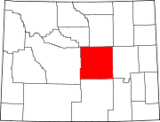
Towns Bar Nunn | Edgerton | Evansville | Midwest | Mills
CDPs Unincorporated
communities State of Wyoming
Cheyenne (capital) Topics Governors · Delegations · Geography · Government · History · People · Visitor Attractions · State Symbols · Radio Stations
Society Crime · Demographics · Economy · Education · Politics
Regions Cities Counties Categories:- Wyoming counties
- Natrona County, Wyoming
- 1888 establishments


Wikimedia Foundation. 2010.