Devil's Gate (Wyoming)

Devil's Gate (Wyoming)
Devil's Gate, Wyoming

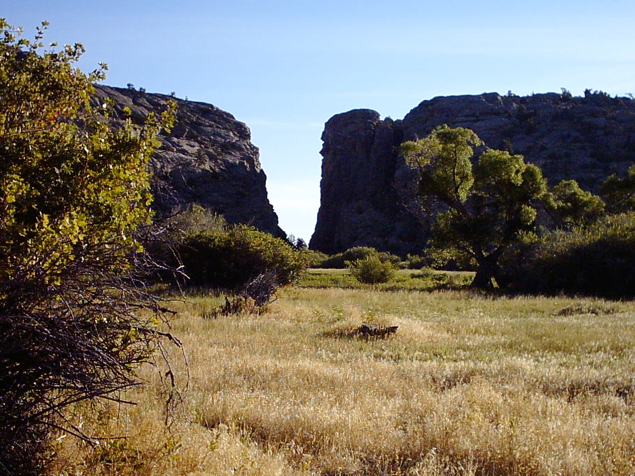
Devil's Gate (Wyoming) is a natural rock formation, a gorge on the Sweetwater River a few miles southwest of Independence Rock. The site, significant in the history of western pioneers, was a major landmark on the Mormon Trail and the Oregon Trail although the actual routes of travel did not pass through the very narrow gorge. The earliest surviving photograph of this landmark was made in 1858 by Samuel C. Mills, a photographer with the Captain Simpson Expedition. It is accessible today from Wyoming Highway 220 (mile marker 57) between Casper and Muddy Gap, near the Mormon Handcart Historic Site and Martin's Cove.

Devil's Gate is a remarkable example of superposed or an antecedent drainage stream. The Sweetwater River cuts a narrow 100-meter deep slot through a granite ridge, yet had it flowed less than a kilometer to the south, it could have bypassed the ridge completely. The gorge was cut because the landscape was originally buried by valley fill sediments. The river cut downward and when it hit granite, kept on cutting. It was a matter of pure chance that the river hit the buried ridge where it did.

The site is accessible via semi-improved hiking trails from the Mormon Handcart Historical Center at the Sun Ranch and from the old paved alignment of Wyoming Highway 220, approximately 60 miles from Casper and 12 miles northeast of Muddy Gap. It is on public land.

External links

Media related to Devil's Gate (Wyoming) at Wikimedia Commons

Coordinates: 42°26′55″N 107°12′39″W / 42.448668°N 107.210855°W / 42.448668; -107.210855


Wikimedia Foundation. 2010.

Игры ⚽ Нужно решить контрольную?

Look at other dictionaries:

  • Devil's Gate — is a frequently used place name; the Geographic Names Information System shows 55 places with that name throughout the USA. It may refer to: Places Devil s Gate (Nevada), a natural rock formation Devil s Gate (Wyoming), a natural rock formation… …   Wikipedia

  • Wyoming — Pour les articles homonymes, voir Wyoming (homonymie). 43° 00′ N 107° 30′ W / …   Wikipédia en Français

  • Ruta del emigrante en Wyoming — Saltar a navegación, búsqueda La ruta del emigrante en Wyoming es el nombre con el que se conoce el camino seguido conjuntamente por tres de las históricas rutas por tierra de migración al Oeste de Estados Unidos la ruta de Oregón («Oregón… …   Wikipedia Español

  • Natrona County, Wyoming — For other uses, see Natrona (disambiguation). Natrona County, Wyoming Location in the state of Wyoming …   Wikipedia

  • Independence Rock (Wyoming) — Infobox nrhp name = Independence Rock nrhp type = nhl caption = Independence Rock location = 60 mi. SW of Casper on WYO 220 nearest city = lat degrees = lat minutes = lat seconds = lat direction = long degrees = long minutes = long seconds = long …   Wikipedia

  • Sweetwater River (Wyoming) — The Sweetwater River is a tributary of the North Platte River, approximately 150 mi (241 km) long, in the U.S. state of Wyoming. It rises in southwestern Fremont County, at the continental divide near South Pass, on the southern end of the Wind… …   Wikipedia

  • Heaven's Gate (film) — Infobox Film name =Heaven s Gate caption = film poster by Tom Jung director = Michael Cimino producer = Joann Carelli writer = Michael Cimino starring = Kris Kristofferson Christopher Walken Isabelle Huppert Jeff Bridges John Hurt Sam Waterston… …   Wikipedia

  • Мормонская тропа — (англ. Mormon Trail)  2092 километровый маршрут, использовавшийся членами Церкви Иисуса Христа Святых последних дней в период с 1846 по 1868 годы. Мормонская тропа пролегает от Наву, Иллинойс, где с 1839 по 1846 располагалось основное… …   Википедия

  • Mark Twain — « Twain » redirige ici. Pour les autres significations, voir Twain (homonymie). Mark Twain …   Wikipédia en Français

  • Sam Clemens — Mark Twain « Twain » redirige ici. Pour les autres significations, voir Twain (homonymie). Mark Twain …   Wikipédia en Français

Share the article and excerpts

Direct link
Do a right-click on the link above
and select “Copy Link”