- Central Norwalk
-
"Downtown Norwalk" redirects here. For the South Norwalk commercial area, see South Norwalk.
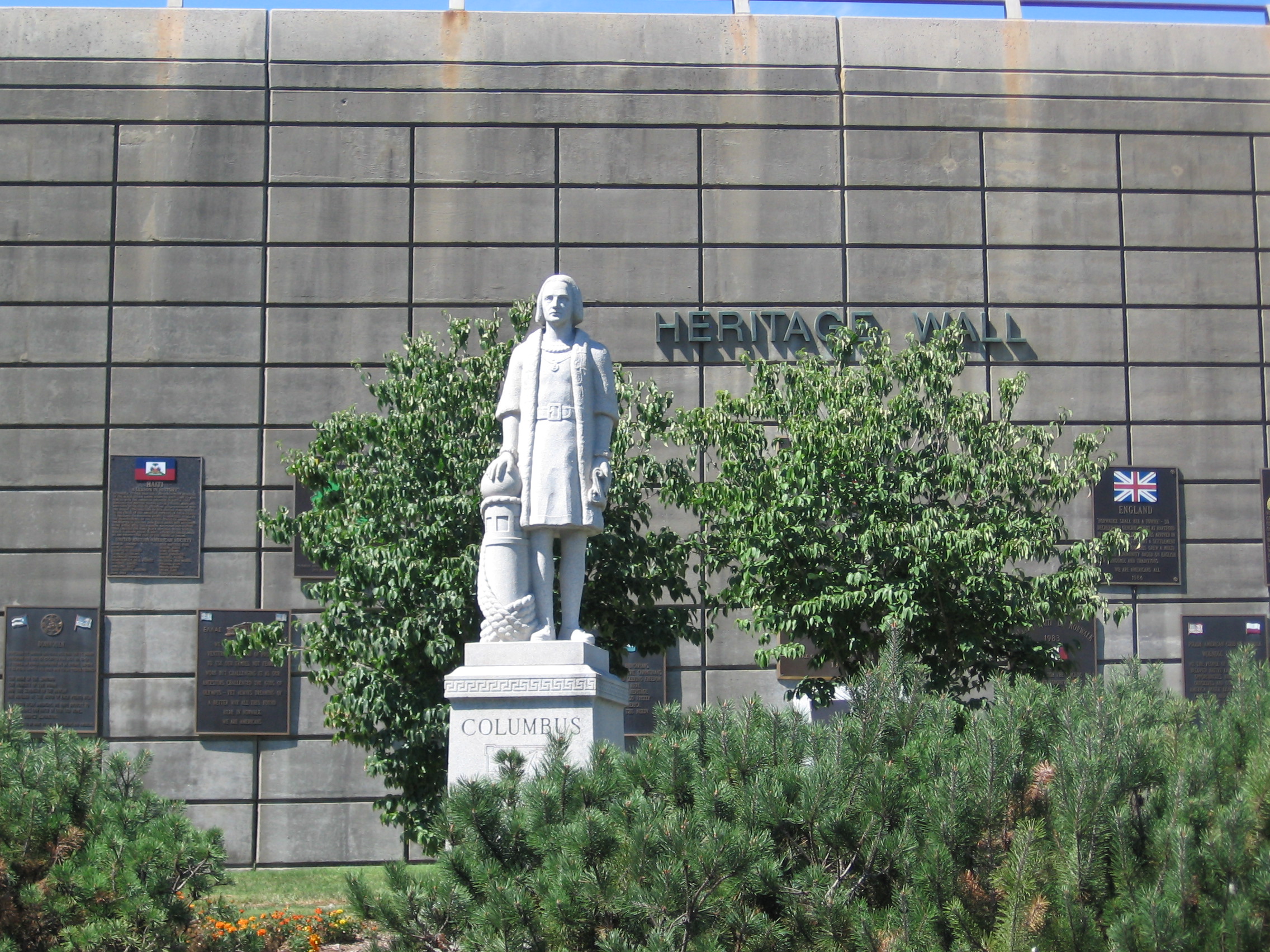
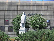 Heritage Wall and statue of Columbus in Thomas C. O'Connor Park on West Avenue
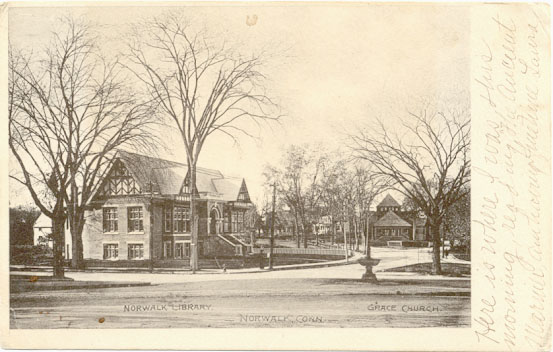
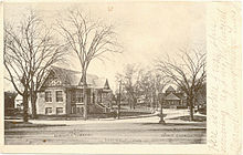 Norwalk Library, ca. 1905
The Central or Midtown section of Norwalk, Connecticut is an urbanized area in roughly the geographic center of the city, north of the South Norwalk neighborhood and the Connecticut Turnpike. Wall Street, West Avenue and Belden Avenue are the main thoroughfares. It has also been called "Downtown Norwalk".
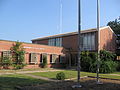
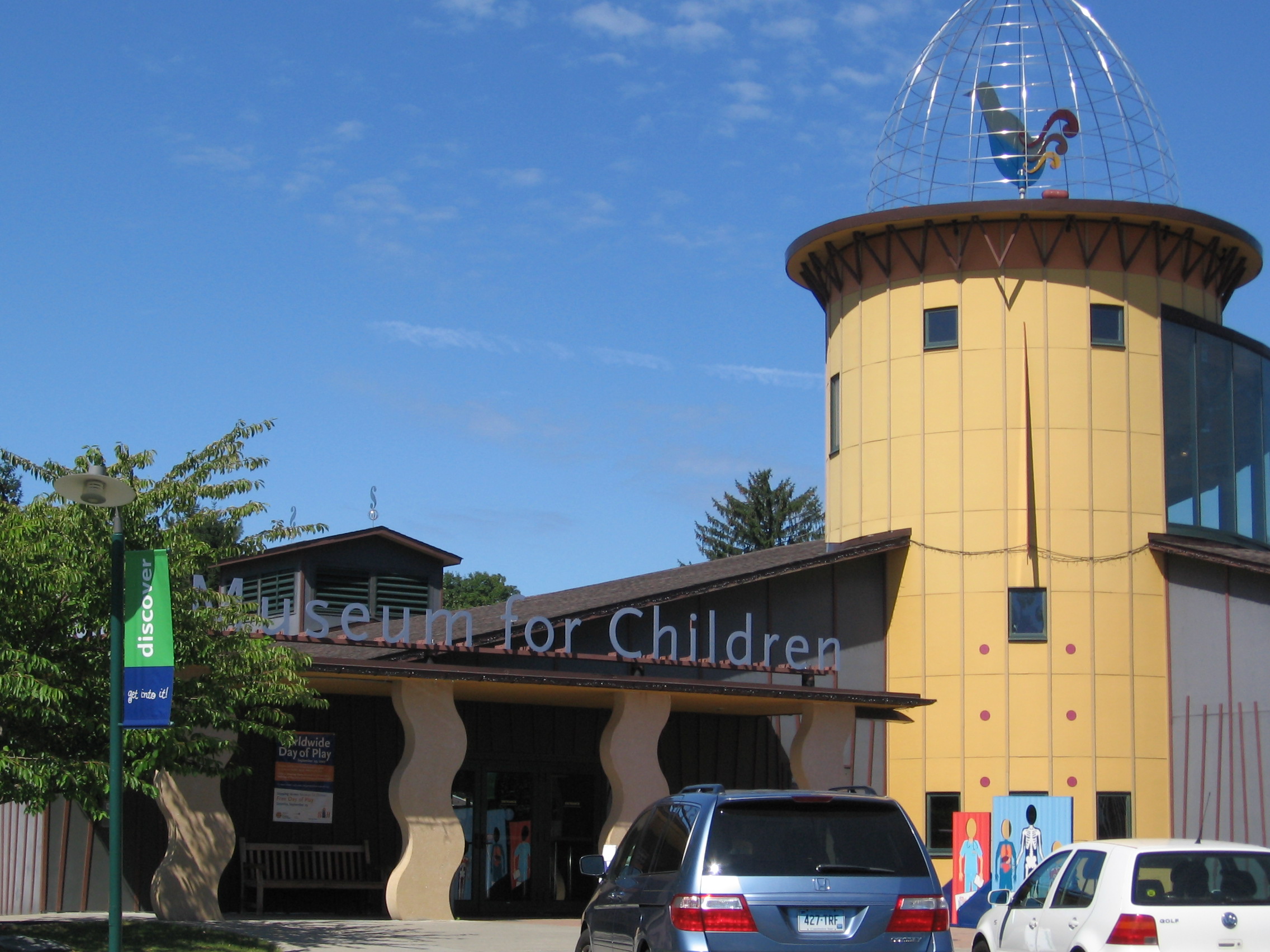
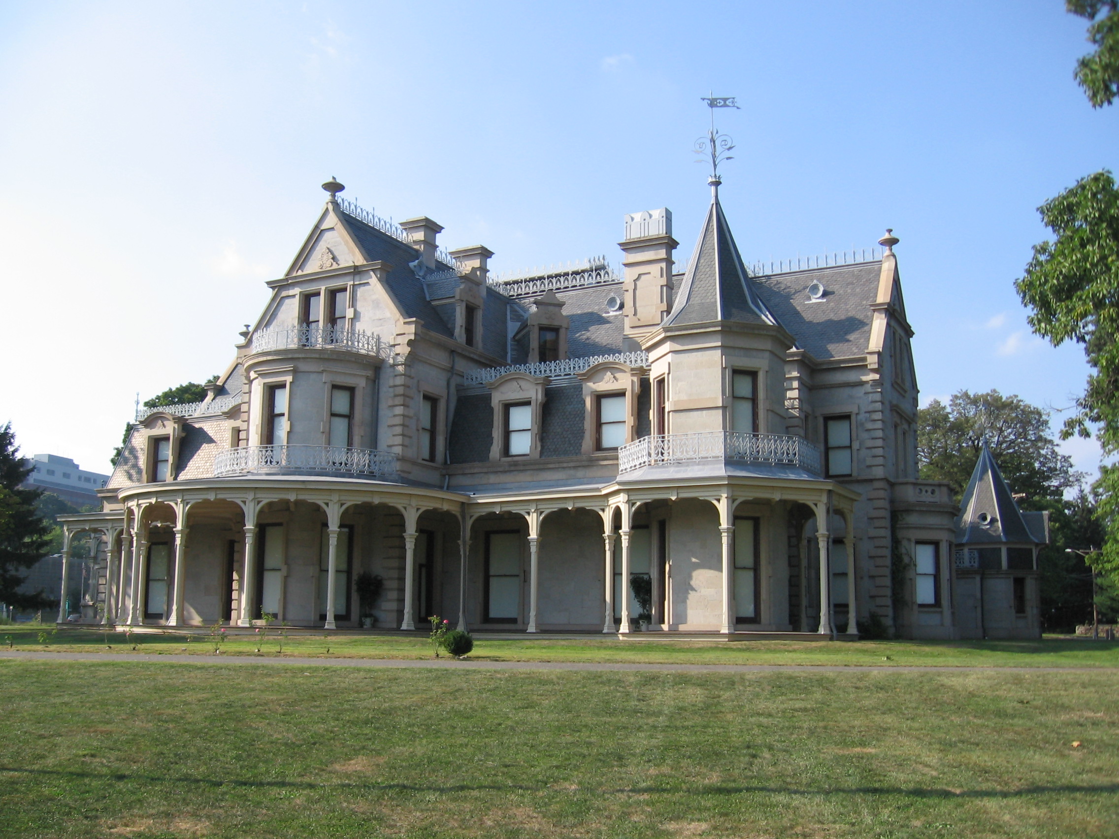
Midtown is the location of a state courthouse, the Norwalk post office, the Norwalk YMCA, Norwalk Library and the River View Mall. On the north side of the intersection of West Avenue and Interstate 95, Mathews Park is the location of the Lockwood-Mathews Mansion, the Stepping Stones Museum for Children, The Center for Contemporary Printmaking, the building which formerly housed the Norwalk police headquarters and Pine Island Cemetery. St. Mary's Roman Catholic Church, a Gothic revival building with a very tall steeple, is a local landmark.
In the summer of 2006 local merchants began the Main and Wall Street Festival with the involvement of 15 businesses, and they expanded the festival with 70 businesses involved in the second year (when it was held on August 2, 2007). At the 2007 festival, developers showed off their plans for the neighborhood.[1]
Contents
History
This portion of Norwalk was the Borough of Norwalk from 1836 [2] until incorporation as the first City of Norwalk in 1893.[3] In 1913 the separate cities of Norwalk, South Norwalk, as well as the unincorporated portions of the Town of Norwalk consolidated to form the City of Norwalk that exists to this day. Central Norwalk is now the First taxing district of the City of Norwalk. Located within the neighborhood is the "Norwalk Green Historic District" which has been on the National register of Historic Places since 1987. The historic district is bound by Smith Street, Park Street, the Boston Post Road (Cross Street), East Avenue, and Morgan Avenue. It includes the Mill Hill Historic Park (that contains the 1835 Norwalk Town House) as well as the Norwalk Green bound by East Avenue, Park Street, and St. Paul's Place.[4]
Proposed redevelopment projects
The neighborhood has been the focus of several real estate redevelopment projects and proposals.
River View Plaza
AvalonBay Communities is preparing to construct a 312-apartment complex at the site of the River View Plaza, which is expected to be demolished by the end of 2007.[1]
West Avenue
In March 2007, the Norwalk Common Council approved plans by Stanley M. Seligson Properties to redevelop a large area along West Avenue. The Council's approval came with conditions including the review of potentially historic buildings (for possible preservation), future approval of a landscaping design consistent with the Reed-Putnam redevelopment area to the south and Council approval on a case-by-case basis of any seizures of land by eminent domain if additional land-purchase negotiations fail. The redevelopment plan extends from Butler Street to Chapel Street along West Avenue and includes 350 homes and more than 600,000 square feet (60,000 m2) of office and retail space. Seligson had first proposed redeveloping the area in 1998.[5] Other developers are working on redevelopment farther north on West Avenue and to the east on Wall Street.
Wall Street
On Jun 15, 2005 the city of Norwalk granted the Poko development company rights to a 6.3-acre (25,000 m2) site in Central Norwalk. The Poko company has unveiled plans to build condominiums and townhomes near the intersections of Wall Street, Belden Avenue, West Avenue, and Isaacs Street; with the development to be called "Wall Street Place" with initial occupancy expected in 2009.[6]
Freese Park
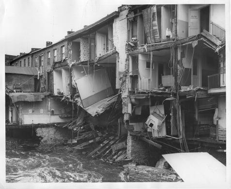
Central's parks include Freese Park, which was created at the intersection of Main and Wall Streets in the mid-1960s as part of reconstruction work following the flood of 1955.[7] On the west side of the park a fenced parapet overlooks the walled-in Norwalk River. Park benches shaded by trees also overlook the river. The park contains a monument to the Hungarian uprising of 1956, placed there by a Hungarian association in the city, and a plaque commemorating the embarkation of Nathan Hale from Norwalk Harbor in mid-September 1776 on his fatal spying mission.
"As Wall Street suffered from recent economic and structural deterioration, so did the park facility which also lacked a defined user group," according to a Norwalk city capital projects report. "A goal identified in the Wall Street Redevelopment Plan is the restoration of Wall Street as a traditional center for the Norwalk community which included the development of a downtown residential population. To achieve this goal the Plan outlined a strategy for revitalization of parks and open spaces along the Norwalk River, Freese Park specifically identified as one of these assets."[7]
In 2007 the Connecticut Light and Power Company utility helped finance $25,000 of the improvements to the park, including new lighting and landscaping, improved pathways, a new railing along the edge of the river and an irrigation system.[8]
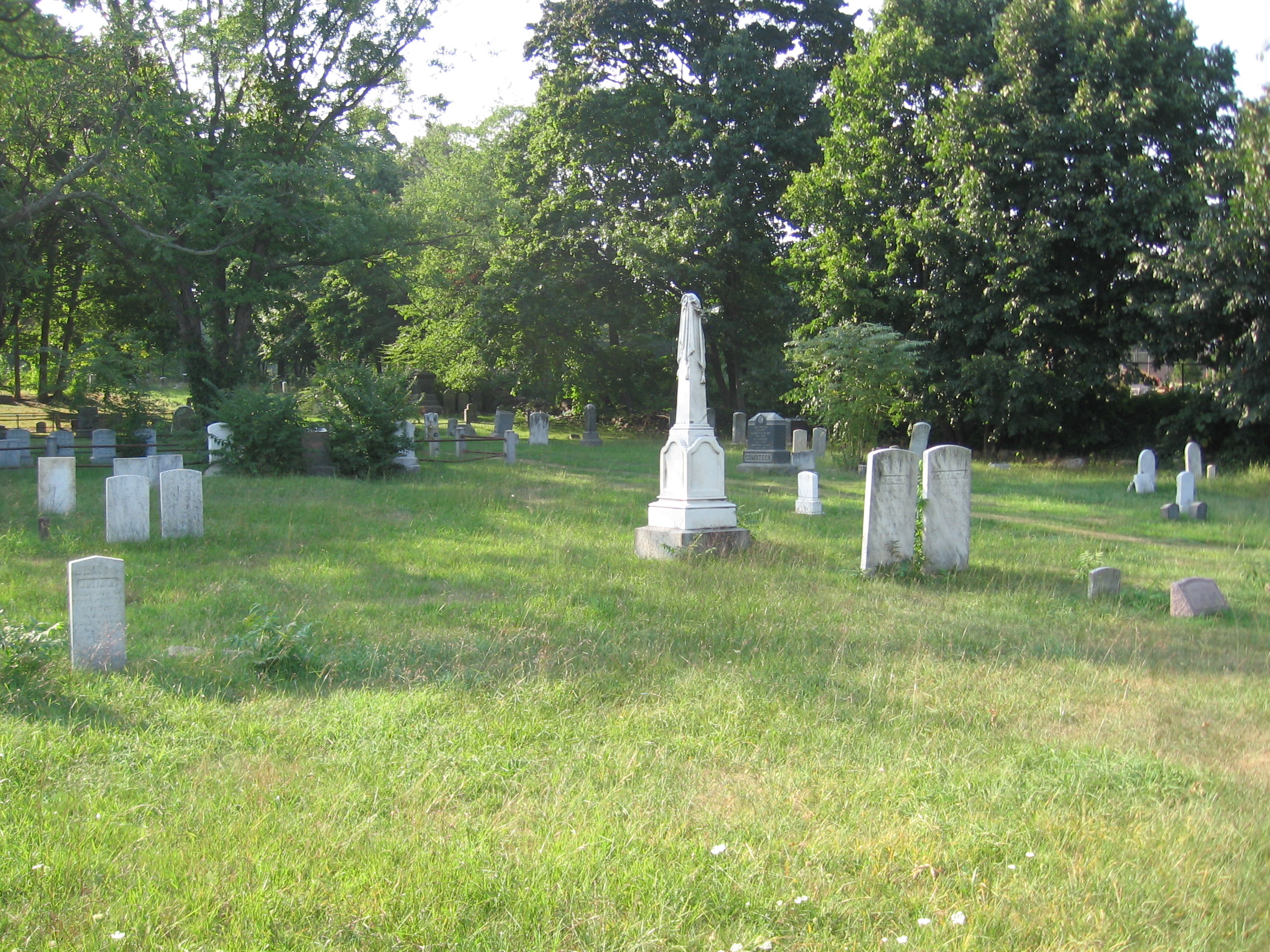
Pine Island Cemetery
 Pine Island Cemetery
The Pine Island Cemetery, located behind Mathews Park (around the Lockwood-Mathews Mansion Museum), dates to 1708 and has about 1,000 graves. The oldest identified grave belongs to Elizabeth Bartlet, wife of one of the city's founders, who died in 1723 at the age of 38. One burial in the cemetery was as late as 2000. As of the summer of 2007, the Norwalk Historical Commission, concerned that the West Avenue and Reed Putnam redevelopment projects might harm the cemetery, was attempting to get the cemetery listed on the National Register of Historic Places, a program run by the National Park Service. Widening nearby Crescent Street, for instance, would mean six graves would have to be moved. The cemetery had been the burial site of pillars of the community, with expensive, elegant gravestones, but by the mid-twentieth century it had become a gravesite for paupers.[9]
Pictures
-

Lockwood-Mathews Mansion Museum, south side
-
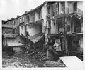
At Main and Wall streets after the October 1955 storm[10]
-
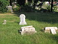
Examples of the many damaged gravestones at Pine Island Cemetery
-
Former police headquarters, Mathews Park
-

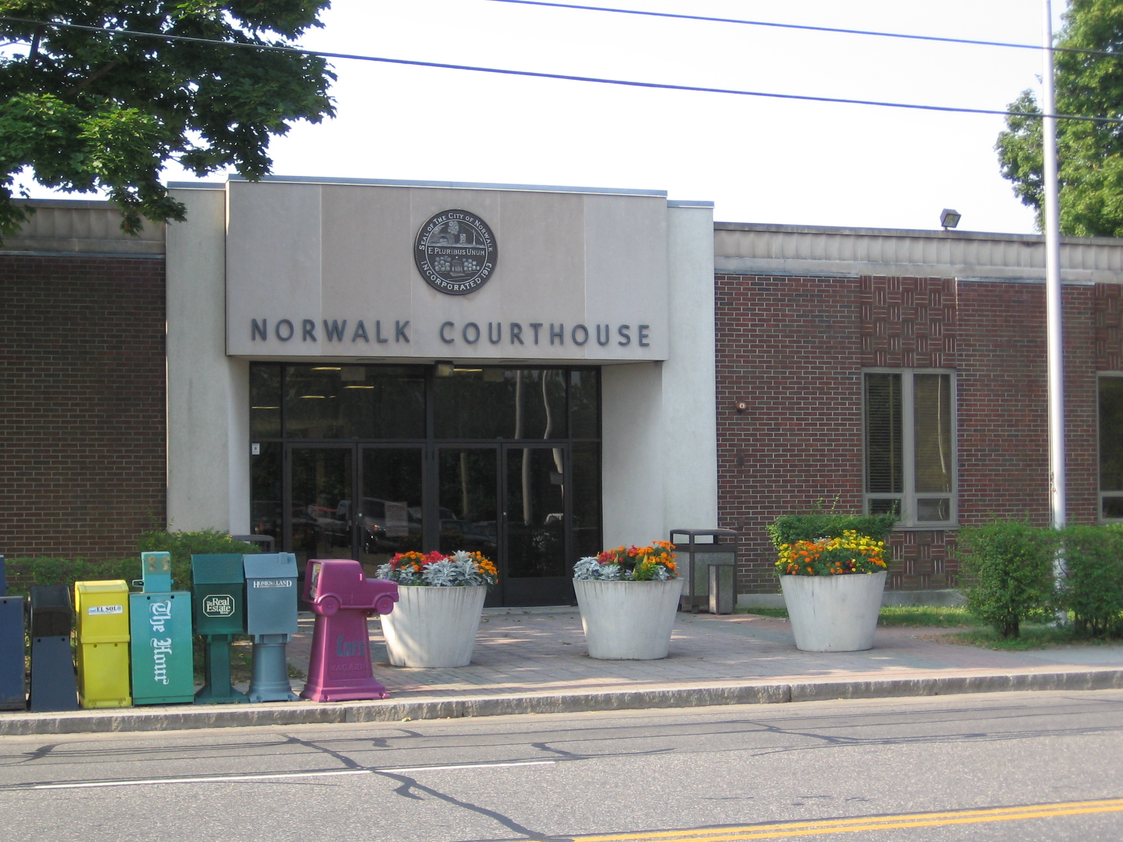
Norwalk Courthouse, Belden Avenue
-

Wall Street, about 1905
-

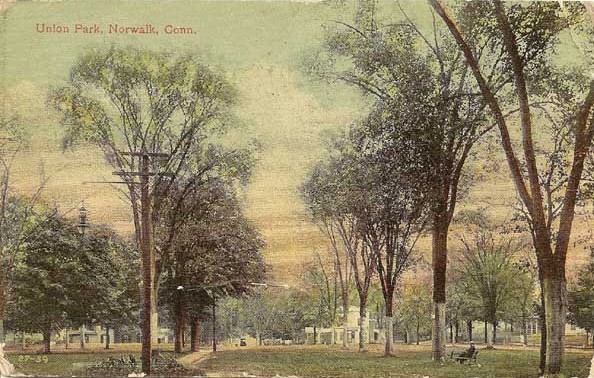
Union Park, about 1913
References
- ^ a b Breslow, Matt, "wall Street festival to show off, celebrate Norwalk revitalization", article in The Advocate of Stamford, Connecticut, pp A11-A12, Norwalk edition
- ^ Borough (Connecticut)
- ^ "SOTS: Town Elections". http://www.ct.gov/sots/cwp/view.asp?a=3188&q=392430#CITIES_IN_CONNECTICUT_WITH_DATE_OF_INCORPORATION. Retrieved 2008-08-04.
- ^ "National Register of Historic Places - CONNECTICT (CT) Fairfield County". http://www.nationalregisterofhistoricplaces.com/CT/Fairfield/districts.html. Retrieved 2008-04-01.
- ^ Stelloh, Tim, "West Ave. plan wins final OK: Some business owners promise to fight", news article, The Advocate of Stamford, Norwalk edition, March 14, 2007, pp. 1, A4
- ^ "Wall Street Place real estate development project in historic downtown Norwalk Connecticut". http://www.wallstplace.com/. Retrieved 2008-08-04.
- ^ a b [1] City of Norwalk Capital Budget document, 2006-2007, accessed May 14, 2007 (page 5)
- ^ Breslow, Matt, "CL&P grant to help 'spruce up' Freese Park", article in The Advocate of Stamford, Norwalk edition, March 6, 2007, pp All, A12
- ^ Stelloh, Tim, "Development threatens 300-year-old cemetery: Commission wants Pine Island on list of historic places", article in The Advocate of Stamford, Connecticut, pp A9-A10, Norwalk edition
- ^ There were three major storms in that affected Norwalk in 1955: Hurricane Connie, Hurricane Diane, and an unnamed storm in October. See "The Connecticut Floods of 1955". http://www.cslib.org/flood1955.htm. Retrieved 2008-04-01.
External links
- Lockwood Mathews Mansion
- Stepping Stones Museum for Children
- Center for Contemporary Printmaking
- Norwalk YMCA
 State of Connecticut
Hartford (capital) Topics Index · Culture · Constitution · Delegations · Elections · Geography · Government · History · Images · People · Visitor Attractions
Regions Counties Fairfield · Hartford · Litchfield · Middlesex · New Haven · New London · Tolland · Windham
Cities Ansonia · Bridgeport · Bristol · Danbury · Derby · Groton · Hartford · Meriden · Middletown · Milford · New Britain · New Haven · New London · Norwalk · Norwich · Shelton · Stamford · Torrington · Waterbury · West Haven
Places Municipalities and communities of Fairfield County, Connecticut Cities Bridgeport | Danbury | Norwalk | Shelton | Stamford
Towns Bethel | Brookfield | Darien | Easton | Fairfield | Greenwich | Monroe | New Canaan | New Fairfield | Newtown | Redding | Ridgefield | Sherman | Stratford | Trumbull | Weston | Westport | Wilton
Borough Other
communitiesAspetuck | Botsford | Black Rock | Branchville | Byram | Cannondale | Compo | Cos Cob | Cranbury | East Norwalk | Georgetown | Glenbrook | Glenville | Greenfield Hill | Greens Farms | Hattertown | Hawleyville | Huntington Center | Long Ridge | Lordship | Mianus | Old Greenwich | Riverside | Round Hill | Rowayton | Sandy Hook | Silvermine | South Norwalk | Southport | Stepney | Springdale
Categories:- Norwalk, Connecticut
- Neighborhoods in Connecticut


Wikimedia Foundation. 2010.