- Guilford, Connecticut
-
Guilford, Connecticut — Town — 
SealLocation in New Haven County, Connecticut
Coordinates: 41°16′58″N 72°40′55″W / 41.28278°N 72.68194°WCoordinates: 41°16′58″N 72°40′55″W / 41.28278°N 72.68194°W Country United States State Connecticut Region South Central Region Settled 1639 Established 1643 Government – Type Selectman-town meeting – First selectman Joseph S. Mazza Area – Total 49.7 sq mi (128.7 km2) – Land 47.1 sq mi (121.9 km2) – Water 2.7 sq mi (6.9 km2) Elevation 56 ft (17 m) Population (2005)[1] – Total 22,307 – Density 474/sq mi (183/km2) Time zone Eastern (UTC-5) – Summer (DST) Eastern (UTC-4) ZIP code 06437 Area code(s) 203 FIPS code 09-34950 GNIS feature ID 0213438 Website http://www.ci.guilford.ct.us/  Guilford Green and Christ Episcopal Church
Guilford is a town in New Haven County, Connecticut, United States, that borders Madison, Branford, North Branford and Durham, and is situated on I-95 and the coast. The population was 21,398 at the 2000 census. It was named one of the top 100 places to live in the United States by Money magazine in 2005.[2]
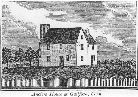
First settled in 1639 after being purchased from Native American leader Wequash, Guilford is considered by some to have the third largest collection of historic homes in New England, with important buildings from the 17th, 18th, and 19th centuries [3] There are five historic house museums, including Dudley Farm and the Henry Whitfield House (1639), the oldest dwelling house in Connecticut and the oldest stone house in North America. The Comfort Starr House (1645–46), is one of the oldest wooden framed private dwellings in Connecticut, and one of the few houses remaining of the original signers who settled Guilford.[4]
Contents
Geography
According to the United States Census Bureau, the town has a total area of 49.7 square miles (129 km2), of which 47.0 square miles (122 km2) is land and 2.7 square miles (6.9 km² or 5.39%) is water.
The northwest side of Guilford is flanked by the Metacomet Ridge, a mountainous trap rock ridgeline that stretches from Long Island Sound to nearly the Vermont border. Notable features of the Metacomet ridge in Guilford include Totoket Mountain; its most notable peak, Bluff Head; and two eastern high points on the Totoket Mountain ridge named East Sugarloaf and West Sugarloaf. The 50-mile (80 km) Mattabesett Trail traverses Bluff Head;, a shorter network of trails criss-cross the Sugarloafs. Guilford also contains the Westwoods Trail System which covers 39 miles (63 km) of trails on 1,200 acres (4.9 km2) of land.
Principal communities
- Guilford Center
- Leete's Island
- North Guilford
- Nut Plains
- Sachem's Head (named after three Pequot chiefs who were captured and decapitated there by Mohegans)[citation needed]
Other minor communities and geographic features in Guilford are: Guilford Lakes, Indian Cove, Old Quarry.
Demographics
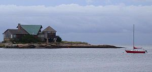 Green Island and Long Island Sound seen from Indian Neck, Branford, adjacent to Guilford
As of the census[5] of 2000, there were 21,398 people, 8,151 households, and 6,039 families residing in the town. The population density was 454.8 people per square mile (175.6/km²). There were 8,724 housing units at an average density of 185.4 per square mile (71.6/km²). The racial makeup of the town was 96.04% White, 0.93% African American, 0.05% Native American, 1.65% Asian, 0.41% from other races, and 0.93% from two or more races. Hispanic or Latino of any race were 2.13% of the population.
There were 8,151 households out of which 35.6% had children under the age of 18 living with them, 64.4% were married couples living together, 7.2% had a female householder with no husband present, and 25.9% were non-families. 21.6% of all households were made up of individuals and 8.6% had someone living alone who was 65 years of age or older. The average household size was 2.59 and the average family size was 3.04.
In the town the population was spread out with 25.4% under the age of 18, 4.4% from 18 to 24, 26.2% from 25 to 44, 31.2% from 45 to 64, and 12.8% who were 65 years of age or older. The median age was 42 years. For every 100 females there were 92.8 males. For every 100 females age 18 and over, there were 89.5 males.
The median income for a household in the town was $76,843, and the median income for a family was $87,045 (these figures had risen to $90,026 and $104,852 respectively as of a 2007 estimate[6]). Males had a median income of $60,623 versus $40,307 for females. The per capita income for the town was $37,161. About 2.3% of families and 3.1% of the population were below the poverty line, including 3.4% of those under age 18 and 3.8% of those age 65 or over.
Voter Registration and Party Enrollment as of October 25, 2005[7] Party Active Voters Inactive Voters Total Voters Percentage Democratic 4,275 82 4,357 27.69% Republican 3,837 85 3,922 24.92% Unaffiliated 7,280 148 7,428 47.20% Minor Parties 29 0 29 0.18% Total 15,421 315 15,736 100% List of town parks
The town government operates these parks:[8]
- Bittner Park — 123 acres (0.50 km2) of woodlands and 15 acres (61,000 m2) of playground, a lighted softball field (Cash Mitchell Field), baseball and soccer fields, jogging/walking path; trout trail; roller sports complex with a skate park, roller hockey and roller blading. Ice skating available in winter.[8]
- Chaffinch Island — Picnic areas, short walking trails, salt marsh.[8]
- Chittenden Park — Softball and soccer fields, bocce courts, picnicking, unsupervised beach area[8]
- Jacobs Beach — Public swimming (salt water), playground, volleyball courts, picnicking; nonresidents may use the beach, but are charged a daily fee at the gate.[8]
- Lake Quonnipaug — Public swimming, picnic area, small craft launch.[8]
- Long Hill — 8-acre (32,000 m2) park with playing fields for baseball, football, soccer/lacrosse and field hockey[8]
- Mill Pond — Lighted, supervised ice skating in winter; fishing[8]
- Nut Plains — Lacrosse/soccer field[8]
- Town Green — available for special events[8]
Notable locations
- Bishop's Orchards
- Rothberg Institute For Childhood Diseases
- Sachem's Head Yacht Club
- Guilford Green
- Westwoods
National Historic Places and other historic sites
Historic sites in or near Guilford, which may or may not be listed on the National Register of Historic Places, may or may not include:
 The Comfort Starr House
- Acadian House.[9]
- Thomas Burgis II House
- Comfort Starr House
- Dudleytown Historic District
- Jared Eliot House
- Falkner's Island Lighthouse
- Griswold House
- Guilford Historic Town Center
- Hyland-Wildman House
- Pelatiah Leete House
- Meeting House Hill Historic District
- Elisha Pitkin House
- Route 146 Historic District
- Sabbathday House
- Henry Whitfield House
References
- ^ U.S. Census Bureau Population Estimates
- ^ Money Top 100 Best Places to Live 2005 Retrieved on 2008-01-09
- ^ The Connecticut Nutmegger, Connecticut Society of Genealogists, (Connecticut Society of Genealogists, 1981).
- ^ Federal Writers' Project (1938). Connecticut. Houghton Mifflin Company. ISBN 9781603540070.
- ^ "American FactFinder". United States Census Bureau. http://factfinder.census.gov. Retrieved 2008-01-31.
- ^ http://factfinder.census.gov/servlet/ACSSAFFFacts?_event=Search&geo_id=06000US0900331240&_geoContext=01000US%7C04000US09%7C05000US09003%7C06000US0900331240&_street=&_county=guilford&_cityTown=guilford&_state=04000US09&_zip=&_lang=en&_sse=on&ActiveGeoDiv=geoSelect&_useEV=&pctxt=fph&pgsl=060&_submenuId=factsheet_1&ds_name=ACS_2007_3YR_SAFF&_ci_nbr=null&qr_name=null®=null%3Anull&_keyword=&_industry=
- ^ "Registration and Party Enrollment Statistics as of October 25, 2005" (PDF). Connecticut Secretary of State. Archived from the original on 2006-09-23. http://web.archive.org/web/20060923151511/http://www.sots.ct.gov/ElectionsServices/lists/2005OctRegEnrollStats.pdf. Retrieved 2006-10-02.
- ^ a b c d e f g h i j [1] Web page titled "Guilford" at Hartford Courant Web site, dated August 16, 2006, accessed January 14, 2007
- ^ Guilford-Acadians website retrieved on 2009-05-13
External links
- Town of Guilford
- Guilford Free Library
- Guilford Public Schools
- Guilford, CT on Google Maps Satellite
- Guilford Chamber of Commerce
 State of Connecticut
Topics - Index
- Culture
- Constitution
- Delegations
- Elections
- Geography
- Government
- History
- Images
- People
- Visitor Attractions
Regions Counties Cities Places Municipalities and communities of New Haven County, Connecticut Cities 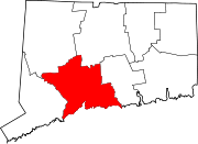
Towns Beacon Falls | Bethany | Branford | Cheshire | East Haven | Guilford | Hamden | Madison | Middlebury | Naugatuck* | North Branford | North Haven | Orange | Oxford | Prospect | Seymour | Southbury | Wallingford | Wolcott | Woodbridge
*Consolidated borough and town
Borough Unincorporated
communitiesDevon | Fair Haven | Heritage Village | Northford | Quaker Farms | Short Beach | South Britain | Stony Creek | Waterville | Westville | Yalesville
Categories:- Guilford, Connecticut
- Towns in New Haven County, Connecticut


Wikimedia Foundation. 2010.