- Madison, Connecticut
-
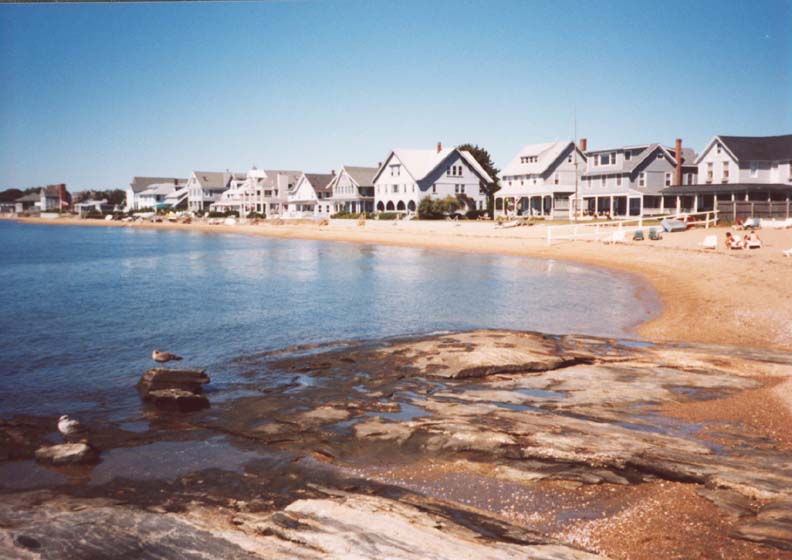
Madison, Connecticut — Town — Beach on Long Island Sound in Madison

SealLocation in New Haven County, Connecticut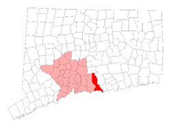
Coordinates: 41°20′16″N 72°37′46″W / 41.33778°N 72.62944°WCoordinates: 41°20′16″N 72°37′46″W / 41.33778°N 72.62944°W Country United States State Connecticut Region South Central Region Incorporated 1826 Government – Type Selectman-town meeting – First Selectman Fillmore McPherson Area – Total 36.8 sq mi (95.3 km2) – Land 36.2 sq mi (93.8 km2) – Water 0.6 sq mi (1.5 km2) Elevation 223 ft (68 m) Population (2005)[1] – Total 18,812 – Density 520/sq mi (201/km2) Time zone Eastern (UTC-5) – Summer (DST) Eastern (UTC-4) ZIP code 06443 Area code(s) 203 FIPS code 09-44560 GNIS feature ID 0213454 Website http://www.madisonct.org/ Madison is a town in the southeastern corner of New Haven County, Connecticut, occupying a central location on Connecticut's Long Island Sound shoreline. The population was 18,812 at the 2000 census.
Madison was first settled in 1641. Throughout the 18th century, Madison was known as East Guilford until it was incorporated as a town in 1826. Since then, Madison and Guilford have shared many cultural and economic similarities despite an unofficial high school rivalry.
Bill Clinton favorably mentions the town in his autobiography, My Life.
Contents
Beaches
Hammonasset State Park possesses the state's longest public beach, with campsites, picnic areas, and a fishing pier, and is extremely popular in the summer causing traffic jams on I-95 on peak days.
Surf Club Beach is the town's major public beach with lifeguards, recreational facilities for baseball, softball, basketball, volleyball and horseshoes. Play grounds for children and picnic tables for families, as well as sailboat racks and kayak racks.
East Wharf sometimes referred to as the "purple sand beach" has life guards, a pier, kayak and sailboat racks in addition to a fantastic gazebo.
West Wharf has a pier, rock formations to the west, a small sunbathing beach and boat spaces.
The Madison Beach Club has its own beach and is a private country club.
Geography
According to the United States Census Bureau, the town has a total area of 36.8 square miles (95.3 km²) of which, 36.2 square miles (93.8 km²) of it is land and 0.6 square miles (1.5 km²) of it (1.58%) is water.
Principal communities
- East River
- Hammonasset Point
- Madison Center
- North Madison
- Rockland
Madison Center
Madison's center of town is the main area for businesses and the location of the town library and Madison Green. The center preserves its old village charm by keeping large franchises out.[citation needed] The center has many boutiques and coffee shops. Although it is called "the center" it is not the actual geographic center of Madison, but is actually located on the south eastern part of town nearer to Clinton.
Education
Madison Public Schools serve grades K-12 and include Ryerson Elementary School, Island Avenue Elementary School, Jeffery Elementary School, Brown Middle School, Polson Middle School, and Daniel Hand High School. Year-round residents boast of a superior school system, an expansive recreational program and many opportunities for volunteer work.[citation needed]
Private elementary Schools in Madison include Our Lady of Mercy School and The Country School.
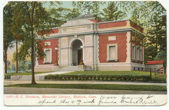
E.C. Scranton Memorial Library
 E.C. Scranton Memorial Library, about 1906
The E.C. Scranton Memorial Library was a 1901 gift to the townspeople from Mary Scranton. The original building was designed by the architect Henry Bacon, who later designed the Lincoln Memorial. Currently this popular library features 114,000 volumes and has an average of 360 visits per day, 860 programs per year. The 1906 postcard below shows the library as it appears at that time. After an expansion in 1989, the main building (the one in the postcard) became the children's section and the expansion to the right of the main door became the main entrance and the adult
Demographics
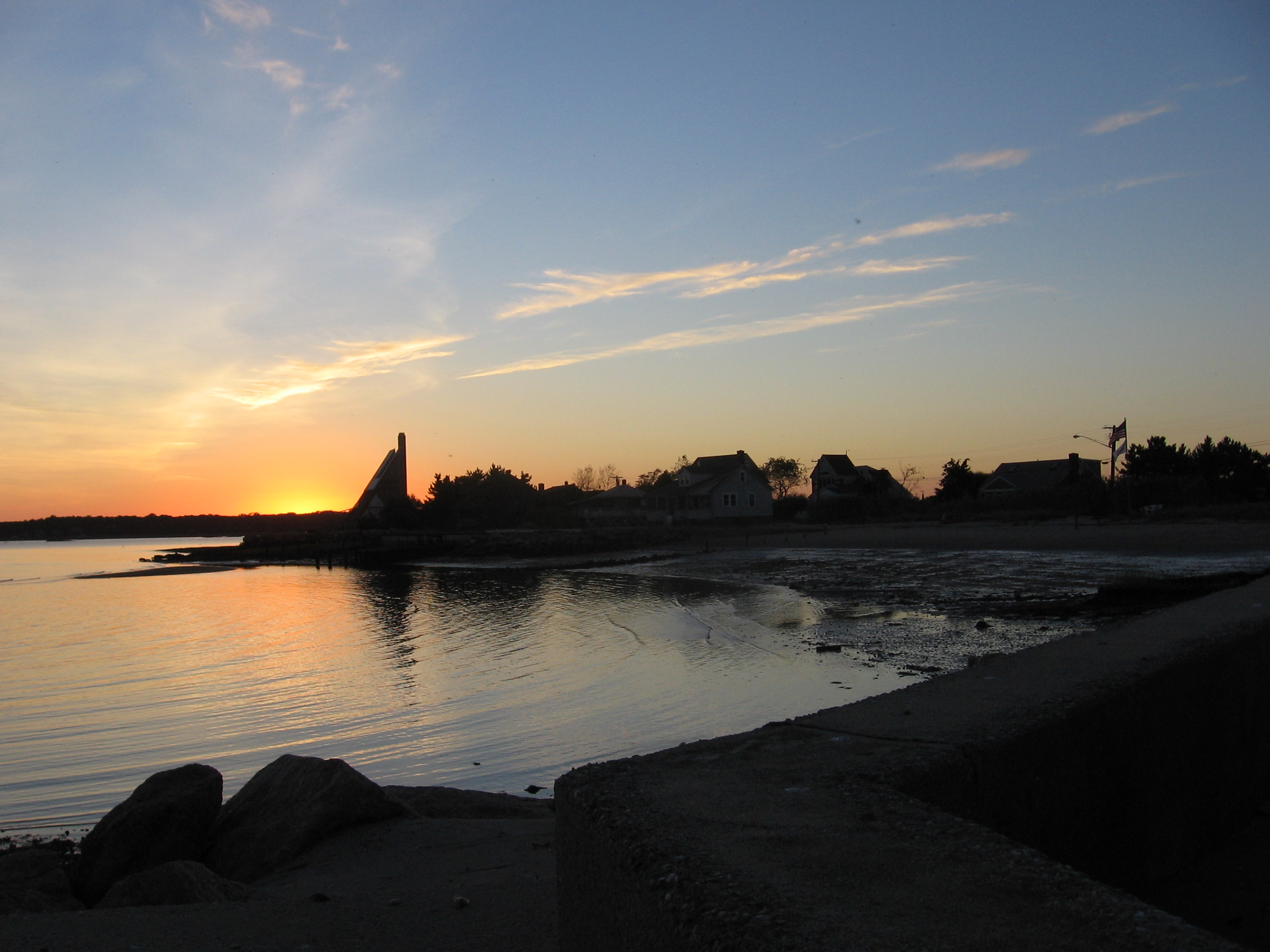
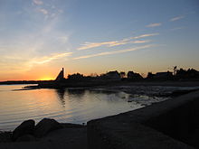 The beach at sunset
As of the census[2] of 2000, there were 17,858 people, 6,515 households, and 5,120 families residing in the town. The population density was 493.3 people per square mile (190.5/km²). There were 7,386 housing units at an average density of 204.0 per square mile (78.8/km²). The racial makeup of the town was 96.62% White, 0.40% African American, 0.06% Native American, 1.71% Asian, 0.01% Pacific Islander, 0.25% from other races, and 0.94% from two or more races. Hispanic or Latino of any race were 1.34% of the population.
There were 6,515 households out of which 39.1% had children under the age of 18 living with them, 69.8% were married couples living together, 6.6% had a female householder with no husband present, and 21.4% were non-families. 18.5% of all households were made up of individuals and 8.5% had someone living alone who was 65 years of age or older. The average household size was 2.72 and the average family size was 3.12.
In the town the population was spread out with 28.2% under the age of 18, 3.8% from 18 to 24, 25.3% from 25 to 44, 28.6% from 45 to 64, and 14.1% who were 65 years of age or older. The median age was 41 years. For every 100 females there were 93.2 males. For every 100 females age 18 and over, there were 89.8 males.
The median income for a household in the town was $87,497, and the median income for a family was $101,297. Males had a median income of $73,525 versus $41,058 for females. The per capita income for the town was $40,537. About 0.9% of families and 1.3% of the population were below the poverty line, including 0.5% of those under age 18 and 2.4% of those age 65 or over.
Voter Registration and Party Enrollment as of October 25, 2005[3] Party Active Voters Inactive Voters Total Voters Percentage Republican 4,459 48 4,507 33.91% Democratic 2,842 37 2,879 21.66% Unaffiliated 5,759 78 5,837 43.91% Minor Parties 69 0 69 0.52% Total 13,129 163 13,292 100% Transportation
The Estuary Transit District provides public transportation between Madison center and Old Saybrook along Route 1 through its 9 Town Transit Service. Services include connections to the Old Saybrook Train Station, served by Amtrak and Shoreline East railroads. The CT Public Transit S bus travels between Madison and New Haven for $1.25 each way.
List of National Historic Sites in Madison
- Allis-Bushnell House, added February 25, 1982
- Hammanasset Paper Mill Site, added February 23, 1996
- Madison Green Historic District, added June 28, 1982
- Meigs-Bishop House, added June 16, 1988
- Jonathan Murray House, added April 12, 1982
- Shelley House, added February 9, 1989
- State Park Supply Yard, added September 4, 1986
Notable people, past and present
- Jill Abramson, editor of the New York Times.
- Sally Benson, screenwriter "Meet Me in St. Louis".
- Elizabeth Bentley, Soviet Spy.
- Cornelius Bushnell, Financier for the American Civil War ironclad ship USS Monitor and a railroad pioneer and investor.
- Jim Calhoun (b. 1942) head coach of the Connecticut Huskies men's basketball team, owns a home in Madison.
- Thomas Chittenden, Founder of the independent Vermont Republic and first Governor to the State of Vermont.
- Ranulf Compton (1878–1974) a United States Representative from Connecticut.
- Frank Duryea, invented the gasoline engine and developed the first commercially manufactured automobile.
- Peter Hastings Falk, expert on American art.
- John Gunther, author "Death Be Not Proud", "Inside Europe".
- Arnold Jackson, 1500 metres gold medalist in the 1912 Olympics and World War I Brigadier General in the British army.
- Dr. Edwin D. Kilbourne, developed vaccine to treat the Influenza virus & principal adviser to President Ford during the swine flu epidemic.
- Charles Kullman, tenor with the Metropolitan Opera.
- Rob Moroso, NASCAR driver.
- Westbrook Pegler, anti-New Deal columnist.
- Jacques Pépin, Celebrity chef[4]
- Edgar Snow, journalist, author, and Cold War-era China expert who knew Mao.
- Karlheinz Stockhausen, German composer.
- Grover Whalen, politician and public relations genius known as "Mr. New York".
- Wheeler Williams (1897–1972), Sculptor.
- Laurence Witten, antiquarian bookseller who sold the Vinland Map to Yale University.
Sister cities
See also
References
- ^ U.S. Census Bureau Population Estimates
- ^ "American FactFinder". United States Census Bureau. http://factfinder.census.gov. Retrieved 2008-01-31.
- ^ "Registration and Party Enrollment Statistics as of October 25, 2005" (PDF). Connecticut Secretary of State. Archived from the original on 2006-09-23. http://web.archive.org/web/20060923151511/http://www.sots.ct.gov/ElectionsServices/lists/2005OctRegEnrollStats.pdf. Retrieved 2006-10-02.
- ^ Maker, Elizabeth, "Suddenly, Balls in Every Court", The New York Times, June 1, 2003, retrieved January 27, 2010
External links
- North Madison Volunteer Fire Company
- Town of Madison Website
- Madison Chamber of Commerce
- Madison Republican Town Committee
- Madison Democratic Town Committee
- E.C. Scranton Memorial Library
- Madison Exchange Club
- Madison Little League
- Madison Rotary Club
- Madison Historical Society
 State of Connecticut
Topics - Index
- Culture
- Constitution
- Delegations
- Elections
- Geography
- Government
- History
- Images
- People
- Visitor Attractions
Regions Counties Cities Places Municipalities and communities of New Haven County, Connecticut Cities 
Towns Beacon Falls | Bethany | Branford | Cheshire | East Haven | Guilford | Hamden | Madison | Middlebury | Naugatuck* | North Branford | North Haven | Orange | Oxford | Prospect | Seymour | Southbury | Wallingford | Wolcott | Woodbridge
*Consolidated borough and town
Borough Unincorporated
communitiesDevon | Fair Haven | Heritage Village | Northford | Quaker Farms | Short Beach | South Britain | Stony Creek | Waterville | Westville | Yalesville
Categories:- Madison, Connecticut
- Towns in New Haven County, Connecticut

Wikimedia Foundation. 2010.