- Clinton, Connecticut
-
Clinton, Connecticut — Town — 
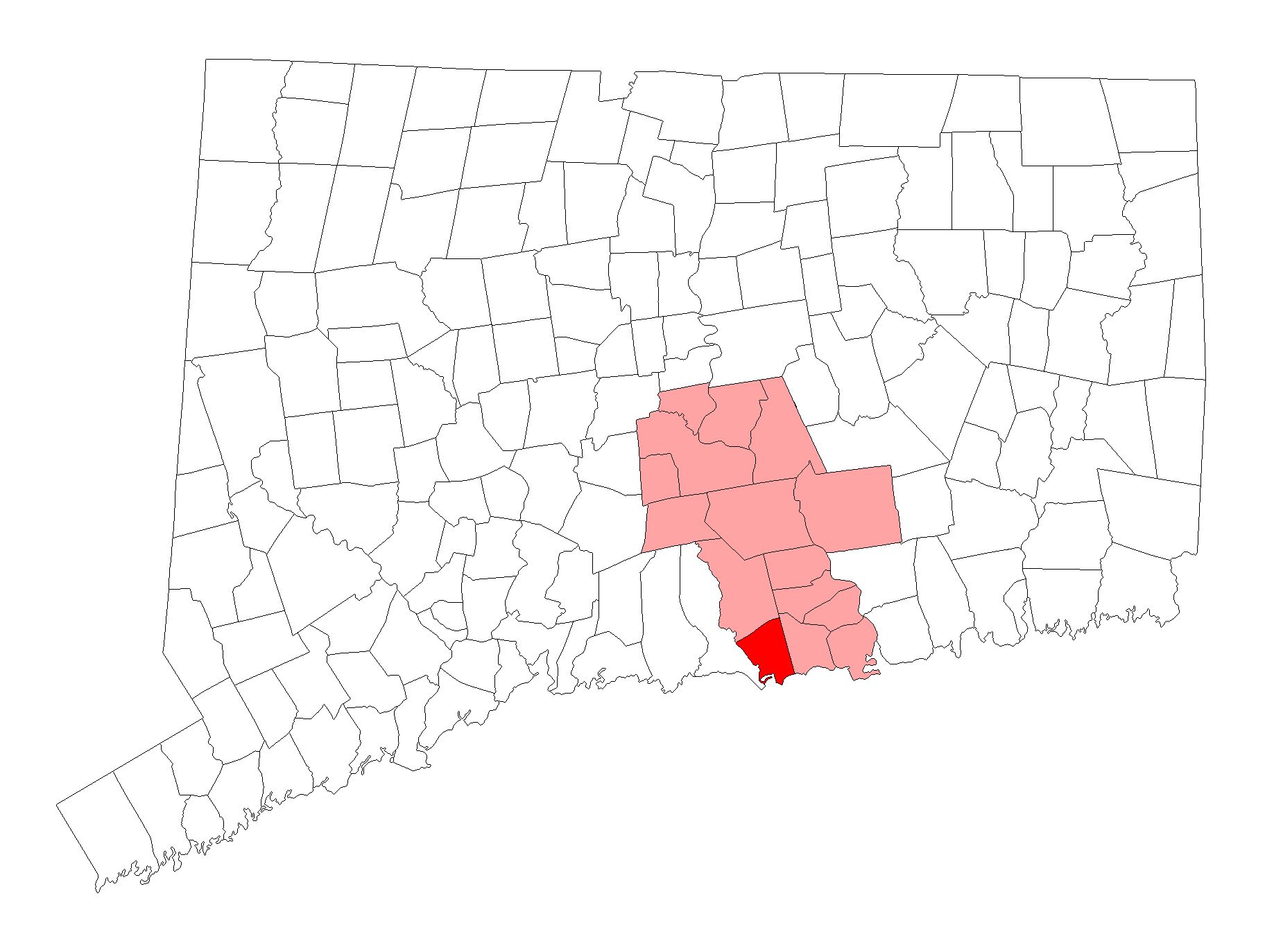
SealLocation within Middlesex County, Connecticut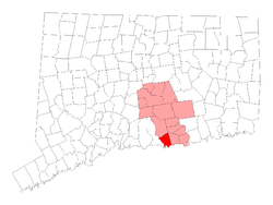
Coordinates: 41°17′40″N 72°31′39″W / 41.29444°N 72.5275°WCoordinates: 41°17′40″N 72°31′39″W / 41.29444°N 72.5275°W Country United States State Connecticut NECTA New Haven Region Connecticut River Estuary Incorporated 1838 Government – Type Selectman-town meeting – First selectman William W. Fritz, Jr. Area – Total 19.0 sq mi (49.2 km2) – Land 16.3 sq mi (42.2 km2) – Water 2.8 sq mi (7.2 km2) Elevation 33 ft (10 m) Population (2005) – Total 13,612 – Density 835/sq mi (322/km2) Time zone EST (UTC-5) – Summer (DST) EDT (UTC-4) ZIP code 06413 Area code(s) 860 FIPS code 09-15350 GNIS feature ID 0213408 Website http://www.clintonct.org/ Clinton is a town located on Long Island Sound in Middlesex County, Connecticut, United States. The population was 13,094 at the 2000 census. The town center along the shore line was listed as a census-designated place (CDP) by the U.S. Census Bureau in the 2000 census.
Contents
Geography
According to the United States Census Bureau, the town has a total area of 19.0 square miles (49 km2), of which, 16.3 square miles (42 km2) of it is land and 2.8 square miles (7.3 km2) of it (14.50%) is water. The CDP corresponding to the town center has a total area of 2.7 square miles (7.0 km2), of which, 2.4 square miles (6.2 km2) of it is land and 0.3 square miles (0.78 km2) of it is water.
Clinton is bordered by the town of Madison on the west, the town of Westbrook on the east, and the town of Killingworth on the north. Clinton is located directly off Long Island Sound. Clinton has one town beach named Clinton Beach. Many fishermen come to Clinton to catch bluefish. The annual Blue Fish Festival is held in Clinton every summer.
Cedar Island (Connecticut) is located in Clinton Harbor.
Other minor communities and geographic features in Clinton are: Beach Park, Boulder Lake, Clinton Beach, Cow Hill, Duck Hole, Grove Beach, Grove Beach Manor, Harbor View, Kelseytown, Lochwood, Mill District, Old Harbor Village, Ridgewood, Riverside, Silver Bluff.
Demographics
As of the census[1] of 2000, there were 13,094 people, 5,134 households, and 3,614 families residing in the town. The population density was 804.2 people per square mile (310.5/km²). There were 5,757 housing units at an average density of 353.6 per square mile (136.5/km²). The racial makeup of the town was 95.85% White, 0.57% Black or African American, 0.29% Native American, 1.13% Asian, 0.02% Pacific Islander, 1.02% from other races, and 1.12% from two or more races. Hispanic or Latino of any race were 3.99% of the population.
There were 5,134 households out of which 33.4% had children under the age of 18 living with them, 59.1% were married couples living together, 8.4% had a female householder with no husband present, and 29.6% were non-families. 23.7% of all households were made up of individuals and 8.7% had someone living alone who was 65 years of age or older. The average household size was 2.55 and the average family size was 3.04.
In the town the population was spread out with 25.1% under the age of 18, 5.8% from 18 to 24, 31.1% from 25 to 44, 26.7% from 45 to 64, and 11.3% who were 65 years of age or older. The median age was 38 years. For every 100 females there were 93.7 males. For every 100 females age 18 and over, there were 91.4 males.
The median income for a household in the town was $60,471, and the median income for a family was $71,403. Males had a median income of $47,363 versus $34,983 for females. The per capita income for the town was $26,080. About 2.0% of families and 4.2% of the population were below the poverty line, including 4.8% of those under age 18 and 3.9% of those age 65 or over. Pronunciation of the name of the town varies, including CLIN-tun, and CLINT-in (much like the name of a twentieth-century president.
Voter Registration and Party Enrollment as of October 25, 2005[2] Party Active Voters Inactive Voters Total Voters Percentage Republican 2,379 34 2,413 26.53% Democratic 2,259 34 2,293 25.21% Unaffiliated 4,318 68 4,386 48.22% Minor Parties 3 0 3 0.03% Total 8,959 136 9,095 100% Town center
The town center is known as Clinton Center. It is the location of the Clinton Village Historic District, which is listed on the National Register of Historic Places.
It is also the center of a Census Designated Place named for it, as Clinton CDP. As of the census2 of 2000, there were 3,516 people, 1,515 households, and 895 families residing in the CDP corresponding to the town center. The population density was 1,451.5 inhabitants per square mile (561.0/km²). There were 1,624 housing units at an average density of 670.4 per square mile (259.1/km²). The racial makeup of the CDP was 95.11% White, 0.63% Black or African American, 0.26% Native American, 1.19% Asian, 0.03% Pacific Islander, 1.42% from other races, and 1.37% from two or more races. Hispanic or Latino of any race were 6.74% of the population.
There were 1,515 households out of which 28.2% had children under the age of 18 living with them, 46.2% were married couples living together, 9.9% had a female householder with no husband present, and 40.9% were non-families. 32.3% of all households were made up of individuals and 12.1% had someone living alone who was 65 years of age or older. The average household size was 2.32 and the average family size was 2.98.
In the CDP the population was spread out with 22.5% under the age of 18, 6.3% from 18 to 24, 32.1% from 25 to 44, 24.4% from 45 to 64, and 14.7% who were 65 years of age or older. The median age was 39 years. For every 100 females there were 89.3 males. For every 100 females age 18 and over, there were 87.2 males.
The median income for a household in the CDP was $47,538, and the median income for a family was $59,667. Males had a median income of $43,672 versus $31,354 for females. The per capita income for the CDP was $23,404. About 3.9% of families and 5.8% of the population were below the poverty line, including 5.6% of those under age 18 and 3.6% of those age 65 or over.
History
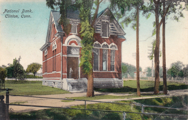
 National Bank in Clinton, about 1908
Clinton traces its history from 1663 when the land between Guilford and Saybrook, as they were then bounded, was known as Hammonasset. In this year a committee was appointed by the General Court at Hartford to lay out this area as a plantation. In 1667 the settlement was designated a town and named Kenilworth. By the middle of the eighteenth century, through changes in usage, this name became Killingworth. In 1838 the southern portion was incorporated by the General Assembly as the Town of Clinton, the northern portion retaining the name of Killingworth. The town was named after New York Governor DeWitt Clinton.[3] The line marking the division between the towns of Killingworth and Clinton was the same as that which divided the first and second ecclesiastical societies, or, as they were later known, "school societies," which were established in 1735.
As in most small New England shore towns, life centered about fishing, farming, shipbuilding, and the church. One of the early leaders of Clinton's church was the Reverend Abraham Pierson. In 1701, when the General Court of the Colony in Hartford granted a charter for "the founding of a collegiate school within His Majesty's Colony of Connecticut, " its founders chose the Reverend Mr. Pierson as its rector. The first classes were held in his parsonage in Clinton. In later years the school was moved to Saybrook and then to New Haven, where it eventually became Yale University. A story entitled "The Birth of Yale" can be found at the town's website and was authored by Clinton resident Peggy Adler.
In the 20th century, Clinton prospered as a suburban bedroom community of New Haven.
Transportation
The Estuary Transit District provides public transportation throughout Clinton and the surrounding towns through its 9 Town Transit Service. Services include connections to the Old Saybrook Train Station, served by Amtrak and Shoreline East railroads.
Points of interest
The eastern half of the town center (east of the Indian River) is listed on the National Register of Historic Places as a historic district known as the Clinton Village Historic District. The central portion of the historic district containing the town green is a local historic district known as the Liberty Green Historic District.
The Clinton Historical Society runs the Buell Tool Museum and the Clinton Historical Society Museum in Andrews Memorial Town Hall. The society's 1750 Elisha White House (known as Old Brick), the oldest brick home between New Haven and New London, has antique furniture, paintings, toys and quilts.
Trivia
Clinton is known as the bluefish capital of the world.
The Bluefish Festival is held annually at the Clinton marina, but in the summer of 2008, it was held at the Clinton Town Hall due to marina construction. It has been held at the Town Hall since.
Notable people, past and present
- Horatio Wright: Civil War general and later, Chief of Army Corps of Engineers
- Dr. Seuss: Children's book writer summered here
- Abraham Pierson: One of the founders of Yale University
- Erica Hill: CNN Headline News news anchor
- Peggy Adler: Author & Illustrator of Children's books; Investigative Researcher; Police Commissioner
- Charles Morgan: Railroad and shipping magnate
- Jared Eliot: Minister, physician, agriculturalist
References
- ^ "American FactFinder". United States Census Bureau. http://factfinder.census.gov. Retrieved 2008-01-31.
- ^ "Registration and Party Enrollment Statistics as of October 25, 2005" (PDF). Connecticut Secretary of State. http://www.sots.ct.gov/ElectionsServices/lists/2005OctRegEnrollStats.pdf. Retrieved 2006-10-02.
- ^ "Profile for Clinton, Connecticut". ePodunk. http://www.epodunk.com/cgi-bin/genInfo.php?locIndex=9122. Retrieved 2010-04-26.
External links
- Town website
- The Clinton Historical Society
- The Henry Carter Hull Library
- The Kelseytown Gazette: Clinton's History
 State of Connecticut
Topics - Index
- Culture
- Constitution
- Delegations
- Elections
- Geography
- Government
- History
- Images
- People
- Visitor Attractions
Regions Counties Cities Places Municipalities and communities of Middlesex County, Connecticut City 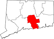
Towns Chester | Clinton | Cromwell | Deep River | Durham | East Haddam | East Hampton | Essex | Haddam | Killingworth | Middlefield | Old Saybrook | Portland | Westbrook
Borough Unincorporated
communitiesCenterbrook | Essex Village | Higganum | Ivoryton | Lake Pocotopaug | Leesville | Middle Haddam | Millington | Moodus | Saybrook Manor
Categories:- Clinton, Connecticut
- Towns in Middlesex County, Connecticut
- Populated coastal places in Connecticut

Wikimedia Foundation. 2010.