- Deep River, Connecticut
-
Deep River, Connecticut — Town — 
SealLocation within Middlesex County, Connecticut
Coordinates: 41°22′03″N 72°27′50″W / 41.3675°N 72.46389°WCoordinates: 41°22′03″N 72°27′50″W / 41.3675°N 72.46389°W Country United States State Connecticut NECTA New Haven Region Connecticut River Estuary Established 1635 Name changed 1947 Government - Type Selectman-town meeting - First selectman Richard H. Smith Area - Total 14.2 sq mi (36.8 km2) - Land 13.6 sq mi (35.1 km2) - Water 0.6 sq mi (1.6 km2) Elevation 131 ft (40 m) Population (2010) - Total 4,629 - Density 325.8/sq mi (125.8/km2) Time zone Eastern (UTC-5) - Summer (DST) Eastern (UTC-4) ZIP code 06417, 06419 Area code(s) 860 FIPS code 09-19130 GNIS feature ID 0213417 Website www.deepriverct.us Deep River (formerly known as Saybrook) is a town in Middlesex County, Connecticut, United States. The population was 4,629 at the 2010 census. The town center is also designated by the U.S. Census Bureau as a census-designated place (CDP). Deep River is part of what the locals call the "Tri-town Area" made up of Deep River, Chester, and Essex, Connecticut.
Every year on the third Saturday in July, Deep River hosts the Deep River Ancient Muster. It is the largest one day gathering of fife and drum corps in the world.[citation needed]
Contents
Geography
According to the United States Census Bureau, the town has a total area of 14.2 square miles (37 km2), of which, 13.6 square miles (35 km2) of it is land and 0.6 square miles (1.6 km2) of it (4.30%) is water. The CDP has a total area of 2.7 square miles (7.0 km2) of which 4.38% is water.
Principal communities
- Deep River center
- Winthrop
History
See also: Saybrook ColonySaybrook Colony formally joined Connecticut in 1644. The portion of the original colony east of the Connecticut River was set off as a separate town in 1665. The site of the present village of Deep River was said to have been owned by John, Nathaniel, and Philip Kirtland in 1723.[1] The village of Winthrop was said to have been settled by Baptists as early as 1729.[1] In the early to mid-19th century, various portions of Saybrook broke off as separate towns, starting from Chester in 1836 to Old Saybrook in 1854. In 1947, the town of Saybrook changed its name to "Deep River", matching the name of the town center village.
Towns created from Saybrook Colony
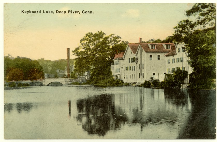
 Keyboard Lake, from an early postcard
Saybrook Colony along the mouth of the Connecticut River was one of the early settlements in the area. Several towns broke off and incorporated separately over the course of time. The towns which were created from parts of Saybrook Colony are listed below.
- Lyme (originally East Saybrook) in 1665
- Chester in 1836
- Westbrook in 1840
- Essex (originally Old Saybrook) in 1852
- Old Saybrook created from Essex in 1854
Points of interest
These sites in town are on the National Register of Historic Places:
- Deep River Freight Station – 152 River St.; since December 21, 1994
- Deep River Town Hall – Connecticut Route 80 and Connecticut Route 9A; since January 1, 1976
- Doris (Sailing yacht) – Connecticut River off River Rd.; located there when NRHP-listed, May 31, 1984
- Pratt, Read and Company Factory Complex – Main St. between Bridge and Spring Sts. and 5 Bridge St.; since August 30, 1984
Demographics
Historical population of
Deep River [1]1970 3,690 1980 3,994 1990 4,332 2000 4,610 2010 4,629 As of the census[2] of 2000, there were 4,610 people, 1,824 households, and 1,262 families residing in the town. The population density was 340.1 people per square mile (131.4/km²). There were 1,910 housing units at an average density of 140.9 per square mile (54.4/km²). The racial makeup of the town was 94.56% White, 2.41% African American, 0.04% Native American, 0.80% Asian, 0.07% Pacific Islander, 1.04% from other races, and 1.08% from two or more races. Hispanic or Latino of any race were 2.95% of the population.
There were 1,824 households out of which 30.2% had children under the age of 18 living with them, 56.6% were married couples living together, 9.1% had a female householder with no husband present, and 30.8% were non-families. 24.0% of all households were made up of individuals and 8.7% had someone living alone who was 65 years of age or older. The average household size was 2.46 and the average family size was 2.93.
In the town the population was spread out with 24.3% under the age of 18, 5.4% from 18 to 24, 30.6% from 25 to 44, 26.3% from 45 to 64, and 13.3% who were 65 years of age or older. The median age was 39 years. For every 100 females there were 98.5 males. For every 100 females age 18 and over, there were 96.6 males.
The median income for a household in the town was $51,677, and the median income for a family was $62,260. Males had a median income of $46,268 versus $32,454 for females. The per capita income for the town was $32,604. About 3.9% of families and 5.1% of the population were below the poverty line, including 4.7% of those under age 18 and 7.8% of those age 65 or over.
CDP
As of the census of 2000, there were 2,470 people, 1,023 households, and 652 families residing in the CDP. The population density was 943.2 inhabitants per square mile (364.0/km²). There were 1,077 housing units at an average density of 411.3 per square mile (158.7/km²). The racial makeup of the CDP was 92.19% White, 3.72% African American, 0.08% Native American, 0.61% Asian, 0.04% Pacific Islander, 1.94% from other races, and 1.42% from two or more races. Hispanic or Latino of any race were 3.81% of the population.
There were 1,023 households out of which 26.7% had children under the age of 18 living with them, 50.0% were married couples living together, 10.6% had a female householder with no husband present, and 36.2% were non-families. 29.2% of all households were made up of individuals and 9.8% had someone living alone who was 65 years of age or older. The average household size was 2.30 and the average family size was 2.84.
In the CDP the population was spread out with 23.1% under the age of 18, 6.3% from 18 to 24, 31.6% from 25 to 44, 24.9% from 45 to 64, and 14.0% who were 65 years of age or older. The median age was 38 years. For every 100 females there were 101.1 males. For every 100 females age 18 and over, there were 95.9 males.
The median income for a household in the CDP was $44,680, and the median income for a family was $51,685. Males had a median income of $42,958 versus $30,880 for females. The per capita income for the CDP was $27,261. About 3.9% of families and 5.5% of the population were below the poverty line, including 7.0% of those under age 18 and 3.5% of those age 65 or over.
Voter Registration and Party Enrollment as of October 25, 2005[3] Party Active Voters Inactive Voters Total Voters Percentage Democratic 909 33 942 29.17% Republican 651 31 682 21.12% Unaffiliated 1,527 71 1,598 49.49% Minor Parties 7 0 7 0.22% Total 3,049 135 3,229 100% Education
The towns of Deep River, Chester, and Essex make up Regional School District #4. Deep River is home to Deep River Elementary School, serving grades K-6. John Winthrop Middle School and Valley Regional High School, serve students for grades 7-8 and 9-12, and are located on Warsaw Street and Kelsey Hill Road, respectively.
Transportation
The Estuary Transit District provides public transportation throughout Deep River and the surrounding towns through its 9 Town Transit Service. Services include connections to the Old Saybrook Train Station, served by Amtrak and Shoreline East railroads.
Notable residents
- Paul Hopkins, pitcher in Major League Baseball.
- Gretchen Mol, actress.
- Alpheus S. Williams, lawyer, judge, journalist, U.S. Congressman, and a Union general in the American Civil War.
- David Bushnell, inventor
References
- ^ a b J.B. Beers and Co., History of Middlesex County
- ^ "American FactFinder". United States Census Bureau. http://factfinder.census.gov. Retrieved 2008-01-31.
- ^ "Registration and Party Enrollment Statistics as of October 25, 2005" (PDF). Connecticut Secretary of State. Archived from the original on 2006-09-23. http://web.archive.org/web/20060923151511/http://www.sots.ct.gov/ElectionsServices/lists/2005OctRegEnrollStats.pdf. Retrieved 2006-10-02.
External links
 State of Connecticut
Hartford (capital) Topics Index · Culture · Constitution · Delegations · Elections · Geography · Government · History · Images · People · Visitor Attractions
Regions Counties Fairfield · Hartford · Litchfield · Middlesex · New Haven · New London · Tolland · Windham
Cities Ansonia · Bridgeport · Bristol · Danbury · Derby · Groton · Hartford · Meriden · Middletown · Milford · New Britain · New Haven · New London · Norwalk · Norwich · Shelton · Stamford · Torrington · Waterbury · West Haven
Places Municipalities and communities of Middlesex County, Connecticut City 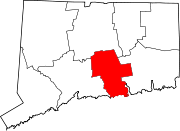
Towns Chester | Clinton | Cromwell | Deep River | Durham | East Haddam | East Hampton | Essex | Haddam | Killingworth | Middlefield | Old Saybrook | Portland | Westbrook
Borough Unincorporated
communitiesCenterbrook | Essex Village | Higganum | Ivoryton | Lake Pocotopaug | Leesville | Middle Haddam | Millington | Moodus | Saybrook Manor
Categories:- Deep River, Connecticut
- Towns in Middlesex County, Connecticut
- Populated places on the Connecticut River


Wikimedia Foundation. 2010.