- Deep River Town Hall
-
Deep River Town Hall
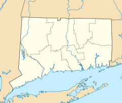

Location: Route 80 and Route 154, Deep River, Connecticut Coordinates: 41°23′6″N 72°26′11″W / 41.385°N 72.43639°WCoordinates: 41°23′6″N 72°26′11″W / 41.385°N 72.43639°W Area: less than one acre Built: 1893 Architectural style: "flatiron" building Governing body: Local NRHP Reference#: 76001977[1] Added to NRHP: January 1, 1976 The Deep River Town Hall is located in Deep River, Connecticut. The building was built in 1893 and was added to the National Register of Historic Places on January 1, 1976.
See also
References
- ^ "National Register Information System". National Register of Historic Places. National Park Service. 2009-03-13. http://nrhp.focus.nps.gov/natreg/docs/All_Data.html.
U.S. National Register of Historic Places Topics Lists by states Alabama • Alaska • Arizona • Arkansas • California • Colorado • Connecticut • Delaware • Florida • Georgia • Hawaii • Idaho • Illinois • Indiana • Iowa • Kansas • Kentucky • Louisiana • Maine • Maryland • Massachusetts • Michigan • Minnesota • Mississippi • Missouri • Montana • Nebraska • Nevada • New Hampshire • New Jersey • New Mexico • New York • North Carolina • North Dakota • Ohio • Oklahoma • Oregon • Pennsylvania • Rhode Island • South Carolina • South Dakota • Tennessee • Texas • Utah • Vermont • Virginia • Washington • West Virginia • Wisconsin • WyomingLists by territories Lists by associated states Other Categories:- Government buildings on the National Register of Historic Places in Connecticut
- Buildings and structures completed in 1893
- Buildings and structures in Middlesex County, Connecticut
- Town halls in Connecticut
- Deep River, Connecticut
- Connecticut Registered Historic Place stubs

Wikimedia Foundation. 2010.