- Durham, Connecticut
-
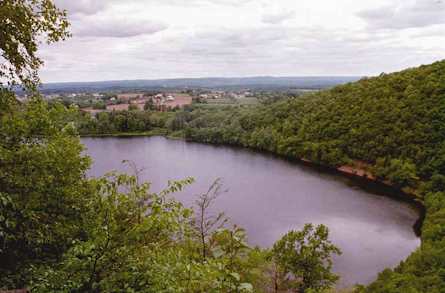
Durham, Connecticut — Town — View from Pistapaug Mountain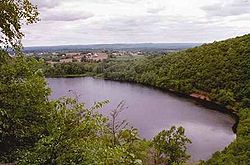
SealLocation within Middlesex County, Connecticut
Coordinates: 41°27′37″N 72°40′55″W / 41.46028°N 72.68194°WCoordinates: 41°27′37″N 72°40′55″W / 41.46028°N 72.68194°W Country United States State Connecticut NECTA New Haven Region Midstate Region Incorporated 1708 Government – Type Selectman-town meeting – First selectman Laura L. Francis Area – Total 23.8 sq mi (61.6 km2) – Land 23.6 sq mi (61.1 km2) – Water 0.2 sq mi (0.4 km2) Elevation 171 ft (52 m) Population (2005) – Total 7,266 – Density 308/sq mi (119/km2) Time zone Eastern (UTC-5) – Summer (DST) Eastern (UTC-4) ZIP code 06422 Area code(s) 860; 959 (future) FIPS code 09-20810 GNIS feature ID 0213419 Website www.townofdurhamct.org Durham is a town in Middlesex County, Connecticut, United States. Durham is a former farming village on the Coginchaug River in central Connecticut. The population was 6,627 at the 2000 census. Every autumn, the town hosts the Durham Fair, the largest volunteer agricultural fair in New England.
The Durham town center is listed by the U.S. Census Bureau as a census-designated place in the 2000 census. The core of the town center has also been listed as a historic district on the National Register of Historic Places.
Contents
Geography
According to the United States Census Bureau, the town has a total area of 23.8 square miles (62 km2), of which, 23.6 square miles (61 km2) is land and 0.2 square miles (40 ha or 0.67%) is water. The town center CDP has a total area of 6.3 square miles (16 km2). 6.3 square miles (16 km2) of it is land and 0.16% is water.
The west side of Durham is flanked by the Metacomet Ridge, a mountainous trap rock ridgeline that stretches from Long Island Sound to nearly the Vermont border. Notable features of the Metacomet ridge in Durham include Trimountain, Fowler Mountain, Pistapaug Mountain, and the north tip of Totoket Mountain. The 50-mile (80-kilometer) Mattabesett Trail traverses the ridge. Miller's Pond State Park is located within the town.
History
First settled in 1699 by Guilford resident Caleb Seward, Durham was originally called Coginchaug by the Native Americans who lived near the swampy area.[citation needed]
Durham has one of the first public libraries in the United States. It was founded in 1733, two years after Benjamin Franklin started the Philadelphia library.[1]
In the 1830s Durham came to prominence as the birthplace of Richard P. Robinson, who was tried for and acquitted of the infamous murder of Helen Jewett.[1]
Demographics
As of the census[2] of 2000, there were 6,627 people, 2,277 households, and 1,871 families residing in the town. The population density was 280.8 people per square mile (108.4/km²). There were 2,349 housing units at an average density of 99.5 per square mile (38.4/km²). The racial makeup of the town was 96.68% White, 1.15% Black or African American, 0.18% Native American, 0.85% Asian, 0.30% from other races, and 0.85% from two or more races. Hispanic or Latino of any race were 1.54% of the population.
There were 2,277 households out of which 41.2% had children under the age of 18 living with them, 72.3% were married couples living together, 7.1% had a female householder with no husband present, and 17.8% were non-families. 14.5% of all households were made up of individuals and 5.9% had someone living alone who was 65 years of age or older. The average household size was 2.85 and the average family size was 3.17.
In the town the population was spread out with 29.0% under the age of 18, 4.8% from 18 to 24, 29.3% from 25 to 44, 27.4% from 45 to 64, and 9.5% who were 65 years of age or older. The median age was 38 years. For every 100 females there were 100.4 males. For every 100 females age 18 and over, there were 94.4 males.
The median income for a household in the town was $77,639, and the median income for a family was $82,864. Males had a median income of $51,250 versus $38,833 for females. The per capita income for the town was $29,306. About 1.3% of families and 1.7% of the population were below the poverty line, including 0.4% of those under age 18 and 3.1% of those age 65 or over.
Town center
As of the census2 of 2000, there were 2,773 people, 1,040 households, and 809 families residing in the CDP corresponding to the town center. The population density was 443.1 inhabitants per square mile (171.0/km²). There were 1,078 housing units at an average density of 172.3 per square mile (66.5/km²). The racial makeup of the CDP was 97.91% White, 0.47% Black or African American, 0.07% Native American, 0.87% Asian, 0.25% from other races, and 0.43% from two or more races. Hispanic or Latino of any race were 1.01% of the population.
There were 1,040 households out of which 36.7% had children under the age of 18 living with them, 66.5% were married couples living together, 8.1% had a female householder with no husband present, and 22.2% were non-families. 18.9% of all households were made up of individuals and 9.9% had someone living alone who was 65 years of age or older. The average household size was 2.66 and the average family size was 3.06.
In the CDP the population was spread out with 26.1% under the age of 18, 4.4% from 18 to 24, 28.9% from 25 to 44, 27.5% from 45 to 64, and 13.0% who were 65 years of age or older. The median age was 40 years. For every 100 females there were 96.2 males. For every 100 females age 18 and over, there were 91.4 males.
The median income for a household in the CDP was $66,505, and the median income for a family was $72,465. Males had a median income of $47,179 versus $37,500 for females. The per capita income for the CDP was $26,972. About 2.1% of families and 3.0% of the population were below the poverty line, including 1.0% of those under age 18 and 4.3% of those age 65 or over.
Voter Registration and Party Enrollment as of October 25, 2005[3] Party Active Voters Inactive Voters Total Voters Percentage Republican 1,284 21 1,305 26.58% Democratic 1,044 22 1,066 21.72% Unaffiliated 2,476 57 2,533 51.60% Minor Parties 5 0 5 0.10% Total 4,809 100 4,909 100% Historic locations in Durham
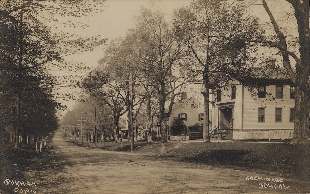
 1910 street scene with school
- Thomas Lyman House
- Main Street Historic District (the town center), noted for the architecture of the houses
- Moses Austin Homestead
Durham Meadows Superfund Site
The Durham Meadows superfund site encompasses an area of town around the abandoned Merriam Manufacturing, and the operational Durham Manufacturing companie. Both companies disposed of organic solvents, paint wastes, and degreasers in open lagoons and buried drums. The waste leached into the town's water supply, contaminating several private wells with methylene chloride, 1,4-dioxane, and other volatile organic carbons (VOCs).
The U.S. Environmental Protection Agency and Connecticut Department of Environmental Protection are coordinating clean up and monitoring efforts, including the delivery of free bottled water to affected residents.
Notable people, past and present
- The Rev. Nathaniel Chauncey, first graduate of Yale University.
- Moses Austin, (1761–1821), born in Durham, noted businessman involved in the lead industry[4]
- Stephen F. Austin, Son of Moses Austin and founder of Texas.
- Chauncey Goodrich (1759–1815), lawyer and politician who served in the U.S. House of Representatives and Senate. In the Sixth Congress, he served with his brother, Elizur.
- Elizur Goodrich (1761–1849), lawyer and politician
- Phineas Lyman (1716–74) major general in the Connecticut militia during the French and Indian War who later led settlers to a tract of land near Natchez, Mississippi
- James Wadsworth (1730–1816) lawyer, the second-highest ranked militia officer in the state during the American Revolutionary War and a delegate to the Continental Congress in 1784.
- Vin Baker (1971-), former professional basketball player who played in the National Basketball Association.
References
- ^ a b Cohen, Patricia C. (1999). The Murder of Helen Jewett. Vintage. ISBN 0679740759. p. 235
- ^ "American FactFinder". United States Census Bureau. http://factfinder.census.gov. Retrieved 2008-01-31.
- ^ "Registration and Party Enrollment Statistics as of October 25, 2005" (PDF). Connecticut Secretary of State. Archived from the original on 2006-09-23. http://web.archive.org/web/20060923151511/http://www.sots.ct.gov/ElectionsServices/lists/2005OctRegEnrollStats.pdf. Retrieved 2006-10-02.
- ^ Who Was Who in America, Historical Volume, 1607-1896. Chicago: Marquis Who's Who. 1963.
- Fowler, Chauncey (1866). History of Durham, Connecticut, From the First Grant of Land in 1662 to 1866. Hartford, Conn.: Hartford, Wiley, Waterman and Eaton.
- [1]
External links
 State of Connecticut
Topics - Index
- Culture
- Constitution
- Delegations
- Elections
- Geography
- Government
- History
- Images
- People
- Visitor Attractions
Regions Counties Cities Places Municipalities and communities of Middlesex County, Connecticut City 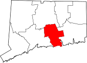
Towns Chester | Clinton | Cromwell | Deep River | Durham | East Haddam | East Hampton | Essex | Haddam | Killingworth | Middlefield | Old Saybrook | Portland | Westbrook
Borough Unincorporated
communitiesCenterbrook | Essex Village | Higganum | Ivoryton | Lake Pocotopaug | Leesville | Middle Haddam | Millington | Moodus | Saybrook Manor
Categories:- Durham, Connecticut
- Towns in Middlesex County, Connecticut


Wikimedia Foundation. 2010.