- Main Street Historic District (Durham, Connecticut)
-
Main Street Historic District
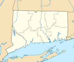

Location: Roughly Maple Ave. and Main St. between Talcott Ln. and Higganum Rd., Durham, Connecticut Coordinates: 41°28′26″N 72°40′51″W / 41.47389°N 72.68083°WCoordinates: 41°28′26″N 72°40′51″W / 41.47389°N 72.68083°W Architectural style: Colonial Revival, Greek Revival, Colonial Governing body: Local NRHP Reference#: 86002837[1] Added to NRHP: September 4, 1986 The Main Street Historic District in Durham, Connecticut is a historic district that was listed on the National Register of Historic Places in 1986.[1] The district is primarily linear and runs along Main Street (Route 17) from between Higganum Road and Town House Road in the south to Talcott Lane in the north. The district also includes properties on the parallel road known as Maple Avenue. It contains 112 contributing and 23 non-contributing properties over an area of 160 acres (0.65 km2). The area is also known as Durham Center and is where several state highways converge.
References
- ^ a b "National Register Information System". National Register of Historic Places. National Park Service. 2009-03-13. http://nrhp.focus.nps.gov/natreg/docs/All_Data.html.
U.S. National Register of Historic Places Topics Lists by states Alabama • Alaska • Arizona • Arkansas • California • Colorado • Connecticut • Delaware • Florida • Georgia • Hawaii • Idaho • Illinois • Indiana • Iowa • Kansas • Kentucky • Louisiana • Maine • Maryland • Massachusetts • Michigan • Minnesota • Mississippi • Missouri • Montana • Nebraska • Nevada • New Hampshire • New Jersey • New Mexico • New York • North Carolina • North Dakota • Ohio • Oklahoma • Oregon • Pennsylvania • Rhode Island • South Carolina • South Dakota • Tennessee • Texas • Utah • Vermont • Virginia • Washington • West Virginia • Wisconsin • WyomingLists by territories Lists by associated states Other Categories:- Historic districts in Connecticut
- Historic districts in Middlesex County, Connecticut
- Colonial Revival architecture in Connecticut
- Connecticut Registered Historic Place stubs

Wikimedia Foundation. 2010.