- New Jersey Route 91
-
Route 91
Jersey Avenue Route information Maintained by the New Jersey Department of Transportation Length: 2.26 mi[1] (3.64 km) Existed: 1953 – present Major junctions South end:  US 1 in North Brunswick Township
North end: Van Dyke Avenue in New Brunswick Highway system New Jersey State Highway Routes
Interstate and US←  Route 90
Route 92  →
→Route 91 is a 2.26-mile (3.64 km) long spur state highway in Middlesex County, New Jersey. The route runs as a spur of U.S. Route 1 along Jersey Avenue in North Brunswick Township to Van Dyke Avenue in the city of New Brunswick. At Van Dyke Avenue, Route 91 ends as a state route, and Jersey Avenue continues as County Route 693 to New Jersey Route 27 in the center of New Brunswick. The mainline of Route 91 only ends at U.S. Route 1 southbound (bound for Trenton), so the 0.37-mile (0.60 km) long connector constructed from U.S. Route 1 northbound is designated as Route 91 Connector.[2]
The route originates as the northernmost portion of the Trenton and New Brunswick Turnpike from Trenton to New Brunswick. The turnpike originated as a chartered highway in 1804, with the new roadway finished by 1806. The turnpike lived out its 99-year charter term, with the alignment of the turnpike turned over to local authorities in 1903. In 1927, the New Jersey State Highway Department designated State Highway Route 26 on the alignment of the turnpike, except for the portion on Jersey Avenue. This alignment was designated as Route 26A, a spur of State Highway Route 26 in 1941, and renumbered in the 1953 state highway renumbering as Route 91. The route has remained virtually untouched since.
Contents
Route description
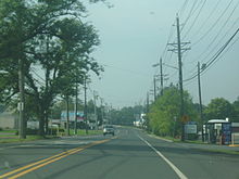
 NJ 91 signage and Jersey Avenue southbound at the transition from NJ 91 to CR 693 in New Brunswick
Route 91 begins at an interchange with U.S. Route 1 in the North Brunswick Township, New Jersey community of Adams. The route heads northward as Jersey Avenue, passing several fields and ponds along a U.S. Route 1 parallel. A short distance later, Route 91 enters the industrial district of North Brunswick, where it reaches a partial interchange with Route 91 Connector, a spur from U.S. Route 1 Northbound to the Route 91 mainline. Paralleling the Northeast Corridor tracks to the west, Jersey Avenue passes through a small corporate park in North Brunswick. A short distance later, Route 91 intersects with Middlesex County Route 680 (How Lane), which connects Route 91 with nearby New Jersey Route 27 and New Jersey Route 26. Upon crossing How Lane, Route 91 crosses the township line and enters the city of New Brunswick.[3]
Route 91 continues northward along Jersey Avenue, passing through the industrial districts in the southeastern portion of the city. With the Northeast Corridor tracks nearby, Route 91 intersects with Triangle Road, where it meets a park & ride and the service road to the Jersey Avenue New Jersey Transit train station. There, the highway also crosses a railroad spur from the train line. The highway continues, passing to the east of a high school and some commercial buildings, before the Route 91 designation terminates at an intersection with Van Dyke Avenue. Jersey Avenue continues into New Brunswick's center as Middlesex County Route 693.[3]
History
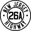 Route 26A (1941-1953)
Route 91 is the northernmost portion of the Trenton and New Brunswick Turnpike, a turnpike originally envisioned in 1795 to connect to Philadelphia, Pennsylvania with New York City. However the $300,000 project only received minimal support and died later. Nine years after the original proposal was brought up, the New Jersey State Legislature developed a charter for a new turnpike from Trenton to New Brunswick. The charter passed on November 14, 1904, for a term of 99 years. The roadway itself was to be 66 feet (20 m) wide, running from Warren and Green Streets in Trenton to an unspecified location in New Brunswick. Construction progressed, and by 1806, the turnpike company started tolling the new roadway. A portion of Route 91 and Route 91 Connector was also the site of one of at least three tollgates on the turnpike. After construction of the Pennsylvania Railroad during the 1800s, the railroad was asked by locals to buy the turnpike. Plans fell apart soon after, and in 1903, when the charter term ended, the old turnpike was turned over to the locals.[4]
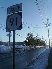
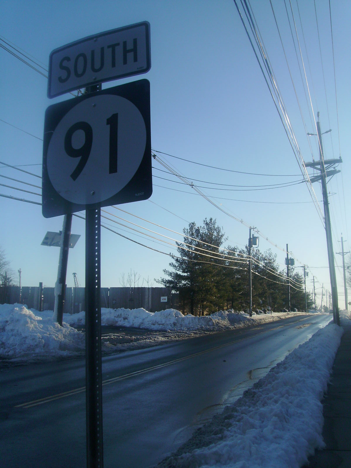
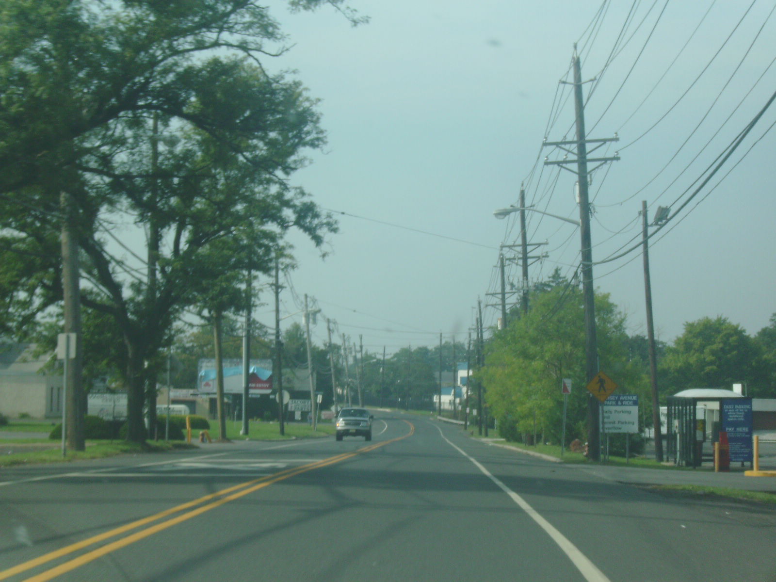
 Route 91 heading southbound through New Brunswick
The New Jersey State Highway Department used the alignment of the Lincoln Highway to designate State Highway Route 26 during the 1927 state highway renumbering from Trenton to New Brunswick. The route continued into New Brunswick, where it would end at Mill Run.[5] As Route 26 left the path of the Trenton and New Brunswick Turnpike to cross the railroad, State Highway Route 26A was designated in 1941 legislature to continue on the former turnpike to a former railroad crossing in North Brunswick Township. There, State Highway Route 26A continued, splitting onto a new alignment to stay northwest of the railroad, ending at Van Dyke Avenue.[6] The existing Jersey Avenue beyond Van Dyke Avenue was taken over by Middlesex County as County Route 3R20,[7] later renumbered County Route 693.[8]
During the second state highway renumbering in January 1953, the designation of Route 26 was truncatd from Trenton to U.S. Route 1 in North Brunswick Township. With Route 26A no longer terminating at its parent highway, the suffixed spur was renumbered to Route 91, heading from U.S. Route 1 in Adams to Van Dyke Road.[9] The route has changed little since designation.[1]
Major intersections
Route 91 mainline
The entire route is in Middlesex County.
Location Mile[1] Destinations Notes North Brunswick Township 0.00 US 1 southSouthern terminus of Route 91 New Brunswick 1.26  CR 680 (How Lane)
2.26 Van Dyke Avenue Northern terminus of Route 91; Continues northward as  CR 693
1.000 mi = 1.609 km; 1.000 km = 0.621 mi Route 91 Connector
The entire route is in North Brunswick Township, Middlesex County.
Mile[2] Destinations Notes 0.00 US 1 northSouthern terminus of Route 91 Connector 0.37  Route 91 (Jersey Avenue)
Northern terminus of Route 91 Connector 1.000 mi = 1.609 km; 1.000 km = 0.621 mi See also
 U.S. Roads portal
 New Jersey portal
References
- ^ a b c "Route 91 straight line diagram". New Jersey Department of Transportation. http://www.state.nj.us/transportation/refdata/sldiag/00000091__-.pdf. Retrieved October 29, 2009.
- ^ a b "Speed Limits for State Roads - Route NJ 91 Connector (Jersey Avenue Connector)". Trenton, New Jersey: New Jersey Department of Transportation. 2009. http://www.state.nj.us/transportation/refdata/traffic_orders/speed/rt91.shtm. Retrieved October 29, 2009.
- ^ a b Bing Maps (2009). Overview map of Route 91 (Map). Cartography by NAVTEQ Inc.. http://www.maps.bing.com/maps/default.aspx?v=2&FORM=LMLTCP&cp=40.466671~-74.47967&style=r&lvl=13&tilt=-90&dir=0&alt=-1000&phx=0&phy=0&phscl=1&rtp=pos.40.4800017178059_-74.468162432313_near%20Van%20Dyke%20Ave%2C%20New%20Brunswick%2C%20New%20Jersey%2008901%2C%20United%20States__~pos.40.4533579945564_-74.4912099838257_near%201797%20Jersey%20Ave%2C%20North%20Brunswick%2C%20New%20Jersey%2008902%2C%20United%20States__&rtop=0~0~0&encType=1. Retrieved October 28, 2009.
- ^ "Trenton and New Brunswick Turnpike". Plainsboro, New Jersey: Plainsboro Historical Society Inc.. 2009. http://www.plainsborohistory.org/turnpike.htm. Retrieved October 29, 2009.
- ^ ROUTE NO. 26. TRENTON TO NEW BRUNSWICK, via Trenton turnpike to Mile Run brook in city of New Brunswick.. New Jersey State Legislature. pp. 319.
- ^ State of New Jersey, Laws of 1941.
- ^ Rutgers University (1947). Map of Middlesex County (Map). http://mapmaker.rutgers.edu/MIDDLESEX_COUNTY/MiddlesexCounty_1947.jpg. Retrieved May 16, 2009.
- ^ "County Route 693 Straight Line Diagram". New Jersey Department of Transportation. New Jersey Department of Transportation. 2008. pp. 2. http://www.state.nj.us/transportation/refdata/sldiag/12000693__-.pdf. Retrieved May 16, 2009.
- ^ 1953 renumbering. New Jersey Department of Highways. http://en.wikisource.org/wiki/1953_New_Jersey_state_highway_renumbering. Retrieved July 31, 2009
External links
Categories:- State highways in New Jersey
- Transportation in Middlesex County, New Jersey


Wikimedia Foundation. 2010.