- Cranbury CDP, New Jersey
Infobox Settlement
official_name = Cranbury, New Jersey
settlement_type = CDP
nickname =
motto =
imagesize =
image_caption =
image_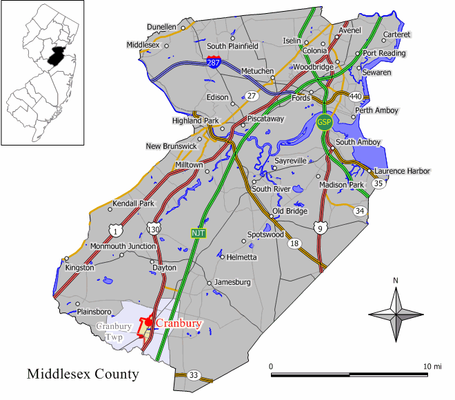
mapsize = 250px
map_caption = Map of Cranbury CDP in Middlesex County
mapsize1 =
map_caption1 =subdivision_type = Country
subdivision_name =United States
subdivision_type1 = State
subdivision_name1 =New Jersey
subdivision_type2 = County
subdivision_name2 = Middlesex
government_footnotes =
government_type =
leader_title =
leader_name =
leader_title1 =
leader_name1 =
established_title =
established_date =area_footnotes =
area_magnitude =
area_total_km2 = 3.2
area_land_km2 = 3.2
area_water_km2 = 0.0
area_total_sq_mi = 1.3
area_land_sq_mi = 1.2
area_water_sq_mi = 0.0population_as_of = 2000
population_footnotes =
population_total = 2008
population_density_km2 = 626.1
population_density_sq_mi = 1621.6timezone = Eastern (EST)
utc_offset = -5
timezone_DST = EDT
utc_offset_DST = -4
elevation_footnotes =
elevation_m = 30
elevation_ft = 98
latd = 40 |latm = 18 |lats = 26 |latNS = N
longd = 74 |longm = 30 |longs = 59 |longEW = Wpostal_code_type =
ZIP code s
postal_code = 08512, 08570
area_code = 609
blank_name = FIPS code
blank_info = 34-15520GR|2
blank1_name = GNIS feature ID
blank1_info = 0875704GR|3
website =
footnotes =Cranbury is a
census-designated place and unincorporated area located within Cranbury Township, in Middlesex County,New Jersey ,United States . The population was 2,008 at the 2000 census. Despite the similarity in the name of the Township and the CDP, the two are not one and the same, as is the case for most paired Township / CDP combinations.Geography
Cranbury is located at coor dms|40|18|26|N|74|30|59|W|city (40.307108, -74.516403)GR|1.
According to the
United States Census Bureau , the CDP has a total area of 3.2km² (1.2 mi²). 3.2 km² (1.2 mi²) of it is land and 0.1 km² (0.04 mi²) of it (1.60%) is water.Demographics
As of the
census GR|2 of 2000, there were 2,008 people, 703 households, and 534 families residing in the CDP. Thepopulation density was 625.2/km² (1,621.6/mi²). There were 728 housing units at an average density of 226.7/km² (587.9/mi²). The racial makeup of the CDP was 88.35% White, 1.89% African American, 8.12% Asian, 0.20% from other races, and 1.44% from two or more races. Hispanic or Latino of any race were 1.49% of the population.There were 703 households out of which 45.7% had children under the age of 18 living with them, 69.4% were married couples living together, 5.0% had a female householder with no husband present, and 23.9% were non-families. 20.3% of all households were made up of individuals and 10.2% had someone living alone who was 65 years of age or older. The average household size was 2.79 and the average family size was 3.27.
In the CDP the population was spread out with 30.9% under the age of 18, 2.4% from 18 to 24, 30.1% from 25 to 44, 23.3% from 45 to 64, and 13.2% who were 65 years of age or older. The median age was 39 years. For every 100 females there were 91.2 males. For every 100 females age 18 and over, there were 86.2 males.
The median income for a household in the CDP was $104,444, and the median income for a family was $129,877. Males had a median income of $95,316 versus $44,500 for females. The
per capita income for the CDP was $51,095. About 1.1% of families and 2.2% of the population were below thepoverty line , including 4.0% of those under age 18 and 1.4% of those age 65 or over.References
External links
* [http://www.cranburytownship.com/ Official Township Web Site]
* [http://www.cranbury.org/ Lions Club Sponsored Web Site]
Wikimedia Foundation. 2010.