- Westport, Connecticut
-
Westport, Connecticut — Town — 
Flag
SealLocation in Fairfield County, Connecticut Coordinates: 41°07′24″N 73°20′49″W / 41.12333°N 73.34694°WCoordinates: 41°07′24″N 73°20′49″W / 41.12333°N 73.34694°W Country United States State Connecticut NECTA Bridgeport-Stamford Region South Western Region Incorporated 1835 Government – Type Representative town meeting – First selectman Gordon F. Joseloff – Town meeting moderator Hadley C. Rose Area – Total 33.3 sq mi (86.2 km2) – Land 20.0 sq mi (51.8 km2) – Water 13.3 sq mi (34.5 km2) Elevation 26 ft (8 m) Population (2010)[1] – Total 26,391 – Density 792.5/sq mi (306/km2) Time zone Eastern (UTC-5) – Summer (DST) Eastern (UTC-4) ZIP code 06880 Area code(s) 203 FIPS code 09-83500 GNIS feature ID 0213532 Website http://www.westportct.gov/ Westport is a coastal town located on Long Island Sound in Fairfield County, Connecticut, 47 miles (76 km) northeast of New York City in the United States. It was reported in 2008 that Westport ranks tenth among the wealthiest towns in the United States with populations between 20,000 and 65,000, and is the second wealthiest town in the state after Darien.[2] The population was 26,391 at the 2010 census.[1] Westport is home to the Westport Country Playhouse, the Westport Public Library, and Staples High School.
Contents
Geography
According to the United States Census Bureau, Westport has a total area of 33.3 square miles (86 km2). 20.0 square miles (52 km2) or 60.02% of it is land and 13.3 square miles (34 km2) or 39.98% is water.
Westport is bordered by Norwalk on the west, Weston to the north, Wilton to the northwest, Fairfield to the east and Long Island Sound to the south.
Climate
Westport Climate chart (explanation) J F M A M J J A S O N D 439203.542224.751294.863394.773484.681574.186634.284614.976544.865424.554344.44325Average max. and min. temperatures in °F Precipitation totals in inches Source: Weather.com Metric conversion J F M A M J J A S O N D 1024-7896-611911-212217411923911727141043017107291612424121221861141211126-4Average max. and min. temperatures in °C Precipitation totals in mm Neighborhoods
- Saugatuck – around the Westport railroad station near the southwestern corner of the town – a built-up area with some restaurants, stores and offices.
- Greens Farms – around the Greens Farms railroad station near the southeastern corner of town.
- Cockenoe Island (pronounced "KawKEEnee") – just off the southeastern coast of the town.
- Old Hill – west of the Saugatuck River and north of the Boston Post Road, a historic section of town with many homes from the Revolutionary and Victorian eras.
- Coleytown – Located at the northern edge of town, near the Weston town line. Home to Coleytown fire station, Middle and Elementary school.
- Compo – Located around the main beach in the town, Compo Beach
Flooding
A total of 26 percent of town residents live within the 100-year floodplain, and homes and businesses located near the water can become flooded in extremely intense storms. Many other communities along the Connecticut shoreline have flood-prone areas, but Westport has been cited as an example of a town that has taken more action than others in mitigating the problem.
In one storm on December 11, 1992, when a Nor'easter struck the state, many cars parked at the Westport railroad station were immersed in water. "Very strong easterly gales of 55 mph (89 km/h) created by the storm caused severe coastal flooding in Westport and several other communities," according to the Association of State Floodplain Managers. "The Compo Beach and Saugatuck Shores areas of Westport were especially hard hit with virtually every building in both areas being inundated." [3]
A total of 22 homes were raised higher starting in the mid-1990s with some help from state grants, and the town has taken other flood protection measures, including the installation of 16 combination staff gauges and evacuation signs, as well as the publication of a disaster preparedness brochure. These made Westport "the first community in Connecticut to have an approved Hazard Mitigation Plan" for flooding.[3]
The town also has enacted tough regulations on home renovation and construction in flood-prone areas. Homeowners or businesses that build additions or renovations to their buildings in flood-prone areas must elevate the structure to one foot above the Base Flood Elevation if their renovations or additions exceed 50 percent of the fair market value of the property in any five-year period.[3]
Another flood which hit the town on October 20, 1996, resulted in no damage to the original seven elevated homes, although several dozen others, not elevated, were flooded again. Ideas for preventing more flooding, such as construction of a berm near Compo Beach, were shelved in the mid-1990s, as they were considered too expensive. To this day, employees of the town's Guests Services division of the Parks and Rec office place sandbags along Soundview Drive twice a year to prevent any further flooding.
Demographics
Historical populations Year Pop. ±% 1840 1,803 — 1850 2,651 +47.0% 1860 3,293 +24.2% 1870 3,361 +2.1% 1880 3,477 +3.5% 1890 3,715 +6.8% 1900 4,017 +8.1% 1910 4,259 +6.0% 1920 5,114 +20.1% 1930 6,073 +18.8% 1940 8,258 +36.0% 1950 11,667 +41.3% 1960 20,955 +79.6% 1970 27,318 +30.4% 1980 25,290 −7.4% 1990 24,410 −3.5% 2000 25,749 +5.5% 2010 26,391 +2.5% Source: [2] As of the census of 2000, there were 26,644 people, 9,586 households, and 7,170 families residing in the town. The population density was 1,286.7 people per square mile (496.8/km²). There were 10,065 housing units at an average density of 503.0 per square mile (194.2/km²).
According to the 2010 Census, the population of Westport was 1.2% Black or African American, 92.6% White, 4.0% Asian, and 0.1% American Indian. Individuals from other races made up 0.6% of Westport's population while individuals from two or more races made up 1.6%. [4] In addition, Hispanics of any race made up 3.5% of Westport’s population. About 29.8% of Westport residents were younger than age 18 as of 2010; lower than the U.S. average of 24%.
According to the 2000 Census, there were 9,586 households, of which 38.4% had children under the age of 18 living with them, 66.1% were married couples living together, 6.8% have a woman whose husband does not live with her, and 25.2% were non-families. 20.8% of all households were made up of individuals and 8.8% had someone living alone who was 65 years of age or older. The average household size was 2.66 and the average family size was 3.10.
In the town the population was spread out with 27.9% under the age of 18, 2.7% from 18 to 24, 26.2% from 25 to 44, 28.0% from 45 to 64, and 15.1% who were 65 years of age or older. The median age was 41 years. For every 100 females there were 90.7 males. For every 100 females age 18 and over, there were 86.3 males.
According to a 2007 estimate, the median income for a household in the town was $147,391, and the median income for a family was $176,740. As of the 2000 Census, males had a median income of $100,000 versus $53,269 for females. The per capita income for the town was $73,664. 2.6% of the population and 1.5% of families were below the poverty line. Out of the total people living in poverty, 2.7% are under the age of 18 and 2.1% are 65 or older.
Westport was named the fifth top-earning city in the US, with a median family income of $193,540 and median home price of $1,200,000 in July, 2008.[5]
History
Prehistoric Settlement
Green's Farms is the site of the earliest reported settlement dating back 4,000 years.[6]
Early Settlement
Colonists settled along the Saugatuck River in 1639.[citation needed]
Five farmers known as the "Bankside Farmers" in the fall of 1648 purchased coastal land within an area that today is known as Green's Farms from the Machamux Native Americans.[7][8] Native Americans called the area of Westport Machamux or beautiful land.[7] The Bankside Farmers constructed an ecclesiastical society separate from that of the town of Fairfield that included civil and religious elements.[8]
Westport was officially incorporated as a town in May 1835 with land taken from Fairfield, Weston and Norwalk.[9] For several decades after that, Westport was a prosperous agricultural community, which distinguished itself as the nation's leading onion-growing center.[10]
Revolutionary War period
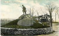
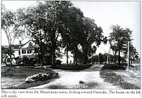
Westport's Compo Beach was the site during the American Revolutionary War of a British expeditionary force's landing, in which about 2,000 British soldiers marched to Danbury, also known as Tryon's Raid, and razed it, resulting in the Battle of Ridgefield.[11] They were attacked on the way and upon landing by Minutemen from Westport and the surrounding areas. A statue of a Minuteman, rifle in hand, is located near Compo Beach; the statue was built facing away from the beach to commemorate the way the Minutemen hid and waited until they could attack the large British army from behind.
1950-1960s
In the late 1950s, the construction of a Nike missile base in Westport became the inspiration for the comedic film Rally 'Round the Flag, Boys!. The launch site has since been demolished and the radar site is now the location of the Rolnick Observatory, a public astronomical facility. Bedford Middle School now sits atop the demolished Nike missile base.
The town was made famous by the I Love Lucy television show, as it is where Ricky and Lucy Ricardo (played by Desi Arnaz and Lucille Ball) moved after purchasing their new home.[12] ("I Love Lucy" writer Bob Weiskopf was from Westport.)
Twenty-first century
On September 11, 2001, two Westport residents were killed in the terrorist attacks of that day: Jonathan J. Uman, 33, and Bradley H. Vadas, 37. Both were in the World Trade Center.[13] The state's 9/11 memorial was put in Sherwood Island State Park in Westport.
Government
The town government consists of a three-member Board of Selectmen, a Representative Town Meeting (RTM), a Board of Finance, a Board of Education, a Planning and Zoning Commission, and various other commissions, boards, and committees.
Education
Westport Public Schools
Staples High School, Westport's only public high school, was ranked by Newsweek magazine in 2005 as 452nd on a list of the best 1,000 high schools in the country[14] (Grades 9 to 12) with 1,800 students. In the 2008-2009 school year Staples was also ranked the #1 school in Connecticut by Connecticut Magazine.[15] [16] In September 2009, Bedford Middle School was awarded the government-honored Blue Ribbon Award.
The district has two middle schools (Grades 6 to 8) – Bedford Middle School and Coleytown Middle School – with a total of 1,321 students. There are five elementary schools (Kindergarten to Grade 5) with a total of 2,556 students:
- Coleytown Elementary School [17]
- King's Highway Elementary School [18]
- Green's Farms Elementary School [19]
- Saugatuck Elementary School [20]
- Long Lots Elementary School [21]
There are a number of preschools in Westport, including Stepping Stones Pre-school, Greens Farms Nursery School, Saugatuck Nursery School, Earthplace Nursery School and the YMCA Childcare.
For the 2009-10 fiscal year, the school district's adopted budget is $110.6 million.[22]
The school district had an estimated $109.1 million budget for the 2009-10 fiscal year, giving it an average per pupil expenditure of $16,266.[23] The average 2010 class size for kindergarden through first grade was 22 students and 25 students for second through fifth grade.[24]
Private education
- Greens Farms Academy, located in the 1920s Vanderbilt estate overlooking Long Island Sound, is a K-12 private preparatory school located in the Greens Farms section of town.
- Pierrepont School, located on Sylvan Road, opened in that location in 2002. Pierrepont is a private K-12 school for gifted students.
Attractions
- Earthplace, The Nature Discovery Center, is a natural history museum, nature center and wildlife sanctuary located at 10 Woodside Lane. The organization is dedicated to the promotion of public environmental education, preservation and conservation. Activities include maintaining a 62-acre (250,000 m2) open space wildlife sanctuary with trails, presenting public nature education programs, a water quality monitoring program, wildlife rehabilitation, an interactive nature discovery area, a nursery school and summer camp.
- The Wheeler House is a Victorian period historic house museum operated by the Westport Historical Society. Located near Town Hall at 25 Avery Place, Wheeler House features a gallery for changing exhibits related to Westport's history and culture. The property includes a seven-sided barn that houses the Museum of Westport History. Open seasonally, exhibits include a model of Westport in the 1860s, a model railroad train, photos and artifacts about the town's industries, agriculture, history and famous residents.
- The Westport Public Library features changing displays of art from area artists.
- Comprising 234 acres (0.95 km2), Sherwood Island State Park is located on Long Island Sound and includes beach access. Compo Beach and Burying Hill Beach are municipal beaches that are open to out-of-town visitors in the summer for a fee.
- The Rolnick Observatory, operated by the Westport Astronomical Society, is open to the public for free on clear Wednesday and Thursday evenings. The observatory is located at 182 Bayberry Avenue, on a former Nike missile site.
Theater & Culture
- The Westport Country Playhouse, founded in 1930, is a regional theater known for its excellent theatrical performances.[25] After Paul Newman moved to Westport in the 1960 he became a principle "driving force" behind the playhouse reported as "one the country’s most respected summer theaters."[25] The playhouse went through a renovation process that was completed in 2005 on its seventy-fifth anniversary.[8]
Famous places and events of Westport
- It was also the fictional residence (1164 Morning Glory Circle) of Darrin and Samantha Stephens on the television series Bewitched.[26] The Twilight Zone had one episode called A Stop at Willoughby where the main character worked in NYC and commuted on the train to his home in Westport.[27] It aired on May 6, 1960, and the episode was written by then-Westport resident Rod Serling.
- One of the most popular tracks on REO Speedwagon's eponymous debut album, released on Epic Records in 1971, was "157 Riverside Avenue." The title refers to the Westport address in which the band stayed during the recording process.
- In the musical Rent, Benny is married to Alison Grey of Westport, who comes from a wealthy family.
- In the television series The West Wing, Bradley Whitford plays Josh Lyman, the White House Deputy Chief of Staff, who comes from a wealthy family from Westport.
On the National Register of Historic Places
- Bradley-Wheeler House — 25 Avery Pl. (added August 5, 1984), home to the Westport Historical Society.[6][28]
- Compo-Owenoke Historic District — Roughly bounded by Gray's Cr., Compo Rd. S. and Long Island Sound (added May 19, 1991)[29]
- Godillot Place — 60, 65 Jesup Rd. (added September 29, 1977)[30]
- Green Farms School — Jct. of Morningside Dr. S. and Boston Post Rd. (added May 19, 1991)
- Kings Highway North Historic District — Roughly along Kings Hwy. N, from Wilton Rd. to Woodside Ave. (added September 10, 1998)
- Mill Cove Historic District — Between Compo Mill Cove and Long Island Sound (added May 19, 1991)
- National Hall Historic District — Riverside Ave., Wilton and Post Rds. (added October 13, 1984)
- Saugatuck River Bridge — CT 136 (added March 12, 1987)
- Saugatuck River Railroad Bridge — Metro-North Railroad Right-of-way at Saugatuck River (added July 12, 1987)
- Shambaugh House — 12 Old Hill Rd. (added May 9, 1999)
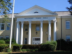
- Westport Town Hall — 90 Post Rd. E. (added June 18, 1982)
Economy
Prominent companies
- Bridgewater Associates, a global investment manager is the largest employer in Westport.[31] The company has about 900 employees spread between its 1 Glendinning Place headquarters, a nearby building, the Nyala Farms Corporate Center, and a building on the Saugatuck River.[citation needed] Presidential candidate John McCain visited Bridgewater Associates on a campaign trip in 2008.[citation needed]
- Canaan Partners, a leading early stage venture capital firm focusing on IT and life sciences. Canaan is located on Riverside Avenue, less than 1-mile (1.6 km) from the Westport train station.
- dLife, a multimedia diabetes education (and marketing) company with a weekly television program on CNBC.
- Playtex Products Inc. (PYX) – used to have its headquarters at 300 Nyala Farms Road; the company is concentrating on feminine, infant, and skin care products, selling off brands that don't fit those categories; its brands include Playtex tampons, the No. 2 brand in the country behind Procter & Gamble's Tampax; brands acquired since 1994 include Banana Boat, Wet Ones, Mr. Bubble, Ogilvie, Binaca, Diaper Genie and Baby Magic; Douglas Wheat, the former chairman, owns about 33% of the company through his investment firm Haas Wheat & Partners, another 20 percent is owned by investors ed by merchant banker Richard Blum (husband of U.S. Senator Diane Feinstein); 1,250 employees companywide, 200 of them at the Westport headquarters; net sales of $643.8 million in 2005; CEO Neil Defeo (older brother of the Terex CEO Ronald M. DeFeo, whose offices are also in town)
- Terex, a Fortune 500 company that makes equipment for industries including construction, infrastructure, quarrying, recycling, surface mining, shipping, transportation, refining, utility and maintenance, and it offers financial services to assist in the acquisition of Terex equipment; 17,600 employees companywide, 91 in Connecticut; $6.4 billion in 2005 revenues; CEO Ronald M. Defeo (younger brother of the Playtex CEO Neil DeFeo, whose offices are also in town)
Prominent companies once in Westport
At one point Business Express Airlines had its headquarters in Westport.[32]
Media
Westport is served by both English-language newspapers and news websites including Westport News and WestportNow, as well as the Westport Minuteman. The town is also home to a monthly magazine Westport.
Transportation
Interstate 95, the Merritt Parkway and U.S. 1, as well as the Saugatuck River, run through Westport.
Westport has two train stations, Green's Farms and Westport on the Metro-North Railroad's New Haven Line, which serves Stamford and Grand Central Terminal in New York City or New Haven-Union Station. This line is shared with Amtrak trains as it is part of the Northeast Corridor, but no Amtrak services stop at Green's Farms or Westport. The nearest Amtrak stations are at Bridgeport (10 miles) and Stamford (12 miles).
Westport station is the more widely used of the two, even among people living geographically closer to Green's Farms, mainly because more trains stop there. The wait for a parking sticker at the Westport station is now nearly four years long.[33]
Notable people
For a much longer list, see: List of people from Westport, Connecticut
Among the many famous actors, singers and other entertainers who have lived in town is Paul Newman (until his death in 2008).[34] Fala (1940–1952), President Franklin D. Roosevelt's dog, was an early Christmas gift from Mrs. Augustus G. Kellogg, a town resident.[35] Actress Gene Tierney grew up in Greens Farms.[36] Martha Stewart also lived in Westport for a time.[37]
Literature and film
Westport has been the subject, inspiration, or location for written and cinematic works. In the popular book series, Percy Jackson and the Olympians by Rick Riordan, the main antagonist, Luke Castellan, formerly lived in Westport.
In 1911, part of the film The Charity of the Poor was filmed in Saugatuck[38] followed up the next year, in 1912, with the film In Time of Peril.
Two films partially filmed in Westport during the 1950s include the 1956 movie, The Man in the Gray Flannel Suit, with Gregory Peck, based on the book by Sloan Wilson which was itself based in Westport, takes place in part and was filmed in parts of Westport. In particular, shots of the Westport Saugatuck train station can be seen, as well as a sequence towards the end of the movie showing a still recognizable Westport Main Street in the late 1950s. Followed up by the 1958 production of Rally 'Round the Flag, Boys!.[39]
The 1968 film The Swimmer starring Burt Lancaster and based on a short story by John Cheever, was partially filmed in Westport backyard pools.[40]
The 1972 the local filmmaker Sean Cunningham shot The Last House on the Left which was his first feature film.[41] Three years later the 1975 production of The Stepford Wives was released featuring scenes shot in a Williamsburg colonial house in Westport.[42]
The 1998 production This Is My Father was partly filmed in Westport.[43]
The film The Girl Next Door was vaguely based on Westport - director Luke Greenfield grew up in town. It was filmed and set in California. That same decade parts of the 2008 production of The Sisterhood of the Traveling Pants 2 were filmed in Westport[44]
Significant nonprofit institutions
- Save the Children, the American charity, governed entirely separately from the British charity of the same name, is based in Westport, with about 200 employees working in its headquarters.
Sister cities
Westport currently has three sister cities:
 Marigny, France
 St. Petersburg, Russia
 Yangzhou, People's Republic of China
For further reading
- Klein, Woody. "Westport, Connecticut: The Story of a New England Town's Rise to Prominence". Westport: Greenwood Press, 2000.
References
- ^ a b "Race, Hispanic or Latino, Age, and Housing Occupancy: 2010 Census Redistricting Data (Public Law 94-171) Summary File (QT-PL), Westport town, Connecticut". U.S. Census Bureau, American FactFinder 2. http://factfinder2.census.gov. Retrieved August 11, 2011.
- ^ Sherman, Lauren (09 December 2008). "In Depth: Twenty Most Affluent U.S. Neighborhoods". Forbes. http://www.forbes.com/2008/12/08/america-affluent-neighborhoods-forbeslife-cx_ls_1209realestate_slide_12.html. Retrieved 14 November 2011.
- ^ a b c Floods.org, a page on the Web site of the Association of State Floodplain Managers accessed on July 4, 2006.
- ^ "Profile of General Population and Housing Characteristics: 2010". U.S. Census Bureau. http://factfinder2.census.gov/faces/tableservices/jsf/pages/productview.xhtml?src=bkmk. Retrieved November 14, 2011.
- ^ "25 top-earning towns". CNN. 7 August 2008. http://money.cnn.com/galleries/2008/moneymag/0807/gallery.bplive_topearners.moneymag/5.html. Retrieved 21 November 2011.
- ^ a b Woody Klein; Westport Historical Society (Conn.) (May 2000). Westport, Connecticut: the story of a New England town's rise to prominence. Greenwood Press. p. 17. ISBN 978-0-313-31126-0. http://books.google.com/books?id=mLh4AAAAMAAJ. Retrieved 21 November 2011.
- ^ a b Sydney Bauer (1 July 2008). Undertow. Penguin. p. 41. ISBN 978-0-425-22290-4. http://books.google.com/books?id=jqz2FWQIyp0C&pg=PT41. Retrieved 21 November 2011.
- ^ a b c Richard Somerset-Ward (11 June 2005). An American theatre: the story of Westport Country Playhouse, 1931-2005. Yale University Press. p. 24. ISBN 978-0-300-10648-0. http://books.google.com/books?id=7wbvVZvDjrYC&pg=PA24. Retrieved 21 November 2011.
- ^ Connecticut State Library (1909). Bulletin. p. 50. http://books.google.com/books?id=hY_EAAAAIAAJ&pg=RA1-PA50. Retrieved 20 November 2011.
- ^ James Jay Mapes (1853). Working farmer. Kingman & Cross. http://books.google.com/books?id=kc1FAAAAYAAJ&pg=PA1. Retrieved 21 November 2011.
- ^ Mark Mayo Boatner (1975). Landmarks of the American Revolution: a guide to locating and knowing what happened at the sites of independence. Hawthorn Books. pp. 45–47. http://books.google.com/books?id=l0UaAQAAIAAJ. Retrieved 13 November 2011.
- ^ Lori Landay (15 April 2010). I love Lucy. Wayne State University Press. p. 108. ISBN 978-0-8143-3261-0. http://books.google.com/books?id=ZwX7qqzVeF0C&pg=PT108. Retrieved 13 November 2011.
- ^ Associated Press listing as it appeared in The Advocate of Stamford on September 12, 2006 ("State residents killed on September 11, 2001"), page A4
- ^ Msn.com Web page listing high schools in Newsweek survey, accessed September 5, 2006
- ^ WestportNow WestportNow article about Connecticut Magazine cover, accessed July 19, 2010
- ^ Steele, Charles (November 2008). "Top High Schools". Connecticut Magazine. http://www.connecticutmag.com/Connecticut-Magazine/November-2008/Top-High-Schools/. Retrieved 21 November 2011.
- ^ Coleytown Elementary School
- ^ King's Highway Elementary School
- ^ Green's Farms Elementary School
- ^ Saugatuck Elementary School
- ^ Long Lots Elementary School
- ^ WestportCT.gov Westport 2010-2011 Fiscal Year Budget
- ^ Westport School District General information about the district incl. number of enrolled students
- ^ Lomuscio, James (01 September 2010). "Opening Day for Schools Called a ‘Great Kickoff’". WestportNow.com. http://www.westportnow.com/index.php?/v2_5/comments/opening_day_for_schools_called_a_great_kickoff/. Retrieved 12 November 2011.
- ^ a b Morris, Stacey. "Westport: The Beverly Hills of the East". The Jerusalem Post. doi:13 June, 2010. http://www.jpost.com/Travel/TravelNews/Article.aspx?id=178214. Retrieved 21 November 2011.
- ^ Vincent Terrace (October 1993). Television character and story facts: over 110,000 details from 1,008 shows, 1945-1992. McFarland & Co.. p. 46. ISBN 978-0-89950-891-7. http://books.google.com/books?id=1jUbAQAAIAAJ. Retrieved 13 November 2011.
- ^ Leslie Dale Feldman (30 November 2010). Spaceships and Politics: The Political Theory of Rod Serling. Lexington Books. pp. 91–92. ISBN 978-0-7391-2045-3. http://books.google.com/books?id=sD1Rj8rRDiUC&pg=PA91. Retrieved 13 November 2011.
- ^ Westport Historical Socierty
- ^ "National Register of Historic Place - Compo--Owenoke Historic District". 19 April 1991. http://pdfhost.focus.nps.gov/docs/NRHP/Text/91000393.pdf. Retrieved 21 November 2011.
- ^ "National Register of Historic Placee - Godillot Place". 27 August 1977. http://pdfhost.focus.nps.gov/docs/NRHP/Text/77001396.pdf. Retrieved 21 November 2011.
- ^ "Bridgewater, Town’s Largest Employer, Could Be Leaving". WestportNow. 09 July 2010. http://westportnow.com/index.php?/v2/comments/bridgewater_towns_largest_employer_could_be_leaving/. Retrieved 13 November 2011.
- ^ "Business Express plans to go Public." The Buffalo News. April 4, 1992. Retrieved on May 31, 2009.
- ^ [1] westportct.gov
- ^ Harmetz, Aljean (September 28, 2008). "Paul Newman, a Magnetic Titan of Hollywood, Is Dead at 83". The New York Times. http://www.nytimes.com/2008/09/28/movies/28newman.html. Retrieved April 6, 2010.
- ^ Mark Derr (15 September 2005). A Dog's History of America: How Our Best Friend Explored, Conquered, and Settled a Continent. Macmillan. p. 305. ISBN 978-0-374-52997-0. http://books.google.com/books?id=AO1WTqb5fMwC&pg=PA305. Retrieved 12 November 2011.
- ^ Time Inc (19 February 1940). LIFE. Time Inc. p. 35. ISSN 00243019. http://books.google.com/books?id=tj8EAAAAMBAJ&pg=PA35. Retrieved 12 November 2011.
- ^ Joann F. Price (June 2007). Martha Stewart: a biography. Greenwood Publishing Group. p. 33. ISBN 978-0-313-33893-9. http://books.google.com/books?id=uIAgzyk4VboC&pg=PA33. Retrieved 12 November 2011.
- ^ Internet Movie DataBase Web site's page for Saugatuck, Connecticut, accessed on July 2, 2006
- ^ Shawn Levy. Paul Newman: A Life. Random House Digital, Inc.; 5 May 2009 [cited 12 November 2011]. ISBN 978-0-307-35375-7. p. 178.
- ^ Donovan, Elisabeth (24 June 1990). "Just Pooling Around". The Miami Herald.
- ^ The Film journal. Pubsun Corp.. 1 January 1989. http://books.google.com/books?id=8QnsAAAAMAAJ. Retrieved 14 November 2011.
- ^ Charles, Eleanor (21 April 1985). "Connecticut Guide". New York Times.
- ^ Irène Bessière; Roger Odin (2004). Les européens dans le cinéma américain: émigration et exil. Presses Sorbonne Nouvelle. p. 217. ISBN 978-2-87854-261-5. http://books.google.com/books?id=MVEXawZ3zD0C&pg=PA217. Retrieved 14 November 2011.
- ^ Meyers, Joe (10 September 2008). "Major movies filmed scenes in Conn.". Connecticut Post Online. "The recent Warner Bros. release "The Sisterhood of the Traveling Pants 2" features parts of Bridgeport standing in for Providence, R.I. and Manhattan; the Westport Country Playhouse is passed off as a Vermont summer stock theater; and WestConn in Danbury fills in for the Rhode Island School of Design."
External links
 State of Connecticut
Topics - Index
- Culture
- Constitution
- Delegations
- Elections
- Geography
- Government
- History
- Images
- People
- Visitor Attractions
Regions Counties Cities Places Municipalities and communities of Fairfield County, Connecticut Cities Bridgeport | Danbury | Norwalk | Shelton | Stamford
Towns Bethel | Brookfield | Darien | Easton | Fairfield | Greenwich | Monroe | New Canaan | New Fairfield | Newtown | Redding | Ridgefield | Sherman | Stratford | Trumbull | Weston | Westport | Wilton
Borough Other
communitiesAspetuck | Botsford | Black Rock | Branchville | Byram | Cannondale | Compo | Cos Cob | Cranbury | East Norwalk | Georgetown | Glenbrook | Glenville | Greenfield Hill | Greens Farms | Hattertown | Hawleyville | Huntington Center | Long Ridge | Lordship | Mianus | Old Greenwich | Riverside | Round Hill | Rowayton | Sandy Hook | Silvermine | South Norwalk | Southport | Stepney | Springdale
Categories:- Westport, Connecticut
- Towns in Fairfield County, Connecticut
Wikimedia Foundation. 2010.


