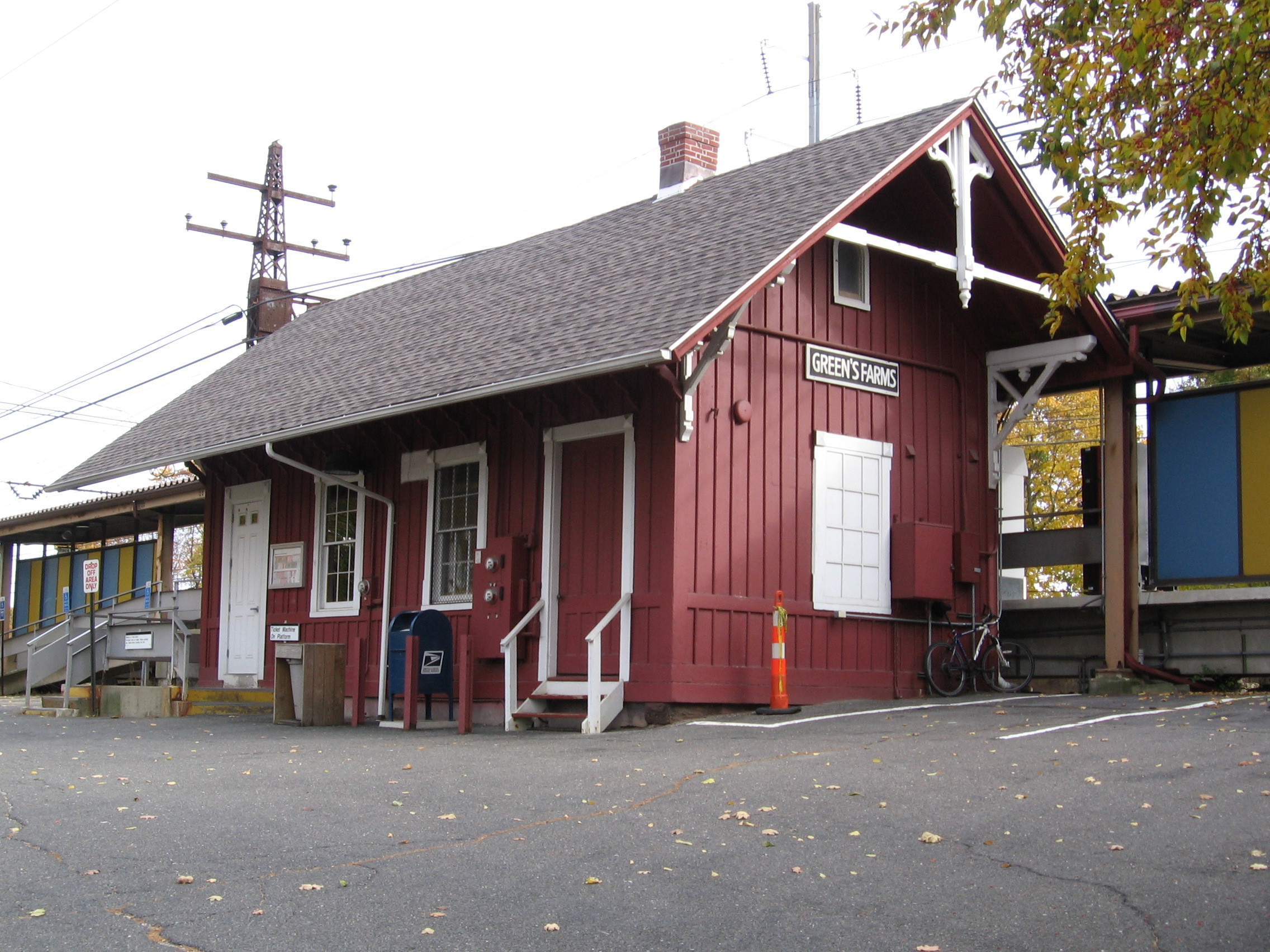
- Green's Farms (Metro-North station)
Infobox Station
name=Green's Farms
style=MNRR New Haven
type=

image_size=
image_caption=The Green's Farms tiny station house
address=2 Post Office Lane,Westport, CT 06880
coordinates=coord|41.123316|-73.315415
line=Metro-North Railroad :
other=Norwalk Transit District :
G1, G2
structure=
platform=
depth=
levels=
tracks=
parking=466 spaces
bicycle=
baggage_check=
opened=
closed=
rebuilt=
electrified=
ADA=
code=
owned=
zone=
former=
passengers=150,540
pass_year=2006
pass_percent=0
pass_system=
mpassengers=
services=
map_locator=Green's Farms
Metro-North Railroad station is one of two New Haven Line stations serving the residents ofWestport, Connecticut . The station is located in the Greens Farms area of Westport in the southeastern part of town, and the technically-incorrect apstrophe in the station name dates toNew York, New Haven and Hartford Railroad ownership of the line. No other entity spells "Greens Farms" with an apostrophe.Green's Farms is convert|47.2|mi from
Grand Central Terminal and the average travel time from Grand Central is one hour, 11 minutes though this varies depending on run and time of day.The station has 466 parking spaces, all owned by the state. [cite web| url=http://www.ct.gov/dotinfo/lib/dotinfo/ctgov/FinalParkingReport.pdf| title=Task 2: Technical Memorandum parking Inventory and Utilization: Final Report| publisher=Urbitran Associates Inc. to the Connecticut Department of Transportation| chapter=Table 1: New Haven Line Parking Capacity and Utilization| pages=p 6| month=July| year=2003| ] Interstate 95 borders the parking lots to the north of the station on either side of New Creek Road.
Like other station houses on the New Haven Line, the one at Green's Farms is on the north side of the tracks, just east of New Creek Road, which runs beneath a railroad bridge. Access to the south side of the tracks is down a wooden staircase, under the railroad bridge at New Creek Road, and up another wooden staircase. Part of the platform near the station house is covered, and on the east end of the north platform another, rusty metal canopy covers a small area. A ticket machine is on the north platform near the station house. Bicycle stands are located to the east of the station house. On the south side of the tracks, a standard see-through shelter seats eight.
On
December 8 ,2007 , a 59-year-old Greens Farms woman committed suicide at the station by jumping from behind an aluminum bridgeplate (used to allow riders to enter trains stopped at a track not adjacent to a platform) and moving onto a track in front of a passing train. She was pronounced dead at the scene. Trains were delayed by about two hours. [cite news| author=Nickerson, John| title=Woman killed by train at Green's Farms station: Second death in two days on Metro-North tracks| publisher=The Advocate of Stamford, Norwalk edition| pages=p A4| date=2007-12-11 | ] [cite news| author=Nickerson, John| title=Death on tracks in Westport ruled suicide| publisher=The Advocate of Stamford, Norwalk edition| date=2007-12-11 | ]Within walking distance
The Greens Farms Post Office is north and east of the station, on Post Office Lane about 200 feet from the station house. A large bell, cast in 1887 by the Henry McShane Company in Baltimore, sits in a small, round traffic island just past the USPS office. No plaque identifies the bell's original function.
Within walking distance of the station there is little but expensive homes and, to the south, a nice view of
Long Island Sound .Greens Farms Academy is about a 10 minute walk from the station, south, just past the salt marsh on the station's south side.Past the school, Beachside Avenue provides a pleasant walk past many large estates (some of the most expensive residential property in Westport).
Marlo Thomas and her husband,Phil Donohue , live in the area. The street has no sidewalks, but there is little traffic. High walls block some views, but not all: A giantClaes Oldenberg artwork — a typewriter eraser — stands perhaps eight feet high on the lawn of one estate on the south side of the road. (Radio personalityDon Imus is a present or former resident, as well, andMartha Stewart previously lived in the neighborhood, producing a television program out of her home on Turkey Hill Road.)About convert|1.6|mi from the railroad station, where Beachside Avenue crosses a small bridge leads to Pequot Road and Burial Hill Beach, and past that into the Southport section of
Fairfield, Connecticut . Another mile up Pequot Road, on Center Street, is the next station up the line, the Southport Railroad Station.About convert|1.5|mi in the opposite direction from the station (north and west), is the Nyala Farms office complex, the headquarters of
Bridgewater Associates , one of the world's largest hedge funds. The office buildings are barely visible from the road and a guardhouse blocks the entrance. Just past that office complex is Exit 18 of Interstate 95 and the entrance toSherwood Island State Park . The east edge of the park actually extends quite close to the station, but public access to it is roundabout.Connections
*
Norwalk Transit District : G1, G2ee also
*
Connecticut Rail Commuter Council is the official state advocate for train commuters and brings station problems to the attention of officials.Pictures
References
External links
* [http://as0.mta.info/mnr/stations/station_detail.cfm?key=240 Metro-North Railroad - Green's Farms]
* [http://www.ct.gov/dot/lib/dot/documents/dpt/Greens_Farms_Individual_Station_Report.pdf] Visual Inspection Report for the station (January 2007), from the state Department of Transportation
* [http://www.ct.gov/dotinfo/lib/dotinfo/ctgov/Greens_Farms.pdf] Bureau of Public Transportation of the Connecticut Department of Transportation, "Condition Inspection for the Westport Station" report dated October 2006
Wikimedia Foundation. 2010.
