- Mansfield Township, Burlington County, New Jersey
-
Mansfield Township, New Jersey — Township — Mansfield Township highlighted in Burlington County. Inset map: Burlington County highlighted in the State of New Jersey.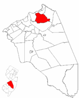 Census Bureau map of Mansfield Township, Burlington County, New Jersey
Coordinates: 40°4′58″N 74°42′50″W / 40.08278°N 74.71389°WCoordinates: 40°4′58″N 74°42′50″W / 40.08278°N 74.71389°W Country United States State New Jersey County Burlington Formed November 6, 1688 Royal Charter May 9, 1770 Incorporated February 21, 1798 Government – Type Township (New Jersey) – Mayor Arthur Puglia – Administrator Joseph Broski[1] Area – Total 21.9 sq mi (56.6 km2) – Land 21.7 sq mi (56.3 km2) – Water 0.1 sq mi (0.4 km2) Elevation[2] 52 ft (16 m) Population (2006)[3] – Total 8,047 – Density 234.3/sq mi (90.5/km2) Time zone Eastern (EST) (UTC-5) – Summer (DST) EDT (UTC-4) ZIP code 08022 Area code(s) 609 FIPS code 34-43290[4][5] GNIS feature ID 0882108[6] Website www.mansfieldburlington.com Mansfield Township is a Township in Burlington County, New Jersey, United States. As of the United States 2000 Census, the township population was 5,090, which was forecast to have grown to 8,047 as of the 2006 Census estimate, representing growth of 58.1% since the previous enumeration.[3]
Mansfield was first formed on November 6, 1688, and reformed by Royal Charter on May 9, 1770. Mansfield was incorporated as one of New Jersey's initial 104 townships by an Act of the New Jersey Legislature on February 21, 1798. Portions of the township were taken to form Fieldsboro (March 7, 1850, within township; became fully independent c. 1894), Bordentown Township (March 8, 1852) and Florence Township (March 7, 1872).[7]
Contents
Geography
According to the United States Census Bureau, the township has a total area of 21.9 square miles (56.6 km²), of which, 21.7 square miles (56.3 km²) of it is land and 0.1 square miles (0.4 km²) of it (0.64%) is water.
Mansfield Township encompasses the communities of Columbus (where the town hall is located), Georgetown, Hedding and Kinkora. The hamlets are Mansfield and Rising Sun Square (also known as Mansfield Square). "Homestead," a retirement village, consists of 1,200 homes in Columbus.
Liberty Lake is a 6-acre (24,000 m2) freshwater spring-fed lake, that allows boating, swimming and fishing.

Bordentown Twp Florence Twp 
Chesterfield Twp  Mansfield Township

Springfield Twp Demographics
Historical populations Census Pop. %± 1930 1,709 — 1940 1,642 −3.9% 1950 1,907 16.1% 1960 2,084 9.3% 1970 2,597 24.6% 1980 2,523 −2.8% 1990 3,874 53.5% 2000 5,090 31.4% Est. 2006 8,047 [3] 58.1% Population 1930 - 1990[8] As of the census[4] of 2000, there were 5,090 people, 2,077 households, and 1,561 families residing in the township. The population density was 234.3 people per square mile (90.5/km²). There were 2,122 housing units at an average density of 97.7 per square mile (37.7/km²). The racial makeup of the township was 95.42% White, 1.91% African American, 0.18% Native American, 1.49% Asian, 0.04% Pacific Islander, 0.22% from other races, and 0.75% from two or more races. Hispanic or Latino of any race were 1.83% of the population.
There were 2,077 households out of which 23.8% had children under the age of 18 living with them, 68.4% were married couples living together, 4.5% had a female householder with no husband present, and 24.8% were non-families. 22.6% of all households were made up of individuals and 17.0% had someone living alone who was 65 years of age or older. The average household size was 2.45 and the average family size was 2.86.
In the township the population was spread out with 18.7% under the age of 18, 4.9% from 18 to 24, 21.4% from 25 to 44, 23.1% from 45 to 64, and 31.9% who were 65 years of age or older. The median age was 49 years. For every 100 females there were 92.2 males. For every 100 females age 18 and over, there were 87.8 males.
The median income for a household in the township was $50,757, and the median income for a family was $59,040. Males had a median income of $45,560 versus $40,968 for females. The per capita income for the township was $26,559. About 2.9% of families and 4.5% of the population were below the poverty line, including 2.9% of those under age 18 and 4.3% of those age 65 or over.
Government
Local government
Mansfield Township is governed under the Township form of government with a five-member Township Committee. The Township Committee is elected directly by the voters in partisan elections to serve three-year terms of office on a staggered basis, with one or two seats coming up for election each year.[9] At an annual reorganization meeting, the Township Committee selects one of its members to serve as Mayor and another as Deputy Mayor. The Mayor presides at the meetings and votes as a member of the Committee. All formal legislative and executive powers are exercised by the Committee as a whole.
The Township Committee has allocated coordination of administrative and departmental functions among its members. Every Township board and department has at least one member of Committee as a liaison.
Members of the Mansfield Township Committee are Mayor Arthur Pugglia, Deputy Mayor Kenneth Denti, Robert Higgins, LaVerne Cholewa and Terri Tallon-Hammill.[10]
Federal, state and county representation
Mansfield Township is in the 4th Congressional district. New Jersey's Fourth Congressional District is represented by Christopher Smith (R). New Jersey is represented in the United States Senate by Frank Lautenberg (D, Cliffside Park) and Bob Menendez (D, Hoboken).
Mansfield is in the 8th district of the New Jersey Legislature, which is represented in the New Jersey Senate by Dawn Marie Addiego (R, Evesham Township) and in the New Jersey General Assembly by Gerry Nardello (R, Mount Laurel Township) and Scott Rudder (R, Medford Township).[11][12]
Burlington County is governed by a Board of Chosen Freeholders, whose five members are elected at-large to three-year terms of office on a staggered basis, with one or two seats coming up for election each year. As of 2011, Burlington County's Freeholders are Freeholder Director Bruce D. Garganio (Florence Township, 2012), Deputy Director Christopher J. Brown (Evesham Township, 2011), Joseph B. Donnelly (Cinnaminson Township, 2013), Mary Ann O'Brien (Medford Township, 2012) and Mary Anne Reinhart (Shamong Township, 2011).[13][14]
Education
Children in grades K - 6 attend the Mansfield Public Schools. Schools in the district (with 2005-06 enrollment data from the National Center for Education Statistics.[15]) are John Hydock Elementary School, serving grades Pre-K through 2 "Home of the Cougars" (302 students) and Mansfield Township Elementary School serving Grades 3-6 "Home of the Mustangs" (372 students).
Children in public school for grades 7 - 12 attend the schools of the Northern Burlington County Regional School District, which also serves students from Chesterfield Township, North Hanover Township and Springfield Township, along with children of United States Air Force personnel based at McGuire Air Force Base.[16] The schools in the district (with 2005-06 enrollment data from the National Center for Education Statistics[17]) are Northern Burlington County Regional Middle School for grades 7 and 8 (665 students) and Northern Burlington County Regional High School for grades 9-12 (1,264 students). Both schools are in the Columbus section of Mansfield Township.
Transportation
Interstate 95 (the New Jersey Turnpike) and Interstate 295 pass through the township, as do U.S. Route 130, U.S. Route 206 and Route 68. Mansfield Township houses Interchange 6 on the turnpike, which connects to the Pennsylvania Extension and Route 130. The 6 tollgate is located further west on the Penn Ext. in the township of Florence.
On December 1, 2004, the Turnpike Authority announced a plan to extend the 'dual-dual' setup of the turnpike from Exit 8A in Monroe Township to Exit 6. This widening would change the current configuration (from 3-3) to "3-3-3-3" and is anticipated to be completed by 2014.
New Jersey Transit provides bus service to Philadelphia on the 409 route.[18]
References
- ^ Administration PHONE DIRECTORY, Mansfield Township. Accessed April 24, 2008.
- ^ U.S. Geological Survey Geographic Names Information System: Township of Mansfield, Geographic Names Information System. Accessed January 4, 2008.
- ^ a b c Census data for Mansfield township, United States Census Bureau. Accessed September 11, 2007.
- ^ a b "American FactFinder". United States Census Bureau. http://factfinder.census.gov. Retrieved 2008-01-31.
- ^ A Cure for the Common Codes: New Jersey, Missouri Census Data Center. Accessed July 14, 2008.
- ^ "US Board on Geographic Names". United States Geological Survey. 2007-10-25. http://geonames.usgs.gov. Retrieved 2008-01-31.
- ^ "The Story of New Jersey's Civil Boundaries: 1606-1968", John P. Snyder, Bureau of Geology and Topography; Trenton, New Jersey; 1969. p. 96.
- ^ New Jersey Resident Population by Municipality: 1930 - 1990, Workforce New Jersey Public Information Network. Accessed March 1, 2007.
- ^ 2005 New Jersey Legislative District Data Book, Rutgers University Edward J. Bloustein School of Planning and Public Policy, April 2005, p. 103.
- ^ Mansfield Township Committee Members, Mansfield Township. Accessed April 24, 2008.
- ^ "Legislative Roster: 2010-2011 Session". New Jersey Legislature. http://www.njleg.state.nj.us/members/roster.asp. Retrieved 2011-01-25.
- ^ "Former Mount Laurel mayor is chosen to fill seat of departing assemblyman". Newark Star-Ledger. http://www.nj.com/news/index.ssf/2011/08/former_mount_laurel_mayor_is_c.html. Retrieved 2011-08-23.
- ^ Meet the Freeholders, Burlington County, New Jersey Board of Chosen Freeholders. Accessed January 3, 2011.
- ^ Staff. BRUCE GARGANIO CHOSEN FREEHOLDER DIRECTOR FOR SECOND YEAR; CHRIS BROWN OF EVESHAM CHOSEN DEPUTY DIRECTOR, Burlington County, New Jersey press release dated January 1, 2011. Accessed January 3, 2011.
- ^ data for the Mansfield Public Schools, National Center for Education Statistics. Accessed April 24, 2008.
- ^ Northern Burlington County Regional School District 2007 Report Card Narrative, New Jersey Department of Education. Accessed April 24, 2008. "The Northern Burlington County Regional School District is an important part of its growing community. The Northern Burlington County Regional Middle School and High School are located in Mansfield Township. Its constituent elementary districts are Chesterfield, Mansfield, North Hanover, and Springfield Townships. In addition, the district serves the children of United States Air Force personnel stationed at McGuire Air Force Base."
- ^ Data for the Northern Burlington County Regional School District, National Center for Education Statistics. Accessed April 24, 2008.
- ^ Burlington County Bus/Rail Connections, New Jersey Transit. Accessed July 15, 2007.
External links
- Mansfield Township website
- Mansfield Public Schools
- Mansfield Public Schools's 2009–10 School Report Card from the New Jersey Department of Education
- Data for the Mansfield Public Schools, National Center for Education Statistics
- Northern Burlington County Regional School District
- Northern Burlington County Regional School District's 2009–10 School Report Card from the New Jersey Department of Education
- Data for the Northern Burlington County Regional School District, National Center for Education Statistics
Municipalities and communities of Burlington County, New Jersey Cities 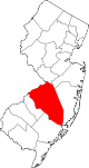
Boroughs Fieldsboro | Medford Lakes | Palmyra | Pemberton | Riverton | Wrightstown
Townships Bass River | Bordentown | Burlington | Chesterfield | Cinnaminson | Delanco | Delran | Eastampton | Edgewater Park | Evesham | Florence | Hainesport | Lumberton | Mansfield | Maple Shade | Medford | Moorestown | Mount Holly | Mount Laurel | New Hanover | North Hanover | Pemberton | Riverside | Shamong | Southampton | Springfield | Tabernacle | Washington | Westampton | Willingboro | Woodland
CDPs Communities Arneytown | Centerton | Chairville | Chatsworth | Columbus | Cookstown | Crosswicks | Evesboro | Fellowship | Fostertown | Georgetown | Hartford | Hedding | Jacksonville | Jacobstown | Jobstown | Kinkora | Masonville | New Gretna | New Lisbon | Rancocas | Rancocas Woods | Retreat | Sandtown | Vincentown
Categories:- Townships in Burlington County, New Jersey
- Populated places established in 1688


Wikimedia Foundation. 2010.