- Garland, Utah
Infobox Settlement
official_name = Garland, Utah
other_name =
native_name =
nickname =
settlement_type =City
motto =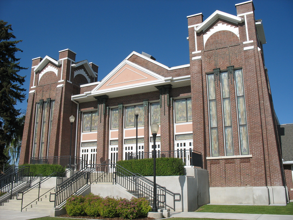
imagesize =
image_caption = The Garland Tabernacle, an early Latter-day Saint meetinghouse
flag_size =
image_
seal_size =
image_shield =
shield_size =
image_blank_emblem =
blank_emblem_size =
mapsize = 250px
map_caption = Location of BGarland, Utah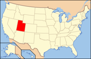
mapsize1 =
map_caption1 = Location of Utah in the United States
image_dot_
dot_mapsize =
dot_map_caption =
dot_x =
dot_y =
pushpin_
pushpin_label_position =
pushpin_map_caption =
pushpin_mapsize =
subdivision_type = Country
subdivision_name =United States
subdivision_type1 = State
subdivision_name1 =Utah
subdivision_type2 = County
subdivision_name2 = Box Elder
subdivision_type3 =
subdivision_name3 =
subdivision_type4 =
subdivision_name4 =
government_footnotes =
government_type =
leader_title =
leader_name =
leader_title1 =
leader_name1 =
leader_title2 =
leader_name2 =
leader_title3 =
leader_name3 =
leader_title4 =
leader_name4 =
established_title =
established_date =
established_title2 =
established_date2 =
established_title3 =
established_date3 =
area_magnitude =
unit_pref = Imperial
area_footnotes =
area_total_km2 = 4.6
area_land_km2 = 4.6
area_water_km2 = 0.0
area_total_sq_mi = 1.8
area_land_sq_mi = 1.8
area_water_sq_mi = 0.0
area_water_percent =
area_urban_km2 =
area_urban_sq_mi =
area_metro_km2 =
area_metro_sq_mi =
population_as_of = 2000
population_footnotes =
population_note =
population_total = 6000
population_density_km2 = 423.8
population_density_sq_mi = 1,097.8
population_metro =
population_density_metro_km2 =
population_density_metro_sq_mi =
population_urban =
population_density_urban_km2 =
population_density_urban_sq_mi =
population_blank1_title =
population_blank1 =
population_density_blank1_km2 =
population_density_blank1_sq_mi =
timezone = MST
utc_offset = -7
timezone_DST = MDT
utc_offset_DST = -6
latd = 41 |latm = 43 |lats = 58 |latNS = N
longd = 112 |longm = 9 |longs = 42 |longEW = W
elevation_footnotes =
elevation_m = 1323
elevation_ft = 4341
postal_code_type = ZIP code
postal_code = 84312
area_code = 435
blank_name = FIPS code
blank_info = 49-28150GR|2
blank1_name = GNIS feature ID
blank1_info = 1428146GR|3
website =
footnotes = Garland is a city in Box Elder County,Utah ,United States . The population was 1,943 at the 2000 census.Geography
Garland is located at coor dms|41|43|58|N|112|9|42|W|city (41.732874, -112.161796)GR|1.
According to the
United States Census Bureau , the city has a total area of 1.8square mile s (4.6km² ), all of it land.Demographics
As of the
census GR|2 of 2000, there were 1,943 people, 588 households, and 476 families residing in the city. Thepopulation density was 1,097.8 people per square mile (423.8/km²). There were 621 housing units at an average density of 350.9/sq mi (135.5/km²). The racial makeup of the city was 88.99% White, 0.41% Native American, 3.14% Asian, 0.05% Pacific Islander, 5.46% from other races, and 1.96% from two or more races. Hispanic or Latino of any race were 7.87% of the population.There were 588 households out of which 51.5% had children under the age of 18 living with them, 69.2% were married couples living together, 7.8% had a female householder with no husband present, and 18.9% were non-families. 17.5% of all households were made up of individuals and 8.5% had someone living alone who was 65 years of age or older. The average household size was 3.30 and the average family size was 3.74.
In the city the population was spread out with 39.6% under the age of 18, 10.4% from 18 to 24, 27.3% from 25 to 44, 14.0% from 45 to 64, and 8.6% who were 65 years of age or older. The median age was 25 years. For every 100 females there were 96.5 males. For every 100 females age 18 and over, there were 95.2 males.
The median income for a household in the city was $38,679, and the median income for a family was $42,426. Males had a median income of $35,518 versus $22,237 for females. The
per capita income for the city was $13,408. About 5.7% of families and 6.9% of the population were below thepoverty line , including 7.6% of those under age 18 and 4.9% of those age 65 or over.References
External links

Wikimedia Foundation. 2010.