- Wrightstown, New Jersey
Infobox Settlement
official_name = Wrightstown, New Jersey
settlement_type = Borough
nickname =
motto =
imagesize =
image_caption =
image_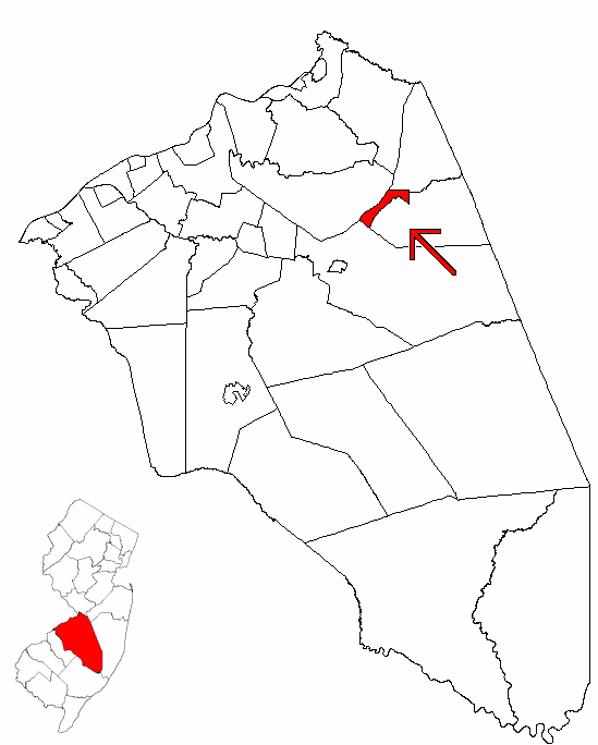
mapsize = 250x200px
map_caption = Wrightstown highlighted in Burlington County. Inset
mapsize1 = 250x200px
map_caption1 = Census Bureau map of Wrightstown, New Jerseysubdivision_type = Country
subdivision_name =United States
subdivision_type1 = State
subdivision_name1 =New Jersey
subdivision_type2 = County
subdivision_name2 = Burlington
government_footnotes =
government_type =Borough (New Jersey)
leader_title =
leader_name =
leader_title1 =
leader_name1 =
established_title = Incorporated
established_date =March 26 ,1918 unit_pref = Imperial
area_footnotes =
area_magnitude =
area_total_km2 = 4.6
area_land_km2 = 4.6
area_water_km2 = 0.0
area_total_sq_mi = 1.8
area_land_sq_mi = 1.8
area_water_sq_mi = 0.0population_as_of = 2006
population_footnotes =
population_total = 741
population_density_km2 = 164.1
population_density_sq_mi = 425.1timezone = Eastern (EST)
utc_offset = -5
timezone_DST = EDT
utc_offset_DST = -4
elevation_footnotes = [Gnis|885453|Borough of Wrightstown,Geographic Names Information System . AccessedJanuary 4 ,2008 .]
elevation_m = 51
elevation_ft = 167
latd = 40 |latm = 01 |lats = 39 |latNS = N
longd = 74 |longm = 37 |longs = 51 |longEW = Wpostal_code_type =
ZIP code
postal_code = 08562
area_code = 609
blank_name = FIPS code
blank_info = 34-82960GR|2 [ [http://mcdc2.missouri.edu/webrepts/commoncodes/ccc_nj.html A Cure for the Common Codes: New Jersey] , Missouri Census Data Center. AccessedJuly 14 ,2008 .]
blank1_name = GNIS feature ID
blank1_info = 0885453GR|3
website =
footnotes =Wrightstown is a Borough in Burlington County,
New Jersey ,United States . As of theUnited States 2000 Census , the borough population was 748.Wrightstown was incorporated as a borough by an Act of the
New Jersey Legislature onMarch 4 ,1918 , from portions of New Hanover Township and North Hanover Township, based on the results of a referendum held onMarch 26 ,1918 ."The Story of New Jersey's Civil Boundaries: 1606-1968", John P. Snyder, Bureau of Geology and Topography; Trenton, New Jersey; 1969. p. 100.]Geography
Wrightstown is located at coor dms|40|1|56|N|74|37|21|W|city (40.032260, -74.622574)GR|1.
According to the
United States Census Bureau , the borough has a total area of 1.8square mile s (4.6km² ), all of it land.Wrightstown borders North Hanover Township, New Hanover Township, Pemberton Township, and Springfield Township.
Demographics
USCensusPop
1930= 176
1940= 241
1950= 1199
1960= 4846
1970= 2719
1980= 3031
1990= 3843
2000= 746
estimate=741
estyear=2006
estref= [http://factfinder.census.gov/servlet/SAFFPopulation?_event=Search&geo_id=06000US3400582420&_geoContext=01000US%7C04000US34%7C05000US34005%7C06000US3400582420&_street=&_county=wrightstown&_cityTown=wrightstown&_state=04000US34&_zip=&_lang=en&_sse=on&ActiveGeoDiv=geoSelect&_useEV=&pctxt=fph&pgsl=060&_submenuId=population_0&ds_name=null&_ci_nbr=null&qr_name=null®=null%3Anull&_keyword=&_industry= Census data for Wrightstown borough] ,United States Census Bureau . AccessedMarch 1 ,2007 .]
footnote=Population 1930 - 1990. [ [http://www.wnjpin.net/OneStopCareerCenter/LaborMarketInformation/lmi01/poptrd6.htm New Jersey Resident Population by Municipality: 1930 - 1990] , Workforce New Jersey Public Information Network. AccessedMarch 1 ,2007 .] As of thecensus GR|2 of 2000, there were 748 people, 312 households, and 181 families residing in the borough. Thepopulation density was 425.1 people per square mile (164.1/km²). There were 339 housing units at an average density of 192.7/sq mi (74.4/km²). The racial makeup of the borough was 49.87% White, 30.21% African American, 0.53% Native American, 7.22% Asian, 7.22% from other races, and 4.95% from two or more races. Hispanic or Latino of any race were 11.23% of the population.There were 312 households out of which 33.3% had children under the age of 18 living with them, 28.2% were married couples living together, 25.3% had a female householder with no husband present, and 41.7% were non-families. 34.6% of all households were made up of individuals and 7.4% had someone living alone who was 65 years of age or older. The average household size was 2.37 and the average family size was 3.09.
In the borough the population was spread out with 29.7% under the age of 18, 10.2% from 18 to 24, 33.2% from 25 to 44, 18.4% from 45 to 64, and 8.6% who were 65 years of age or older. The median age was 31 years. For every 100 females there were 94.8 males. For every 100 females age 18 and over, there were 88.5 males.
The median income for a household in the borough was $27,500, and the median income for a family was $29,375. Males had a median income of $28,889 versus $25,417 for females. The
per capita income for the borough was $14,489. About 22.8% of families and 24.0% of the population were below thepoverty line , including 31.8% of those under age 18 and 22.4% of those age 65 or over.Government
Local government
Wrightstown is governed under the Borough form of New Jersey municipal government. The government consists of a Mayor and a Borough Council made up of six council members, with all positions elected at large in partisan elections. A Mayor is elected directly by the voters to a four-year term of office. The Borough Council consists of six members elected to serve three-year terms on a staggered basis, with two seats coming up for election each year. ["2005 New Jersey Legislative District Data Book",
Rutgers University Edward J. Bloustein School of Planning and Public Policy , April 2005, p. 43.]Federal, state and county representation
Wrightstown is in the Third Congressional District and is part of New Jersey's 8th Legislative District. [ [http://www.lwvnj.org/pubs/CG06.pdf 2006 New Jersey Citizen's Guide to Government] , New Jersey
League of Women Voters , p. 66. AccessedAugust 30 ,2006 .]Education
Students in public school for grades pre-K to 8 attend the
New Hanover Township School , which serves students from both New Hanover Township and Wrightstown, as part of the consolidatedNew Hanover Township School District . ["2005 New Jersey Legislative District Data Book",Rutgers University Edward J. Bloustein School of Planning and Public Policy , April 2005, p. 212.] The school had an enrollment of 151 students as of the 2005-06 school year. [ [http://nces.ed.gov/ccd/schoolsearch/school_list.asp?Search=1&DistrictID=3411250 Data for the New Hanover Township School] ,National Center for Education Statistics . AccessedJune 14 ,2008 .]For grades 9–12, public school students from both New Hanover Township and Wrightstown Borough attend
Bordentown Regional High School as part of a sending/receiving relationship. The high school is part of theBordentown Regional School District , a regional K–12 school district that serves students from Bordentown City, Bordentown Township and Fieldsboro Borough. [ [http://education.state.nj.us/rc/rc06/narrative/05/0475/05-0475-000.html Bordentown Regional School District 2006 Report Card Narrative] ,New Jersey Department of Education . AccessedApril 15 ,2008 . "The Bordentown Regional School District is a progressive, comprehensive K-12 regional. Comprised of four schools and serving the communities of Bordentown Township, Bordentown City and Fieldsboro, the district prides itself on offering programs that address the needs of our diverse population. Students from the New Hanover School district attend our high school on a tuition basis."]Transportation
New Jersey Transit provides bus service toPhiladelphia on the 317 line. [ [http://www.njtransit.com/sf_tp_rc_burlington.shtml Burlington County Bus/Rail Connections] ,New Jersey Transit . AccessedJuly 15 ,2007 .]News coverage
Wrightstown and neighboring Cookstown were put in the national spotlight when six Islamic militants, dubbed "The Fort Dix Six", were arrested while trying to carry out an attack against Fort Dix on
May 7 ,2007 . Heightened security around the bases affected the local economy based heavily in restaurants specializing in delivery to the base.Fact|date=June 2008Notable residents
Notable current and former residents of Wrightstown include:
*Samuel G. Wright (1781 - 1845), represented ushr|New Jersey|2 in 1845. [ [http://bioguide.congress.gov/scripts/biodisplay.pl?index=W000769 Samuel Gardiner Wright] , "Biographical Directory of the United States Congress ". AccessedJune 22 ,2008 .]References
External links
* [http://www.newhanover.k12.nj.us/ New Hanover Township Public Schools]
*NJReportCard|05|3540|0|New Hanover Township School District
* [http://nces.ed.gov/ccd/schoolsearch/school_list.asp?Search=1&DistrictID=3411250 Data for the New Hanover Township School] ,National Center for Education Statistics
* [http://www.bordentown.k12.nj.us/brhs/brhs.htm Bordentown Regional High School]

Wikimedia Foundation. 2010.