- Woodland Township, New Jersey
-
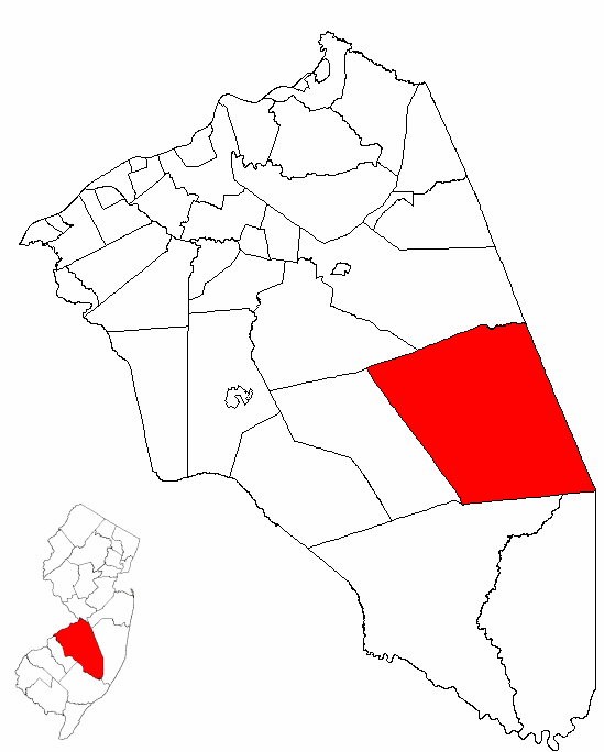
Woodland Township, New Jersey — Township — Woodland Township highlighted in Burlington County. Inset map: Burlington County highlighted in the State of New Jersey. Census Bureau map of Woodland Township, New Jersey
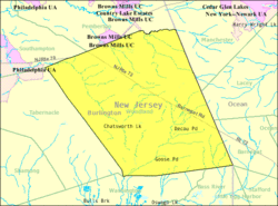
Coordinates: 39°50′50″N 74°30′54″W / 39.84722°N 74.515°WCoordinates: 39°50′50″N 74°30′54″W / 39.84722°N 74.515°W Country United States State New Jersey County Burlington Incorporated March 7, 1866 Government[1] - Type Township (New Jersey) Area - Total 96.4 sq mi (249.6 km2) - Land 95.9 sq mi (248.5 km2) - Water 0.4 sq mi (1.2 km2) Elevation[2] 118 ft (36 m) Population (2008)[3] - Total 1,352 - Density 12.2/sq mi (4.7/km2) Time zone Eastern (EST) (UTC-5) - Summer (DST) EDT (UTC-4) ZIP code 08019 - Chatsworth Area code(s) 609 FIPS code 34-82420[4][5] GNIS feature ID 0882080[6] Woodland Township is a Township in Burlington County, New Jersey, United States. As of the United States 2000 Census, the township population was 1,170.
Woodland was incorporated as a township by an Act of the New Jersey Legislature on March 7, 1866, from portions of Pemberton Township, Shamong Township, Southampton Township and Washington Township. Portions of the township were taken to form Tabernacle Township on March 22, 1901.[7]
The township is located in the Pinelands National Reserve which is coextensive with the Pine Barrens, north of the Wharton State Forest. It includes the unincorporated community of Chatsworth, which is the postal address for most of the residents of the township.
Contents
Geography
According to the United States Census Bureau, the township has a total area of 96.4 square miles (250 km2), of which, 95.9 square miles (248 km2) of it is land and 0.4 square miles (1.0 km2) of it (0.47%) is water.
Demographics
Historical populations Census Pop. %± 1930 970 — 1940 1,374 41.6% 1950 1,524 10.9% 1960 1,904 24.9% 1970 2,032 6.7% 1980 2,285 12.5% 1990 2,063 −9.7% 2000 1,170 −43.3% Est. 2008 1,352 [3] 15.6% Population 1930 - 1990.[8] As of the census[4] of 2000, there were 1,170 people, 425 households, and 323 families residing in the township. The population density was 12.2 people per square mile (4.7/km²). There were 448 housing units at an average density of 4.7 per square mile (1.8/km²). The racial makeup of the township was 98.03% White, 0.60% African American, 0.09% Native American, 0.34% Asian, 0.17% from other races, and 0.77% from two or more races. Hispanic or Latino of any race were 1.20% of the population.
There were 425 households out of which 35.1% had children under the age of 18 living with them, 60.5% were married couples living together, 8.9% had a female householder with no husband present, and 24.0% were non-families. 19.1% of all households were made up of individuals and 5.2% had someone living alone who was 65 years of age or older. The average household size was 2.75 and the average family size was 3.15.
In the township the population was spread out with 25.8% under the age of 18, 7.3% from 18 to 24, 31.3% from 25 to 44, 27.9% from 45 to 64, and 7.7% who were 65 years of age or older. The median age was 38 years. For every 100 females there were 99.0 males. For every 100 females age 18 and over, there were 101.9 males.
The median income for a household in the township was $59,271, and the median income for a family was $65,972. Males had a median income of $43,654 versus $31,765 for females. The per capita income for the township was $26,126. About 2.0% of families and 2.9% of the population were below the poverty line, including 2.9% of those under age 18 and 4.0% of those age 65 or over.
Surrounding Municipalities

Pemberton Twp Manchester Twp Tabernacle Twp 
Lacey Twp  Woodland Twp

Washington Twp Stafford Twp, Barnegat Twp,
Bass River Township
and Little Egg Harbor TwpGovernment
Local government
Woodland Township is governed under the Township form of government with a three-member Township Committee. The Township Committee is elected directly by the voters in partisan elections to serve three-year terms of office on a staggered basis, with one seat coming up for election each year.[1] At an annual reorganization meeting, the Township Committee selects one of its members to serve as Mayor.
Federal, state and county representation
Woodland Township is in the 3rd Congressional district. New Jersey's Third Congressional District is represented by Jon Runyan (R, Mount Laurel Township). New Jersey is represented in the United States Senate by Frank Lautenberg (D, Cliffside Park) and Bob Menendez (D, Hoboken).
Woodland is in the 8th district of the New Jersey Legislature, which is represented in the New Jersey Senate by Dawn Marie Addiego (R, Evesham Township) and in the New Jersey General Assembly by Gerry Nardello (R, Mount Laurel Township) and Scott Rudder (R, Medford Township).[9][10]
Burlington County is governed by a Board of Chosen Freeholders, whose five members are elected at-large to three-year terms of office on a staggered basis, with one or two seats coming up for election each year. As of 2011, Burlington County's Freeholders are Freeholder Director Bruce D. Garganio (Florence Township, 2012), Deputy Director Christopher J. Brown (Evesham Township, 2011), Joseph B. Donnelly (Cinnaminson Township, 2013), Mary Ann O'Brien (Medford Township, 2012) and Mary Anne Reinhart (Shamong Township, 2011).[11][12]
Transportation
Only two major state and county routes pass through Woodland. Route 70 runs along the northwestern border while Route 72 travels from the northwest to the southeast. CR 532 and CR 563 also pass through and intersect with each other in Chatsworth.
The Garden State Parkway is accessible outside the township in neighboring Lacey, Barnegat, Stafford, Little Egg Harbor, and Bass River Townships.
Education
The Woodland Township School District serves students in kindergarten through eighth grade at Chatsworth Elementary School, which had an enrollment of 153 students in grades K-8 as of the 2005-06 school year.[13]
High school students in Woodland Township attend Seneca High School located in Tabernacle Township, which is part of the Lenape Regional High School District. The district serves students from Evesham Township, Medford Lakes, Medford Township, Mount Laurel Township, Shamong Township, Southampton Township, Tabernacle Township and Woodland Township.[14] The school serves students in ninth through twelfth grade from Shamong, Southampton, Tabernacle and Woodland Townships.[15]
References
- ^ a b 2005 New Jersey Legislative District Data Book, Rutgers University Edward J. Bloustein School of Planning and Public Policy, April 2005, p. 103.
- ^ U.S. Geological Survey Geographic Names Information System: Township of Woodland, Geographic Names Information System. Accessed January 4, 2008.
- ^ a b Census data for Woodland township, United States Census Bureau. Accessed June 30, 2009.
- ^ a b "American FactFinder". United States Census Bureau. http://factfinder.census.gov. Retrieved 2008-01-31.
- ^ A Cure for the Common Codes: New Jersey, Missouri Census Data Center. Accessed July 14, 2008.
- ^ "US Board on Geographic Names". United States Geological Survey. 2007-10-25. http://geonames.usgs.gov. Retrieved 2008-01-31.
- ^ "The Story of New Jersey's Civil Boundaries: 1606-1968", John P. Snyder, Bureau of Geology and Topography; Trenton, New Jersey; 1969. p. 100.
- ^ New Jersey Resident Population by Municipality: 1930 - 1990, Workforce New Jersey Public Information Network. Accessed March 1, 2007.
- ^ "Legislative Roster: 2010-2011 Session". New Jersey Legislature. http://www.njleg.state.nj.us/members/roster.asp. Retrieved 2011-01-25.
- ^ "Former Mount Laurel mayor is chosen to fill seat of departing assemblyman". Newark Star-Ledger. http://www.nj.com/news/index.ssf/2011/08/former_mount_laurel_mayor_is_c.html. Retrieved 2011-08-23.
- ^ Meet the Freeholders, Burlington County, New Jersey Board of Chosen Freeholders. Accessed January 3, 2011.
- ^ Staff. BRUCE GARGANIO CHOSEN FREEHOLDER DIRECTOR FOR SECOND YEAR; CHRIS BROWN OF EVESHAM CHOSEN DEPUTY DIRECTOR, Burlington County, New Jersey press release dated January 1, 2011. Accessed January 3, 2011.
- ^ Data for the Woodland Township School District, National Center for Education Statistics. Accessed April 10, 2008.
- ^ Lenape Regional High School District 2007 Report Card Narrative, New Jersey Department of Education. Accessed April 8, 2008. "The Lenape Regional High School District serves the eight municipalities of Evesham, Medford, Mount Laurel, Shamong, Southampton, Tabernacle and Woodland townships and Medford Lakes borough."
- ^ Seneca High School 2007 Report Card Narrative, New Jersey Department of Education. Accessed April 9, 2008.
External links
- Woodland Township School District's 2009–10 School Report Card from the New Jersey Department of Education
- Data for the Woodland Township School District, National Center for Education Statistics
- Lenape Regional High School District
Municipalities and communities of Burlington County, New Jersey County seat: Mount Holly Township Cities 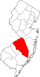
Boroughs Fieldsboro | Medford Lakes | Palmyra | Pemberton | Riverton | Wrightstown
Townships Bass River | Bordentown | Burlington | Chesterfield | Cinnaminson | Delanco | Delran | Eastampton | Edgewater Park | Evesham | Florence | Hainesport | Lumberton | Mansfield | Maple Shade | Medford | Moorestown | Mount Holly | Mount Laurel | New Hanover | North Hanover | Pemberton | Riverside | Shamong | Southampton | Springfield | Tabernacle | Washington | Westampton | Willingboro | Woodland
CDPs Communities Arneytown | Centerton | Chairville | Chatsworth | Columbus | Cookstown | Crosswicks | Evesboro | Fellowship | Fostertown | Georgetown | Hartford | Hedding | Jacksonville | Jacobstown | Jobstown | Kinkora | Masonville | New Gretna | New Lisbon | Rancocas | Rancocas Woods | Retreat | Sandtown | Vincentown
Categories:- Townships in Burlington County, New Jersey
- Populated places established in 1866

Wikimedia Foundation. 2010.