- Lumberton Township, New Jersey
Infobox Settlement
official_name = Lumberton Township, New Jersey
settlement_type = Township
nickname =
motto =
imagesize =
image_caption =
image_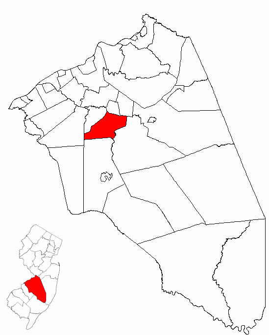
mapsize = 250x200px
map_caption = Lumberton Township highlighted in Burlington County. Inset
mapsize1 = 250x200px
map_caption1 = Census Bureau map of Lumberton Township, New Jerseysubdivision_type = Country
subdivision_name =United States
subdivision_type1 = State
subdivision_name1 =New Jersey
subdivision_type2 = County
subdivision_name2 = Burlington
government_footnotes =
government_type =Township (New Jersey)
leader_title =mayor
leader_name = Patrick Delany
leader_title1 =
leader_name1 =
established_title = Incorporated
established_date =March 14 ,1860 unit_pref = Imperial
area_footnotes =
area_magnitude =
area_total_km2 = 33.8
area_land_km2 = 33.3
area_water_km2 = 0.4
area_total_sq_mi = 13.0
area_land_sq_mi = 12.9
area_water_sq_mi = 0.2population_as_of = 2006
population_footnotes =
population_total = 12331
population_density_km2 = 313.9
population_density_sq_mi = 813.0timezone = Eastern (EST)
utc_offset = -5
timezone_DST = EDT
utc_offset_DST = -4
elevation_footnotes = [Gnis|882091|Township of Lumberton,Geographic Names Information System . AccessedJune 13 ,2008 .]
elevation_m = 3
elevation_ft = 10
latd = 39 |latm = 58 |lats = 4 |latNS = N
longd = 74 |longm = 48 |longs = 1 |longEW = Wpostal_code_type =
ZIP code
postal_code = 08048
area_code = 609
blank_name = FIPS code
blank_info = 34-42060GR|2 [ [http://mcdc2.missouri.edu/webrepts/commoncodes/ccc_nj.html A Cure for the Common Codes: New Jersey] , Missouri Census Data Center. AccessedJuly 14 ,2008 .]
blank1_name = GNIS feature ID
blank1_info = 0882091GR|3
website = http://www.lumbertontwp.com
footnotes =Lumberton Township is a Township in Burlington County,
New Jersey ,United States . As of theUnited States 2000 Census , the township population was 10,461.Lumberton was incorporated as a township by an Act of the
New Jersey Legislature onMarch 14 ,1860 , from portions of Medford Township, Southampton Township and Eastampton Township. Portions of the township were taken onMarch 12 ,1924 , to form Hainesport."The Story of New Jersey's Civil Boundaries: 1606-1968", John P. Snyder, Bureau of Geology and Topography; Trenton, New Jersey; 1969. p. 96.]In March 2007, Lumberton was identified as having the most active community of
EBay buyers and sellers on a per-capita basis in the United States. [cite news|title=A South Jersey Town Emerges as a Hub of E-Commerce|author=The New York Times|date=2007-03-20|url=http://www.nytimes.com/2007/03/20/nyregion/20ebay.html|accessdate=2007-03-20] [ [http://www2.ebay.com/aw/core/200611291633282.html Community Counts Winner Announced] , accessedMarch 20 ,2007 .]Geography
According to the
United States Census Bureau , the township has a total area of 13.0square mile s (33.8km² ), of which, 12.9 square miles (33.3 km²) of it is land and 0.2 square miles (0.4 km²) of it (1.30%) is water.Lumberton Township borders Eastampton Township, Southampton Township, Medford Township, Mount Laurel Township, Hainesport Township, and Mount Holly Township.
Demographics
USCensusPop
1930= 905
1940= 1007
1950= 1325
1960= 2833
1970= 3945
1980= 5236
1990= 6705
2000= 10461
estimate=12331
estyear=2006
estref= [http://factfinder.census.gov/servlet/SAFFPopulation?_event=Search&geo_id=06000US3400529010&_geoContext=01000US%7C04000US34%7C05000US34005%7C06000US3400529010&_street=&_county=lumberton&_cityTown=lumberton&_state=04000US34&_zip=&_lang=en&_sse=on&ActiveGeoDiv=geoSelect&_useEV=&pctxt=fph&pgsl=060&_submenuId=population_0&ds_name=null&_ci_nbr=null&qr_name=null®=null%3Anull&_keyword=&_industry= Census data for Lumberton township] ,United States Census Bureau . AccessedOctober 30 ,2007 .]
footnote=Population 1930 - 1990 [ [http://www.wnjpin.net/OneStopCareerCenter/LaborMarketInformation/lmi01/poptrd6.htm New Jersey Resident Population by Municipality: 1930 - 1990] , Workforce New Jersey Public Information Network. AccessedMarch 1 ,2007 .] As of thecensus GR|2 of 2000, there were 10,461 people, 3,930 households, and 2,731 families residing in the township. Thepopulation density was 813.0 people per square mile (313.8/km²). There were 4,080 housing units at an average density of 317.1/sq mi (122.4/km²). The racial makeup of the township was 78.31% White, 13.75% African American, 0.23% Native American, 3.38% Asian, 0.02% Pacific Islander, 1.90% from other races, and 2.41% from two or more races. Hispanic or Latino of any race were 5.15% of the population.There were 3,930 households out of which 39.2% had children under the age of 18 living with them, 54.9% were married couples living together, 10.9% had a female householder with no husband present, and 30.5% were non-families. 25.1% of all households were made up of individuals and 9.1% had someone living alone who was 65 years of age or older. The average household size was 2.61 and the average family size was 3.17.
In the township the population was spread out with 28.1% under the age of 18, 6.2% from 18 to 24, 35.6% from 25 to 44, 19.0% from 45 to 64, and 11.1% who were 65 years of age or older. The median age was 36 years. For every 100 females there were 91.2 males. For every 100 females age 18 and over, there were 87.6 males.
The median income for a household in the township was $60,571, and the median income for a family was $70,329. Males had a median income of $46,045 versus $32,431 for females. The
per capita income for the township was $25,789. About 2.6% of families and 3.8% of the population were below thepoverty line , including 3.2% of those under age 18 and 5.9% of those age 65 or over.Government
Local government
Lumberton Township is governed under the Township form of government with a five-member Township Committee. The Township Committee is elected directly by the voters in partisan elections to serve three-year terms of office on a staggered basis, with one or two seats coming up for election each year. ["2005 New Jersey Legislative District Data Book",
Rutgers University Edward J. Bloustein School of Planning and Public Policy , April 2005, p. 103.] At an annual reorganization meeting, the Township Committee selects one of its members to serve as Mayor and another as Deputy Mayor.Members of the Lumberton Township Committee are
Mayor Patrick Delany,Deputy Mayor Michael Mansdoerfer, James Conway, Jr., Beverly Marinelli and James "Buddy" Miller, Jr. [ [http://www.lumbertontwp.com/Government/TownshipDirectory/tabid/549/Default.aspx Township Committee] , Lumberton Township. AccessedJune 25 ,2008 .]Federal, state and county representation
Lumberton Township is in the Third Congressional District and is part of New Jersey's 8th Legislative District. [ [http://www.lwvnj.org/pubs/CG06.pdf 2006 New Jersey Citizen's Guide to Government] , New Jersey
League of Women Voters , p. 60. AccessedAugust 30 ,2006 .]Education
For Pre-Kindergarten through eighth grade, public school students attend the
Lumberton Township School District . With an average addition of 80-100 students per year, Lumberton has been one of the most rapidly growing school districts inSouth Jersey for the past ten years. Schools in the district (with 2005-06 enrollment data from theNational Center for Education Statistics [ [http://nces.ed.gov/ccd/schoolsearch/school_list.asp?Search=1&DistrictID=3409180 Data for the Lumberton Township School District] ,National Center for Education Statistics . AccessedJune 24 ,2008 .] ) are [http://www.lumberton.k12.nj.us/Default.aspx?tabid=54 Florence L. Walther School] with 390 students in pre-Kindergarten to first grade, [http://www.lumberton.k12.nj.us/Default.aspx?tabid=56 Ashbrook Elementary School] with 396 students in grades 2-3, [http://www.lumberton.k12.nj.us/Default.aspx?tabid=55 Bobby's Run School] with 385 students in grades 4-5 and [http://www.lumberton.k12.nj.us/Default.aspx?tabid=57 Lumberton Middle School] with 578 students in grades 6-8, a New Jersey Star School.For grades 9 - 12, public school students attend the
Rancocas Valley Regional High School , a comprehensive regional publichigh school serving students in grades 9 through 12 from five communities encompassing approximately 40 square miles and comprising the communities of Eastampton Township, Hainesport Township, Lumberton Township, Mount Holly Township and Westampton Township. [ [http://www.rvrhs.com/about_us/history.jsp?rn=2473882 History of the School] , Rancocas Valley Regional High School. AccessedJune 24 ,2008 . "The district encompasses approximately 40 square miles and comprises the townships of Eastampton, Hainesport, Lumberton, Mount Holly, and Westampton."] The current population of the school is approximately 2,250 students. The school is located in Mount Holly Township and is part of the Rancocas Valley Regional High School District.Transportation
New Jersey Transit provides bus service toPhiladelphia on the 317 and 413 routes. [ [http://www.njtransit.com/sf_tp_rc_burlington.shtml Burlington County Bus/Rail Connections] ,New Jersey Transit . AccessedJuly 15 ,2007 .] TheFlying W Airport is located 1 mile (2 km) southwest of thecentral business district .Notable residents
Notable current and former residents of Lumberton Township include:
*Clifford Ross Powell (1893-1973), politician who served as ActingGovernor of New Jersey in 1935. [cite news |first= |last= |authorlink= |coauthors= |title=Gen. Clifford R. Powell, 80; Jersey Senator Led Guard |quote=Maj. Gen. Clifford R. Powell, a retired commander of theNew Jersey National Guard and a former State Senator and Assemblyman, died of a heart attack a Burlington County Memorial Hospital Wednesday. He was 80 years old and lived in Lumberton. |work= |publisher=New York Times |date=March 31 ,1973 , Saturday |accessdate=2007-06-14 ]References
External links
* [http://www.lumbertontwp.com/ Lumberton Township website]
* [http://www.lumberton.k12.nj.us/ Lumberton Township School District]
*NJReportCard|05|2850|0|Lumberton Township School District
* [http://nces.ed.gov/ccd/schoolsearch/school_list.asp?Search=1&DistrictID=3409180 Data for the Lumberton Township School District] ,National Center for Education Statistics
* [http://alpha.fdu.edu/~bender/PH25.html Former Lumberton Nike Missile Site]

Wikimedia Foundation. 2010.