- Florence-Roebling, New Jersey
Infobox Settlement
official_name = Florence-Roebling, New Jersey
settlement_type = CDP
nickname =
motto =
imagesize =
image_caption =
image_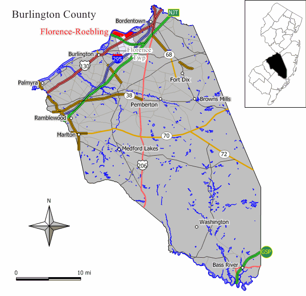
mapsize = 250x200px
map_caption = Map of Florence-Roebling CDP in Burlington County
mapsize1 =
map_caption1 =subdivision_type = Country
subdivision_name =United States
subdivision_type1 = State
subdivision_name1 =New Jersey
subdivision_type2 = County
subdivision_name2 = Burlington
government_footnotes =
government_type =
leader_title =
leader_name =
leader_title1 =
leader_name1 =
established_title =
established_date =area_footnotes =
area_magnitude =
area_total_km2 = 6.8
area_land_km2 = 5.7
area_water_km2 = 1.1
area_total_sq_mi = 2.6
area_land_sq_mi = 2.2
area_water_sq_mi = 0.4population_as_of = 2000
population_footnotes =
population_total = 8200
population_density_km2 = 1431.3
population_density_sq_mi = 3707.0timezone = Eastern (EST)
utc_offset = -5
timezone_DST = EDT
utc_offset_DST = -4
elevation_footnotes =
elevation_m =
elevation_ft =
latd = 40 |latm = 7 |lats = 1 |latNS = N
longd = 74 |longm = 47 |longs = 41 |longEW = Wpostal_code_type =
postal_code =
area_code =
blank_name = FIPS code
blank_info = 34-23895GR|2
blank1_name =
blank1_info =
website =
footnotes =Florence-Roebling is a
census-designated place and unincorporated area located within Florence Township, in Burlington County,New Jersey . As of theUnited States 2000 Census , the CDP population was 8,200.Geography
Florence-Roebling is located at coor dms|40|7|1|N|74|47|41|W|city (40.116810, -74.794795)GR|1.
According to the
United States Census Bureau , the CDP has a total area of 6.8km² (2.6 mi²). 5.7 km² (2.2 mi²) of it is land and 1.1 km² (0.4 mi²) of it (15.91%) is water.Demographics
USCensusPop
1990=8564
2000=8200
footnote=source: [cite web
url=http://factfinder.census.gov/servlet/SAFFPopulation?_event=Search&geo_id=16000US3422530&_geoContext=01000US%7C04000US34%7C16000US3422530&_street=&_county=Florence-Roebling&_cityTown=Florence-Roebling&_state=04000US34&_zip=&_lang=en&_sse=on&ActiveGeoDiv=geoSelect&_useEV=&pctxt=fph&pgsl=160&_submenuId=population_0&ds_name=null&_ci_nbr=null&qr_name=null®=null%3Anull&_keyword=&_industry=
title=Population Finder: Florence-Roebling CDP, New Jersey
publisher=U.S. Census Bureau
accessdate=2007-03-18] As of thecensus GR|2 of 2000, there were 8,200 people, 3,220 households, and 2,170 families residing in the CDP. Thepopulation density was 1,432.6/km² (3,707.0/mi²). There were 3,439 housing units at an average density of 600.8/km² (1,554.7/mi²). The racial makeup of the CDP was 85.07% White, 10.54% African American, 0.09% Native American, 2.09% Asian, 0.01% Pacific Islander, 0.61% from other races, and 1.60% from two or more races. Hispanic or Latino of any race were 2.04% of the population.There were 3,220 households out of which 33.0% had children under the age of 18 living with them, 47.0% were married couples living together, 15.1% had a female householder with no husband present, and 32.6% were non-families. 27.6% of all households were made up of individuals and 10.7% had someone living alone who was 65 years of age or older. The average household size was 2.53 and the average family size was 3.10.
In the CDP the population was spread out with 25.6% under the age of 18, 7.9% from 18 to 24, 31.6% from 25 to 44, 21.9% from 45 to 64, and 12.9% who were 65 years of age or older. The median age was 36 years. For every 100 females there were 89.7 males. For every 100 females age 18 and over, there were 85.1 males.
The median income for a household in the CDP was $51,192, and the median income for a family was $61,135. Males had a median income of $42,985 versus $30,493 for females. The
per capita income for the CDP was $22,074. About 5.7% of families and 7.3% of the population were below thepoverty line , including 7.6% of those under age 18 and 8.1% of those age 65 or over.Transportation
The River Line offers service to Camden and Trenton Rail Station, with stations in Roebling at Hornberger Avenue and Florence at
U.S. Route 130 .Roebling Steel Mill
Roebling was founded by
Charles Roebling , son ofJohn A. Roebling . John A. Roebling & Sons company built and provided the steel for theBrooklyn Bridge , theGolden Gate Bridge , as well as numerous other bridges including one overNiagara Falls .The Steel Mill was also responsible for the production of the elevator cables for the
Empire State Building inNew York City , theChicago Board of Trade Building inChicago and theWashington Monument inWashington, D.C. John A. Roebling & Sons company made the wire for the originalslinky as well.References
External links
* [http://www.roebling.org/ "Village" of Roebling]
Wikimedia Foundation. 2010.