- Barnegat Township, New Jersey
Infobox Settlement
official_name = Barnegat Township, New Jersey
settlement_type = Township
nickname =
motto =
imagesize =
image_caption =
image_
imagesize =
image_caption =
image_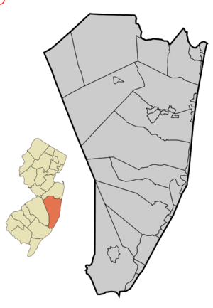
mapsize = 250x200px
map_caption = Map of Barnegat Township in Ocean County. Inset: Location of Ocean County highlighted in the State of New Jersey.
mapsize1 = 250x200px
map_caption1 = Census Bureau map of Barnegat Township, New Jerseysubdivision_type = Country
subdivision_name =United States
subdivision_type1 = State
subdivision_name1 =New Jersey
subdivision_type2 = County
subdivision_name2 = Ocean
government_footnotes =
government_type =Township (New Jersey)
leader_title =Mayor
leader_name = Jeff Melchiondo
leader_title1 = Administrator
leader_name1 = David Breeden
established_title = Incorporated
established_date =March 10 ,1846 as "Union Township"
established_title1 = Renamed
established_date1 =January 1 ,1977 as "Barnegat Township"unit_pref = Imperial
area_footnotes =
area_magnitude =
area_total_km2 = 105.7
area_land_km2 = 89.8
area_water_km2 = 15.9
area_total_sq_mi = 40.8
area_land_sq_mi = 34.7
area_water_sq_mi = 6.2population_as_of = 2006
population_footnotes =
population_total = 21192
population_density_km2 = 170.0
population_density_sq_mi = 440.4timezone = Eastern (EST)
utc_offset = -5
timezone_DST = EDT
utc_offset_DST = -4
elevation_footnotes = [Gnis|882070|Township of Barnegat,Geographic Names Information System , accessedJanuary 4 ,2008 .]
elevation_m = 33
elevation_ft = 108
latd = 39 |latm = 45 |lats = 46 |latNS = N
longd = 74 |longm = 16 |longs = 9 |longEW = Wpostal_code_type =
ZIP code
postal_code = 08005
area_code = 609
blank_name = FIPS code
blank_info = 34-03050GR|2 [ [http://mcdc2.missouri.edu/webrepts/commoncodes/ccc_nj.html A Cure for the Common Codes: New Jersey] , Missouri Census Data Center. AccessedJuly 14 ,2008 .]
blank1_name = GNIS feature ID
blank1_info = 0882070GR|3
website = http://www.ci.barnegat.nj.us
footnotes =Barnegat Township is a Township in Ocean County,
New Jersey ,United States . As of theUnited States 2000 Census the population was 15,270.What is now Barnegat Township was incorporated as Union Township on
March 10 ,1846 , from portions of both Dover Township (now Toms River Township) and Stafford Township, while the area was still part of Monmouth County. It became part of the newly-formed Ocean County onFebruary 15 ,1850 . Portions of the township were taken to form Lacey Township (March 23 ,1871 ), Ocean Township (April 13 ,1876 ), Harvey Cedars (December 13 ,1894 ) and Long Beach Township (March 23 ,1899 )."The Story of New Jersey's Civil Boundaries: 1606-1968", John P. Snyder, Bureau of Geology and Topography; Trenton, New Jersey; 1969. p. 206.] Union Township changed its name to Barnegat Township as ofJanuary 1 ,1977 .Barnegat CDP (2000 Census population of 1,690) is a
census-designated place and unincorporated area located within Barnegat Township. Ocean Acres (13,155) is a census-designated place and unincorporated area split between Barnegat Township and Stafford Township.Geography
According to the
United States Census Bureau , the township has a total area of 40.8square mile s (105.7km² ), of which, 34.7 square miles (89.8 km²) of it is land and 6.2 square miles (16.0 km²) of it (15.09%) is water.The municipality borders the Ocean County municipalities of Lacey Township, Ocean Township, Long Beach Township, Harvey Cedars, Stafford Township and Woodland Township in Burlington County.
History
Barnegat gets its name from nearby
Barnegat Bay andBarnegat Inlet . The inlet was originally "Barendegat," or "Inlet of the Breakers," and was named by Dutch settlers in 1609 for the waterway's turbulent channel. [Lloyd, John Bailey. "Eighteen Miles of History on Long Beach Island." p. 42. 1994 Down The Shore Publishing and The SandPaper, Inc.]Demographics
USCensusPop
1930=1037
1940=1045
1950=1173
1960=1270
1970=1539
1980=8702
1990=12235
2000=15270
estimate= 21192
estyear=2006
estref= [http://factfinder.census.gov/servlet/SAFFPopulation?_event=ChangeGeoContext&geo_id=06000US3402903050&_geoContext=01000US%7C04000US34%7C05000US34031%7C06000US3403177840&_street=&_county=barnegat&_cityTown=barnegat&_state=04000US34&_zip=&_lang=en&_sse=on&ActiveGeoDiv=geoSelect&_useEV=&pctxt=fph&pgsl=010&_submenuId=population_0&ds_name=null&_ci_nbr=null&qr_name=null®=null%3Anull&_keyword=&_industry= Census data for Barnegat township] ,United States Census Bureau . AccessedJuly 28 ,2007 .]
footnote=Population 1930 - 1990. [http://www.wnjpin.net/OneStopCareerCenter/LaborMarketInformation/lmi01/poptrd6.htm New Jersey Resident Population by Municipality: 1930 - 1990] , Workforce New Jersey Public Information Network. AccessedMarch 1 ,2007 .] As of thecensus GR|2 of 2000, there were 15,270 people, 5,493 households, and 4,191 families residing in the township. Thepopulation density was 440.4 people per square mile (170.1/km²). There were 6,066 housing units at an average density of 175.0/sq mi (67.6/km²). The racial makeup of the township was 94.75% White, 2.21% African American, 0.09% Native American, 1.00% Asian, 0.70% from other races, and 1.25% from two or more races. Hispanic or Latino of any race were 3.86% of the population.There were 5,493 households out of which 35.3% had children under the age of 18 living with them, 63.0% were married couples living together, 9.7% had a female householder with no husband present, and 23.7% were non-families. 20.2% of all households were made up of individuals and 12.0% had someone living alone who was 65 years of age or older. The average household size was 2.76 and the average family size was 3.19.
In the township the population was spread out with 27.1% under the age of 18, 6.6% from 18 to 24, 26.0% from 25 to 44, 22.4% from 45 to 64, and 17.9% who were 65 years of age or older. The median age was 39 years. For every 100 females there were 93.0 males. For every 100 females age 18 and over, there were 88.6 males.
The median income for a household in the township was $48,572, and the median income for a family was $56,093. Males had a median income of $42,460 versus $28,452 for females. The
per capita income for the township was $19,307. About 5.1% of families and 6.2% of the population were below thepoverty line , including 9.7% of those under age 18 and 4.9% of those age 65 or over.Government
Local government
Barnegat Township is governed under the Township form of government with a five-member Township Committee. The Township Committee is elected directly by the voters in partisan elections to serve three-year terms of office on a staggered basis, with one or two seats coming up for election each year. ["2005 New Jersey Legislative District Data Book",
Rutgers University Edward J. Bloustein School of Planning and Public Policy , April 2005, p. 49.] At an annual reorganization meeting, the Township Committee selects one of its members to serve as Mayor and another as Deputy Mayor.Members of the Barnegat Township Committee are
Mayor Jeff Melchiondo (R, 2009)Deputy Mayor Al Cirulli (R, 2009), Thomas E. Hartman Jr. (R, 2008), Len Morano (D, 2008) and Dorothy Ryan (D, 2010). [http://www.ci.barnegat.nj.us/Govern.htm Barnegat Township Government] , Barnegat Township. AccessedMarch 9 ,2008 .] [ [http://www.oceancountyclerk.com/elelectedofficials2008.pdf#page=1 2008 Elected Officials of Ocean County] , Ocean County,New Jersey . p. 1. AccessedJune 16 ,2008 .]Local politics
The majority of the Barnegat Township Committee ran as Republicans, with the exception of Len Morano. [ Prince, Brian. "GOP majority intact in Barnegat", p. 1B, "
Asbury Park Press ",November 8 ,2006 .] Morano is a former member of a loosely-organized group called the Wawa Boys. The Wawa boys used to stand outside a local Wawa convenience store and talk politics. They have been both credited with being a grass-roots movement with an impact on local government and villainized for being a group of "nit-picking blowhards, part of why town politics are so venomous." [Vandiver, John. "Where the "boys" are". A1, "Asbury Park Press ",June 21 ,2006 .]Federal, state and county representation
Barnegat Township is in the Third Congressional District and is part of New Jersey's 9th Legislative District. [ [http://www.lwvnj.org/pubs/CG06.pdf 2006 New Jersey Citizen's Guide to Government] , New Jersey
League of Women Voters , p. 54. AccessedAugust 30 ,2006 .]Education
The
Barnegat Township School District now serves public school students in Kindergarten through Twelfth grade. Schools in the district (with 2005-06 enrollment data from theNational Center for Education Statistics [ [http://nces.ed.gov/ccd/schoolsearch/school_list.asp?Search=1&DistrictID=3416470 Data for the Barnegat Township School District] ,National Center for Education Statistics . AccessedJune 16 ,2008 .] ) are three K-5 elementary schools — [http://barnegatschools.com/cscs/site/default.asp Cecil S. Collins Elementary School] (664 students), [http://barnegatschools.com/lmds/site/default.asp Lillian M. Dunfee Elementary School] (371) and [http://barnegatschools.com/rlhs/site/default.asp Robert L. Horbelt Elementary School] (432) — [http://barnegatschools.com/robms/site/default.asp Russell O. Brackman Middle School] for grades 6-8 (783) andBarnegat High School for grades 9-12 as of September 2007 (546).Transportation
In addition to easy access to and from the
Garden State Parkway , Barnegat is a hub of major state and county highways. Route 72, which runs east to west, provides access to Burlington County andPhiladelphia . County Route 539, which intersects Route 72, links the Township with Trenton. U.S. Route 9 and the Garden State Parkway split the Township east-west.New Jersey Transit provides bus service to Atlantic City on the 559 bus route. [ [http://www.njtransit.com/sf_tp_rc_ocean.shtml Ocean County Bus/Rail Connections] ,New Jersey Transit . AccessedJuly 27 ,2007 .]References
External links
* [http://www.ci.barnegat.nj.us/ Barnegat Township website]
* [http://www.bts.k12.nj.us Barnegat Township School District]
*NJReportCard|29|0185|0|Barnegat Township School District
* [http://nces.ed.gov/ccd/schoolsearch/school_list.asp?Search=1&DistrictID=3416470 Data for the Barnegat Township School District] ,National Center for Education Statistics
* [http://www.oceancounty.lib.nj.us/Branches/BGT/bgt.htm Barnegat Branch of Ocean County Library]
Wikimedia Foundation. 2010.