- Huntington, New York
Infobox Settlement
official_name = Huntington, New York
settlement_type =Town
nickname =
imagesize =
image_caption =
pushpin_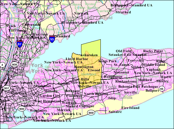
mapsize = 250x200px
map_caption =
mapsize1 =
map_caption1 =
subdivision_type = Country
subdivision_name =United States
subdivision_type1 = State
subdivision_name1 =New York
subdivision_type2 = County
subdivision_name2 = Suffolk
government_type =
leader_title = Supervisor
leader_name = Frank P. Petrone
established_date =
unit_pref = Imperial
area_footnote =
area_magnitude = 1 E9
area_total_km2 = 355.1
area_land_km2 = 243.4
area_water_km2 = 111.8
population_footnotes = [http://www.demographia.com/db-metrocore2005.htm Metropolitan & Central City Population: 2000-2005] . "Demographia.com", accessed September 3, 2006.]
area_total_sq_mi = 137.1
area_land_sq_mi = 94.0
area_water_sq_mi = 43.1
elevation_m = 41
elevation_ft = 135
latd = 40 |latm = 51 |lats = 4 |latNS = N
longd = 73 |longm = 22 |longs = 31 |longEW = W
population_as_of = 2000
population_note =
population_total = 195,289
population_density_km2 = 802.5
timezone = EST
utc_offset = −5
timezone_DST = EDT
utc_offset_DST = −4
latitude = 42°54'17" N
longitude = 78°50'58" W
website = [http://town.huntington.ny.us/ Huntington, NY]
postal_code_type =ZIP code
postal_code = 11743
area_code = 631
blank_name = FIPS code
blank_info = 36-37000
blank1_name = GNIS feature ID
blank1_info = 0979087
footnotes = The Town of Huntington is a town located on the North Shore ofLong Island , in northwestern Suffolk County,New York . Just east of Nassau County, it was settled in 1653. Huntington is part of theNew York metropolitan area . As of theUnited States 2000 Census , the town population was 195,289.History
On
April 2 ,1653 , Richard Holbrook, Robert Williams and Daniel Whitehead, all of Oyster Bay, bought from Raseokan, Sachem of the Matinecock tribe, a parcel of land that is now known as "the First Purchase." The Oyster Bay men immediately turned the land over to a group of white men who had already settled within its boundaries. This first purchase was bordered on the west by Cold Spring Harbor, on the east by Northport Harbor, on the south by what is now known asOld Country Road and on the north by Long Island Sound. As time went on, other land was purchased from the Indians, gradually extending the limits of the town from Long Island Sound on the north to Great South Bay on the south, and from Oyster Bay on the west to Smithtown and Islip on the east. In 1872, part of the town was removed to form the Town of Babylon.Most of the early settlers were English people who came to Huntington by way of Massachusetts and Connecticut. As a result, they felt more of a kinship with New England than with their Dutch neighbors to the west in New Amsterdam. The town in fact voted in 1660 to place itself under the jurisdiction of Connecticut to gain some protection from the Dutch. Following the custom of New England, the earliest form of government in Huntington was the Town Meeting. Called as the need arose, free men of the town gathered to distribute town-held land, resolve disputes, regulate the pasturing of cattle on town land, engage schoolmasters, appoint someone to keep the ordinary (public house) and maintain the roads, as well as resolve any other matters that concerned the town as a whole. For example, the people of Huntington showed their interest in education very soon after the founding of the town. The Town Meeting voted on February 11, 1657 to hire Jonas Houldsworth as the first schoolmaster. In 1660 the town voted to build a schoolhouse.
When in 1664 the Duke of York became proprietor of the area formerly known as New Netherland, he (in the person of Governor
Richard Nicholls ) informed Connecticut that by virtue of his royal patent they no longer had any claim to any territory on Long Island. Governor Nicholls summoned representatives of each town on Long Island to meet in Hempstead early in 1665. The representatives were required to bring with them evidence of title to their land and to receive new grants affirming that title. The Hempstead Convention also adopted the "Duke's Laws," which regulated virtually every area of life. At this time, too, Long Island, Staten Island and Westchester were formed into an entity called "Yorkshire," which was divided into three parts, or "ridings," as land was divided in England. Suffolk County, including Huntington, became part of the East Riding. With some modifications, including the abolition of "Yorkshire" and "ridings" this was the form that the government of New York retained until the Revolution. Huntington was incorporated by patent on November 30, 1666. This patent was renewed by GovernorThomas Dongan on August 2, 1688 and again on October 4, 1694.cite book | last = Place | first = Frank | title = Gazetteer of the State of New York | publisher = R.P. Smith | date = 1860 | pages = 635 | url = http://books.google.com/books?id=0kkVAAAAYAAJ&pg=PA635&ei=P8KQSO62Hqa6jgHGrvn9Cg ] In addition, the 1688 patent mandated the creation of "Trustees" to manage and distribute town-owned land. The Trustees, like other town officials, were chosen at a Town Meeting. It also authorized the creation and use of a seal, which is still in use today.In the years between the first settlement of the town and the start of the American Revolution, Huntington became an established community. The earliest settlers clustered near what became known as the "town spot", the site of the present Village Green. As the town prospered and grew, people moved to fill the outlying areas. In addition to the many farms that were established in remote as well as central portions of the town, the town included a school, a church, flour mills, saw mills, brickyards, tanneries, a town dock and a fort.
Huntington's fine harbor meant that shipping became an important part of the economy. The harbor was a busy place, with vessels traveling not only to and from other ports along the Sound but also as far as the West Indies. Ship making and related nautical businesses prospered, since water was for many years by far the most efficient way to transport both goods and people. In the first half of the nineteenth century, Cold Spring Harbor was a busy whaling port, second on Long Island only to Sag Harbor.
In June 1774 Huntington adopted a "Declaration of Rights" affirming "that every freemans property is absolutely his own" and that
taxation without representation is a violation of the rights of British subjects. The Declaration of Rights also called for the colonies to unite in a refusal to do business with Great Britain. Two years later, news of the Declaration of Independence was received with great enthusiasm in Huntington, but the euphoria was short-lived. Following the defeat of the rebel forces at theBattle of Long Island on August 27, 1776 Long Island was occupied by the British Army. Residents were required to take oaths of allegiance to the Crown. If a man refused to take the oath, he and his family could be turned off their property, losing everything. In 1782 the occupying army established an encampment in Huntington's Old Burying Ground, razing tombstones to clear the site. Not surprisingly, many townspeople resisted, waging guerilla warfare until the war was over and the British left in 1783.Nathan Hale landed at Huntington in 1776, coming by boat from Norwalk, Connecticut on a spying mission for George Washington. Sent to gather information about the British forces on Long Island and in New York City, he was captured and executed in New York City in September 1776. A memorial stands at the approximate site of his coming ashore in Huntington, an area now known as Halesite.Huntington was formally recognized as a town on March 7,
1788 , at which time Eatons Neck and Crab Meadow were annexed.Slavery existed in Huntington until the beginning of the nineteenth century. Farmers relied on slave labor for help in the fields and it was a mark of status to have black slaves as domestic servants, but rarely did a person own more than a few slaves. For example, according to a 1755 census, there were 81 slaves belonging to 35 families in Huntington. Unlike the South, the economy was not heavily dependent on slave labor. The New York State Legislature passed an act in 1799 allowing for the gradual abolition of slavery.
The War of 1812 did not touch Huntington as had the Revolution, but the town was prepared. "On one occasion a corps of 200 militiamen marched from Huntington to Lloyd's Neck on the circulation of a report [untrue] that the British were there effecting a landing in force." In November 1814 the Town Meeting voted that $207.86 be paid by the town for costs incurred in preparing its defense.Huntington's best-known resident,
Walt Whitman , was born in South Huntington in 1819. His family moved to Brooklyn when he was a child but he returned to Long Island as a young man. At the age of 19 Walt Whitman founded The Long-Islander, a Huntington newspaper, which is still in existence to this day.The railroad was extended from Syosset to Northport in 1867. The arrival of the railroad in Huntington presaged the decline of the maritime economy, although shipping was important until approximately the turn of the twentieth century. Since shipping had long been an important part of the life and economy of Huntington, the town had not been unconnected to the rest of the world. With the increased accessibility of Long Island due to steamboats, trains and later automobiles, Huntington became physically less isolated. Residents of New York City were able to easily visit Huntington, as had not been possible in earlier days. Cold Spring Harbor became a popular summer resort.
When World War II ended in 1945 the population of Huntington, like that of Long Island as a whole, exploded. After almost 200 years of gradual growth, the population of the town mushroomed. Huntington had approximately 32,000 residents in 1940. By 1960 there were 126,000 inhabitants. By the 1980s the population had gone over the 200,000 mark. With the enormous growth of the town its rural landscape changed. Farms and vacant land disappeared, replaced by housing, schools, highways, recreational facilities and new and expanding business and industry.
Huntington was named an All-America City in 2002 by the
National Civic League . It was also a finalist in 2001.Geography
According to the
United States Census Bureau , the town has a total area of 137.1square mile s (355.1km² ), of which, 94.0 square miles (243.4 km²) of it is land and 43.2 square miles (111.8 km²) of it (31.47%) is water.The west town line is the border of Nassau County, and the north town line, delineated by the
Long Island Sound , is the border ofConnecticut . Also, the two other town lines include the east town line which is the border of Smithtown and the south town line which is the border of Babylon.Demographics
As of the
census GR|2 of 2000, there were 195,289 people, 65,917 households, and 52,338 families residing in the town. Thepopulation density was 2,078.4 people per square mile (802.5/km²). There were 67,708 housing units at an average density of 720.6/sq mi (278.2/km²). The racial makeup of the town was 88.31% White, 4.22% Black or African American, 0.13% Native American, 3.50% Asian, 0.02% Pacific Islander, 2.27% from other races, and 1.55% from two or more races. Hispanic or Latino of any race were 6.58% of the population.There were 65,917 households out of which 37.1% had children under the age of 18 living with them, 67.4% were married couples living together, 8.9% had a female householder with no husband present, and 20.6% were non-families. 16.2% of all households were made up of individuals and 6.7% had someone living alone who was 65 years of age or older. The average household size was 2.91 and the average family size was 3.26.
In the town the population was spread out with 25.5% under the age of 18, 5.8% from 18 to 24, 30.2% from 25 to 44, 25.5% from 45 to 64, and 13.1% who were 65 years of age or older. The median age was 39 years. For every 100 females there were 96.2 males. For every 100 females age 18 and over, there were 93.4 males.
According to a 2006 estimate, the median income for a household in the town was $95,089, and the median income for a family was $103,263. [cite web |url=http://factfinder.census.gov/servlet/ACSSAFFFacts?_event=Search&geo_id=06000US3608760510&_geoContext=01000US%7C04000US36%7C05000US36087%7C06000US3608760510&_street=&_county=huntington&_cityTown=huntington&_state=04000US36&_zip=&_lang=en&_sse=on&ActiveGeoDiv=geoSelect&_useEV=&pctxt=fph&pgsl=060&_submenuId=factsheet_1&ds_name=ACS_2006_SAFF&_ci_nbr=null&qr_name=null®=null%3Anull&_keyword=&_industry= |title=Fact Sheet |accessdate=2007-11-28 |year=2006 |work=American Community Survey |publisher=U.S. Census Bureau ] Males had a median income of $61,748 versus $40,825 for females. The
per capita income for the town was $36,390. About 2.9% of families and 4.6% of the population were below thepoverty line , including 5.1% of those under age 18 and 4.6% of those age 65 or over.Climate
Education
There are a number of different school districts in Huntington, providing very fair education for youth residents of the town. Here are some listed below (some might extend further out of the town).
Cold Spring Harbor Central School District
*
Cold Spring Harbor Jr./Sr. High School
* Goosehill Primary Center
* Lloyd Harbor School
* West Side SchoolCommack School District * Commack Middle School
* Commack High School
* Burr Intermediate School
* Indian Hollow School
* North Ridge School
* Rolling Hills School
* Sawmill Intermediate School
* Wood Park SchoolElwood Union Free School District *
Harley Avenue Primary School
*James H. Boyd Intermediate School
*Elwood Middle School
*John Glenn High School Half Hollow Hills Central School District * Candlewood Middle School
* Half Hollow Hills High School East
* Half Hollow Hills High School West
* West Hollow Middle School
* Otsego Elementary School
* Chestnut Hill Elementary School
* Forest Park Elementary School
* Paumanok Elementary School
* Signal Hill Elementary School
* Sunquam Elementary School
* Vanderbilt Elementary SchoolHarborfields Central School District
* Oldfield Middle School
* Thomas J. Lahey Elementary School
*Harborfields High School
* Washington Drive Primary SchoolHuntington Union Free School District
* Huntington High School
* Finley Junior High School
* Woodhull Intermediate School
* Jack Abrams Intermediate School (formerly Huntington Intermediate School)
* Flower Hill School
* Jefferson School
* Southdown School
* Washington SchoolNorthport-East Northport Union Free School District *
Northport High School
* East Northport Middle School
* Northport Middle School
* Bellerose Elementary School
* Dickinson Avenue Elementary School
* Fifth Avenue Elementary School
* Norwood Avenue School
* Ocean Avenue School
* Pulaski Road Schoolouth Huntington Union Free School District
* Countrywood Primary Center
* Oakwood Primary Center
* Maplewood Intermediate
* Birchwood Intermediate School
* Silas Wood Sixth Grade Center
* Henry L. Stimson Middle School
*Walt Whitman High School, South Huntington .Local Media
Several weekly newspapers cover local news exclusively, most notably [http://www.longislandernews.com/papers/longislander/front/index.html The Long-Islander] since 1838.
Communities and locations
Villages (incorporated)
* Asharoken
* Huntington Bay
* Lloyd Harbor
* NorthportHamlets (unincorporated)
* Centerport
* Cold Spring Harbor
* Commack (partly)
* Dix Hills
* East Northport
* Eatons Neck
* Elwood
* Fort Salonga (partly)
* Greenlawn
* Halesite
* Huntington Station
* Huntington
* Melville
* South Huntington
* West HillsNotable residents
*
Billy Joel , Singer
*Chad Pennington , QB, The Miami Dolphins
*John Coltrane , Musician
*Jack Kerouac , Author
*John Derbyshire , Journalist, author
*Mariah Carey , Singer
*Ashanti , Singer
*The Bogmen , Band
*Alicia Coppola , Actress
*Buzzy Feiten , Guitarist
*Ralph Macchio , Actor
* Steve Park, Nascar Driver
*Fred Seibert , Cartoon Producer, Media Executive
*Walt Whitman , Poet
*Harry Chapin , Folk Singer
*Jen Chapin , Singer
*Latterman , Band
*The Scofflaws , Band
*Gerry Cooney , Boxer
*Carey Lowell , Actress
*Treydmark , Rapper [cite web |url=http://www.soundclick.com/bands/pageartist.cfm?bandID=500321 |title=Treydmark |accessdate=2007-11-28 |work=HipHop Charts |publisher=SoundClick ]
*Sean Hannity , radio talk-show host
*Lindsay Lohan , Actress, Singer
*Brian Fischer , Professional Bass Fisherman, appeared on ESPN Bass Masters several times
*Rube Goldberg ,cartoonist
*Wally Szczerbiak , NBA star
*Lloyd Banks , Rapper
*Vic Thrill , musician, multimedia persona
*Greg Packer , man on the street
*Joey Fulco & The Subway Gunmen Former
*
Louis Cafora ,1978 Lufthansa heist suspect
*Anthony G. Brown , Maryland Lieutenant Governor
*Anders Kallur , Ice Hockey player
*Susanna Kallur , Hurdler runner
*Jenny Kallur , Hurdler runner
*David Owen , Sprinter
*Brent Sutter , Ice Hockey player
*Brandon Sutter , son of Brent Sutter was born here during Brent's career with theNew York Islanders
*Evan Thomas , author and newsman, born in Huntington onApril 25 ,1951
*Bruce Kapler , Musician, The Late Show with David Letterman
*Jimmy Haslip , Musician, Founder of theYellowjackets
*Mariah Carey , Singer
*Tom Gugliotta , Former NBA Star
*Adam Ferrara , Comedian
*Deep Purple , Bandee also
* [http://upload.wikimedia.org/wikipedia/commons/f/fa/1946_Huntington_Planning_Map.png1946 Town of Huntington planning map] (7.16 MB file)
References
External links
* [http://town.huntington.ny.us Town of Huntington, NY]
* [http://www.huntingtonhistoricalsociety.org/ Huntington Historical Society]

Wikimedia Foundation. 2010.