- Lambertville, New Jersey
Infobox Settlement
official_name = Lambertville, New Jersey
settlement_type =City (New Jersey)
nickname =
motto =
imagesize =
image_caption =
image_
imagesize =
image_caption =
image_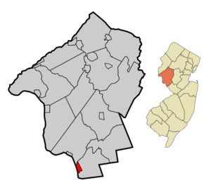
mapsize = 250x200px
map_caption = Map of Lambertville in Hunterdon County. Inset: Location of Hunterdon County highlighted in the State of New Jersey.
mapsize1 = 250x200px
map_caption1 = Census Bureau map of Lambertville, New Jerseysubdivision_type = Country
subdivision_name =United States
subdivision_type1 = State
subdivision_name1 =New Jersey
subdivision_type2 = County
subdivision_name2 = Hunterdon
government_footnotes =
government_type =Faulkner Act (Small Municipality)
leader_title =Mayor
leader_name = David M. DelVecchio
leader_title1 =
leader_name1 =
established_title = Incorporated
established_date =March 1 ,1849 unit_pref = Imperial
area_footnotes =
area_magnitude =
area_total_km2 = 3.2
area_land_km2 = 2.9
area_water_km2 = 0.3
area_total_sq_mi = 1.3
area_land_sq_mi = 1.1
area_water_sq_mi = 0.1population_as_of = 2006
population_footnotes =
population_total = 3808
population_density_km2 = 1316.1
population_density_sq_mi = 3408.6timezone = Eastern (EST)
utc_offset = -5
timezone_DST = EDT
utc_offset_DST = -4
elevation_footnotes = [Gnis|885271|City of Lambertville,Geographic Names Information System , accessedJanuary 4 ,2008 .]
elevation_m = 24
elevation_ft = 79
latd = 40 |latm = 22 |lats = 05 |latNS = N
longd = 74 |longm = 56 |longs = 35 |longEW = Wpostal_code_type =
ZIP code
postal_code = 08530
area_code = 609
blank_name = FIPS code
blank_info = 34-38610GR|2 [ [http://mcdc2.missouri.edu/webrepts/commoncodes/ccc_nj.html A Cure for the Common Codes: New Jersey] , Missouri Census Data Center. AccessedJuly 14 ,2008 .]
blank1_name = GNIS feature ID
blank1_info = 0885271GR|3
website = http://www.lambertvillenj.org
footnotes =Lambertville is a City in Hunterdon County,
New Jersey ,United States . As of theUnited States 2000 Census , the city population was 3,868.Lambertville was originally incorporated as a town by an Act of the
New Jersey Legislature onMarch 1 ,1849 , from portions of West Amwell Township. The area was reincorporated as a city onMarch 26 ,1872 ."The Story of New Jersey's Civil Boundaries: 1606-1968", John P. Snyder, Bureau of Geology and Topography; Trenton, New Jersey; 1969. p. 156.]Lambertville is located on the
Delaware River in the southwestern portion of Hunterdon County. During the 1700s, the City was named after various operators of ferries across the river toPennsylvania , ultimately becoming known as Coryell's Ferry, after Emanuel Coryell who owned the Ferry. Coryell's Ferry was the western terminus of the New Jersey portion of the York Road (which is now known asU.S. Highway 202 ) connectingNew York City and Philadelphia. The City was named Lambertville in 1814 when the post office was established, in honor of John Lambert, a local resident, who had served asUnited States Senator and Acting Governor of New Jersey. [ [http://www.co.hunterdon.nj.us/mun/lville.htm The City of Lambertville] ,Hunterdon County, New Jersey . AccessedAugust 21 ,2007 . "The City was named Lambertville in 1814 when the post office was established and honored the Honorable John Lambert, a local resident and United States Senator."]History
The
Delaware River and theDelaware and Raritan Canal were instrumental in the prosperity of Lambertville. In June 1834, the opening of the canal was celebrated with a barge ride from Trenton to Lambertville. The canal's completion was not without hardship. 4,000 Irish immigrants were hired to dig the canal with pick and shovel. During the construction an epidemic ofcholera broke out and dozens of men were buried along the banks of the canal and the Delaware River.Since the 1800s, Lambertville, due to its proximity to the canal and the (now defunct) railroad, became a factory town where the range of products produced went from underwear to rubber bands. After the introduction of the automobile (and of course trucks) made the canals and, ultimately, the railroad obsolete, the factories shut down, one by one.
The town lagged for a long time, most definitely the poorer sibling to its sister city, New Hope,
Pennsylvania , which lies across the Delaware River. In the 1970s, young people who had grown up in Lambertville but left to make their fortunes returned with a mission -- to re-energize their home town. Ultimately, pioneers like the Jonsdottir art gallery, Hamilton Grill (still the city's most renowned restaurant) and the Lambertville Station eatery (a hotel soon followed), the city began to attract artists and other creative types. These days, much of its 18th and 19th century flavor remains -- particularly in its houses, many of which have been restored. The town has become a tourist destination, with many shops, galleries, restaurants, and B&Bs. The canal path offers cyclists a place to ride for people of all skill levels.Geography
Lambertville is located at coor dms|40|22|4|N|74|56|34|W|city (40.367881, -74.942860).GR|1 The city borders Delaware Township and West Amwell Township.
According to the
United States Census Bureau , the city has a total area of 1.2 square miles (3.2 km²), of which, 1.1 square miles (2.9 km²) of it is land and 0.1 square miles (0.3 km²) of it (9.60%) is water..
are also located in the city, which include trails and bridges.
Demographics
USCensusPop
1930= 4518
1940= 4447
1950= 4477
1960= 4269
1970= 4359
1980= 4044
1990= 3927
2000= 3868
estimate= 3808
estyear=2006
estref= [http://factfinder.census.gov/servlet/SAFFPopulation?_event=Search&geo_id=06000US3401937065&_geoContext=01000US%7C04000US34%7C05000US34019%7C06000US3401937065&_street=&_county=lambertville&_cityTown=lambertville&_state=04000US34&_zip=&_lang=en&_sse=on&ActiveGeoDiv=geoSelect&_useEV=&pctxt=fph&pgsl=060&_submenuId=population_0&ds_name=null&_ci_nbr=null&qr_name=null®=null%3Anull&_keyword=&_industry= Census data for Lambertville city] ,United States Census Bureau . AccessedAugust 9 ,2007 .]
footnote=Population 1930 - 1990. [ [http://www.wnjpin.net/OneStopCareerCenter/LaborMarketInformation/lmi01/poptrd6.htm New Jersey Resident Population by Municipality: 1930 - 1990] , Workforce New Jersey Public Information Network. AccessedMarch 1 ,2007 .] As of thecensus GR|2 of 2000, there were 3,868 people, 1,860 households, and 939 families residing in the city. Thepopulation density was 3,408.6 people per square mile (1,321.6/km²). There were 1,961 housing units at an average density of 1,728.1/sq mi (670.0/km²). The racial makeup of the city was 94.65% White, 1.94% African American, 0.34% Native American, 1.06% Asian, 0.05% Pacific Islander, 0.90% from other races, and 1.06% from two or more races. Hispanic or Latino of any race were 3.10% of the population.There were 1,860 households out of which 18.3% had children under the age of 18 living with them, 40.3% were married couples living together, 7.8% had a female householder with no husband present, and 49.5% were non-families. 38.8% of all households were made up of individuals and 10.8% had someone living alone who was 65 years of age or older. 3.7% have unmarried partners. The average household size was 2.06 and the average family size was 2.82.
In the city the population was spread out with 15.4% under the age of 18, 6.1% from 18 to 24, 32.4% from 25 to 44, 30.9% from 45 to 64, and 15.2% who were 65 years of age or older. The median age was 43 years. For every 100 females there were 94.8 males. For every 100 females age 18 and over, there were 93.2 males.
The median income for a household in the city was $52,647, and the median income for a family was $80,669. Males had a median income of $47,313 versus $40,369 for females. The
per capita income for the city was $36,267. About 4.5% of families and 5.9% of the population were below thepoverty line , including 2.5% of those under age 18 and 12.3% of those age 65 or over.Government
Local government
Lambertville is governed by the
Faulkner Act (Small Municipality) form of government. The Faulkner Act allows municipalities to adopt a Small Municipality form of government only for municipalities with a population of under 12,000. The government consists of a Mayor and a four-member City Council, with all positions elected at large in partisan elections. A Mayor is elected directly by the voters to a four-year term of office. Council members serve a term of three years, which are staggered so that one or two seats come up for election each year."2005 New Jersey Legislative District Data Book",Rutgers University Edward J. Bloustein School of Planning and Public Policy , April 2005, p. 103.]The Mayor exercises executive power of the municipality. The Mayor presides over Council with voice and vote, but has no veto powers; Exercises executive power of the municipality; Appoints Council committees; Appoints municipal clerk, attorney, tax assessor, tax collector and the treasurer, all with Council confirmation. The Council exercises legislative power of the municipality and also approves Mayor's appointees for municipal clerk, attorney, tax assessor, tax collector and treasurer.
The Mayor of Lambertville is David M. DelVecchio. Members of the City Council are Council President Steven M. Stegman, Cynthia Ege, Ron Pittore and Wardell Sanders, Jr. [ [http://www.lambertvillenj.org/content/102/164/default.aspx Mayor and City Council Members] , Borough of Lambertville. Accessed
July 31 ,2008 .]Federal, state and county representation
Lambertville is the only city in Hunterdon County. It is in the Twelfth Congressional District and is part of New Jersey's 23rd Legislative District. [ [http://www.lwvnj.org/pubs/CG06.pdf 2006 New Jersey Citizen's Guide to Government] , New Jersey
League of Women Voters , p. 59. AccessedAugust 30 ,2006 .]Education
The
Lambertville School District serves students in public school for prekindergarten through grade six. Lambertville Public School had an enrollment of 177 students as of the 2005-06 school year. [ [http://nces.ed.gov/ccd/schoolsearch/school_list.asp?Search=1&DistrictID=3408250 Data for the Lambertville Public School] ,National Center for Education Statistics . AccessedJuly 31 ,2008 .]Public school students in grade 7 - 12 attend the
South Hunterdon Regional High School in Lambertville, part of the South Hunterdon Regional High School District, which served 335 students in southern Hunterdon County in the 2005-06 school year. [ [http://nces.ed.gov/ccd/schoolsearch/school_list.asp?Search=1&DistrictID=3415300 Data for the South Hunterdon Regional High School District] ,National Center for Education Statistics . AccessedJune 17 ,2008 .] Students from Lambertville, Stockton and West Amwell Township attend South Hunterdon Regional High School. [ [http://education.state.nj.us/rc/rc06/narrative/19/4890/19-4890-000.html South Hunterdon Regional High School 2006 Report Card Narrative] ,New Jersey Department of Education . AccessedJune 17 ,2008 . "Nestled in the lush, green fields of beautiful, historic southern Hunterdon County, South Hunterdon Regional High School is comprised of students in grades 7 – 12 from the municipalities of Lambertville, Stockton and West Amwell."]Community
Annually, in April or May, the city celebrates the return of the
Shad , a fish popular in the area. The festival includes vendors' booths and others of the like focusing on the Area arts community. [ [http://www.lambertville.org/main.php?cntr%40funqsrfg Shad Fest 2008] , Lambertville Borough. AccessedMarch 4 ,2008 .]Notable residents
Notable current and former residents of Lambertville include:
*Gerald Stern (born 1925),poet andPoet Laureate ofNew Jersey from 2000 to 2002 [ [http://www.poets.org/poet.php/prmPID/231 Academy of American Poets] , accessedMay 16 ,2008 ] [ [http://www.loc.gov/rr/main/poets/newjersey.html Library of Congress] accessedMay 16 ,2008 ]
*James Gould Cozzens (1903-1978), novelist andPulitzer Prize winner. [ [http://205.188.238.109/time/magazine/article/0,9171,809854,00.html "The Hermit of Lambertville"] , "Time (magazine) ",September 2 ,1957 , accessedApril 29 ,2007 . "Army Air Corps during World War II, Cozzens has not stirred much beyond the neighborhood of his fieldstone house and convert|124|acre|km2|sing=on farm near Lambertville, N.J. (pop. 5,000)."]
*Elsie Driggs (1898-1992), painter mostly known for her contributions to thePrecisionism movement of the 1920s. [ [http://www.michenermuseum.org/bucksartists/artist.php?artist=67 Elsie Driggs] ,James A. Michener Art Museum . AccessedAugust 9 ,2007 .]
*William Crane Gray , elected first Bishop of the Episcopal Missionary Jurisdiction of Southern Florida in 1892. [Cushman, Joseph D., Jr., "A Goodly Heritage: The Episcopal Church in Florida, 1821-1892", Gainesville: University of Florida Press (1965) pp. 199-200.]
*William Holcombe , first Lieutenant Governor of Minnesota. [ [http://www.mnhs.org/people/governors/lt_gov/ltgov_01.htm William Holcombe profile] ,Minnesota Historical Society , accessedApril 29 ,2007 .]
*John E. Hunt (1908-1989), representedNew Jersey's 1st congressional district in theUnited States House of Representatives from 1967 to 1975. [ [http://bioguide.congress.gov/scripts/biodisplay.pl?index=H000972 John Edmund Hunt] , "Biographical Directory of the United States Congress ". AccessedAugust 26 ,2007 .]
*Samuel Lilly (1816-1880), represented ushr|New Jersey|3 from 1853 to 1855. Lilly served as the first mayor of Lambertville, serving in office from 1849-1852. [ [http://bioguide.congress.gov/scripts/biodisplay.pl?index=L000310 Samuel Lilly] , "Biographical Directory of the United States Congress ". AccessedSeptember 1 ,2007 .]
*James W. Marshall (1810-1885), discoverer ofgold atSutter's Mill inCalifornia in 1848. [ [http://www.lambertvillehistoricalsociety.org/marshall.php3 James Wilson Marshall House] , Lambertville Historical Society. AccessedMay 30 ,2007 . "The Marshall House, on the National and New Jersey Registers of Historic Places, was the boyhood home of James Wilson Marshall, discoverer of gold in California in 1848, and is now the headquarters of the Lambertville Historical Society."]
*John Runk (1791-1872), represented ushr|New Jersey|3 in theUnited States House of Representatives from 1845-1847. [ [http://bioguide.congress.gov/scripts/biodisplay.pl?index=R000509 John Runk] , "Biographical Directory of the United States Congress ". AccessedSeptember 2 ,2007 .]References
External links
* [http://www.lambertvillenj.org Official web page for the City of Lambertville]
* [http://www.co.hunterdon.nj.us/mun/lville.htm Hunterdon County web page for Lambertville]
* [http://www.lpschool.org/ Lambertville Public School]
*NJReportCard|19|2530|0|Lambertville Public School
* [http://nces.ed.gov/ccd/schoolsearch/school_list.asp?Search=1&DistrictID=3408250 Data for the Lambertville Public School] ,National Center for Education Statistics
* [http://www.lambertville.org/ Lambertville Chamber of Commerce]
* [http://www.lambertvillehistoricalsociety.org Lambertville Historical Society]
* [http://www.drjtbc.com/default.aspx?pageid=73 New Hope-Lambertville Route 202 Toll Bridge article at the Delaware River Joint Toll Bridge Commission website]
* [http://www.drjtbc.com/default.aspx?pageid=74 New Hope-Lambertville Toll Supported Bridge article at the Delaware River Joint Toll Bridge Commission website]
* [http://www.artchatter.com Art Chatter - Local artists and galleries in the New Hope-Lambertville areas]
* [http://www.hlta.org Hunterdon Land Trust Alliance]
Wikimedia Foundation. 2010.