- West Amwell Township, New Jersey
Infobox Settlement
official_name = West Amwell Township, New Jersey
settlement_type = Township
nickname =
motto =
imagesize =
image_caption =
image_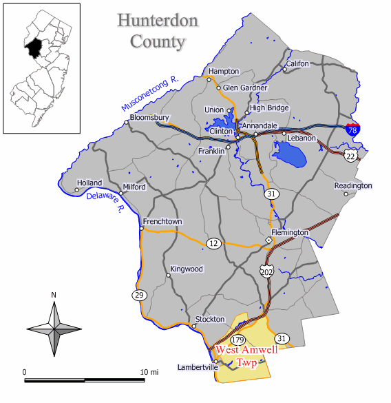
mapsize = 250x200px
map_caption = Map of West Amwell Township in Hunterdon County. Inset: Location of Hunterdon County highlighted in the State of New Jersey.
mapsize1 = 250x200px
map_caption1 = Census Bureau map of West Amwell Township, New Jerseysubdivision_type = Country
subdivision_name =United States
subdivision_type1 = State
subdivision_name1 =New Jersey
subdivision_type2 = County
subdivision_name2 = Hunterdon
government_footnotes =
government_type =Township (New Jersey)
leader_title =Mayor
leader_name = Bill Corboy
leader_title1 =
leader_name1 =
established_title = Incorporated
established_date =April 6 ,1846 unit_pref = Imperial
area_footnotes =
area_magnitude =
area_total_km2 = 56.7
area_land_km2 = 56.3
area_water_km2 = 0.5
area_total_sq_mi = 21.9
area_land_sq_mi = 21.7
area_water_sq_mi = 0.2population_as_of = 2006
population_footnotes =
population_total = 2944
population_density_km2 = 42.4
population_density_sq_mi = 109.7timezone = Eastern (EST)
utc_offset = -5
timezone_DST = EDT
utc_offset_DST = -4
elevation_footnotes = [Gnis|882181|Township of West Amwell,Geographic Names Information System . AccessedJune 13 ,2008 .]
elevation_m = 111
elevation_ft = 364
latd = 40 |latm = 22 |lats = 45 |latNS = N
longd = 74 |longm = 54 |longs = 55 |longEW = Wpostal_code_type =
ZIP code
postal_code = 08530
area_code = 609
blank_name = FIPS code
blank_info = 34-78230GR|2 [ [http://mcdc2.missouri.edu/webrepts/commoncodes/ccc_nj.html A Cure for the Common Codes: New Jersey] , Missouri Census Data Center. AccessedJuly 14 ,2008 .]
blank1_name = GNIS feature ID
blank1_info = 0882181GR|3
website = http://www.westamwelltwp.org
footnotes =West Amwell Township is a Township in Hunterdon County,
New Jersey ,United States . As of theUnited States 2000 Census , the township population was 2,383.West Amwell Township was incorporated as a township by an Act of the
New Jersey Legislature onApril 6 ,1846 , when Amwell Township was split, also creating East Amwell Township at the same time. Portions of the township were taken to form Lambertville town onMarch 1 ,1849 ."The Story of New Jersey's Civil Boundaries: 1606-1968", John P. Snyder, Bureau of Geology and Topography; Trenton, New Jersey; 1969. p. 158.]The Delaware Native Americans had a path through the woods from Lambertville through Mount Airy, Ringoes and Reaville to Newark upon which the Old York Road was subsequently laid. [ [http://www.co.hunterdon.nj.us/mun/wamwell.htm Webpage for West Amwell Township] , Hunterdon County,
New Jersey . AccessedMarch 18 ,2007 .]Geography
According to the
United States Census Bureau , the township has a total area of 21.9square mile s (56.7km² ), of which, 21.7 square miles (56.3 km²) of it is land and 0.2 square miles (0.5 km²) of it (0.82%) is water.West Amwell Township borders the City of Lambertville, Delaware Township, and East Amwell Township. West Amwell Township also borders Hopewell Township in Mercer County.
The
Delaware River separates West Amwell Township from the Commonwealth of Pennsylvania.Demographics
USCensusPop
1930= 788
1940= 975
1950= 1213
1960= 1683
1970= 2142
1980= 2299
1990= 2251
2000= 2383
estimate= 2944
estyear=2006
estref= [http://factfinder.census.gov/servlet/SAFFPopulation?_event=Search&geo_id=06000US3401974420&_geoContext=01000US%7C04000US34%7C05000US34019%7C06000US3401974420&_street=&_county=west+amwell&_cityTown=west+amwell&_state=04000US34&_zip=&_lang=en&_sse=on&ActiveGeoDiv=geoSelect&_useEV=&pctxt=fph&pgsl=060&_submenuId=population_0&ds_name=null&_ci_nbr=null&qr_name=null®=null%3Anull&_keyword=&_industry= Census data for West Amwell township] ,United States Census Bureau . AccessedSeptember 19 ,2007 .]
footnote=Population 1930 - 1990. [ [http://www.wnjpin.net/OneStopCareerCenter/LaborMarketInformation/lmi01/poptrd6.htm New Jersey Resident Population by Municipality: 1930 - 1990] , Workforce New Jersey Public Information Network. AccessedMarch 1 ,2007 .] As of thecensus GR|2 of 2000, there were 2,383 people, 949 households, and 696 families residing in the township. Thepopulation density was 109.7 people per square mile (42.4/km²). There were 984 housing units at an average density of 45.3/sq mi (17.5/km²). The racial makeup of the township was 98.07% White, 0.63% African American, 0.08% Native American, 0.71% Asian, 0.04% from other races, and 0.46% from two or more races. Hispanic or Latino of any race were 0.71% of the population.There were 949 households out of which 29.1% had children under the age of 18 living with them, 65.3% were married couples living together, 5.1% had a female householder with no husband present, and 26.6% were non-families. 21.3% of all households were made up of individuals and 8.7% had someone living alone who was 65 years of age or older. The average household size was 2.51 and the average family size was 2.93.
In the township the population was spread out with 21.1% under the age of 18, 4.5% from 18 to 24, 28.3% from 25 to 44, 32.1% from 45 to 64, and 13.8% who were 65 years of age or older. The median age was 43 years. For every 100 females there were 100.3 males. For every 100 females age 18 and over, there were 101.2 males.
The median income for a household in the township was $73,380, and the median income for a family was $79,605. Males had a median income of $49,539 versus $33,333 for females. The
per capita income for the township was $33,877. About 0.6% of families and 1.6% of the population were below thepoverty line , including none of those under age 18 and 1.2% of those age 65 or over.Government
Local government
West Amwell Township is governed under the Township form of government with a three-member Township Committee. The Township Committee is elected directly by the voters in partisan elections to serve three-year terms of office on a staggered basis, with one seat coming up for election each year."2005 New Jersey Legislative District Data Book",
Rutgers University Edward J. Bloustein School of Planning and Public Policy , April 2005, p. 103.] At an annual reorganization meeting, the Township Committee selects one of its members to serve as Mayor and another as Deputy Mayor.As of 2008 , members of the West Amwell Township Committee areMayor Bill Corboy,Deputy Mayor Ron Shapella and Frank Materson. [http://www.westamwelltwp.org/WAT%20Directory%20webpage.htm Township Committee] , West Amwell Township. AccessedJune 26 ,2008 .]Federal, state and county representation
West Amwell Township is in the Twelfth Congressional District and is part of New Jersey's 23rd Legislative District. [ [http://www.lwvnj.org/pubs/CG06.pdf 2006 New Jersey Citizen's Guide to Government] , New Jersey
League of Women Voters , p. 66. AccessedAugust 30 ,2006 .]Education
The
West Amwell Township School District serves public school students in preschool through sixth grade. The West Amwell Township Elementary School had an enrollment of 250 students in the 2005-06 school year. [ [http://nces.ed.gov/ccd/schoolsearch/school_list.asp?Search=1&DistrictID=3417370 Data for the West Amwell Township School] ,National Center for Education Statistics . AccessedJune 17 ,2008 .]Public school students in grade 7 - 12 attend the
South Hunterdon Regional High School in Lambertville, part of the South Hunterdon Regional High School District, which served 335 students in southern Hunterdon County in the 2005-06 school year. [ [http://nces.ed.gov/ccd/schoolsearch/school_list.asp?Search=1&DistrictID=3415300 Data for the South Hunterdon Regional High School District] ,National Center for Education Statistics . AccessedJune 17 ,2008 .] Students from Lambertville, Stockton and West Amwell Township attend South Hunterdon Regional High School. [ [http://education.state.nj.us/rc/rc06/narrative/19/4890/19-4890-000.html South Hunterdon Regional High School 2006 Report Card Narrative] ,New Jersey Department of Education . AccessedJune 17 ,2008 . "Nestled in the lush, green fields of beautiful, historic southern Hunterdon County, South Hunterdon Regional High School is comprised of students in grades 7 – 12 from the municipalities of Lambertville, Stockton and West Amwell."]References
External links
* [http://www.westamwelltwp.org/ West Amwell Township website]
* [http://www.westamwellschool.org West Amwell Township School]
*NJReportCard|19|5600|0|West Amwell Township School
* [http://nces.ed.gov/ccd/schoolsearch/school_list.asp?Search=1&DistrictID=3417370 Data for the West Amwell Township School] ,National Center for Education Statistics
* [http://www.shrhs.org/ South Hunterdon Regional High School]
* [http://www.hlta.org Hunterdon Land Trust Alliance]
Wikimedia Foundation. 2010.