- Laurel Lake, New Jersey
Infobox Settlement
official_name = Laurel Lake, New Jersey
settlement_type = CDP
nickname =
motto =
imagesize =
image_caption =
image_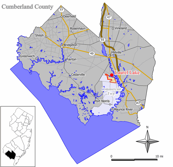
mapsize = 250x200px
map_caption = Map of Laurel Lake CDP in Cumberland County
mapsize1 =
map_caption1 =subdivision_type = Country
subdivision_name =United States
subdivision_type1 = State
subdivision_name1 =New Jersey
subdivision_type2 = County
subdivision_name2 = Cumberland
government_footnotes =
government_type =
leader_title =
leader_name =
leader_title1 =
leader_name1 =
established_title =
established_date =area_footnotes =
area_magnitude =
area_total_km2 = 4.8
area_land_km2 = 4.6
area_water_km2 = 0.3
area_total_sq_mi = 1.9
area_land_sq_mi = 1.8
area_water_sq_mi = 0.1population_as_of = 2000
population_footnotes =
population_total = 2929
population_density_km2 = 642.2
population_density_sq_mi = 1663.3timezone = Eastern (EST)
utc_offset = -5
timezone_DST = EDT
utc_offset_DST = -4
elevation_footnotes =
elevation_m = 7
elevation_ft = 23
latd = 39 |latm = 19 |lats = 41 |latNS = N
longd = 75 |longm = 1 |longs = 53 |longEW = Wpostal_code_type =
ZIP code
postal_code = 08332
area_code = 856
blank_name = FIPS code
blank_info = 34-39120GR|2
blank1_name = GNIS feature ID
blank1_info = 0877684GR|3
website =
footnotes =Laurel Lake is a
census-designated place and unincorporated area located within Commercial Township, in Cumberland County,New Jersey . It is part of the Vineland-Millville- BridgetonPrimary Metropolitan Statistical Area for statistical purposes. As of theUnited States 2000 Census , the CDP population was 2,929.Geography
Laurel Lake is located at coor dms|39|19|41|N|75|1|53|W|city (39.328014, -75.031345)GR|1.
According to the
United States Census Bureau , the CDP has a total area of 4.8km² (1.9 mi²). 4.6 km² (1.8 mi²) of it is land and 0.3 km² (0.1 mi²) of it (5.88%) is water.Demographics
As of the
census GR|2 of 2000, there were 2,929 people, 1,078 households, and 767 families residing in the CDP. Thepopulation density was 642.6/km² (1,663.3/mi²). There were 1,240 housing units at an average density of 272.0/km² (704.1/mi²). The racial makeup of the CDP was 95.05% White, 1.74% African American, 0.41% Native American, 0.14% Asian, 0.03% Pacific Islander, 0.82% from other races, and 1.81% from two or more races. Hispanic or Latino of any race were 4.30% of the population.There were 1,078 households out of which 37.8% had children under the age of 18 living with them, 46.3% were married couples living together, 16.1% had a female householder with no husband present, and 28.8% were non-families. 22.8% of all households were made up of individuals and 8.3% had someone living alone who was 65 years of age or older. The average household size was 2.72 and the average family size was 3.13.
In the CDP the population was spread out with 28.8% under the age of 18, 10.1% from 18 to 24, 30.5% from 25 to 44, 19.7% from 45 to 64, and 10.8% who were 65 years of age or older. The median age was 32 years. For every 100 females there were 98.7 males. For every 100 females age 18 and over, there were 96.6 males.
The median income for a household in the CDP was $32,041, and the median income for a family was $32,432. Males had a median income of $33,299 versus $21,048 for females. The
per capita income for the CDP was $12,965. About 15.7% of families and 17.8% of the population were below thepoverty line , including 22.8% of those under age 18 and 19.6% of those age 65 or over.References
External links
Wikimedia Foundation. 2010.