- Milton, Delaware
-
Milton, Delaware — Town — Location of Milton, Delaware
Coordinates: 38°46′48″N 75°18′46″W / 38.78°N 75.31278°WCoordinates: 38°46′48″N 75°18′46″W / 38.78°N 75.31278°W Country United States State Delaware County Sussex Area – Total 1.2 sq mi (3.0 km2) – Land 1.1 sq mi (2.7 km2) – Water 0.1 sq mi (0.3 km2) Elevation 13 ft (4 m) Population (2010) – Total 2,576 – Density 2,341.8/sq mi (954.1/km2) Time zone Eastern (EST) (UTC-5) – Summer (DST) EDT (UTC-4) ZIP code 19968 Area code(s) 302 FIPS code 10-48330 GNIS feature ID 0214325 Website www.ci.milton.de.us Milton is a town in Sussex County, Delaware, in the United States. The population was 2,576 at the 2010 census, an increase of 55.5% over the previous decade[1]. It is part of the Seaford, Delaware Micropolitan Statistical Area. Delaware Route 5 passes through Milton.
Contents
History
Located at the head of the Broadkill River, Milton was first settled in 1672 by English Colonists. The town was known by various names until 1807, when it was named for the English poet, John Milton. The Delaware General Assembly passed the charter that recognized The Town of Milton as a municipality in 1945.[2]
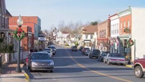
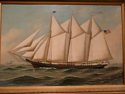
History and Milton's shipbuilding heritage remain very important to the town, which is home to some of the finest Victorian and Colonial architecture in Delaware. Many of the homes have been restored to their original form, particularly those on Union and Federal streets.
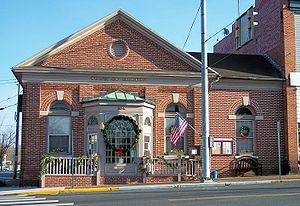
Milton has 198 structures on the Federal Register Historic District and its history is preserved in the Lydia Black Cannon Museum, the Governor James Carey home, the Chestnut Street Cemetery, and the Governor David Hazzard Mansion.
Today, Milton serves local residents and summer tourists in the Milton, Broadkill Beach and Primehook Beach areas with family operated businesses and new office and shopping complexes.
Milton boasts numerous community organizations, a civic center, a memorial park, a volunteer fire department, a public library, more than a half-dozen major annual events, and churches.
Recreational opportunities abound with the Broadkill River, Wagamon's Pond, Diamond Pond and Lavinia Pond. Public boat docks and fishing piers are also available.
Geography
Milton is located at 38°46′48″N 75°18′46″W / 38.78°N 75.31278°W (38.779873, -75.312827),[3] along the Broadkill River.[4]
According to the United States Census Bureau, the town has a total area of 1.2 square miles (3.1 km2), of which, 1.1 square miles (2.8 km2) of it is land and 0.1 square miles (0.26 km2) of it (8.62%) is water.
Demographics
Historical populations Census Pop. %± 1940 1,198 — 1950 1,321 10.3% 1960 1,617 22.4% 1970 1,490 −7.9% 1980 1,359 −8.8% 1990 1,417 4.3% 2000 1,657 16.9% 2010 2,576 55.5% As of the census[5] of 2000, there were 1,657 people, 700 households, and 438 families residing in the town. The population density was 1,568.5 people per square mile (603.6/km²). There were 804 housing units at an average density of 761.1 per square mile (292.9/km²). The racial makeup of the town was 67.11% White, 24.32% African American, 0.24% Native American, 0.48% Asian, 0.12% Pacific Islander, 6.04% from other races, and 1.69% from two or more races. Hispanic or Latino of any race were 8.93% of the population.
There were 700 households out of which 31.4% had children under the age of 18 living with them, 37.3% were married couples living together, 20.1% had a female householder with no husband present, and 37.4% were non-families. 31.3% of all households were made up of individuals and 17.4% had someone living alone who was 65 years of age or older. The average household size was 2.33 and the average family size was 2.90.
In the town the population was spread out with 24.6% under the age of 18, 10.2% from 18 to 24, 26.4% from 25 to 44, 22.0% from 45 to 64, and 16.8% who were 65 years of age or older. The median age was 37 years. For every 100 females there were 78.7 males. For every 100 females age 18 and over, there were 71.8 males.
The median income for a household in the town was $32,368, and the median income for a family was $40,313. Males had a median income of $26,065 versus $23,269 for females. The per capita income for the town was $17,016. About 12.8% of families and 18.0% of the population were below the poverty line, including 28.6% of those under age 18 and 14.0% of those age 65 or over.
References
- ^ http://www.stateplanning.delaware.gov/census_data_center/
- ^ Delaware.gov
- ^ "US Gazetteer files: 2010, 2000, and 1990". United States Census Bureau. 2011-02-12. http://www.census.gov/geo/www/gazetteer/gazette.html. Retrieved 2011-04-23.
- ^ DeLorme (2004). Maryland Delaware Atlas & Gazetteer. p. 45. Yarmouth, Maine: DeLorme. ISBN 0-89933-279-X.
- ^ "American FactFinder". United States Census Bureau. http://factfinder.census.gov. Retrieved 2008-01-31.
External links
Municipalities and communities of Sussex County, Delaware Cities Lewes | Milford‡ | Rehoboth Beach | Seaford
Towns Bethany Beach | Bethel | Blades | Bridgeville | Dagsboro | Delmar | Dewey Beach | Ellendale | Fenwick Island | Frankford | Georgetown | Greenwood | Henlopen Acres | Laurel | Millsboro | Millville | Milton | Ocean View | Selbyville | Slaughter Beach | South Bethany
CDP Unincorporated
communitiesAngola | Argo's Corner | Atlanta | Bacons | Bayard | Belltown | Blackwater Beach | Broad Creek | Broadkill Beach | Bryans Store | Cannon | Cave Colony | Cedar Creek | Clarksville | Cocked Hat | Concord | Cool Spring | Coverdale Crossroads | Cross Keys | Fairmount | Federalsburg | Five Points | Flea Hill | Fowler Beach | Green Hill | Gum Crossroads | Gumboro | Harbeson | Hardscrabble | Hearns Crossroads | Holiday Acres | Hollymount | Hollyville | Israel Haul | Jimtown | Johnson | Knowles Crossroads | Lake Pines | Lincoln | Lowe | Marshtown | McDonalds Crossroads | Middleford | Middlesex Beach | Midnight Thicket | Midway | Mission | Morris Mill | Mount Joy | Nassau | Oakley | Oak Orchard | Old Furnace | Omar | Owens | Pepperbox | Phillips Hill | Pinetown | Piney Grove | Piney Grove Manor | Pusey Crossroads | Redden | Reliance | Riverview | Roxana | Saulsbury Switch | Shortly | Springfield Crossroads | Stockley | Trinity | Tussock Pond | Ward | Warwick | Westwoods | Whaleys Corners | Whaleys Crossroads | Whitesville | Williamsville | Wood Branch | Woodland Heights | Zoar
Hundreds Baltimore | Broad Creek | Broadkill | Cedar Creek | Dagsboro | Georgetown | Gumboro | Indian River | Lewes & Rehoboth | Little Creek | Nanticoke | Northwest Fork | Seaford
Ghost towns Footnotes ‡This populated place also has portions in an adjacent county or counties
Categories:- Towns in Sussex County, Delaware
Wikimedia Foundation. 2010.


