- Omar, Delaware
-
Omar — Unincorporated community — Intersection in Omar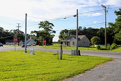 Location within the state of Delaware
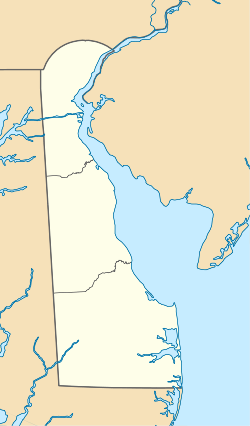
 Omar
OmarCoordinates: 38°31′38″N 75°11′59″W / 38.52722°N 75.19972°WCoordinates: 38°31′38″N 75°11′59″W / 38.52722°N 75.19972°W Country United States State Delaware County Sussex Time zone Eastern (EST) (UTC-5) – Summer (DST) EDT (UTC-4) ZIP codes FIPS code GNIS feature ID 216170[1] Omar is an unincorporated community in Sussex County, Delaware, United States, located at the crossroads of Delaware Route 20 and Sussex County Road 54 and between the towns of Dagsboro and Roxana.[1]
References
Municipalities and communities of Sussex County, Delaware Cities Lewes | Milford‡ | Rehoboth Beach | Seaford

Towns Bethany Beach | Bethel | Blades | Bridgeville | Dagsboro | Delmar | Dewey Beach | Ellendale | Fenwick Island | Frankford | Georgetown | Greenwood | Henlopen Acres | Laurel | Millsboro | Millville | Milton | Ocean View | Selbyville | Slaughter Beach | South Bethany
CDP Unincorporated
communitiesAngola | Argo's Corner | Atlanta | Bacons | Bayard | Belltown | Blackwater Beach | Broad Creek | Broadkill Beach | Bryans Store | Cannon | Cave Colony | Cedar Creek | Clarksville | Cocked Hat | Concord | Cool Spring | Coverdale Crossroads | Cross Keys | Fairmount | Federalsburg | Five Points | Flea Hill | Fowler Beach | Green Hill | Gum Crossroads | Gumboro | Harbeson | Hardscrabble | Hearns Crossroads | Holiday Acres | Hollymount | Hollyville | Israel Haul | Jimtown | Johnson | Knowles Crossroads | Lake Pines | Lincoln | Lowe | Marshtown | McDonalds Crossroads | Middleford | Middlesex Beach | Midnight Thicket | Midway | Mission | Morris Mill | Mount Joy | Nassau | Oakley | Oak Orchard | Old Furnace | Omar | Owens | Pepperbox | Phillips Hill | Pinetown | Piney Grove | Piney Grove Manor | Pusey Crossroads | Redden | Reliance | Riverview | Roxana | Saulsbury Switch | Shortly | Springfield Crossroads | Stockley | Trinity | Tussock Pond | Ward | Warwick | Westwoods | Whaleys Corners | Whaleys Crossroads | Whitesville | Williamsville | Wood Branch | Woodland Heights | Zoar
Hundreds Baltimore | Broad Creek | Broadkill | Cedar Creek | Dagsboro | Georgetown | Gumboro | Indian River | Lewes & Rehoboth | Little Creek | Nanticoke | Northwest Fork | Seaford
Ghost towns Footnotes ‡This populated place also has portions in an adjacent county or counties
Categories:- Unincorporated communities in Sussex County, Delaware
- Delaware geography stubs


Wikimedia Foundation. 2010.