- Bethel, Delaware
Geobox Town
name = Town of Bethel
native_name =
other_name =
other_name1 =
category = Town
image_size =
image_caption =
flag_size =
symbol_type =
symbol =
symbol_size =
nickname =
motto =
country = United States
state = Delaware
region_type = County
region = Sussex
district =
part_type =
part_count =
part =
part1 =
area_imperial = 0.4
area_land_imperial = 0.4
area_water_imperial = 0.0
area_round = 1
location =
lat_d = 38
lat_m = 34
lat_s = 07
lat_NS = N
long_d = 75
long_m = 37
long_s = 13
long_EW = W
elevation_imperial =
elevation_round = 1
population_as_of = 2000
population = 184
population_density_imperial = 413.2
established_type =
established =
mayor =
timezone = EST
utc_offset = -5
timezone_DST = EDT
utc_offset_DST = -4
postal_code =
postal_code_type =
area_code = 302
area_code_type =
code2_type =
code2 =
free_type =
free =
free1_type =
free1 =
map_size = 100
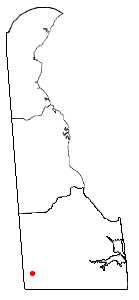
map_caption = Location of Bethel in Delaware
map_locator =
map_locator_x =
map_locator_y =
map1 = Map of USA DE.svg
map1_caption = Location of Delaware in the United States
website =Bethel is a town in Sussex County,
Delaware ,United States . According to 2006 Census Bureau estimates, the population of the town is 195.cite web | date =June 21 2006 | url = http://www.census.gov/popest/cities/tables/SUB-EST2005-04-10.csv | title = Annual Estimates of the Population for All Incorporated Places in Delaware | format = CSV | work = 2005 Population Estimates | publisher = U.S. Census Bureau, Population Division | accessmonthday = November 22 | accessyear = 2006] It is part of theSeaford, Delaware Micropolitan Statistical Area.Geography
Bethel is located at coor dms|38|34|7|N|75|37|13|W|city (38.568676, -75.620188)GR|1.
According to the
United States Census Bureau , the town has a total area of 0.4square mile s (1.2km² ), all of it land.Demographics
As of the
census GR|2 of 2000, there were 184 people, 78 households, and 56 families residing in the town. Thepopulation density was 413.2 people per square mile (157.9/km²). There were 97 housing units at an average density of 217.8/sq mi (83.2/km²). The racial makeup of the town was 96.20% White, 2.72% African American and 1.09% Asian. Hispanic or Latino of any race were 0.54% of the population.There were 78 households out of which 23.1% had children under the age of 18 living with them, 60.3% were married couples living together, 9.0% had a female householder with no husband present, and 28.2% were non-families. 24.4% of all households were made up of individuals and 12.8% had someone living alone who was 65 years of age or older. The average household size was 2.36 and the average family size was 2.82.
In the town the population was spread out with 20.7% under the age of 18, 7.6% from 18 to 24, 23.9% from 25 to 44, 28.8% from 45 to 64, and 19.0% who were 65 years of age or older. The median age was 44 years. For every 100 females there were 89.7 males. For every 100 females age 18 and over, there were 84.8 males.
The median income for a household in the town was $34,107, and the median income for a family was $58,750. Males had a median income of $33,750 versus $21,500 for females. The
per capita income for the town was $25,254. About 3.6% of families and 2.5% of the population were below thepoverty line , including none of those under the age of eighteen and 14.3% of those sixty five or over.References
Wikimedia Foundation. 2010.