- Chesapeake City, Maryland
-
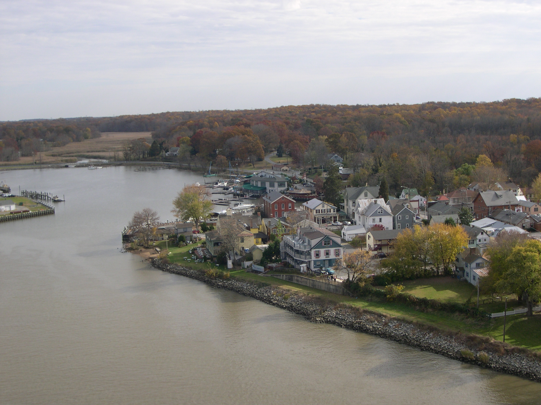
Chesapeake City, Maryland — Town — Chesapeake City along the Chesapeake and Delaware Canal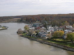

SealLocation of Chesapeake City, Maryland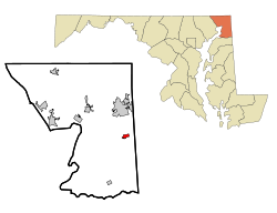
Coordinates: 39°31′40″N 75°48′44″W / 39.52778°N 75.81222°WCoordinates: 39°31′40″N 75°48′44″W / 39.52778°N 75.81222°W Country United States State Maryland County Cecil Area - Total 0.7 sq mi (1.8 km2) - Land 0.6 sq mi (1.5 km2) - Water 0.1 sq mi (0.4 km2) Elevation 26 ft (8 m) Population (2000) - Total 787 - Density 1,393.1/sq mi (537.9/km2) Time zone Eastern (EST) (UTC-5) - Summer (DST) EDT (UTC-4) ZIP code 21915 Area code(s) 410 FIPS code 24-15950 GNIS feature ID 0589952 Website www.chesapeakecity-md.gov Chesapeake City is a town in Cecil County, Maryland, United States. The population was 787 at the 2000 census.
The town was originally named by Bohemian colonist Augustine Herman[1] the Village of Bohemia (or Bohemia Manor), but the name was changed in 1839 when the Chesapeake and Delaware Canal was built. Today, the town contains numerous old homes from that era that have been converted in to bed and breakfasts, restaurants, and the local historical museum.
Contents
History
The town was separated into north and south sections when the Chesapeake and Delaware Canal was built through the middle of the town. The two were connected by a drawbridge until 1942, when that was destroyed by a freighter that struck it. The current bridge opened in 1949.
The new bridge had to be tall enough to allow supertankers to pass beneath it, resulting in a structure so high and long that cars no longer went into the city to cross the canal. Business declined for decades thereafter.[2]
On Thursday, October 8, 2009, a bus heading from both Bohemia Manor Middle School and Bohemia Manor High School crashed head on into a Mini Cooper on the bridge. 4 students on the bus were injured and 2 were taken to Christiana Hospital in Stanton, Delaware, and the other two went to Union Hospital in Elkton. The man in the car suffered an injured knee and wrist. The female driver was unharmed and at fault for the accident.[2]
It is the location of Old Lock Pump House, Chesapeake and Delaware Canal, listed on the National Register of Historic Places in 1966.[3] The South Chesapeake City Historic District was listed in 1974.[3]
Geography
Chesapeake City is located at 39°31′40″N 75°48′44″W / 39.52778°N 75.81222°W (39.527826, -75.812270)[4].
According to the United States Census Bureau, the town has a total area of 0.7 square miles (1.8 km2), of which, 0.6 square miles (1.6 km2) of it is land and 0.1 square miles (0.26 km2) of it (19.72%) is water.
Demographics
As of the census[5] of 2000, there were 787 people, 330 households, and 228 families residing in the town. The population density was 1,393.1 people per square mile (542.6/km²). There were 371 housing units at an average density of 656.7 per square mile (255.8/km²). The racial makeup of the town was 94.92% White, 3.56% African American, 0.25% Native American, 0.38% Asian, 0.51% from other races, and 0.38% from two or more races. Hispanic or Latino of any race were 0.76% of the population.
There were 330 households out of which 27.9% had children under the age of 18 living with them, 51.8% were married couples living together, 12.4% had a female householder with no husband present, and 30.9% were non-families. 24.2% of all households were made up of individuals and 11.8% had someone living alone who was 65 years of age or older. The average household size was 2.38 and the average family size was 2.79.
In the town the population was spread out with 21.7% under the age of 18, 6.1% from 18 to 24, 27.8% from 25 to 44, 27.7% from 45 to 64, and 16.6% who were 65 years of age or older. The median age was 40 years. For every 100 females there were 84.3 males. For every 100 females age 18 and over, there were 88.4 males.
The median income for a household in the town was $46,917, and the median income for a family was $52,813. Males had a median income of $35,250 versus $26,471 for females. The per capita income for the town was $21,621. About 5.2% of families and 6.2% of the population were below the poverty line, including 12.7% of those under age 18 and 2.3% of those age 65 or over.
Government services
Chesapeake City is a part of the Cecil County Public Schools System. There are three schools in the town:
- Chesapeake City Elementary School
- Bohemia Manor Middle School
- Bohemia Manor High School
Chesapeake City is served by the Chesapeake City Branch of the Cecil County Public Library located on Maryland Route 213. The library offers books, music, movies, computers with Internet access, free wifi, and programs for adults, teens, and children.
References
- ^ Nead (1980). The Pennsylvania-German in the Settlement of Maryland. Genealogical Publishing Co., Inc.. ISBN 978-0806306780. http://books.google.com/books?id=wBYRo7zZgQwC&lpg=PA21&dq=Augustine%20Herman&pg=PA20#v=onepage&q=Augustine%20Herman&f=false.
- ^ a b James F. Lee (August 12, 2009). "Chesapeake City, Md., Has a Lock on History". Washington Post. http://www.washingtonpost.com/wp-dyn/content/article/2009/08/11/AR2009081102902.html?wprss=rss_print/style.
- ^ a b "National Register Information System". National Register of Historic Places. National Park Service. 2008-04-15. http://nrhp.focus.nps.gov/natreg/docs/All_Data.html.
- ^ "US Gazetteer files: 2010, 2000, and 1990". United States Census Bureau. 2011-02-12. http://www.census.gov/geo/www/gazetteer/gazette.html. Retrieved 2011-04-23.
- ^ "American FactFinder". United States Census Bureau. http://factfinder.census.gov. Retrieved 2008-01-31.
External links
- Town website
- Chesapeake City Merchants Association
- Bohemia Manor High School
- Bohemia Manor Middle School
- Chesapeake City Elementary School
- Volunteer Fire Company No. 1 of Chesapeake City Inc.
Municipalities and communities of Cecil County, Maryland County seat: Elkton Towns Cecilton | Charlestown | Chesapeake City | Elkton | North East | Perryville | Port Deposit | Rising Sun

Unincorporated
communitiesGhost town Frenchtown
Categories:- Populated places in Cecil County, Maryland
- Towns in Maryland
- Czech American history


Wikimedia Foundation. 2010.