- Interstate 12
Infobox road
state=LA
type=I
route=12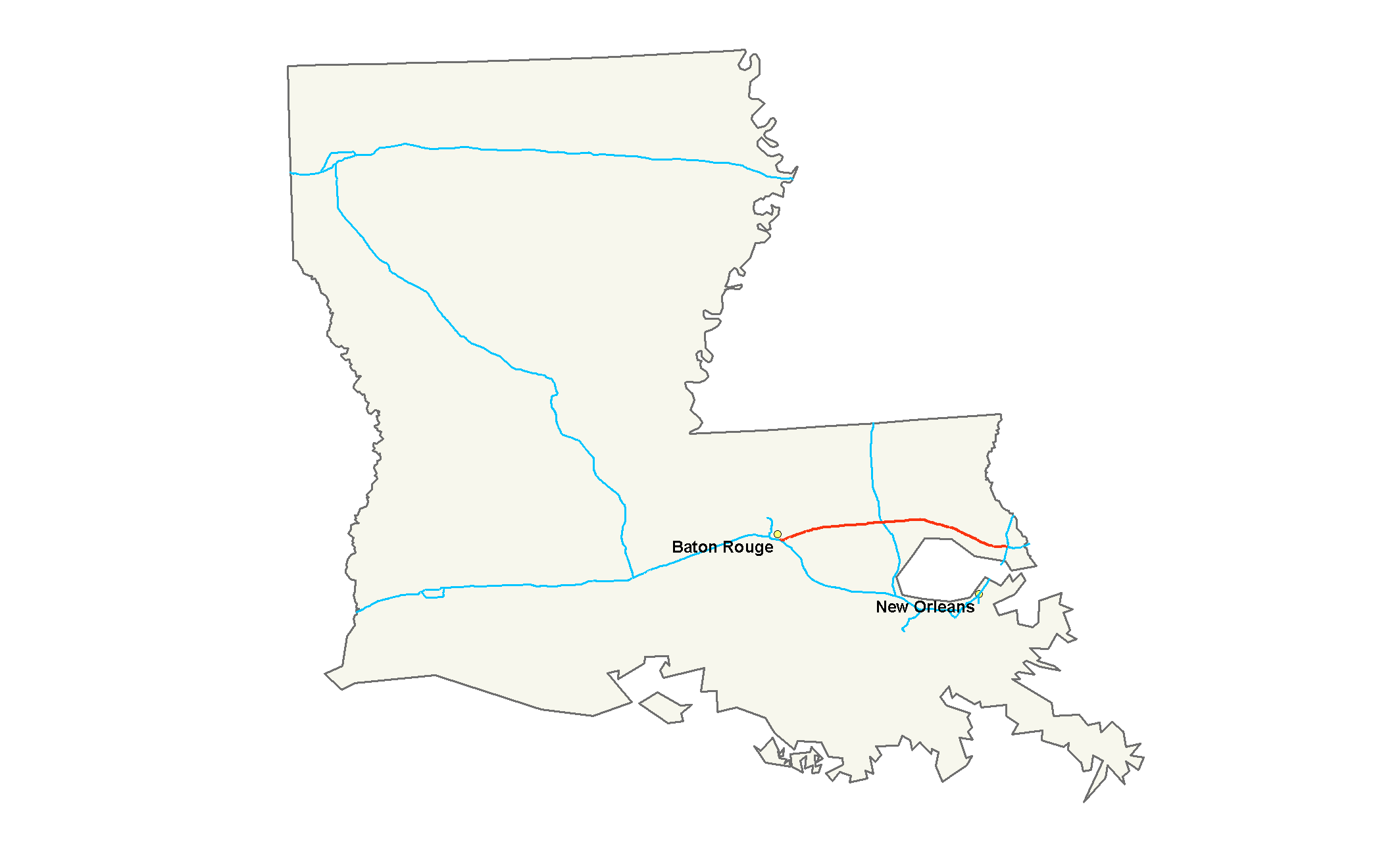
maint=LaDOTD
length_mi=85.59
length_round=2
length_ref=cite web|publisher=Interstate Guide|url=http://www.interstate-guide.com/i-012.html|title=Interstate 12 @ Interstate-Guide.com|accessdate=2008-02-15]
established=
direction_a=West
terminus_a=Jct|state=LA|I|10 in Baton Rouge
junction=Jct|state=LA|US|61 in Baton Rouge
Jct|state=LA|I|55 near Hammond
Jct|state=LA|US|190 near Covington
direction_b=East
terminus_b=Jct|state=LA|I|10|I|59 near Slidell
previous_type=LA
previous_route=11
next_type=LA
next_route=12
commons=categoryInterstate 12 (I-12) is an intrastate
interstate highway located entirely within the state ofLouisiana . I-12 starts in Baton Rouge atInterstate 10 , and travels along the North Shore ofLake Pontchartrain before ending at the intersection ofInterstate 10 andInterstate 59 near Slidellcite web|publisher=Google Maps |url=http://maps.google.com/maps?f=d&hl=en&geocode=9745900613042113492,30.418080,-91.107920&saddr=I-12+E+%4030.418080,+-91.107920&daddr=30.305762,-89.740105&mra=mi&mrsp=1,0&sz=16&sll=30.307911,-89.740019&sspn=0.008373,0.014462&ie=UTF8&ll=30.332583,-90.491638&spn=1.0715,1.851196&z=9|title=Overview Map of I-12|accessdate=2008-02-15] . In 1993, the state legislature renamed Interstate 12 as the "Republic of West Florida Parkway". In 2003, signs identifying the highway's official name and bearing the flag of theRepublic of West Florida were erected by theLouisiana Department of Transportation and Development in order to highlight the unique history of Louisiana'sFlorida Parishes . I-12 is six lanes from its western terminus until Exit 7 (O'Neal Lane) at which point it becomes a four-lane highway to its eastern terminus.The highway is relatively short for a mainline route at only convert|85|mi. While Interstates 19, 66, 97 and the partially-completed
Interstate 99 are all shorter, none of these has two termini with the same route, much less within the same state (I-99 will eventually extend intoNew York ). Compare the length of I-12 to that of the convert|73.5|mi|adj=on I-295 in New Jersey and Delaware, or the convert|72.8|mi|adj=on I-405 in California, or even the convert|121|mi|adj=on I-495 in Massachusetts both of which are auxiliary Interstate highways.Route description
I-12 breaks away from I-10 near Baton Rouge,LA. It is used as a main route around New Orleans,LA and Lake Pontchartrain. I-12 continues East passing through the suburbs of Baton Rouge. It makes an interchange with I-55 near Hammond. I-12 ends at I-10 (Heading East and South) and I-59(Heading North) near Slidell.
History
With major damage to the
I-10 Twin Span Bridge acrossLake Pontchartrain fromHurricane Katrina , I-12 was temporarily "functioning" as I-10. OnOctober 14 ,2005 , the eastbound span of I-10 over Lake Pontchartrain was reopened to two-way traffic. The westbound span of I-10 reopened onJanuary 6 ,2006 , with speed, weight and size restrictions, relieving I-12 of much of the congestion that was clogging it from theLake Pontchartrain Causeway to the junction with I-10 and I-59.Exit list
References
Wikimedia Foundation. 2010.