- Interstate 16
Infobox road
state=GA
type=I
route=16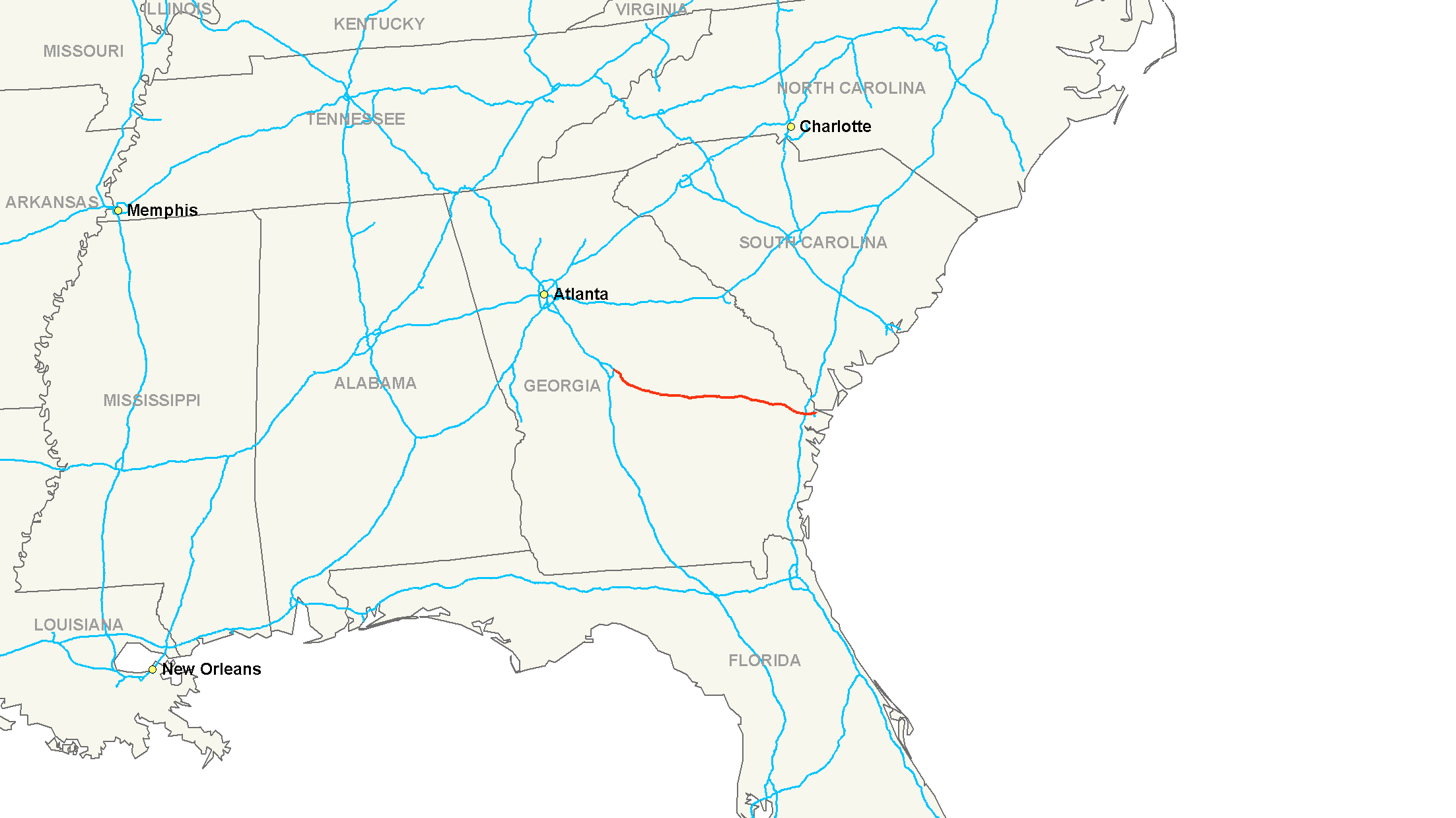
maint=Georgia DOT
length_mi=166.81
length_round=2
length_ref= [ [http://www.fhwa.dot.gov/reports/routefinder/table1.htm Route Log - Main Routes of the Eisenhower National System Of Interstate and Defense Highways - Table 1] ] cite web|publisher=Interstate Guide|url=http://www.interstate-guide.com/i-016.html|title=Interstate 16 @ Interstate-Guide.com|accessdate=2008-02-15]
established=
direction_a=West
terminus_a=Jct|state=GA|I|75 in Macon
junction=Jct|state=GA|I|95 near Savannah
direction_b=East
terminus_b=Montgomery Street in Savannah
previous_type=SR
previous_route=403
browse_route=
next_type=SR
next_route=405
commons=categoryInterstate 16 (I-16), also known as Jim Gillis Historic Savannah Parkway or State Route 404, is an intrastate
interstate highway located entirely within the state of Georgia,United States . [ [http://www.dot.state.ga.us/DOT/plan-prog/transportation_data/400reports/2003/dpp438_2003.pdf Interstate Mileage Report (438 Report] , Georgia Deartment of Transportation, 2003] I-16 runs from downtown Macon, atInterstate 75 to downtown Savannah at Montgomery Street (Exit 167B).cite web|publisher=Google Maps |url=http://maps.google.com/maps?f=d&hl=en&geocode=894757657656619927,32.854040,-83.635220&saddr=I-16+E+%4032.854040,+-83.635220&daddr=32.071829,-81.102684&mra=mi&mrsp=1,0&sz=16&sll=32.07312,-81.100559&sspn=0.008219,0.014462&ie=UTF8&ll=32.565333,-82.43042&spn=2.092474,3.702393&z=8|title=Overview Map of I-16|accessdate=2008-02-15]The highway carries the unsigned designation of State Route 404, though the state route has a spur that is signed.
Route description
I-516 spurs off in two opposite directions, perpendicular to I-16.
I-16 serves as a
hurricane evacuation route for Savannah and other coastal areas. The road is designed for contraflow travel with railroad-type gates to block most entrance and exit ramps for the normally eastbound lanes. Some ramps are ungated, apparently for entrance to and exit from the contraflow lanes. Just east of Exit 42 is a crossover to return all westbound traffic to the westbound travel lanes.Southeast of Macon, I-16 passes through
Ocmulgee National Monument but without direct access. Visitors need to first exit at the Colliseum Drive (U.S. Route 80 ) exit.History
In 2003 the Georgia Legislature passed a resolution [ [http://www.legis.state.ga.us/legis/2003_04/fulltext/hr88.htm House Resolution 88 - Jim Gillis Historic Savannah Parkway] , Georgia General Assembly, March 27, 2003] to designate Interstate 16 in honor of
James L. Gillis, Sr. , a Democrat who served as a State Representative, State Senator and Director of theGeorgia Department of Transportation .Gillis' sons, Hugh and James, Jr., also served as Democratic State legislators. Hugh was a Representative from 1941 to 1953 and a State Senator from 1953 to 1955 and from 1963 to 2005. James, Jr. was a State Senator from 1945 to 1946. [ [http://www.legis.state.ga.us/cgi-bin/peo_detail.pl?Leg=gass20 Georgia General Assembly - Senator Hugh M. Gillis (D-SS 20)] , February 2003]
As with all Georgia interstate highways, exit numbers were replaced in 2000 with
mile-log numbers.Exit list
Auxiliary routes
ee also
*
Earl T. Shinhoster Interchange
*Interstate 516 References
External links
* [http://www.interstate-guide.com/i-016.html I-16 at Interstate-guide.com]
Wikimedia Foundation. 2010.