- Puerto Rico Highway 52
Infobox road
marker_
state=
highway_name=
name_notes=
type=
route=PRI-1
alternate_name=PR-52, PRI-1Luis A. Ferre Expressway
maint=Puerto Rico Dept. of Transportation and Public Works (DTOP)
section=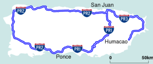
length_mi=67
length_round=
length_ref=
length_notes=
established=
decommissioned=
direction_a=north
terminus_a=
beltway_city=
junction=
direction_b=south
terminus_b=
counties=
rural_municipalities=
cities=San Juan,Caguas ,Ponce
system=Puerto Rico Highway System
spur_type=
spur_of=
previous_type=
previous_route=
next_type=
next_route=
browse=
commons=
customcommons=. The expressway is currently the longest in the island, but this will change when PR-22 extends to Aguadilla.The section between the Caguas toll and the town of Salinas is somewhat treacherous, and accidents have been known to occur there rather frequently. In that section the freeway begins a steep slope, followed by an equally steep downward spiral. Dense fog and low visibility are often present in this area, particularly during or just after a rain. Signs warning drivers to test their brakes while in that area of highway 52 are posted around and several emergency ramps are available going south. Puerto Rico's only
rest area is on this expressway. The rest area has no relief, vending, or service facilities such as a restaurant or a gas station.Puerto Rico Highway 18
This short segment connects PR-52 to PR-22 and makes intersections with PR-17 (Ave. Piñero), PR-23 (Ave. Roosevelt), which grants access to
Plaza Las Américas (the largest shopping mall in the Caribbean), Ave. Domenech (access to Parque Luis M. Marín). It is mostly 4-lane in each direction.The combined route of PR-18 and PR-52 is coterminous with the unsigned
Interstate Highway PRI-1.Exit list
ee also
*
Puerto Rico Highway 1
*Puerto Rico Highway 10
*Puerto Rico Highway 2
*Puerto Rico Highway 22
*Interstate Highways in Puerto Rico References

Wikimedia Foundation. 2010.