- New Jersey Route 19
-
Route 19
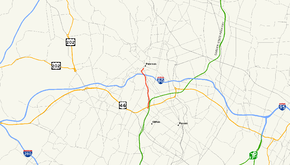
Route information Maintained by NJDOT and Passaic County Length: 3.04 mi[1] (4.89 km) Existed: 1988 – present Major junctions South end:  CR 509 in Clifton
 US 46 in Clifton
 G.S. Pkwy. in Clifton
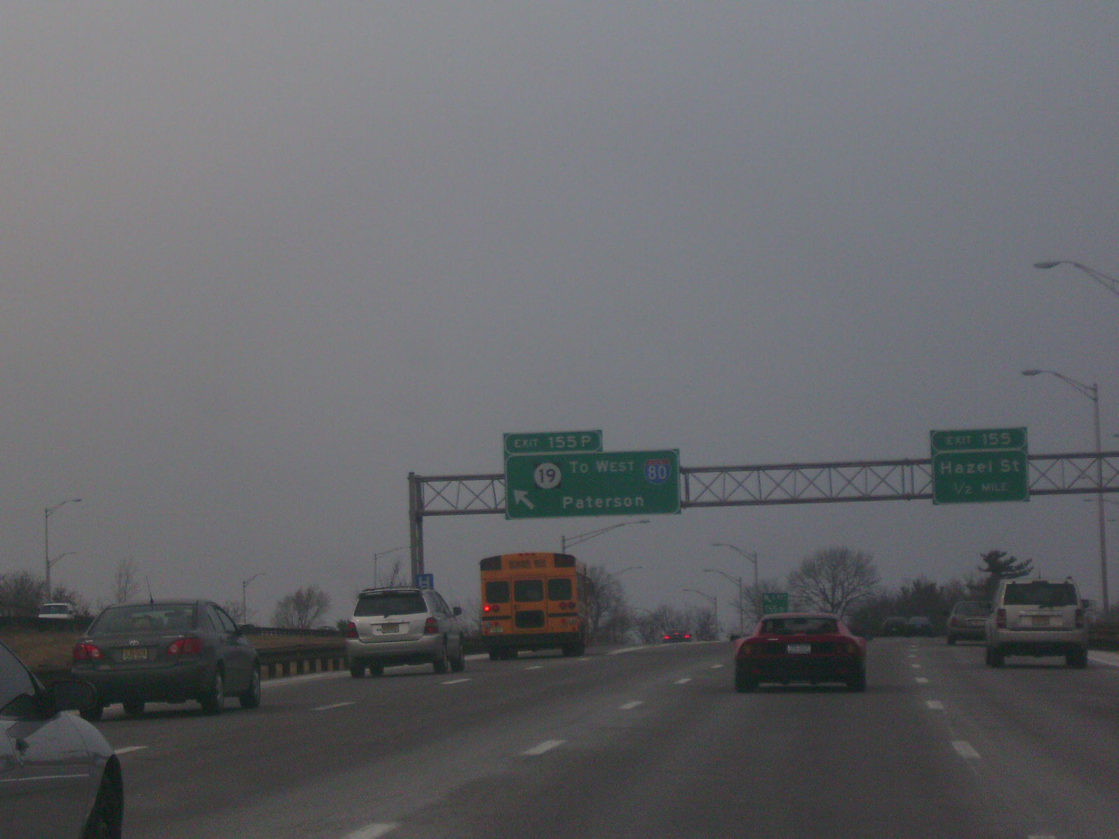
 I-80 in Paterson
North end: CR 509 in PatersonHighway system New Jersey State Highway Routes
Interstate and US←  Route 18N
Route 20  →
→Route 19 is a state highway in Passaic County, New Jersey, United States. Also referred to as the Paterson Peripheral, it runs 3.04 mi (4.89 km) from an intersection with County Route 509 (Broad Street) and County Route 609 (Colfax Avenue) in Clifton north to another intersection with County Route 509 (Main Street) in downtown Paterson. Berween U.S. Route 46 in Clifton and Interstate 80 in Paterson, Route 19 is a freeway. The main purpose of the route is to connect the Garden State Parkway to I-80 and downtown Paterson. The road was originally proposed as the Paterson spur of the Garden State Parkway that was to run north to Wayne. In 1959, it was planned to become part of the Paterson Peripheral, an extension of Route 20 from downtown Paterson. By 1971, the road was completed between the Garden State Parkway and I-80, at which time it received the Route 20 designation; the rest was cancelled in 1978 due to feared community disruption. In 1988, this portion of Route 20 became Route 19 as it did not connect with the other segment of the route. In the 1990s, Route 19 was extended to Main Street in downtown Paterson as part of a project that also completed the interchange with I-80.
Contents
Route description
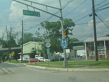 Route 19 beginning at the intersection with Colfax Avenue (CR 609) in Clifton
Route 19 begins at the intersection of County Route 509 (Broad Street) and County Route 609 (Colfax Avenue) in Clifton. From this intersection, it heads north concurrenct with County Route 509 as a four-lane divided highway with a 35 mph (56 km/h) speed limit, soon interchanging with U.S. Route 46.[1][2] Past US 46, the road crosses a brook and County Route 509 (Broad Street) splits off, with Route 19 interchanging with the Garden State Parkway.[1] Route 19 continues past the Garden State Parkway as a six-lane 40 mph (64 km/h) freeway surrounded by trees, coming to a northbound exit and southbound entrance with County Route 509.[1][2]
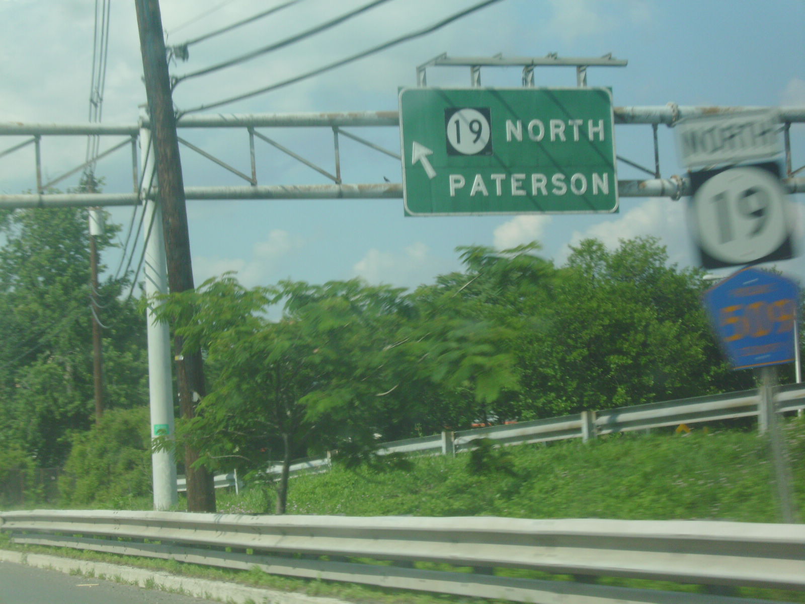
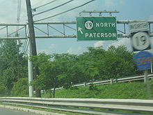 A service road along NJ 19 in Clifton with signage in the background
Past this interchange, the speed limit increases to 55 mph (89 km/h) and the road heads into Paterson. Here, the route has a southbound exit and northbound entrance with County Route 621 (Valley Road) before becoming an eight-lane road and interchanging with Interstate 80, where the speed limit drops to 50 mph (80 km/h). Past I-80, the speed limit lowers to 40 mph (64 km/h) and Route 19 continues north as a five-lane road, with three northbound lanes and two southbound lanes, to an interchange with County Route 638 (Grand Street).[1] From here, the route becomes a four-lane divided surface road and heads into urbanized areas of downtown Paterson.[1][2] The route turns east and becomes a 25 mph (40 km/h) county-maintained undivided road at the intersection with Marshall Street and continues to its northern terminus at the intersection of County Route 509 (Main Street) and Ward Street.[1]
History

What is now Route 19 was once planned as the Paterson spur of the Garden State Parkway, which was to run through Paterson and Haledon to County Route 504 in Wayne.[3] The planned Paterson spur would become an extension of Route 20 in 1959.[4] This road, which was to be a six-lane, $58 million freeway called the Paterson Peripheral, was to run from Clifton north to the existing Route 20 in downtown Paterson.[3] This road was completed between the Garden State Parkway and Valley Road by 1969 and north to Interstate 80 in 1971.[3][5] Upon completion, this road received the Route 20 designation. The extension to Route 20 through Paterson was stopped in 1978 because of the designation of the Great Falls Historic District, a historical district recognizing Paterson’s heritage as an industrial center, and the number of homes and businesses that would be displaced by the route whether or not it ran through the historic district. In 1988, this portion of Route 20 was redesignated Route 19 as it did not connect with the mainline of the route. In 1992, a project to complete the interchange with I-80 and extend the route to Main Street in downtown Paterson to ease congestion was finished at a cost of $27 million.[3] This interchange received the Prize Bridge Award in the category of Grade Separation from Modern Steel Construction magazine in 1996.[6]
Exit list
The entire route is in Passaic County.
Location Mile[1] Roads Notes Clifton 0.00 CR 509 south (Broad Street)Continuation beyond Colfax Avenue, south end of CR 509 overlap 0.02  CR 609 (Colfax Avenue)
0.13 US 46 eastInterchange, southbound exit is via a U-turn at Colfax Avenue US 46 west – DoverInterchange, no northbound exit South end of freeway 0.46 CR 509 north (Broad Street)North end of CR 509 overlap; northbound exit and southbound entrance 0.50 G.S. Pkwy. southSouthbound exit and northbound entrance 1.15 CR 509 (Broad Street) – CliftonNorthbound exit and southbound entrance Paterson 1.80 
 CR 601 (Main Street) / CR 621 (Valley Road) – Clifton
Southbound exit and northbound entrance 2.46 I-80 – Delaware Water Gap, George Washington Bridge, New YorkSouthbound exit to I-80 west is via Spruce Street 2.71  CR 638 (Grand Street)
Northbound exit and southbound entrance 2.84 Spruce Street Southbound exit and entrance North end of freeway 3.04 CR 509 (Main Street)1.000 mi = 1.609 km; 1.000 km = 0.621 mi See also
 U.S. Roads portal
 New Jersey portal
References
- ^ a b c d e f g h "Route 19 straight line diagram". New Jersey Department of Transportation. http://www.state.nj.us/transportation/refdata/sldiag/00000019__-.pdf. Retrieved 2007-04-08.
- ^ a b c Google, Inc. Google Maps – overview of New Jersey Route 19 (Map). Cartography by Google, Inc. http://maps.google.com/maps?f=d&source=s_d&saddr=broad+street+and+colfax+avenue+clifton,+nj&daddr=route+19+and+main+street+paterson,+nj&geocode=&hl=en&mra=ls&sll=40.873578,-74.171748&sspn=0.014343,0.027466&ie=UTF8&t=h&z=13. Retrieved 2009-06-17.
- ^ a b c d Anderson, Steve. "NJ 19 Freeway". Eastern Roads. http://www.nycroads.com/roads/NJ-19/. Retrieved 2009-03-11.
- ^ State of New Jersey, Laws of 1959, Chapter 4.
- ^ Chevron Oil Company (1969). Map of New Jersey (Map). Cartography by H.M. Gousha.
- ^ "1996 Prize Bridge Award: Grade Separation - Route 19-Interstate 80 Interchange" (PDF). Modern Steel Construction. October 1996. http://www.modernsteel.com/Uploads/Issues/October_1996/9610_12_route19interstate80.pdf. Retrieved 2009-07-23.
External links
Controlled-access highways and Expressways in New Jersey Interstate Highways U.S. and state highways Toll roads and other highways Atlantic City Expressway (Brigantine Connector) • Garden State Parkway • New Jersey Turnpike • Palisades Interstate ParkwayCategories:- State highways in New Jersey
- Limited access New Jersey state routes
- Transportation in Passaic County, New Jersey
- Clifton, New Jersey


Wikimedia Foundation. 2010.