- Palisades Interstate Parkway
-
Palisades Interstate Parkway
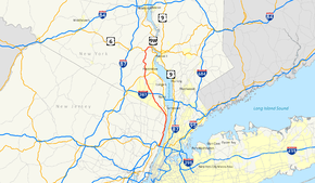
Map of the New York City area with the Palisades Interstate Parkway highlighted in redRoute information Maintained by Palisades Interstate Park Commission Length: 38.25 mi[3][1][4] (61.56 km)
NJ 445S: 0.42 miles (0.68 km)[1]Existed: 1958[2] – present Major junctions South end: 

 I-95 / US 1-9 / US 46 in Fort Lee, NJ
 US 9W / Route 67 in Fort Lee, NJ


 I-87 / I-287 / Thruway in Nanuet, NY
 US 202 in Mount Ivy, NY
 US 6 in Bear Mountain State Park, NY
North end: US 6 / US 9W / US 202 in Ft. Montgomery, NYLocation Counties: NJ: Bergen NY: Rockland, Orange Highway system New Jersey State Highway Routes
Interstate and US
Numbered highways in New York
Interstate • U.S. • N.Y. (former) • Reference • County← Route 444 445 Route 446 → 

Coordinates: 41°4′37.2″N 73°59′2.4″W / 41.077°N 73.984°WCoordinates: 41°4′37.2″N 73°59′2.4″W / 41.077°N 73.984°W NRHP Reference#: 99000940[5] NJRHP #: 102[6] Significant dates Added to NRHP: August 2, 1999 Designated NJRHP: October 3, 1999 The Palisades Interstate Parkway (PIP) is a 38.25-mile (61.56 km) long limited-access highway in the U.S. states of New Jersey and New York. The parkway is a major commuter route into New York City from Rockland and Orange counties in New York and Bergen County in New Jersey. The southern terminus of the route is at the George Washington Bridge in Fort Lee, New Jersey, where it connects to Interstate 95 (I-95), U.S. Route 1–9 (US 1–9), US 46 and Route 4. Its northern terminus is at a traffic circle in Fort Montgomery, New York, where the PIP meets US 9W and US 202 at the Bear Mountain Bridge. At exit 18, the PIP forms a concurrency with US 6 for the duration of its run.
The route is named for the New Jersey Palisades, a line of cliffs rising along the western side of the Hudson River. In New Jersey, the parkway is designated, but not signed as, Route 445. A short spur in Fort Lee is designated, but not signed as, Route 445S. In New York, the roadway is designated New York State Route 987C (NY 987C), an unsigned reference route. As with most parkways in the New York metropolitan area, commercial traffic is prohibited from using the PIP. The Palisades Interstate Parkway was built from 1947–1958, and fully opened to traffic on August 28, 1958.[2]
Contents
Route description
Lengths mi km NJ 11.48[3][1] 18.48 NY 26.77[4] 43.08 Total 38.25 61.56 New Jersey
The Palisades Interstate Parkway begins at the George Washington Bridge in Fort Lee.[7] Passengers from the upper level of the GWB can directly get on the PIP northbound. Passengers from the lower level of the bridge must travel through GWB Plaza on US 9W, before getting on the PIP. Passengers riding northbound on the New Jersey Turnpike (I-95) must be in local lanes to directly get on the PIP. It can be a confusing interchange for someone unfamiliar with the arrangement. Construction to fix this problem has been rumored for quite sometime, but nothing has been made official. Once the PIP leaves the GWB, it proceeds north along the New Jersey Palisades, breezing by the Englewood Cliffs Service Area. Unlike service areas further north along the parkway, there are two in Englewood, one for northbound drivers and one for southbound drivers. The others are in the center median shared by drivers going in both directions. There are also three different scenic lookout points over the Palisades about where Manhattan Island begins at the Harlem River. After this, the PIP parallels US 9W and the Hudson River for its entire run in New Jersey. In fact, all four exits in New Jersey are either with US 9W, or within mere feet of the route. The PIP leaves New Jersey into New York in the borough of Rockleigh.[7]
The entire New Jersey portion of the Palisades Interstate Parkway is within Bergen County. It is designated as a state scenic byway known as the Palisades Interstate Parkway Scenic Byway.[8]
New York
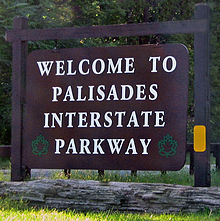 Welcome to the PIP sign posted at its northern terminus in Orange County
Rockland County
The Palisades enters Rockland County in the hamlet of Palisades. At about the border the PIP changes direction from due north along the Hudson River to a north-west direction. Shortly after the Kings Ferry Service Area in the center median, the first two exits in New York are key exits for two colleges in Rockland County. Exit 5 provides a link to St. Thomas Aquinas College, and exit 6 provides a link to Dominican College. In West Nyack, the PIP has a key interchange with the New York State Thruway (I-87, I-287). This intersection is about two miles (3 km) west of the Tappan Zee Bridge. After the PIP's interchange with the NY Thruway, the PIP turns slightly north-east and its speed limit increases to 55 miles per hour (89 km/h). From the GWB to the NY Thruway it is exclusively 50 miles per hour (80 km/h). At exit 13, the PIP intersects US 202 as the route crosses south of Harriman State Park in Mount Ivy. This is the first of two meetings between the PIP and US 202. At exit 15, the PIP has its last busy intersection in Rockland County with County Route 106 (former NY 210) in Stony Point. From here, the PIP enters Harriman State Park, and at exit 16, the PIP intersects Lake Welch Parkway, which is one of several parkways commissioned within the park.[7]
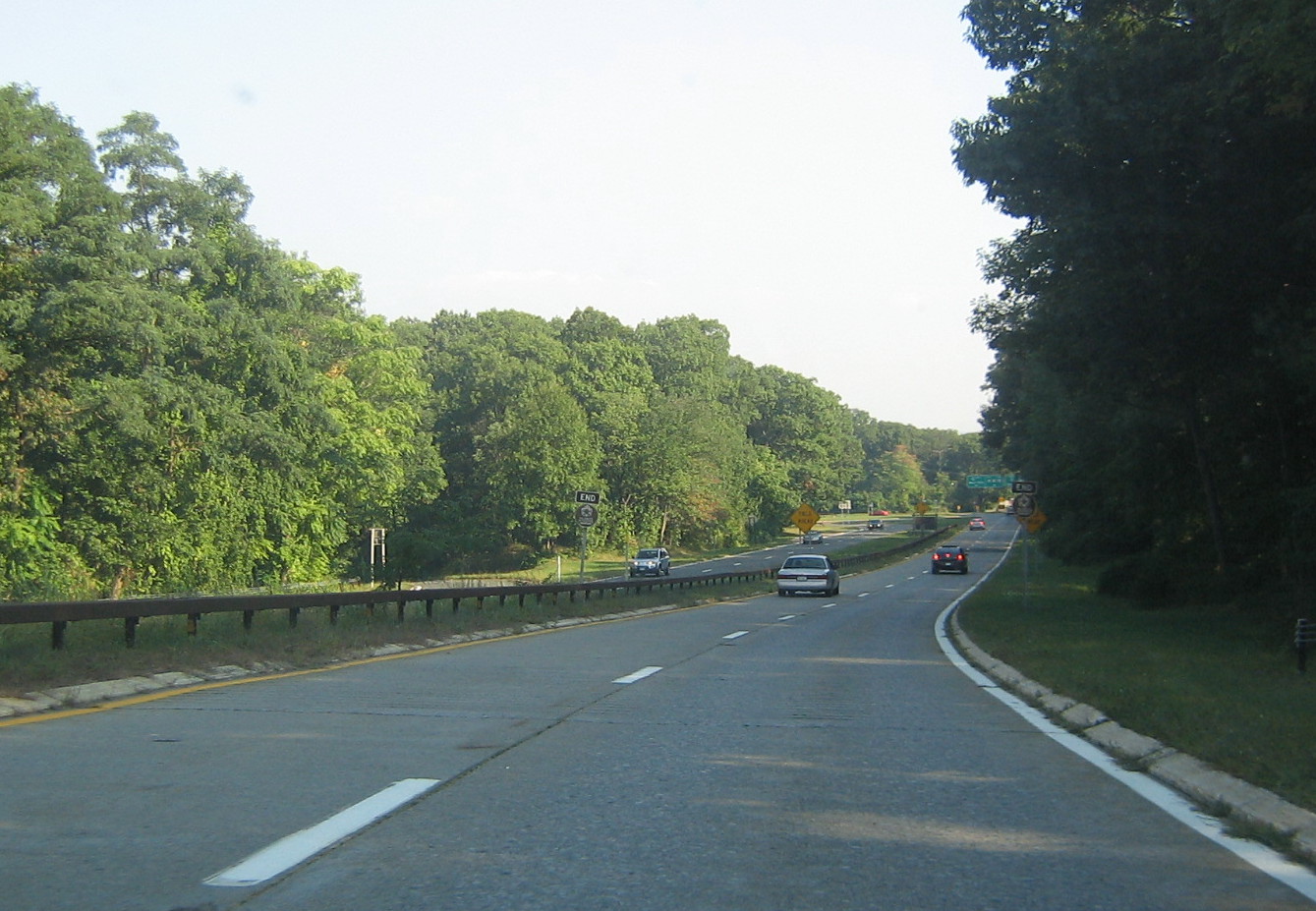
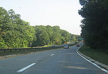 The Palisades Interstate Parkway's northern terminus in Fort Montgomery, New York
Orange County
The Palisades enters Orange County north of Lake Welch Parkway at exit 16 and south of the Palisades Interstate Park Commission Visitor Center, which is located in the center median because it was originally a parkway service area. The first interchange in Orange County is exit 17 at Anthony Wayne Recreation Area. At exit 18, the PIP intersects US 6 and Seven Lakes Drive. US 6 west heads toward the New York Thruway and NY 17 five miles (8 km) west in Harriman. US 6 east forms a concurrency with the PIP for the last two miles (3 km) of the PIP's run. Seven Lakes Drive joins the two routes for one mile (1.6 km) before departing at exit 19. The two routes then enter Bear Mountain State Park in an eastern direction. Finally, the Palisades Interstate Parkway meets its end at US 9W/US 202 at a traffic circle inches from the Hudson River and the Bear Mountain Bridge. US 6 and 202 head east over the bridge, while US 9W heads north toward the United States Military Academy in West Point.[7]
History
In 1933–34, the first thoughts of a Palisades Interstate Parkway were developed by William A. Welch. The plan was to build a parkway to connect the New Jersey Palisades with the state parks along the Hudson River in Rockland and Orange Counties. Welch would soon garner the support of John D. Rockefeller, who donated 700 acres (2.8 km2) of land along the New Jersey Palisades overlooking the Hudson River. With this favorable momentum for the new route, the proposed route was accepted as a Civil Works Administration project under Franklin D. Roosevelt's New Deal coalition. However, the New Jersey Highway Commission did not support construction, so the idea of a parkway was put on hold.[2]
During the 1940s, Rockefeller renewed the push for a parkway along the New Jersey Palisades, and teamed with ultimate PIP planner, Robert Moses, to establish and design the parkway. The plan originally was to have the PIP stretch from the Garden State Parkway, along the Hudson River, to the George Washington Bridge, and then north along its present-day route ending at the Bear Mountain Bridge. This southern extension was never built, but construction began on the current PIP in New York on April 1, 1947. Construction on the New Jersey portion began about one year later.[2]
Construction was delayed twice due to material shortages, but that did not stop the PIP from being opened in stages during the 1940s and 1950s. The route was completed in New Jersey in 1957, and on August 28, 1958, the final piece of the PIP was completed between exits 5 and 9 in southern Rockland County.[2]
Shortly after completion of the PIP, the parkway's interchange with US 6 was upgraded to include what is known as Queensboro Circle. Queensburo Circle is located just off of exit 18 of the PIP. The exiting driver must proceed to this one of many traffic-circles within Bear Mountain State Park and Harriman State Park before getting off on US 6's Long Mountain Spur or Seven Lakes Drive. In the early days of the parkway, the PIP originally had posted speed limits of 40 miles per hour (64 km/h), but now are posted between 55 miles per hour (89 km/h) with additional lanes added in higher traveled areas.[2]
The PIP is a favorite means to access the Catskill Mountains in Sullivan County, New York from New York City. Travellers take the PIP to the New York State Thruway, then on to Route 17 which is exit sixteen of the Thruway. Due to the huge number of hasidic travellers, particularly in the summer months, the PIP has developed a friendly, multi-cultural tone to it. Its rest stops offer regular commuter fare side by side with hasidic labelled kosher foods. Residents of The Bronx and uptown Manhattan also use this route as a means of travelling to Rockland Lake and Harriman State Park on day trips because of their close proximity to the city, especially during the summer.
The PIP is well known for its stone arch overpasses throughout its route and its several scenic overlooks in New Jersey. All sorts of unique trees and flowers, can be seen along the route as well. In 1998, because of all the natural and constructed beauty, the PIP was designated as a national landmark by the National Park Service.[9]
Future
The Palisades Interstate Parkway can be reached from the George Washington Bridge only from the bridge's upper level. Those traveling on the lower level must take the exit for US 9W, and travel through northern Fort Lee to reach the PIP. The Port Authority plans to construct ramps to directly connect the lower level to the PIP. Originally, this was to take place anywhere between 2005 and 2009, but has been postponed with no future date scheduled as of now.[10]
Exit list
County Location Mile
[3][4]Exit Destinations Notes Bergen Fort Lee 0.00 I-95 north / US 1-9 north (George Washington Bridge) – Long Island, New EnglandSouthbound exit and northbound entrance 0.18 George Washington Bridge toll plaza (southbound) Myrtle Avenue Southbound exit and entrance 0.31 US 9W south / Route 67 south (NJ 445S)Fort Lee Spur; southbound exit and northbound entrance; to I-95 (New Jersey Turnpike) south and US 1/9 south Englewood Cliffs 1.89 1  CR 505 (Palisade Avenue) – Englewood Boat Basin
Alpine 7.48 2  US 9W (Palisades Boulevard) to CR 502 (Closter Dock Road)
9.29 3 US 9W (Palisades Boulevard)10.34 4 US 9W (Highland Avenue)11.06
0.00New Jersey – New York state line Rockland Tappan 2.57 5N-S  NY 303 (Commonwealth Avenue) – Orangeburg, Tappan
Orangeburg 3.50 6E-W  CR 20 (Orangeburg Road) – Orangeburg, Pearl River
Orangetown/Clarkstown
town line6.40 7  CR 42 (Town Line Road) – Nanuet
Clarkstown 7.13 8E-W  NY 59 (Nyack Turnpike) – West Nyack, Nyack, Spring Valley, Suffern
7.91 9E-W I-87 / I-287 / Thruway – New York City, Albany9.50 10  CR 33 (North Middletown Road) – New City, Nanuet
New Hempstead 11.62 11  CR 80 (New Hempstead Road) – New City, New Square
Pomona 13.30 12  NY 45 (Main Street) – Pomona, New Square
Ramapo/Haverstraw
town line14.32 13 US 202 (Mount Ivy Road) – Haverstraw, SuffernStony Point 16.71 14  CR 98 (Willow Grove Road) – Letchworth Village
17.92 15  CR 106 (Stony Point Road) – Stony Point, Lake Kanawauke
Former routing of NY 210; passenger cars only north of this point 19.05 16 
 Lake Welch Parkway to Tiorati Brook Road
No northbound entrance Orange Highlands Palisades Interstate Park Commission Visitor Center Left exit; former service area 23.50 17 Anthony Wayne Recreation Area 24.37 18  US 6 west (Long Mountain Parkway) / Seven Lakes Drive west
US 6 and Seven Lakes Drive join eastbound and leave westbound 24.57 19 Seven Lakes Drive east to Perkins Memorial DriveSeven Lakes Drive leaves eastbound and joins westbound 26.77 20 US 6 east / US 9W / US 202 – Stony Point, Peekskill, NewburghTraffic circle; US 6 leaves eastbound and joins westbound 1.000 mi = 1.609 km; 1.000 km = 0.621 mi Within New Jersey, the New Jersey Turnpike is the only other highway to use sequential exit numbering; all others are based on mileage, except for the Atlantic City-Brigantine Connector in Atlantic City that uses lettered exits (no numerals).
See also
 U.S. Roads portal
 New Jersey portal
 New York Roads portal
 Hudson Valley portal
References
- ^ a b c "NJ Route 445S Straight Line Diagram" (PDF). http://www.state.nj.us/transportation/refdata/sldiag/00000445S_-.pdf. Retrieved September 2, 2007.
- ^ a b c d e f Anderson, Steve. "Palisades Interstate Parkway". NYCRoads. http://www.nycroads.com/roads/palisades/. Retrieved February 21, 2008.
- ^ a b c "NJ Route 445 Straight Line Diagram" (PDF). http://www.state.nj.us/transportation/refdata/sldiag/00000445__-.pdf. Retrieved September 2, 2007.
- ^ a b c "2007 Traffic Data Report for New York State" (PDF). New York State Department of Transportation. July 25, 2008. https://www.nysdot.gov/divisions/engineering/technical-services/hds-respository/NYSDOT_Traffic_Data_Report_2007.pdf. Retrieved July 17, 2009.
- ^ a b "National Register of Historic Place Listings". National Park Service. August 13, 1999. http://www.nps.gov/nr/listings/990813.htm. Retrieved April 19, 2010.
- ^ "New Jersey and National Registers of Historic Places - Bergen County". NJ DEP - Historic Preservation Office. March 1, 2011. p. 1. http://www.state.nj.us/dep/hpo/1identify/lists/bergen.pdf. Retrieved April 27, 2010.
- ^ a b c d Google Maps. Overview Map of Palisades Interstate Parkway (Map). http://maps.google.com/maps?f=q&hl=en&geocode=&q=Palisades+Interstate+Parkway,+United+States&sll=42.209384,-89.0043&sspn=0.007089,0.014591&ie=UTF8&ll=41.166249,-73.990173&spn=0.922163,1.867676&z=9&iwloc=addr&om=1. Retrieved September 21, 2007.
- ^ "Scenic Byways in New Jersey – Palisades Interstate Parkway". New Jersey Department of Transportation. http://www.state.nj.us/transportation/community/scenic/palisades.shtm. Retrieved July 8, 2010.
- ^ "News on the Palisades Parks". The Palisades Park Conservancy. http://www.palisadesparksconservancy.org/content.php?mode=news&object_id=54. Retrieved February 21, 2008.
- ^ Anderson, Steve. "George Washington Bridge Historic Overview". NYCRoads. http://www.nycroads.com/crossings/george-washington/. Retrieved February 21, 2008.
Further reading
- Myles, William J., Harriman Trails, A Guide and History, The New York-New Jersey Trail Conference, New York, N.Y., 1999.
External links
- Palisades Interstate Parkway
- an enlarged view of road jurisdiction at the Fort Lee approaches to the George Washington Bridge
- Google maps satellite image of the southern end of the Parkway
Controlled-access highways and Expressways in New Jersey Interstate Highways U.S. and state highways Toll roads and other highways Atlantic City Expressway (Brigantine Connector) • Garden State Parkway • New Jersey Turnpike • Palisades Interstate ParkwayCategories:- Historic districts in the United States
- Transportation in Bergen County, New Jersey
- Parkways in New York
- State highways in New Jersey
- Palisades Interstate Park system
- Robert Moses projects
- Transportation in Orange County, New York
- Transportation in Rockland County, New York
- Limited access New Jersey state routes
- U.S. Route 6
- Parkways in the United States


Wikimedia Foundation. 2010.