- Nanuet, New York
-
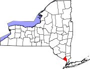
Nanuet, New York — CDP —  Location within the state of New York
 Nanuet, New York
Coordinates: 41°5′43″N 74°0′56″W / 41.09528°N 74.01556°WCoordinates: 41°5′43″N 74°0′56″W / 41.09528°N 74.01556°W Country United States State New York County Rockland Area - Total 5.4 sq mi (14.1 km2) - Land 5.4 sq mi (14.0 km2) - Water 0.0 sq mi (0.0 km2) Elevation 299 ft (91 m) Population (2000) - Total 16,707 - Density 3,080.3/sq mi (1,189.3/km2) Time zone Eastern (EST) (UTC-5) - Summer (DST) EDT (UTC-4) ZIP code 10954 Area code(s) 845 FIPS code 36-49407 GNIS feature ID 0958250 Nanuet is a hamlet (and census-designated place), in the Town of Clarkstown Rockland County, New York, United States located north of Pearl River; south of New City; east of Spring Valley and west of West Nyack. It is 19 miles north of Manhattan, and 2 miles north of the New Jersey border. It has one of three Rockland County stations on New Jersey Transit's Pascack Valley Line.
Lake Nanuet Park is pool which is designed to look like a naturally occurring lake. The park which surrounds it offers residents a summer pool and recreational baseball/softball fields. Recent massive flooding and subsequent contamination closed the park for swimming until 2011.
The opening of the New York State Thruway (Interstate 87/287), the Tappan Zee Bridge, and the Palisades Interstate Parkway in the 1950s helped improve the quality of life of the area, ushering in decades of population growth and real estate development including the construction of the Nanuet Mall and local shopping centers.[1]
Nanuet High School gained national attention in 1989 when its football team claimed the New York State Division III championship. Sports Illustrated named the Nanuet team the No. 1 high school team in the state.
The population was 16,707 at the 2000 census, and was estimated at 18,200 in 2006.
In 2011, CNN Money ranked Nanuet 76 on its annual 100 Best Places to Live list.[2], citing its relatively inexpensive housing and the recreation & shopping opportunities in the area. Nanuet was also ranked 24th on CNN Money's annual 100 Best Places to Live list in 2007. [3].
Contents
Geography
Nanuet is located at 41°5′43″N 74°0′56″W / 41.09528°N 74.01556°W (41.095296, -74.015622)[4].
According to the United States Census Bureau, the CDP has a total area of 5.4 square miles (14 km2), all land.
The topography is result of the massive glaciation of the last Ice Age, and as such the soil is extremely rocky and the surface shows glacial erratic boulders. The glacial ice scraped off and carried with it rocks and minerals from as far north as Canada, depositing them in Nanuet in particular and southern New York in general. This is the hypothesized source of the manganese-rich parvo-mangano-edenite minerals, as well as the placier ore for gold panning within Nauraushaun Brook. There are fossil impressions of huge Precambrian Era jellyfish in the wooded, undeveloped regions. One prominent surface feature, a Hopewell Indian burial mound dating to 325 AD, is located near Nauraushaun Brook at the western edge of the Manhattan Woods Golf Club in West Nyack, New York. Aerial views of this feature reveal it to have been built in the shape of a snake.
Demographics
As of the census[5] of 2000, there were 16,708 people, 5,975 households, and 4,302 families residing in the CDP. The population density was 3,080.3 per square mile (1,190.1/km²). There were 6,134 housing units at an average density of 1,130.9/sq mi (437.0/km²). The racial makeup of the CDP was 71.78% White, 13.34% African American, 0.23% Native American, 9.70% Asian, 0.08% Pacific Islander, 2.30% from other races, and 2.57% from two or more races. Hispanic or Latino of any race were 8.16% of the population.
There were 5,975 households out of which 32.8% had children under the age of 18 living with them, 58.5% were married couples living together, 10.6% had a female householder with no husband present, and 28.0% were non-families. 23.5% of all households were made up of individuals and 9.1% had someone living alone who was 65 years of age or older. The average household size was 2.71 and the average family size was 3.23.
In the CDP the population was spread out with 23.7% under the age of 18, 7.2% from 18 to 24, 31.1% from 25 to 44, 25.1% from 45 to 64, and 12.9% who were 65 years of age or older. The median age was 38 years. For every 100 females there were 91.6 males. For every 100 females age 18 and over, there were 86.0 males.
The median income for a household in the CDP was $71,178, and the median income for a family was $81,205. Males had a median income of $50,713 versus $38,658 for females. The per capita income for the CDP was $30,338. About 3.6% of families and 5.2% of the population were below the poverty line, including 7.4% of those under age 18 and 4.5% of those age 65 or over.
History
According to the New York Times, the hamlet was first named Nannawitt's Meadow after Nannawitt, a migratory Kakiat Indian who settled in the area now occupied by the Nanuet Mall at the intersection of Middletown Road and NY 59. After several name changes the hamlet became known as Nanuet in 1856.
Also according to the Times, the Erie Railroad arrived in Rockland County in 1841 along its original main line to Piermont. The New Jersey and New York Railroad, the predecessor of the Pascack Valley Line, reached Nanuet in 1869.[6]
Education
 Blue Ribbon
- Highview Elementary School (first school in Nanuet)
- George W. Miller Elementary School (2009) is a Blue Ribbon Award winner (2009).
- A. MacArthur Barr Middle School
- Nanuet Senior High School
Nanuet High School is home to the 2008-2009 Girls' Varisty Basketball State and Federation Champions, making history for the school (http://bcany.org/records/great-teams/)
References
- ^ If You're Thinking of Living In / Nanuet, N.Y.; Growth Quickens In Rockland Hamlet - New York Times
- ^ Best Places to Live: Top 100 - Nanuet, N.Y. (76) - Money Magazine
- ^ Best Places to Live: Top 100 - Nanuet, N.Y. (24) - Money Magazine
- ^ "US Gazetteer files: 2010, 2000, and 1990". United States Census Bureau. 2011-02-12. http://www.census.gov/geo/www/gazetteer/gazette.html. Retrieved 2011-04-23.
- ^ "American FactFinder". United States Census Bureau. http://factfinder.census.gov. Retrieved 2008-01-31.
- ^ The Pascack Valley Line: A History of the New Jersey and New York Railroad, Wilson E. Jones; ISBN 0-941652-14-9
External links
- Personal reminiscence page: Nanuet
- Nanuet Fire Department
Municipalities and communities of Rockland County, New York County seat: New City Towns Clarkstown | Haverstraw | Orangetown | Ramapo | Stony Point
Villages Airmont | Chestnut Ridge | Grand View-on-Hudson | Haverstraw | Hillburn | Kaser | Montebello | New Hempstead | New Square | Nyack | Piermont | Pomona | Sloatsburg | South Nyack | Spring Valley | Suffern | Upper Nyack | Wesley Hills | West Haverstraw
CDPs Bardonia | Blauvelt | Congers | Hillcrest | Monsey | Mount Ivy | Nanuet | New City | Orangeburg | Pearl River | Stony Point | Tappan | Thiells | Valley Cottage | Viola | West Nyack
Other
hamletsCentenary | Central Nyack | Doodletown | Garnerville | Grassy Point | Johnsontown | Jones Point | Ladentown | Middletown | Nauraushaun | Palisades | Rockland Lake | Sandyfield | Sickletown | Sparkill | St. John's in the Wilderness | Sterlington | Tallman | Tomkins Cove
Categories:- Census-designated places in New York
- Hamlets in New York
- Populated places in Rockland County, New York


Wikimedia Foundation. 2010.