- Monsey, New York
-
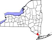
Monsey, New York — CDP — Location within the state of New York
 Monsey, New York
Coordinates: 41°7′10″N 74°3′57″W / 41.11944°N 74.06583°WCoordinates: 41°7′10″N 74°3′57″W / 41.11944°N 74.06583°W Country United States State New York County Rockland Area – Total 2.2 sq mi (5.8 km2) – Land 2.2 sq mi (5.7 km2) – Water 0.0 sq mi (0.1 km2) Elevation 548 ft (167 m) Population (2000) – Total 14,504 – Density 6,554.3/sq mi (2,530.6/km2) Time zone Eastern (EST) (UTC-5) – Summer (DST) EDT (UTC-4) ZIP code 10952 Area code(s) 845 FIPS code 36-48010 GNIS feature ID 0957535 Monsey is a hamlet (and census-designated place), in the Town of Ramapo, Rockland County, New York, United States located north of the state of New Jersey; east of Suffern; south of Airmont and west of Nanuet. The 2010 census listed the population at 18,412.
The hamlet has a large and influential community of Orthodox Jews, consisting predominantly of Chasidim, Hareidim and other Orthodox groups, as well as the Vizhnitz-Monsey hasidim who reside mostly in the Village of Kaser.[citation needed]
Contents
History
Rockland County was inhabited by the Munsee band of Lenape Native Americans, or Delaware Indian, of the Algonquian languages. Monsey Glen, an Indian encampment, is located west of the intersection of NY 59 and NY 306. Numerous artifacts have been found there and some rock shelters are still visible. The Monsey railroad station, which received its name from Munsee, a Lenape chief, was built when the New York & Erie Railroad passed through the glen in 1841.[1] In the 1950s, Monsey was a one stoplight town with a single yeshiva. By 1997, Monsey had 112 synagogues and 45 yeshivas.[2]
Located near Monsey is the Houser-Conklin House, listed on the National Register of Historic Places in 2010.[3]Geography
Monsey is located at 41°7′10″N 74°3′57″W / 41.11944°N 74.06583°W .[4]
According to the United States Census Bureau, the CDP has a total area of 2.2 square miles (5.8 km2), of which, 2.2 square miles (5.7 km2) of it is land and 0.04 square miles (0.1 km2) of it (0.90%) is water.
Culture
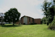
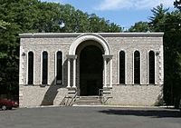 Community Shul
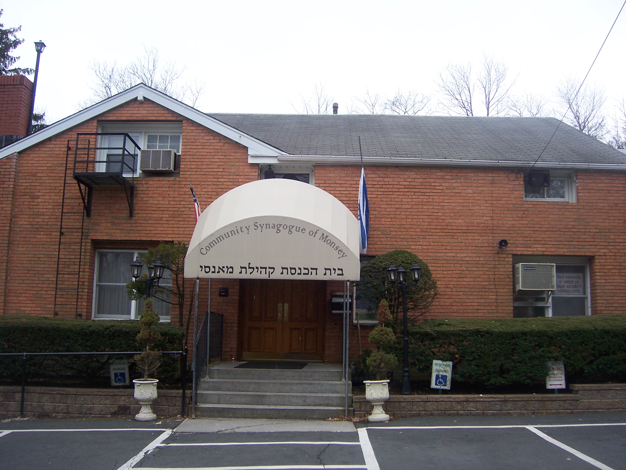
 Community Synagogue
 The Nikolsburg Yeshive
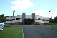 Bas Melech
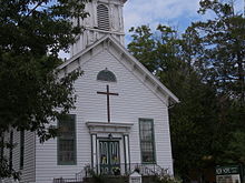 New Hope Christian Church
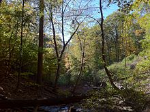 The ravine running through Monsey Glen park
Monsey, compared to the more tightly-knit Village of New Square, had more variety in its stores, a wider selection of yeshivot, more diversity of opinions, and less neighborly connections.[5]
Demographics
As of the census[6] of 2000, there were 14,504 people, 2,981 households, and 2,596 families residing in the CDP. The population density was 6,554.3 per square mile (2,533.9/km2). There were 3,098 housing units at an average density of 1,400.0/sq mi (541.2/km2). The racial makeup of the CDP was 92.82% White, 4.32% African American, 0.03% Native American, 1.05% Asian, 0.01% Pacific Islander, 0.70% from other races, and 1.08% from two or more races. Hispanic or Latino of any race were 2.86% of the population. 43.98% speak English at home, 41.48% Yiddish, 6.88% Hebrew, 2.69% French or a French creole, 1.85% Spanish, and 1.24% Russian.[7]
There were 2,981 households out of which 58.9% had children under the age of 18 living with them, 78.0% were married couples living together, 6.0% had a female householder with no husband present, and 12.9% were non-families. 10.6% of all households were made up of individuals and 4.4% had someone living alone who was 65 years of age or older. The average household size was 4.74 and the average family size was 5.16. In the CDP the population was spread out with 48.6% under the age of 18, 10.5% from 18 to 24, 18.2% from 25 to 44, 16.3% from 45 to 64, and 6.4% who were 65 years of age or older. The median age was 19 years. For every 100 females there were 106.8 males. For every 100 females age 18 and over, there were 106.6 males.
The median income for a household in the CDP was $45,194, and the median income for a family was $45,911. Males had a median income of $41,606 versus $33,576 for females. The per capita income for the CDP was $14,000. About 25.4% of families and 30.6% of the population were below the poverty line, including 37.8% of those under age 18 and 9.2% of those age 65 or over.
Further Reading
Botbyl, Helyne R. (1968). The Patriarch of Monsey. The Museum of Spring Valley and Countryside.
- Green, Frank Bertangue (1886). The History of Rockland County. New York: A. S. Barnes and Co. http://books.google.com/books?id=XCUVAAAAYAAJ&dq=monsey%20true%20reformed%20dutch%20church&pg=PA271#v=onepage&q&f=false.
See also
- The Monsey Church: New Hope Christian Church
- List of people from Monsey, New York
- Ohr Somayach, Monsey
References
- ^ Weinstock, Cheryl Platzman (February 10, 2002). "If You're Thinking of Living In/Monsey; Low Inventory, Lots of Kugel, Some Deer". Real Estate (The New York Times). http://query.nytimes.com/gst/fullpage.html?res=9F04E2D71F3DF933A25751C0A9649C8B63&sec=&spon=&pagewanted=all. Retrieved 2007-10-13. "When the Erie Railroad came through in 1841 and established a station in the hamlet, the stop became known as Monsey, taking its name from Munsee, chief of the Lenape Indians, who settled the area, said Craig H. Long, Ramapo town historian."
- ^ Berger, Joseph. "Growing Pains for a Rural Hasidic Enclave." The New York Times. January 13, 1997.
- ^ "National Register of Historic Places". WEEKLY LIST OF ACTIONS TAKEN ON PROPERTIES: 9/27/10 THROUGH 10/01/10. National Park Service. 2010-10-08. http://www.nps.gov/history/nr/listings/20101008.htm.
- ^ "US Gazetteer files: 2010, 2000, and 1990". United States Census Bureau. 2011-02-12. http://www.census.gov/geo/www/gazetteer/gazette.html. Retrieved 2011-04-23.
- ^ Mintz, Jerome R. Hasidic People. Harvard University Press. 1992. 203.
- ^ "American FactFinder". United States Census Bureau. http://factfinder.census.gov. Retrieved 2008-01-31.
- ^ Modern Language Association, Data center results for Monsey, New York. Retrieved on 2008-03-26.
External links
Municipalities and communities of Rockland County, New York Towns Clarkstown | Haverstraw | Orangetown | Ramapo | Stony Point
Villages Airmont | Chestnut Ridge | Grand View-on-Hudson | Haverstraw | Hillburn | Kaser | Montebello | New Hempstead | New Square | Nyack | Piermont | Pomona | Sloatsburg | South Nyack | Spring Valley | Suffern | Upper Nyack | Wesley Hills | West Haverstraw
CDPs Bardonia | Blauvelt | Congers | Hillcrest | Monsey | Mount Ivy | Nanuet | New City | Orangeburg | Pearl River | Stony Point | Tappan | Thiells | Valley Cottage | Viola | West Nyack
Other
hamletsCentenary | Central Nyack | Doodletown | Garnerville | Grassy Point | Johnsontown | Jones Point | Ladentown | Middletown | Nauraushaun | Palisades | Rockland Lake | Sandyfield | Sickletown | Sparkill | St. John's in the Wilderness | Sterlington | Tallman | Tomkins Cove
Categories:- Monsey, New York
- Census-designated places in New York
- Hamlets in New York
- Populated places in Rockland County, New York
- United States places with Orthodox Jewish communities


Wikimedia Foundation. 2010.