- New York State Route 304
-
NYS Route 304
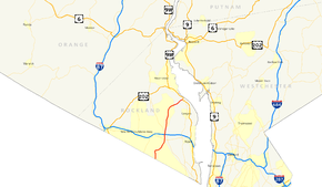
Map of the Lower Hudson Valley with NY 304 highlighted in redRoute information Maintained by NYSDOT Length: 10.38 mi[2] (16.70 km) Existed: 1930[1] – present Major junctions South end:  CR 503 at Orangetown
 NY 59 in Clarkstown
North end:  US 9W in Haverstraw
Location Counties: Rockland Highway system Numbered highways in New York
Interstate • U.S. • N.Y. (former) • Reference • County←  NY 303
NY 305  →
→New York State Route 304 (NY 304) is a New York State Route that is entirely located in Central Rockland County. NY 304 begins at the New Jersey-New York border in Pearl River, New York, and ends at US 9W. Though it crosses both the New York State Thruway and the Palisades Interstate Parkway, it accesses neither of the two major highways. The route was assigned to its current route in 1930 and is a main route in Rockland County.
Contents
Route description
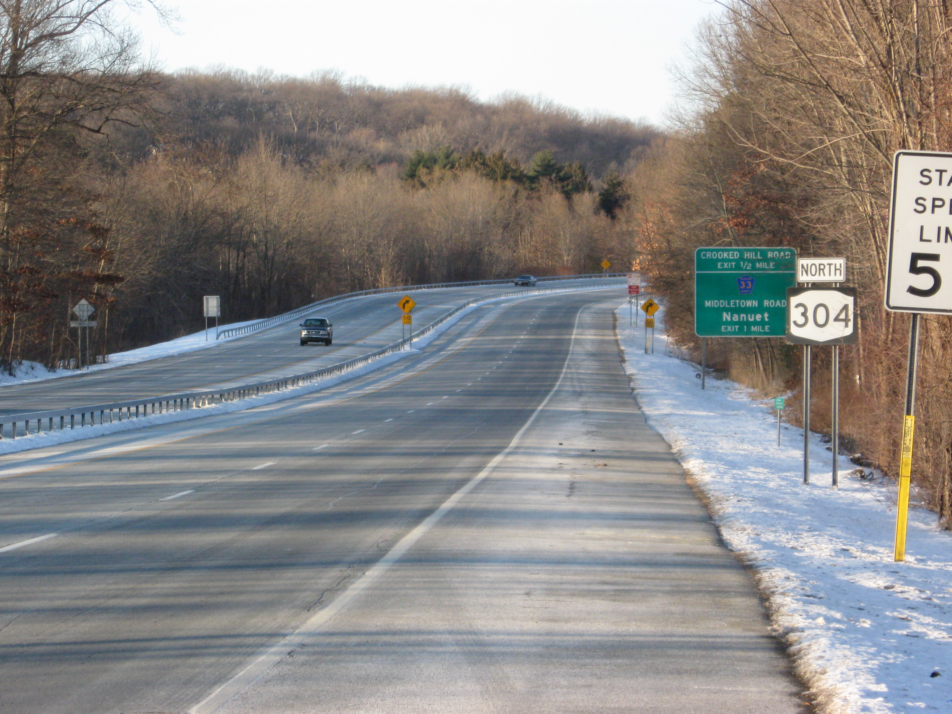
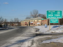 NY 304 begins at the welcome to New York shield ahead.
NY 304 begins at the New Jersey-New York border in Pearl River. South of the border is Montvale in Bergen County, in which NY 304 continues as Bergen County Route 503. NY 304 quickly becomes a four-lane road intersecting CR 33 and CR 30 in Pearl River. CR 33 provides a link to the downtown business district of Pearl River via Central Ave. After its intersection with CR 30, NY 304 becomes a four-lane, limited access highway. This highway runs for about a mile and a half, with at grade intersections with CR 33/Middletown Rd in Pearl River, and NY 59 in Nanuet.[3]
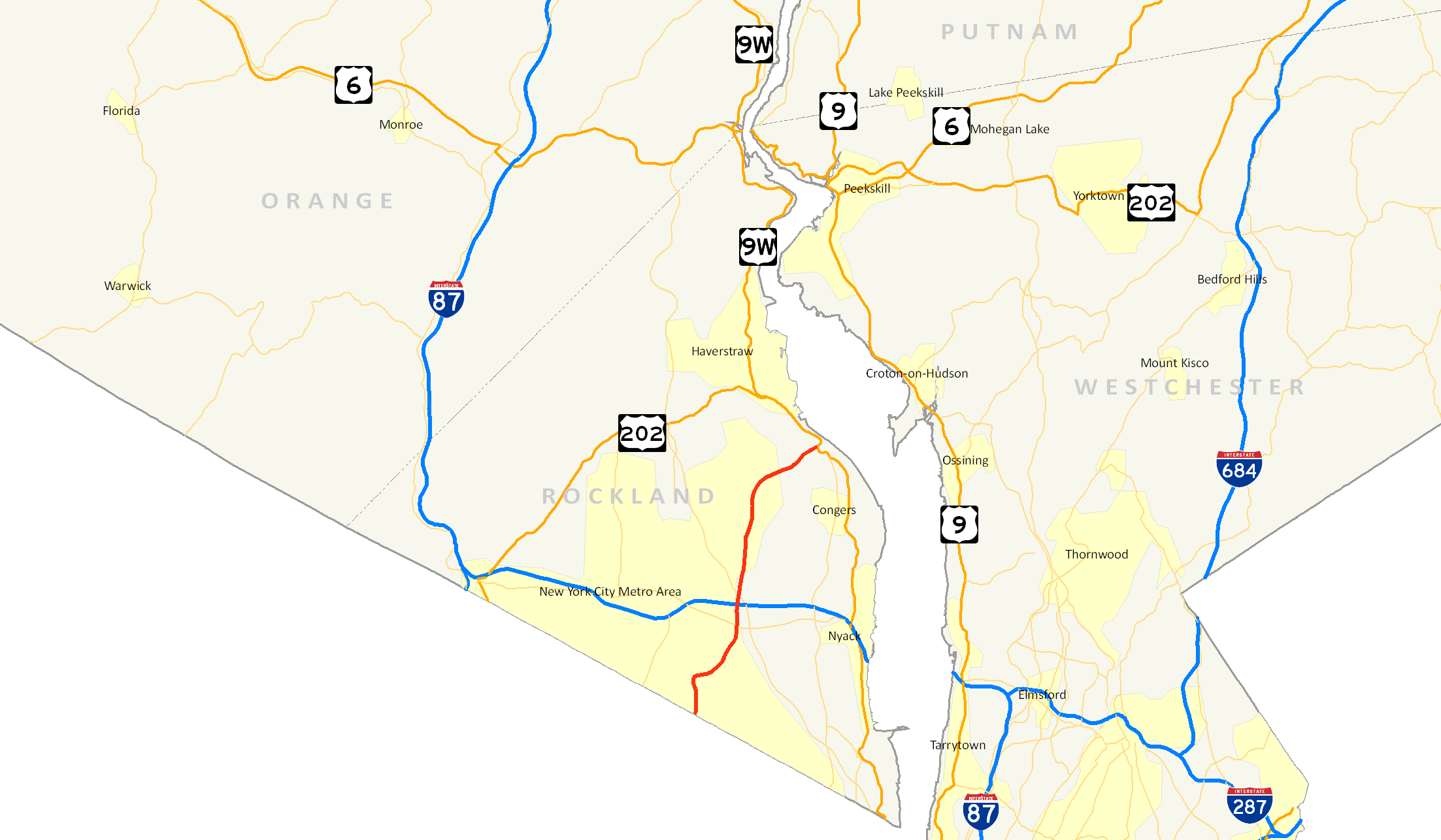
 NY 304 becomes a four-lane, limited exchange highway from here in Pearl River to its intersection with West Nyack Road in Nanuet.
At its intersection with former NY 59A (West Nyack Rd), NY 304 reverts back to being a four-lane, full access road. Here it passes over the New York State Thruway and Palisades Interstate Parkway within a quarter-mile of each other. NY 304 doesn't intersect either of the highways because of the Thruway/PIP interchange literally a jump to the east of when NY 304 crosses both highways. NY 304 continues north, and at CR 27 (Germonds Rd) it enters New City. NY 304 provides a link to the downtown business district of New City at its intersection with Main St. NY 304 then gains a 55-mile-per-hour (89 km/h) speed limit again north of this location. It doesn't become a full highway like before, but other than having a few traffic lights, NY 304 provides a quick route to Haverstraw. NY 304 stays four-lanes until its intersection with CR 80. NY 304 reverts back to two-lanes, but stays a 55-mile-per-hour (89 km/h) road. Finally, after crossing CR 23 in north New City, NY 304 makes its final push toward its northern terminus at US 9W. NY 304 ends at US 9W just inside the Haverstraw townline, less than a mile north of NY 303's northern terminus. The intersection between NY 304 and US 9W is a mere 7/10 of a mile north of the intersection of NY 303 and US 9W.[3]
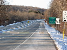
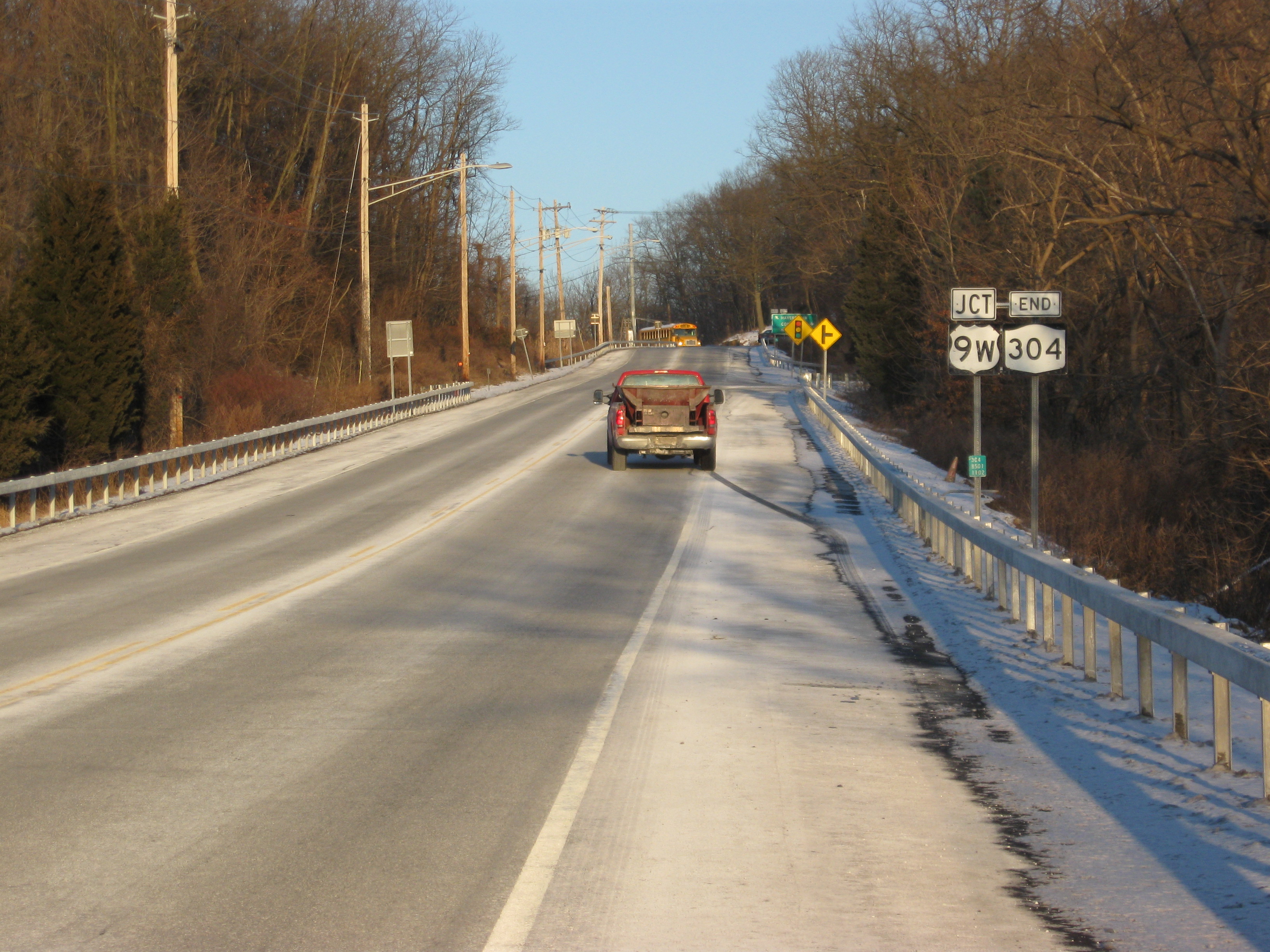
 NY 304's northern terminus at US 9W near the Haverstraw town line.
History
NY 304 was assigned as part of the 1930 renumbering of state highways in New York.[1] The route initially followed East Washington Avenue (CR 35), Middletown Road (CR 33), Church Street, Smith Street,[4] North Main Street (CR 29) in New City, and South Mountain Road (CR 90) in Haverstraw.[5] Street Traffic forecasters predicted that the road would have 30–40,000 people a day going at 10–15 mph in 1980. Since the road would not be able to sustain that amount, a new bypass was opened in 1970 and numbered 304. The New York State Department of Transportation report that the bypass handles about 25,000 cars a day.[4]
Major intersections
The entire route is in Rockland County.
Location Mile[2][3] Destinations Notes Orangetown 0.00 CR 503Continuation into New Jersey 0.46  CR 33 (Central Avenue)
Hamlet of Pearl River 0.60  CR 30 (Washington Avenue)
Hamlet of Pearl River 1.88 CR 33 (Middletown Road)Unnumbered interchange Clarkstown 3.50 NY 59Hamlet of Nanuet; unnumbered interchange; to PIP and I-87/I-287/Thruway 5.48  CR 27 (Germonds Road)
6.30  To CR 76 (Main Street)
7.38  CR 80 (Congers Road)
Hamlet of New City 9.30  CR 23 (Ridge Road)
Hamlet of New City Town of Haverstraw 10.38 US 9W1.000 mi = 1.609 km; 1.000 km = 0.621 mi References
- ^ a b Automobile Legal Association (ALA) Automobile Green Book, 1930/31 and 1931/32 editions, (Scarborough Motor Guide Co., Boston, 1930 and 1931). The 1930/31 edition shows New York state routes prior to the 1930 renumbering
- ^ a b "2008 Traffic Volume Report for New York State" (PDF). New York State Department of Transportation. June 16, 2009. p. 210. https://www.nysdot.gov/divisions/engineering/technical-services/hds-respository/NYSDOT%20TVR%202008%20by%20Route.pdf. Retrieved February 1, 2010.
- ^ a b c Google, Inc. Google Maps – overview map of NY 304 (Map). Cartography by Google, Inc. http://maps.google.com/maps?f=d&hl=en&geocode=11532619163785062220,41.052290,-74.025830%3B2235735682374449982,41.173720,-73.945850&time=&date=&ttype=&saddr=41.052334,-74.025879&daddr=41.17372,-73.94585&mra=dme&mrcr=0&mrsp=0&sz=16&sll=41.05091,-74.024334&sspn=0.007055,0.014591&ie=UTF8&ll=41.10833,-73.983994&spn=0.225571,0.466919&z=11&om=1. Retrieved September 8, 2007.
- ^ a b Anderson, Steve (2007). "Pearl River-Haverstraw Expressway". NYCRoads. http://www.nycroads.com/roads/NY-304/. Retrieved December 6, 2007.
- ^ Anderson, Steve. "Rockland County Routes 26–50". NYCRoads. http://www.nycroads.com/roads/rockland_026-050/. Retrieved March 19, 2010.
External links
Categories:- State highways in New York
- Transportation in Rockland County, New York
- Limited-access roads in New York


Wikimedia Foundation. 2010.