- County Route 502 (New Jersey)
-
County Route 502 Route information Length: 23.79 mi[1] (38.29 km) Major junctions West end:  CR 504 in Wayne
 Route 208 in Franklin Lakes
 CR 507 in Ho-Ho-Kus
 Route 17 in Ho-Ho-Kus
 G.S. Pkwy. in Washington Twp
 CR 503 in Westwood
 CR 505 in Closter
 CR 501 in Closter
East end:  US 9W in Alpine
Highway system County routes in New Jersey
500-series←  CR 501
CR 503  →
→County Route 502 is a county highway in the U.S. state of New Jersey. The highway extends 23.79 miles (38.29 kilometers) from Paterson-Hamburg Turnpike (CR 504) in Wayne to Palisades Boulevard (US 9W) in Alpine.
Route 502 is a very important east–west route in the northern part of Bergen County. north–south travel in the county is available via Route 208 and Route 17, the Garden State Parkway, Route 9W and the Palisades Interstate Parkway. In contrast, the only east–west route in the area is Route 4, from Paterson to Fort Lee. Thus, the north area of the county relies heavily on 502 for east–west travel. Farthest north, NY 59 or the New York State Thruway can be used as east–west alternatives to 502.
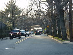
502 comprises Franklin Lakes Avenue, Wyckoff Avenue, Franklin Turnpike (break), Hollywood Avenue, East Saddle River Road (break), Weirimus Road, Washington Avenue, Old Hook Road, High Street, Closter Dock Road and its end at US 9W. In the extreme west of Bergen County, 502 is a pseudo-highway with no-left-turn jughandles, u-turns and stoplights. When 502 runs through Harrington Park, Emerson, and Westwood, it is a four-lane major avenue. As it runs through Washington Township, Ho-Ho-Kus and Waldwick it is a major two-lane road. As it continues west, it is mostly a two-lane road with occasional expansions into a four-lane avenue.
Contents
Route description
CR 502 begins at an intersection with CR 504 in Wayne, Passaic County, heading northwest on four-lane undivided Berdan Avenue through commercial areas. The route turns north as it passes between the Point View Reservoir to the west and residential neighborhoods to the east, intersecting CR 681. From here, the road heads into forested areas with some homes, crossing into Bergen County, at which point it forms the border between Oakland to the west and Franklin Lakes to the east as two-lane Breakneck Road. CR 502 fully enters Oakland, where it intersects CR 93 and turns southeast onto Long Hill Road. The route continues into Franklin Lakes and runs through residential areas as Franklin Lakes Road, intersecting CR 117 before turning east near Franklin Lake and reaching a traffic circle at CR 89. Upon reaching the CR 97 (Ewing Avenue) intersection, CR 502 turns north onto Ewing Avenue, with CR 93 continuing east on Franklin Lakes Road. The road passes more wooded areas of homes as it reaches an interchange with Route 208. A short distance later, the route intersects CR 84 and makes a turn east onto Franklin Avenue. The road crosses into Wyckoff and crosses CR 87 as it heads into the commercial downtown. The route crosses the New York, Susquehanna and Western Railway and passes a mix of homes and businesses as it comes to an intersection with CR 87S and CR 84. CR 502 heads back into wooded residential neighborhoods and enters Waldwick, where it becomes Wyckoff Avenue and reaches a junction with CR 81. The route passes over New Jersey Transit's Main Line/Bergen County Line and widens to four lanes as it comes into businesses areas and reaches an intersection with CR 507.At this point, CR 502 turns south to form a concurrency with CR 507, heading southeast along two-lane Franklin Turnpike. The road heads into Ho-Ho-Kus and passes a mix of homes and businesses before CR 502 splits from CR 507 by heading east on Hollywood Avenue. At this intersection CR 502 Truck heads south along CR 507. CR 502 continues east through wooded residential areas and intersects CR 77 and CR 502 Truck again. A short distance later, the route comes to an interchange with Route 17.[1][2]
From this interchange, CR 502 continues across the Saddle River and reaches an intersection with CR 75, where the route turns south onto East Saddle River Road. The road intersects CR 112 and makes a sharp turn east to a junction with CR 75. At this point, the route becomes Weirmus Road and turns northeast before CR 112 splits to the north on Weirmus Road. CR 502 continues east into Washington Township as Washington Avenue, crossing CR 71 before coming to a partial interchange with the Garden State Parkway that has access to and from the southbound direction of the parkway. The road crosses CR 63 and continues through residential neighborhoods, crossing into Westwood. Here, the route intersects CR 110 and CR 59 before crossing New Jersey Transit's Pascack Valley Line and meeting CR 104 in the commercial downtown. At this point, CR 502 turns southeast onto Broadway and runs to the east of the Pascack Valley Line, passing the Westwood Station. The road curves east away from the railroad tracks, widening to four lanes as it comes to the CR 503 junction. After this, CR 502 becomes Old Hook Road and continues through commercial areas, briefly becoming a divided highway at the entrance to the Hackensack University Medical Center North at Pascack Valley. The road enters Emerson at the Main Street intersection and runs through wooded areas before coming into Harrington Park and intersecting CR 104. CR 502 crosses the Oradell Reservoir into Closter and becomes High Street as it crosses CSX's River Subdivision and comes to the CR 39 junction. From here, the route narrows to two lanes and continues through wooded residential areas, crossing CR 505 before turning southeast and crossing CSX's Northern Branch. At the CR 102 intersection, CR 502 turns south onto Closter Dock Road, with CR 104 continuing along High Street. The route intersects CR 41 and curves southeast onto Old Closter Dock Road, coming to a junction with CR 35 before crossing CR 501. At the Anderson Avenue intersection, CR 502 crosses into Alpine and continues to its eastern terminus at US 9W.[1][2]
Major intersections
County Location Mile[1] Destinations Notes Passaic Wayne 0.00  CR 504 (Hamburg Turnpike)
Western terminus Bergen Franklin Lakes 6.92  Route 208
Interchange Waldwick 11.29  CR 507 north (Franklin Turnpike)
West end of CR 507 overlap Ho-Ho-Kus 11.88  CR 507 south (Franklin Turnpike)
East end of CR 507 overlap 12.50  Route 17
Interchange Township of Washington 14.79-14.84  G.S. Pkwy. south
GSP exit 168 Westwood 17.50  CR 503 (Kinderkamack Road)
Closter 20.38  CR 505 (Knickerbocker Road)
21.62  CR 501 (Piermont Road)
Alpine 23.79  US 9W
US 9WEastern terminus 1.000 mi = 1.609 km; 1.000 km = 0.621 mi CR 502 Truck
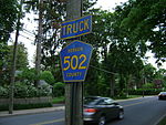
 CR 502 Truck (Sheridan Ave) in Ho-Ho-Kus, New Jersey.

County Route 502 TruckLocation: Ho-Ho-Kus County Route 502 Truck is a bypass of a section of CR 502 in Ho-Ho-Kus, New Jersey. The route travels 0.75 miles, following part of CR 77 and CR 507. It was designated so that trucks could detour around a section of CR 502 westbound where trucks have been banned due to a steeply graded intersection. CR 502 Truck, while signed, is not an official route, and it has no publicly available straight line diagram.[3] However, its length may be determined by utilizing the straight line diagrams for CR 77 and CR 507.
The road begins at the intersection of CR 502 and Hollywood Ave and CR 77 Sheridan Ave in Ho-Ho-Kus. Here, trucks must make a left onto CR 77 to avoid a steep incline at the upcoming intersection of CR 502 and CR 507. Traveling south into downtown Ho-Ho-Kus, CR 502 Truck follows the same route as CR 77 until coming to a skewed intersection with the Franklin Turnpike and North Maple Ave. To the east, CR 62 enters the intersection as the Franklin Turnpike. Ahead and somewhat to the east, CR 507 emerges as North Maple Ave and turns to follow the Franklin Turnpike to the west. CR 502 Truck makes a right turn at the above mentioned intersection and follows CR 507 up a hill for 0.39 miles until it reunites with CR 502 at an intersection with Hollywood Ave. CR 502 then continues in the same direction as CR 507.
See also
 U.S. Roads portal
 New Jersey portal
References
- ^ a b c d NJDOT County Route 502 Straight Line Diagram (PDF) (NJDOT) (Straight-line diagram)
- ^ a b Google, Inc. Google Maps – overview of County Route 502 (Map). Cartography by Google, Inc. http://maps.google.com/maps?f=d&source=s_d&saddr=state+route+502+and+county+road+504&daddr=40.9853188,-74.2479655+to:41.0014,-74.19637+to:41.0135186,-74.150717+to:closter+dock+road+and+route+9w&geocode=FTYBcQId4S2T-ykHgYLIkgLDiTGyTtM5W6kK-A%3BFeZicQId4xCT-ynnoO8PyQLDiTFV35aouqspXA%3BFbihcQIdbtqT-ykPdmW4v-LCiTGuuSh_S3tBMg%3BFQ7RcQIdw4yU-ykjp4tOCuPCiTHTB_IEyu-jlw%3BFaXKcAIdJgaY-ymxtQ9x9-3CiTH83IZnD9mbmw&hl=en&mra=ls&via=1,2,3&sll=40.971992,-73.964596&sspn=0.059102,0.169086&ie=UTF8&t=h&z=12. Retrieved January 4, 2011.
- ^ Alps Roads – New Jersey Route Logs Accessed May 20, 2009.
External links
Categories:- County routes in New Jersey
- Transportation in Bergen County, New Jersey
- Transportation in Passaic County, New Jersey
Wikimedia Foundation. 2010.


