- Westwood, New Jersey
Infobox Settlement
official_name = Westwood, New Jersey
settlement_type = Borough
nickname =
motto =
imagesize =
image_caption =
image_
imagesize =
image_caption =
image_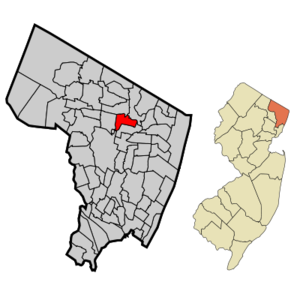
mapsize = 250x200px
map_caption = Map highlighting Westwood's location within Bergen County. Inset: Bergen County's location within New Jersey.
mapsize1 = 250x200px
map_caption1 = Census Bureau map of Westwood, New Jerseysubdivision_type = Country
subdivision_name =United States
subdivision_type1 = State
subdivision_name1 =New Jersey
subdivision_type2 = County
subdivision_name2 = Bergen
government_footnotes =
government_type = Borough
leader_title = Mayor
leader_name = John Birkner Jr. (D, 2011)
leader_title1 =
leader_name1 =
established_title = Incorporated
established_date =May 8 ,1894 unit_pref = Imperial
area_footnotes =
area_magnitude =
area_total_km2 = 6.0
area_land_km2 = 6.0
area_water_km2 = 0.0
area_total_sq_mi = 2.3
area_land_sq_mi = 2.3
area_water_sq_mi = 0.0population_as_of = 2006
population_footnotes =
population_total = 10934
population_density_km2 = 1832.1
population_density_sq_mi = 4745.0timezone = Eastern (EST)
utc_offset = -5
timezone_DST = EDT
utc_offset_DST = -4
elevation_footnotes = [Gnis|885442|Borough of Westwood,Geographic Names Information System , accessedOctober 20 ,2007 .]
elevation_m = 21
elevation_ft = 69
latd = 40 |latm = 59 |lats = 19 |latNS = N
longd = 74 |longm = 1 |longs = 51 |longEW = Wpostal_code_type =
ZIP code s
postal_code = 07675, 07677
area_code = 201
blank_name = FIPS code
blank_info = 34-80270GR|2 [ [http://mcdc2.missouri.edu/webrepts/commoncodes/ccc_nj.html A Cure for the Common Codes: New Jersey] , Missouri Census Data Center. AccessedJuly 14 ,2008 .]
blank1_name = GNIS feature ID
blank1_info = 0885442GR|3
website = http://www.westwoodnj.gov/
footnotes =Westwood (nicknamed "The Hub of the
Pascack Valley " [ [http://www.westwoodnj.gov/ Brief History of Westwood] , Borough of Westwood. AccessedMarch 28 ,2007 .] ) is a borough in Bergen County,New Jersey ,United States . As of theUnited States 2000 Census , the borough population was 10,999.Westwood was officially incorporated as a borough on
May 8 ,1894 , from portions of Washington Township, early during the "Boroughitis " phenomenon then sweeping through Bergen County."The Story of New Jersey's Civil Boundaries: 1606-1968", John P. Snyder, Bureau of Geology and Topography; Trenton, New Jersey; 1969. p. 88.] Isaac D. Bogert served as the first mayor of the Borough. In April 1909, the area of Westwood was enlarged through the annexation of the 'Old Hook' section of the borough of Emerson, and onSeptember 24 ,1957 , portions of the borough were exchanged with Emerson.Geography
Westwood is located at coor dms|40|59|19|N|74|1|51|W|city (40.988548, -74.030747)GR|1.
According to the
United States Census Bureau , the borough has a total area of 2.3square mile s (6.0km² ), all of it land.History
In the early 19th century, the area that would later become Westwood Borough was within the larger political boundaries of Harrington Township, which had been established by royal charter in 1775. In 1840, the western half of Harrington Township became Washington Township. [Snyder, John P. "The Story of New Jersey's Civil Boundaries: 1606-1968." (Trenton, NJ: Bureau of Geology and Topography; 1969)] The Hackensack River was the dividing line. Washington Township was an agrarian region with isolated farmsteads. Early families, including the Hoppers and Ackermans are buried at the Old Hook Cemetery. An 18th century mill was situated at the dammed stream near the intersection of today’s Mill Street and First Avenue. This mill was on an important east west pathway and was the first on the Musquapsink. [Howard I. Durie, “Bogert’s Mill, Westwood; The Earliest Pascack Mill Site,” 1990; pp. 8, 23.] After operating for close to two centuries, it was almost completely ruined by an arsonist’s fire and had to be dismantled in 1910.
A brief description of Washington Township written in 1844 described it as a township "with six stores, four schools for 135 students, six grist mills, and 14 saw mills." [Barber, John W. and Henry Howe "Historical Collections of the State of New Jersey" (1844); p. 85]
The first wave of concentrated development took place as the result of the coming of the
Hackensack and New York Railroad in 1870, which followed the route of today'sPascack Valley Line . OnMarch 5 ,1870 , service began between Westwood and New York City (via Jersey City and a ferry ride). Several small hotels were built near the depot and in 1872, several houses in the latest European influenced styles began to be built along Centre Avenue.Joseph Oettinger, Jr. “Westwood Time Line 1861-1905,” 2006.] Old maps show that growth occurred simultaneously on the land both to the east and west of the tracks. The commercial buildings included lumber and coal sheds, stores, and a bakery. There was a chapel on the corner of Third and Park Avenues. The triangular park that has played an important role as a place of community gatherings is also shown on the 1876 map. [ Walker’s 1876 Atlas of Bergen County]By the 1880s, Westwood had four factories, several distilleries, a new school, a laundry and grocery store, and a new Reformed Church. In 1890, following a meeting of interested residents, those favoring the incorporation of Westwood as an independent borough conducted a petition drive. By 1894, Washington Township lost one of its villages as Westwood established itself as an independent borough. Isaac D. Bogert, from a long established Bogert family, was elected mayor. [Rogers, Georgia and Edward Knopf. "History of Westwood, Bergen County and New Jersey" (Westwood, NJ: The Westwood Press, Inc., 1942); p.32]
One aspect of any town's development is the availability of water. By 1899, a water plant built by Cornelius S. DeBraun provided service to an expanding number of houses that were constructed along newly laid streets. By the time of the 1905 New Jersey Census, there were 234 dwellings housing a population of 1,044. [Meeker, Ellis R. "New Jersey: A Historical, Commercial and Industrial Review."(Elizabeth, N.J.: Commonwealth Publishing Co., 1906).]
Lincoln High School was constructed around the turn of the 20th century, which also saw the introduction of electricity, telephones, and automobiles to the town.
Underwood & Underwood Stereoscope Company opened a plant during the first decades of the 20th century and many congregations established their first chapels, which were replaced in later years as the congregations grew in numbers and wealth. Following a typical pattern of development throughout the 20th century, the results are a mature railroad suburb almost covered with housing units, commercial, municipal, and ecclesiastical buildings. Nevertheless, the town still retains the open space of the triangular park at its heart.Demographics
USCensusPop
1930= 4861
1940= 5388
1950= 6766
1960= 9046
1970= 11105
1980= 10714
1990= 10446
2000= 10999
estimate=10780
estyear=2007
estref= [http://factfinder.census.gov/servlet/SAFFPopulation?_event=Search&geo_id=06000US3400377135&_geoContext=01000US%7C04000US34%7C05000US34003%7C06000US3400377135&_street=&_county=westwood&_cityTown=westwood&_state=04000US34&_zip=&_lang=en&_sse=on&ActiveGeoDiv=geoSelect&_useEV=&pctxt=fph&pgsl=060&_submenuId=population_0&ds_name=null&_ci_nbr=null&qr_name=null®=null%3Anull&_keyword=&_industry= Census data for Westwood] ,United States Census Bureau , accessedOctober 9 ,2008 .]
footnote=Population 1930 - 1990 [ [http://www.wnjpin.net/OneStopCareerCenter/LaborMarketInformation/lmi01/poptrd6.htm Jersey Resident Population by Municipality: 1930 - 1990] , Workforce New Jersey Public Information Network. AccessedMarch 1 ,2007 .] As of thecensus GR|2 of 2000, there were 10,999 people, 4,485 households, and 2,879 families residing in the borough. Thepopulation density was 4,745.0 people per square mile (1,830.5/km²). There were 4,610 housing units at an average density of 1,988.8/sq mi (767.2/km²). The racial makeup of the borough was 86.60% White, 5.72% African American, 0.14% Native American, 4.39% Asian, 0.01% Pacific Islander, 1.67% from other races, and 1.47% from two or more races. Hispanic or Latino of any race were 6.00% of the population. Significant pockets ofCroatia n, Bosnian, Irish,Ghana ian, German, Greek,Colombia n, andSyria n communities are present in Westwood.There were 4,485 households out of which 28.4% had children under the age of 18 living with them, 53.3% were married couples living together, 8.0% had a female householder with no husband present, and 35.8% were non-families. 31.1% of all households were made up of individuals and 13.4% had someone living alone who was 65 years of age or older. The average household size was 2.42 and the average family size was 3.08.
In the borough the population was spread out with 21.5% under the age of 18, 5.6% from 18 to 24, 33.6% from 25 to 44, 23.4% from 45 to 64, and 15.9% who were 65 years of age or older. The median age was 39 years. For every 100 females there were 90.3 males. For every 100 females age 18 and over, there were 85.1 males.
The median income for a household in the borough was $59,868, and the median income for a family was $77,105. Males had a median income of $50,800 versus $42,459 for females. The
per capita income for the borough was $32,083. About 1.8% of families and 4.4% of the population were below thepoverty line , including 2.8% of those under age 18 and 8.7% of those age 65 or over.Government
Local government
Westwood is governed under the Borough form of New Jersey municipal government. The governing body consists of a mayor directly elected by the voters and a six-member Borough Council. The Mayor serves a four-year term of office, and the Borough Council members serve three year terms of office on a staggered basis, with two seats coming up for election each year.
The
Mayor of Westwood is John Birkner, Jr. (D, term endsDecember 31 ,2011 ). Members of the Westwood Borough Council are Council President Cynthia L. Waneck (R, 2008), Peter A. Grefrath (R, 2009), John J. Sciara (R, 2008), Ingrid H. Quinn (R, 2010), Robert W. Miller (R, 2010) and William C. Phayre (R, 2009). [ [http://www.westwoodnj.gov/index.asp?Type=B_BASIC&SEC={DF28B27E-0E52-44CE-BFB8-51B1BD2CD6F4} Mayor and Council] , Borough of Westwood. AccessedFebruary 19 ,2008 .] ["County of Bergen: 2007 County and Municipal Directory",Bergen County, New Jersey , p. 68. Term end year for Griffith and Phayre are incorrectly shown as 2010.]In elections held on
November 6 ,2007 , 42% of registered voters turned out to fill a four-year term for mayor and two three-year seats on the Borough Council. The results were split, with a Democrat replacing a Republican as Mayor, and two Republicans elected to fill seats on the Borough Council that had been held by Democrats. Democratic candidate John Birkner Jr. (1,264 votes) won election as mayor, defeating both Republican candidate John J. Sciara (1,219) and incumbent Republican Mayor Thomas Wanner (169); who was defeated in the Republican primary having not run a reelection campaign and yet then ran a write-in campaign to highlight issues and assert a two party governing body. Mayor Wanner had stated in 2004 he would be a one term Mayor. Republicans Ingrid H. Quinn (1,363) and Robert W. Miller (1,362), won seats on the council, defeating Democrats Thomas M. Constantine (1,293) and Wilhem D. Auer (1,192). The 2008 Council consists entirely of Republicans, with a Democrat as Mayor. [ [http://www.northjersey.com/page.php?qstr=eXJpcnk3ZjcxN2Y3dnFlZUVFeXkyJmZnYmVsN2Y3dnFlZUVFeXk3MjE3MzMz "Westwood municipal elections"] , "The Record (Bergen County) ",November 3 ,2007 . AccessedDecember 4 ,2007 .] [ [http://www.northjersey.com/page.php?qstr=eXJpcnk3ZjcxN2Y3dnFlZUVFeXkyJmZnYmVsN2Y3dnFlZUVFeXk3MjE4MzY0 "Westwood election results"] , "The Record (Bergen County) ",November 6 ,2007 . AccessedDecember 4 ,2007 .] [ [http://www.northjersey.com/dngmedia/media_server/tr/2007/11/06election/bergencounty2007.html Bergen County election results] , "The Record (Bergen County) ",November 7 ,2007 . AccessedNovember 10 ,2007 .] [Yellin, Deena. [http://www.northjersey.com/page.php?qstr=eXJpcnk3ZjcxN2Y3dnFlZUVFeXkyJmZnYmVsN2Y3dnFlZUVFeXk3MjIwNzIy "Voters deliver garbled message"] , "The Record (Bergen County) ",November 12 ,2007 .]On Election Day,
November 7 ,2006 , Westwood voters filled two seats on the Borough Council. As of Election Day, the council was composed of four Republicans and two Democrats, in a community in which registered Republicans outnumber Democrats by a 3-2 margin. Republican incumbent Peter A. Grefrath (with 1,866 votes) and newcomer William C. Phayre (who led the pack with 2,084 votes) won election, defeating Democrats Russell Miller (1,757) and Erick Martinez (1,205). The Republican sweep maintained the 4-2 Republican edge and gave Grefrath his fourth full term on the Council. Republican Mayor Thomas Wanner had publicly supported the Democratic candidates, blaming Grefrath for overspending on a firehouse project among other criticism. [ [http://www.northjersey.com/page.php?qstr=eXJpcnk3ZjcxN2Y3dnFlZUVFeXkyJmZnYmVsN2Y3dnFlZUVFeXk3MDEzNzQ0 Westwood Election Guide] , "The Record (Bergen County) ",November 1 ,2006 .] [ [http://www.northjersey.com/page.php?qstr=eXJpcnk3ZjcxN2Y3dnFlZUVFeXkzJmZnYmVsN2Y3dnFlZUVFeXk3MDE2NzA2 Westwood election results] , "The Record (Bergen County) ",November 8 ,2006 .] [ [http://151.198.187.55/countyclerk/2006%20General/2006_General.pdf Bergen County 2006 General Election Results] , accessedFebruary 1 ,2007 .]Federal, state and county representation
Westwood Borough is in the Fifth Congressional District and is part of New Jersey's 39th Legislative District. [ [http://www.lwvnj.org/pubs/CG06.pdf 2006 New Jersey Citizen's Guide to Government] , New Jersey
League of Women Voters , p. 63. AccessedAugust 30 ,2006 .]Politics
As of
April 1 ,2006 , out of a 2004 Census estimated population of 11,051 in Westwood, there were 6,513 registered voters (58.9% of the population, vs. 55.4% in all of Bergen County). Of registered voters, 1,101 (16.9% vs. 20.7% countywide) were registered as Democrats, 1,683 (25.8% vs. 19.2% countywide) were registered as Republicans and 3,728 (57.2% vs. 60.1% countywide) were registered as Undeclared. There was one voter registered to another party. ["County of Bergen: Voter Statistics by Municipality, Ward & District," datedApril 1 ,2006 .]On the national level, Westwood leans toward the Republican Party. In the 2004 presidential election, Republican
George W. Bush received 51% of the vote here, edging DemocratJohn Kerry , who received around 48%. [ [http://www.nj.gov/lps/elections/2004results/04_Municipality_pdf%27s/presidential_bergen_co_2004.pdf 2004 Presidential Election results: Bergen County] ,New Jersey Department of Law and Public Safety , Division of Elections, datedDecember 13 ,2004 .]Education
Students in public school for grades Kindergarten through 12 attend the
Westwood Regional School District , a comprehensive regional school district serving both Washington Township and Westwood. [ [http://education.state.nj.us/rc/rc07/narrative/03/5755/03-5755-000.html Westwood regional School District 2007 Report Card Narrative] ,New Jersey Department of Education . AccessedJune 1 ,2008 . "The Westwood Regional School District, the only K-12 regional school district in Bergen County, serves approximately 2,700 students from the Borough of Westwood and the Township of Washington."] Schools in the district (with 2005-06 enrollment data from theNational Center for Education Statistics [ [http://nces.ed.gov/ccd/schoolsearch/school_list.asp?Search=1&DistrictID=3417820 Data for the Westwood Regional School District] ,National Center for Education Statistics . AccessedMarch 8 ,2008 .] ) are four K-4 lower elementary schools — [http://www.westwood.k12.nj.us/berkeleyaes/site/default.asp Berkeley Avenue Elementary School] (207 students), [http://www.westwood.k12.nj.us/jessieges/site/default.asp Jessie F. George Elementary School] (292 students), [http://www.westwood.k12.nj.us/ketleres/site/default.asp Ketler Elementary School] (318 students) and [http://www.westwood.k12.nj.us/washingtones/site/default.asp Washington Elementary School] (297 students) — [http://www.westwood.k12.nj.us/brooksidees/site/default.asp Brookside Upper Elementary School] for grades 5 and 6 (424 students), [http://www.westwood.k12.nj.us/westwoodrjhs/site/default.asp Westwood Regional Junior High School] for grades 7 and 8, andWestwood Regional High School for grades 9-12 (1,100 students in grades 7-12).Transportation
Westwood is served by
New Jersey Transit on thePascack Valley Line at the Westwood train station. The station is located at Broadway and Westwood Avenue.This line runs north-south to
Hoboken Terminal with connections via theSecaucus Junction transfer station to New Jersey Transit one-stop service to New York Penn Station and to other NJ Transit rail service. Connections are available at theHoboken Terminal to other New Jersey Transit rail lines, the PATH train at the Hoboken PATH station,New York Waterways ferry service to theWorld Financial Center and other destinations andHudson-Bergen Light Rail service.The Pascack Valley Line is a single-track line providing service towards Hoboken during the morning rush hour and service from Hoboken in the evening rush hour.
New Jersey Transit bus route 165 serves Westwood with service to New York. Westwood is the terminus for bus route 165. [ [http://www.njtransit.com/sf/sf_servlet.srv?hdnPageAction=BusRoutesBergenCountyTo Routes by County: Bergen County] ,
New Jersey Transit . AccessedAugust 8 ,2008 .]County Route 503 passes through Westwood.
Corporate residents
Rockland Coaches is a commuter coach company based in Westwood, that operates local and commuterbus service betweenNew York City and points in Bergen County andRockland County, New York to points whereNew Jersey Transit does not already provide local service, utilizing a fleet of MCI D4000s and MCI D4500s owned by New Jersey Transit.Notable residents
Some noted current and former residents:
*JV Bastard (born 1999), musician Best known for work withGotham Road , featuringMichale Graves ofThe Misfits .Fact|date=February 2008
*Jenna Marie Castle (born 1994), actress best known for voice of Paprika on "Blue's Clues ".Fact|date=December 2007
*James Gandolfini (born 1961), actor known for playingTony Soprano onHBO 's "The Sopranos ". [ [http://www.hbo.com/sopranos/cast/actor/james_gandolfini.shtml James Gandolfini cast profile] from "The Sopranos ", accessedDecember 21 ,2006 .]
*Doug Henwood (born 1952), journalist
*Robert Sean Leonard (born 1969), actor best known for his roles in "House" and "Dead Poets Society ". [Filichia, Peter. [http://infoweb.newsbank.com/iw-search/we/InfoWeb?p_action=doc&p_docid=0EFD63F723E89BB3&p_docnum=6&p_queryname=NaN&p_product=NewsBank&p_theme=aggregated4&p_nbid=I53N59FQMTE4NTg0NzQ0OS4yODY4NjU6MTo3OnJhLTE4ODg "Class actors: Meet New Jersey's Tony-nominated performers"] , "The Star-Ledger ",June 3 ,2001 . AccessedAugust 2 ,2007 . "Robert Sean Leonard... Jersey roots: 1969-1986 in Westwood, Ridgewood and Paramus."]
*Kevin Sampson (born 1981), tackle for theKansas City Chiefs . [ [http://www.kcchiefs.com/player/kevin_sampson/ Kevin Sampson player profile] from theKansas City Chiefs . AccessedDecember 21 ,2006 .]Points of interest
*
Pascack Valley Hospital (PVH), a 291 bed hospital located at 250 Old Hook Road [ [http://web.archive.org/web/20070610140958/www.pvhospital.org/abouthome.asp PVH About our Hospital] , Pascack Valley Hospital. AccessedOctober 21 ,2007 .] , filed for bankruptcy onSeptember 24 ,2007 , and shut down on November 21, 2007. [ [http://www.pvhospital.org/ Important Information from Pascack Valley Hospital] , Pascack Valley Hospital. AccessedOctober 21 ,2007 .]Hackensack University Medical Center andTouro University College of Medicine plan to re-open theemergency department in October 2008.References
External links
* [http://www.westwoodnj.gov/ Borough of Westwood official website]
* [http://www.westwood.k12.nj.us/westwoodrsd/site/default.asp Westwood Regional School District]
*NJReportCard|03|5755|0|Westwood Regional School District
* [http://nces.ed.gov/ccd/schoolsearch/school_list.asp?Search=1&DistrictID=3417820 Data for the Westwood Regional School District] ,National Center for Education Statistics
* [http://www.westwoodchamberofcommerce.com/ Westwood Chamber of Commerce website]
* [http://www.handyguide.com/westwoodnjcenter.shtml/ Westwood Town Center HANDYGUIDE]
* [http://www.handyguide.com/westwoodnjoverview.shtml/ Westwood Area Overview HANDYGUIDE]
* [http://www.westwoodheritage.org/ Westwood Heritage Society]
Wikimedia Foundation. 2010.