- County Route 507 (New Jersey)
-
County Route 507
Route information Length: 28.37 mi[1] (45.66 km) Major junctions South end:  CR 508 in Kearny / Harrison
 Route 7 in Kearny
 US 46 in Elmwood Park
 I-80 in Elmwood Park
 Route 17 in Ramsey
North end:  US 202 at the New York state line in Mahwah
Highway system County routes in New Jersey
500-series←  CR 506
CR 508 →County Route 507 is a county highway in the U.S. state of New Jersey. The highway extends 28.37 mi (45.66 km) from Harrison Avenue (CR 508) on the Kearny-Harrison town line to the New York state line in Mahwah. Between Ho-Ho-Kus and Mahwah, this highway is known as Franklin Turnpike. At its northern terminus, County Route 507 continues north into the New York State as Orange Avenue, which is a portion of US Route 202.
Contents
Route description
Harrison to Carlton Hill
County Route 507 begins at an intersection with County Route 508 (Harrison Street) in the community of Harrison, New Jersey. The highway progresses northward as Schuyler Street, weaving northward through downtown Harrison. A short distance later, Route 507 passes West Hudson Park and turns to the northeast, entering a mainly commercial district of Harrison. The route soon enters Kearny, the westernmost district in Hudson County and its Arlington district. There, Route 507 continues as Schuyler Avenue, intersecting with the Gunnel Oval, which leads to Kearny Playground. After an intersection with Midland Avenue, the highway crosses New Jersey Transit's former Boonton Line through Arlington, abandoned on September 20, 2002. After crossing the tracks, County Route 507 continues through a long residential stretch in Arlington, soon forking with the Arlington Memorial Park, a cemetery at Prospect Place in Kearny. County Route 507 parallels the cemetery, until the intersection with New Jersey Route 7 and County Route 506 (the Belleville Turnpike). Here, County Route 507 turns westward along Route 7 and Route 506 while Schuyler Avenue continues northward as Bergen County Route 11. Routes 7, 506 and 507 head west, crossing through a mix of residential homes and local businesses and soon intersecting with Ridge Road (New Jersey Route 17) at its southern terminus on the Kearny / North Arlington border. From there, the surroundings become vastly residential and at the intersection with Hudson County Route 699 (Passaic Avenue), Route 507 turns northward as River Road along the right-of-way and away from Routes 7 and 506.[2]
From the intersection, County Route 507 continues north through North Arlington, crossing a mix of industrial, commercial and residential residences as it parallels the Passaic River. Soon after, the route passes the local football and baseball fields, approaching the waterfront of the Passaic. County Route 507 soon passes a waterfront park and curves to the northeast away from the Passaic at Riverside County Park. Near the intersection with Bergen County Route 26 (Jauncey Avenue), the route curves to the northwest and becomes Riverside Avenue. County Route 507 continues to parallel Riverside County Park until Park Street, where the park terminates, and after entering Lyndhurst, the highway intersects with County Route 28 (Park Avenue) near the Passaic. County Route 507 continues northward along Riverside Avenue, passing residences and a large local park before intersecting with County Route 45 (American Legion Avenue) at a fork in the roadway. The route first heads northward and reaches the Passaic River waterfront, where it turns to the northeast and parallels the river before crossing under New Jersey Transit's Main Line. County Route 507 enters Rutherford after crossing County Route 30 (Rutherford Avenue), County Route 507 than intersects with New Jersey Route 3 westbound at a partial cloverleaf interchange. There is no interchange for Route 3 eastbound along County Route 507, which continues along the Passaic riverside through a largely residential area. At the intersection with Donaldson Avenue, Route 507 becomes known as Jackson Avenue. After making a skip to the northeast, the road turns back to the northeast through a wooded residential district. At the intersection with County Route 34 (Union Avenue), County Route 507 passes some commercial businesses, but remains highly residential afterwards.[2] After the intersection with County Route 32 (Erie Avenue), the highway crosses the former Erie Railroad main line and the site of the former Carlton Hill station. Soon after, County Route 507 passes the former Royce Chemical Standard and Bleachery,[3] where it changes names to Carlton Avenue for entering East Rutherford.[2]
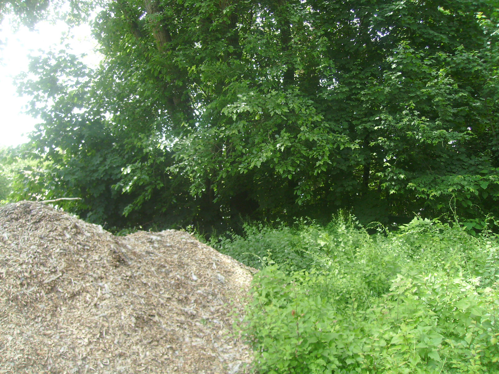
 Carlton Hill station site in May 2010, 46 years after the last passenger train serviced the station. The station site has become overgrown with trees
East Rutherford to Ho-Ho-Kus
In East Rutherford, County Route 507 turns to the northwest along Carlton Avenue, passing a mixture of residential and commercial residences as the route progresses westward. At the intersection with Locust Avenue, the highway turned northeastward along Locust, intersecting with County Route 14 (Paterson Avenue) in East Rutherford. County Route 507 continues northward, passing local residences for several blocks, until reaching an intersection with Main Avenue near the Passaic River. Locust Avenue crosses the Passaic locally-maintained while County Route 507 turns eastward and heads along Main Avenue, which parallels the Passaic. At a fork, the highway turns to the northwest along Midland Avenue while Main Avenue becomes County Route 61. The highway continues northward along Midland, passing local factories and intersects with River Drive, where County Route 507 turns westward along River while Midland Avenue continues northward as County Route 67. County Route 507 continues westward alongside the Passaic River as a two-lane boulevard through now the city of Garfield. The residences soon dissipate, leaving way for commercial businesses and soon intersecting with County Route 42 (Outwater Lane). However, County Route 507 continues northwestward alongside the Passaic, passing a local waterfall and local residences as it gradually turns northward, crossing under the Garden State Parkway soon after. A short distance from the Parkway, the highway enters a partial cloverleaf interchange with U.S. Route 46, where County Route 507 enters a large commercial district just south of Interstate 80. Interstate 80 interchanges with Route 507 and continues northward, crossing the main line of the New York, Susquehanna and Western Railroad near Summit Avenue. The highway continues northwestward as a mix of residential and commercial businesses partially interchanging with New Jersey Route 4 in now Elmwood Park. County Route 507 continues northward along River Drive, weaving its way through many residences and soon a local church. Near the intersection with Berdan Avenue, the commercial district returns to Route 507.[2]
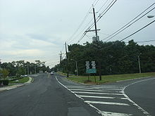 County Route 507 at the interchange with Route 208 in Fair Lawn
The route continues northward, passing through Fair Lawn as a four-lane boulevard with businesses and industry paralleling. At an intersection with County Route 77 (Maple Avenue), County Route 507 turns eastward along Maple, following a long stretch of businesses as it progresses northward. Soon after, the highway parallels Fair Lawn Cemetery and Terrace Park before interchanging with New Jersey Route 208 on a partial cloverleaf interchange. South Maple Avenue continues northward as a residential highway, turning from the north to the northeast into the community of Glen Rock, where it crosses New Jersey Transit's Bergen County Line. In Glen Rock, County Route 507 intersects with County Route 134 (Rock Road), which provides access to both of Glen Rock's train stations, nearby Glen Rock-Boro Hall and the Main Line station a short distance further. South Maple Avenue continues northward through the residential districts of Glen Rock, intersecting soon with County Route 79 (Ackerman Avenue). After turning northeastward once again, County Route 507 intersects with County Route S-79 (Prospect Street) and through a largely residential portion of now Ridgewood. The route the enters downtown Ridgewood, intersecting with County Route 80 for a short distance, which turns westward on Franklin Avenue soon after. In downtown Ridgewood, County Route 507 passes the local high school, the Veterans Memorial Park and Graydon Park before intersecting with County Route 110 (Linwood Avenue) soon after. County Route 507, now known as North Maple Avenue, continues northward, paralleling a nearby brook past an intersection with County Route 82. After curving to the northeast at Undercliff Court, the highway continues north through Ridgewood until crossing 1st Street, where it enters the town of Ho-Ho-Kus. In Ho-Ho-Kus, County Route 507 passes through downtown, soon intersecting with County Route 77 (Sheridan Avenue) and County Route 62 (Franklin Turnpike). Route 507 turns westward along the Franklin Turnpike, providing County Route 62's western terminus, paralleling Ho-Ho-Kus Brook and providing access to Ho-Ho-Kus train station by way of Warren Avenue. Soon after, County Route 507 intersects with County Route 502 (Hollywood Avenue) and becomes concurrent.[2]
Waldwick to Mahwah
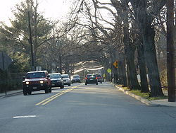 County Route 502 in Ho-Ho-Kus as Hollywood Avenue, approaching the intersection with County Route 507
County Route 507 and County Route 502 continue through Ho-Ho-Kus as a two-lane residential highway along the Franklin Turnpike. They soon pass a local cemetery and enter the downtown of Waldwick, where County Route 502 forks to the west via Wyckoff Avenue. County Route 507 continues northward along Franklin Turnpike, heading through downtown Waldwick as a four-lane arterial, passing east of the local train station. The highway turns to the northwest once again, returning to the residential surroundings until crossing into Allendale near Mackay Avenue, where it becomes commercial once again. County Route 507, a two-lane local street, soon intersects with County Route 101 (Orchard Street) in Allendale, and after crossing local parkland, intersects with County Route 90 (Allendale Avenue). County Route 507 continues northward along the Franklin Turnpike through a wooded residential district, which soon dissipates to mostly forestry on the northbound side until County Route 81 (Crescent Avenue), where it becomes residential once again. At the intersection with Arlton Avenue, County Route 507 crosses northward from Allendale and into the borough of Ramsey. Soon after, the Franklin Turnpike continues northward near Wyckoff Lake and the residential homes nearby. As the highway enters downtown Ramsey, County Route 507 intersects with County Route 87 (East Main Street) and County Route S-81 (Lake Street) and soon after County Route 83 (Airmount Avenue) through a large commercial/residential mix area. The highway continues northward through a now largely residential district, intersecting with New Jersey Route 17 southbound and soon crossing over a two-lane bridge, which soon intersects with Route 17 northbound. County Route 507 continues northward along the Franklin Turnpike through the northern reaches of Ramsey, intersecting with Spring Street. The highway becomes commercial once again, intersecting with Orchard Street, where the route crosses the borough line into Mahwah.[2]
 CR 507's first southbound reassurance shield after its intersection with US 202 just mere feet south of the NY/NJ state line
In Mahwah, County Route 507 continues northwestward along the Franklin Turnpike, passing a large industrial district and nearby local residences. The road passes east of some local residential complexes, intersecting with County Route 100 (Ramapo Avenue) in downtown Mahwah. Ramapo Avenue heads westward to the Mahwah train station and the business district. County Route 507 continues northward, paralleling its own business district and soon paralleling the Main Line, maintained by New Jersey Transit. The final stretch of the Franklin Turnpike is mostly commercial, passing several local businesses and intersecting with U.S. Route 202 just south of the state border. This provides the northern terminus of County Route 507 and the Franklin Turnpike continues for a short 0.03 miles (0.048 km) long stretch to the New York state line in Mahwah.[2]
History
Originally, the Franklin Turnpike went from Mahwah through Waldwick, but an extension (through Ho-Ho-Kus) was later built in 1936 to connect with NJ 2 (today's Route 17.)
Major intersections
County Location Mile[1] Destinations Notes Hudson Harrison 0.00 CR 508 (Harrison Avenue)Southern terminus Kearny 2.21 Route 7 eastSouth end of NJ 7 overlap 2.73 Route 17 north (Ridge Road)3.22 Route 7 westNorth end of NJ 7 overlap Bergen Rutherford 6.28  Route 3
Interchange Elmwood Park 12.19 US 46Interchange 12.70 I-80I-80 exit 61 14.03  Route 4
Interchange Fair Lawn 16.69  Route 208
Interchange Ho-Ho-Kus 20.76  CR 502 east (Hollywood Avenue)
South end of CR 502 overlap Waldwick 21.35 CR 502 west (Wyckoff Avenue)North end of CR 502 overlap Ramsey 25.64 Route 17Interchange Mahwah 28.34 US 202 southSouth end of US 202 overlap 28.37 US 202 east (Orange Avenue)New York border, northern terminus 1.000 mi = 1.609 km; 1.000 km = 0.621 mi See also
 U.S. Roads portal
 New Jersey portal
References
- ^ a b NJDOT County Route 507 Straight Line Diagram from the New Jersey Department of Transportation
- ^ a b c d e f g Microsoft. Map of Overview map of County Route 507 – Bing Maps (Map). Cartography by NavTEQ, Inc. http://www.maps.bing.com/maps/?FORM=Z9LH9#JmNwPTQwLjkyNTUyNjEyMzQ5Mzg4fi03NC4xMTUxMjEzNjQ1OTM1Jmx2bD0xMCZzdHk9ciZydHA9cG9zLjQwLjc0ODM2MTY3OTAyMTc4NF8tNzQuMTQ1MjI0NDY2OTE5OV9uZWFyJTIwMyUyMFNjaHV5bGVyJTIwQXZlJTJDJTIwS2Vhcm55JTJDJTIwTkolMjAwNzAzMi01OTIxX19fYV9+cG9zLjQwLjc3ODAwMzE4NTk4NzQ3Xy03NC4xMzEwNzI0NjE2MDUwN183NjglMjBGb3Jlc3QlMjBTdCUyQyUyMEtlYXJueSUyQyUyME5KJTIwMDcwMzItMzgzNl9fX2FffnBvcy40MC43ODYwMTYyODU0MTk0NjRfLTc0LjE0NjM4MzE4MTIxNDMzXzElMjBSaXZlciUyMFJkJTJDJTIwTm9ydGglMjBBcmxpbmd0b24lMkMlMjBOSiUyMDA3MDMxLTYxMDFfX19hX35wb3MuNDAuODE5OTQ0ODg4MzUzMzVfLTc0LjEyNjkxNzA0OTI4ODc1XzEyMCUyMFJpdmVyc2lkZSUyMEF2ZSUyQyUyMEx5bmRodXJzdCUyQyUyME5KJTIwMDcwNzEtMTAxM19fX2FffnYuNDAuODM3NzM2NjUxMzAxMzg0Xy03NC4xMTY0Mzg5OTk3NzIwN19KYWNrc29uJTIwQXZlJTIwJTJGJTIwQ1ItNTA3fnBvcy40MC44NTQzNzc3NDY1ODIwM18tNzQuMTA5NzMwMTI0NDczNTdfMiUyMFN0cm9uZyUyMFN0JTJDJTIwV2FsbGluZ3RvbiUyQyUyME5KJTIwMDcwNTctMTQxNV9fX2FffnBvcy40MC44NjM5OTE0NTQyNDM2Nl8tNzQuMTA2NDIwMjc4NTQ5Ml8xMDUlMjBSaXZlciUyMERyJTJDJTIwR2FyZmllbGQlMkMlMjBOSiUyMDA3MDI2LTMxMTVfX19hX35wb3MuNDEuMTA3MTAwODQ0MzgzMjRfLTc0LjE0OTgyOTE0OTI0NjIyX19fX2FfJm1vZGU9RCZydG9wPTB+MH4wfg==. Retrieved June 4, 2010.
- ^ Yanosey, Robert J. (2006). Erie Railroad Facilities (In Color). Volume 1: New Jersey. Scotch Plains, New Jersey: Morning Sun Books Inc.. pp. 32–34. ISBN 1582481830.
External links
Categories:- County routes in New Jersey
- Transportation in Bergen County, New Jersey
- County Routes in Hudson County, New Jersey


Wikimedia Foundation. 2010.