- Main Line (NJ Transit)
-

Main Line
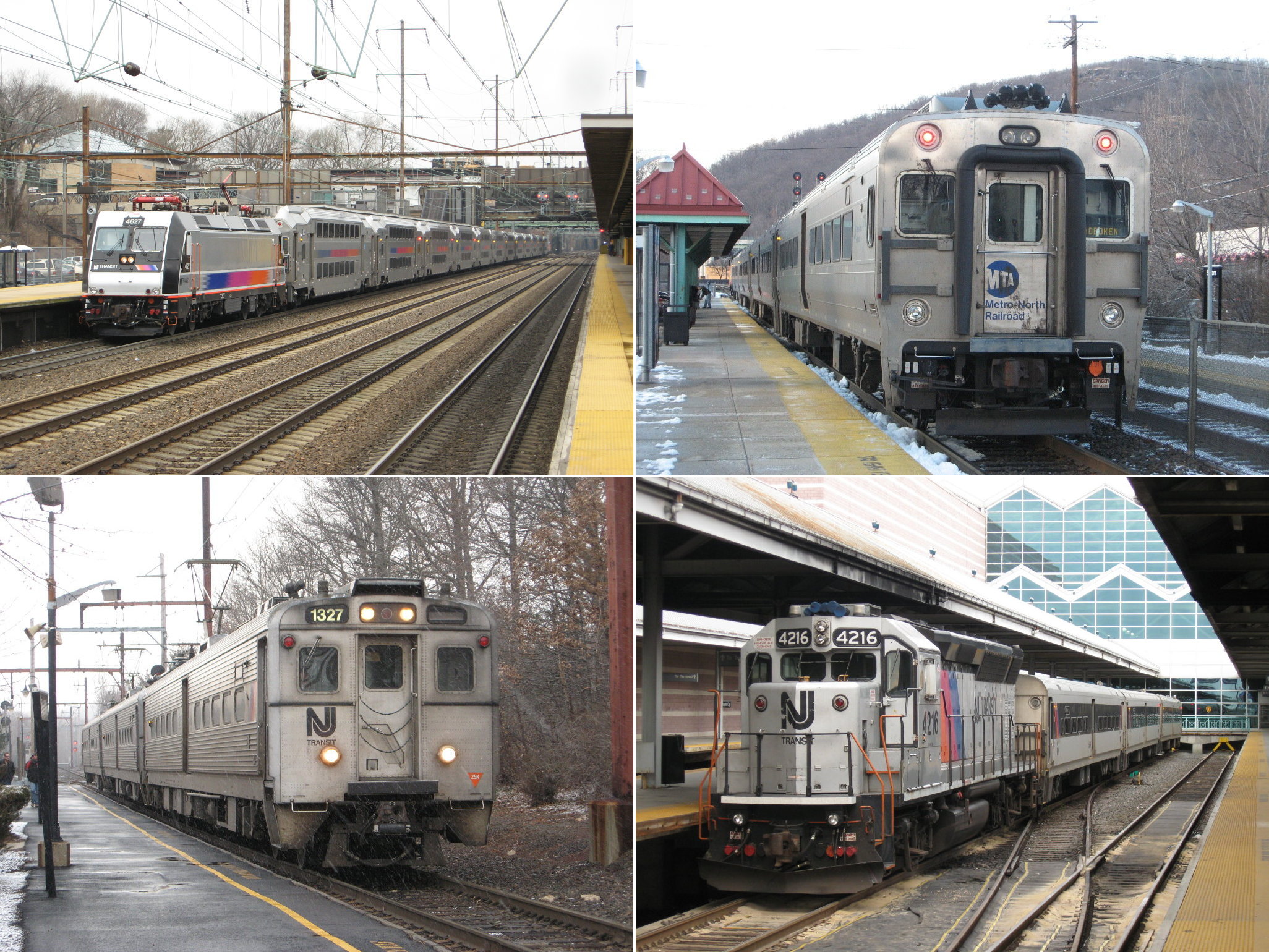
Main Line train #1728 sits at Suffern.Overview Type Commuter rail line System New Jersey Transit and Metro-North Railroad Locale North Jersey, Hudson Valley Termini Hoboken Terminal
SuffernStations 26 Daily ridership 9,160[1] Operation Owner New Jersey Transit Rail Operations Operator(s) New Jersey Transit Rail Operations Rolling stock F40PH-2CAT/GP40PH-2/GP40FH-2/PL42AC locomotives
Comet coachesTechnical Track length 152.9 km (95.0 mi) Track gauge 1,435 mm (4 ft 8 1⁄2 in) Route map Legend
Port Jervis Line to Port Jervis 
30.6 Hillburn Yard 


Former Erie Piermont Branch 
30.5 Suffern 
New York–New Jersey border 
29.1 Mahwah 
NJ 17 
Ramsey-Route 17 26.5 Ramsey-Main St. 24.6 Allendale 23.5 Waldwick Yard 23.2 Waldwick 22.1 Ho-Ho-Kus 20.9 Ridgewood 

20.2 Bergen County Line diverges at Ridgewood Jct 19.4 Glen Rock (Main Line) NJ 208 17.7 Hawthorne 

NYS&W 
Passaic River 
Paterson-River Street 15.6 Paterson Interstate 80 former Erie Main Line (closed 1963) South Paterson (1963-1980s) 

former Lackawana Boonton Branch (closed 1963) Garden State Parkway 
Newark Branch US 46 12.2 Clifton 10.6 Passaic 9.3 Delawanna NJ 3 
NJ 21 Passaic River 8.2 Lyndhurst NJ 17 7.6 Kingsland 
Harrison-Kingsland Branch 
Kingsland Tunnel NJ Turnpike Hackensack R. via Upper Hack Lift 
Bergen County Line rejoins NJ Turnpike 

Secaucus Junction 
Morris & Essex Lines Bergen Tunnels Hoboken Yard 


0.0 Hoboken Terminal 
Hudson River This route map:
The Main Line (or Erie Main Line) is a rail line owned and operated by New Jersey Transit running from Suffern, New York to Hoboken, New Jersey. It runs daily commuter service and was once the north-south main line of the Erie Lackawanna Railroad. It is colored yellow on NJ Transit system maps, and its symbol is a water wheel.[2]
The Bergen County Line splits off the Main Line just west of the Secaucus Junction transfer station and rejoins it at Ridgewood. Trains on both lines are push-pull, powered by diesel locomotives (ordinarily on the west end of the train).
Contents
History
The Erie Railroad's main line ran from Jersey City to Chicago via Binghamton, New York, Buffalo, Akron, Ohio, and Marion, Indiana, with a spur to Cleveland. The section in New Jersey and lower New York State saw frequent commuter service to the waterfront Pavonia Terminal with connections to the Pavonia Ferry to Lower Manhattan.
In 1963, the Erie Main Line south of Paterson to its connection with the Bergen County Line at Carlton Hill in Rutherford was abandoned and service began using the former Lackawanna Boonton Branch south of Paterson via Lyndhurst and the Upper Hack Lift bridge as the route through downtown Passaic was abandoned. Boonton Line service began using the Erie's Greenwood Lake division up to its junction the Lackawanna Boonton Branch at Mountain View in Wayne as the Lackawanna right-of-way in Paterson was used for the construction of Interstate 80. The Erie Jersey City terminal was abandoned circa 1959 after all Erie service had moved to the Lackawanna Hoboken Terminal.
Service under Erie Lackawanna introduced new GE U34CH diesels and Comet I cars in 1970 which lasted under NJ DOT and Conrail into the NJ Transit era. Metro-North took over service north of Suffern in 1983. Service was increased along with the opening of the Secaucus Transfer Station in late 2003.
Route guide
Departing the historic (1907) Hoboken Terminal, the yards for the coaches to the left. Trains pass over two city streets and the Hudson Bergen Light Rail before entering the Bergen Tunnels under the Bergen Hill section of Hudson Palisades. Midway through the tunnel there are air shafts allowing light through and venting out the diesel fumes. Exiting the tunnel, the train curves right onto the Main Line at West End interlocking in Jersey City. Until 1963 this was the DL&W Boonton Branch; about a mile ahead was the connection built circa 1956 with the Erie main line (that after 1963 became the Bergen County Line). Two trains collided head-on here in 1996, killing two engineers and a passenger. New Jersey Turnpike Interchange 15X is now on the Erie alignment, since in 2003 the Bergen County line was rerouted parallel to the Main Line to pass through Secaucus Junction.
At Secaucus Junction all trains stop for passengers to change to and from Northeast Corridor Line and North Jersey Coast Line trains on the upper level.
The Main Line then runs through an industrial section of Secaucus. Shortly afterwards the Bergen Line curves right on its new connection to the Erie alignment. The Main Line then crosses over the Hackensack River on the single-track Upper Hack Lift bridge, built in 1958.
Double track resumes under the New Jersey Turnpike's western spur after 0.4 mile of single track. The train continues through the Meadowlands and passes the first grade crossing at Valley Brook Avenue in Lyndhurst. The line curves slightly and passes through the 1903 Kingsland tunnel. Kingsland station is shortly after the tunnel in an open cut. Just beyond Kingsland station is Lyndhurst station, on an embankment.
After Lyndhurst the train crosses the Passaic River on a swing bridge that has been bolted shut, although it is required by Federal regulation to be opened on 24 hours notice.[3] The train passes under Route 3 and approaches Delawanna station.
Next stop is Passaic, on an embankment. After Passaic, the Main Line has a stretch through some industrial areas before the Clifton station, also on an embankment.
The Main Line passes under U.S. Route 46 and the Garden State Parkway before it crosses under and over several streets in south Paterson. It leaves the DL&W Boonton Branch alignment at about 40°53′10″N 74°10′01″W / 40.886°N 74.167°W and reaches the Erie Main Line alignment at 40°54′18″N 74°09′50″W / 40.905°N 74.164°W. This connection was single track when built circa 1963, then double-tracked in a rehabilitation project in 2002. The line passes under Interstate 80 and heads into downtown Paterson. The Erie station in Paterson is elevated, with a center platform.
Continuing north the Main Line is elevated through Paterson, passing over streets. After several grade crossings in an industrial area, the tracks cross the Passaic River on a truss bridge. Hawthorne is the next stop, at grade level. After a long stretch, the train reaches Glen Rock station, at grade level at a crossing.
After Glen Rock the Main Line merges with the Bergen County Line at Ridgewood Junction. The line widens to three tracks (in Erie days the line was four tracks from here to Suffern NY). Ridgewood station is next, with Spanish-style design on the station building and platforms. (Fall 2010: High level platforms are being built at Ridgewood Station).
Next is Ho-Ho-Kus, also at grade. Waldwick follows with an abandoned station building on the northbound side and a footbridge connecting the two platforms. Waldwick Yard is just north of the station with the restored WC tower on the southbound side by the yard. Just following Waldwick Yard is a grade crossing. North of the grade crossing (which has three tracks) the line becomes two tracks.
Allendale and Ramsey follow, both as grade-level stations. Ramsey-Route 17 station (opened August 22, 2004) is next. It is a park-and-ride facility located off of Route 17 South in Ramsey.
Mahwah follows and is the last station in New Jersey. Crossing over the New York state line the train arrives at Suffern, the last stop. Some trains continue via Metro-North's Port Jervis Line to the north end of passenger operations at Port Jervis. The yards are just to the north, under the New York State Thruway overpass.
Rolling stock
All trains on the Main Line are push-pulled by diesel locomotives. Coaches used are from the Comet series, and often feature Metro-North owned Comet Vs as these are pooled with New Jersey Transit's coaches as part of the operating agreement.
References
- ^ NJT boarding data Berkeley Retrieved 2008-07-13
- ^ Official Map
- ^ Title 33, Code of Federal Regulations, section 117.739
External links
New Jersey Transit Rail Operations Hoboken Division 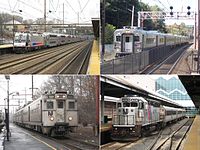
Newark Division Proposed Lackawanna Cut-Off • MOM • Northern Branch • Passaic-Bergen Rail Line • West Trenton Line • Access to the Region's Core (canceled)Connections Aldene Connection • Lehigh Line Connection (owned by Amtrak) • Kearny Connection • Montclair Connection • Secaucus Junction • Waterfront ConnectionOther information Stations • ALP-44 • ALP-46 • PL42AC • ALP-45DP • U34CH • Comet coaches • Comet V • MultiLevel coaches • Retired fleetCategories:- New Jersey Transit Rail Operations
- Rail infrastructure in New Jersey
- Transportation in Bergen County, New Jersey
- Transportation in Rockland County, New York

Wikimedia Foundation. 2010.