- Bergen County Line
Infobox rail line
name = rail color box|system=NJT|line=Bergen County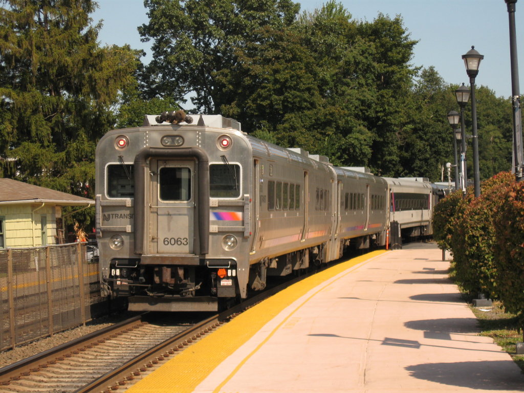
image_width = 250px
caption = Train #1253 departs Glen Rock-Boro Hall.
type = Commuter rail line
system = New Jersey Transit andMetro-North Railroad
status =
locale = North Jersey,Hudson Valley
start =Hoboken Terminal
end = Port Jervis
stations = 24
routes =
ridership = 4,305 [https://webfiles.berkeley.edu/~lensovet/njtboardingdata.htm NJT boarding data] "Berkeley" Retrieved2008-07-13 ]
open =
close =
owner = New Jersey Transit
(Hoboken Terminal to Suffern)Norfolk Southern Railway
(Suffern to Port Jervis, leased to and maintained byMetro-North Railroad )
operator = New Jersey Transit
character =
stock = F40PH-2CAT/GP40PH-2/GP40FH-2/PL42AC locomotives
Comet coaches
linelength =
tracklength = 152.9 km (95.0 miles)
notrack =
gauge = RailGauge|sg
el =
speed =
elevation =
infobox rdt|NJTransit-Bergen-infoboxThe Bergen County Line (or Bergen Line) is a
commuter rail line and service owned and operated byNew Jersey Transit in theU.S. state ofNew Jersey . The line loops off the Main Line between the Meadowlands and Glen Rock, with trains continuing in either direction along the Main Line. The junction there is in Ridgewood, and named Ridgewood Jct. or to the railroad WJ. There on railroad west to Waldwick there is a three track mainline until it goes back into two tracks toSuffern, New York . Like on the Main Line, the equipment used on this line isdiesel equipment operated in a push-pull fashion. Some trains ofMetro-North Railroad 'sPort Jervis Line also operate over the line. TheNorfolk Southern Railway provides freight service along the line viatrackage rights .Peak trains arrive in Hoboken on weekdays between 7:09 am and 8:57 am; they leave Hoboken on weekdays between 4:29 pm and 6:24 pm. [http://www.njtransit.com/pdf/rail/r0020.pdf]
History
From a point in Secaucus, just south of the Hackensack River bridge near the former Harmon Cove station, to a point in East Rutherford north of the Rutherford station, the Bergen County Line uses the former
Erie Railroad Main Line. This portion was opened in 1833 by thePaterson and Hudson River Railroad [PDFlink| [http://www.prrths.com/Hagley/PRR1833%20June%2004.wd.pdf PRR Chronology, 1833] |61.1 KiB , June 2004 Edition] and leased by theNew York and Erie Rail Road in 1852. [PDFlink| [http://www.prrths.com/Hagley/PRR1852%20Mar%2005.pdf PRR Chronology, 1852] |83.5 KiB , March 2005 Edition] The rest of the line, from East Rutherford north to Glen Rock, opened in 1881 as theBergen County Railroad .Until the late 1950s, the Erie Bergen County Cutoff was a minor spur offering commuter service. In 1963 the Lackawanna
Boonton Line up to Paterson became the newErie Main Line . This was due to the abandonment of the Main Line section through downtown Passaic and also due the the factInterstate 80 construction used the old Boonton Line right-way in Paterson. The old Main Line up to Rutherford was now exclusively part of the Bergen Line.Prior to the opening of
Secaucus Junction in 2003, Bergen County Line trains used a longer stretch of old Erie Main Line in Secaucus, extending south toCroxton Yard and a merge with the former Lackawanna Boonton Line. A curving track was built between theHX Draw atHackensack River and the Main Line north of Secaucus Junction to allow Bergen County Line trains to use Secaucus Junction.Route guide
Approaching Secaucus Junction, a westbound train headed for the Bergen County Line will use the more northerly pair of tracks, designated G and H at the transfer. West of the transfer, these tracks diverge from the Main Line over a new right-of-way opened in 2003, connecting the Main Line with the Bergen County Line. During this stretch, the Hackensack River is to the left, while industrial plants on Meadowlands Parkway are to the right. A former station, Harmon Cove was located nearby along the old Erie right-of-way and opened between 1978 and 2003 to serve the high-rise apartments nearby.
Soon, the train joins the old Erie Main Line right-of-way and crosses the Hackensack over
HX Bridge , a two-track bascule draw. For the next two miles, the train crosses the Meadowlands, under theNew Jersey Turnpike western spur with theMeadowlands Sports Complex in East Rutherford visible in the distance to the right and a new development beginning to take shape in Rutherford, to the left. Here, the track parallelsBerrys Creek and eventually crosses it just before passing below Route 3.Beyond Route 3, the landscape changes to industrial. Office buildings line the side of the track, some serviced by sidings. The
Pascack Valley Line soon splits off to the right at Pascack Junction, and the train then crosses Route 17 and approaches the Rutherford station.For the next half-mile, the train passes residences on either side, but it then swings to the right, abandoning the old Erie Main Line, and again passes through industrial areas with several grade level crossings. Soon, the tracks form the border of Carlstadt and Wallington. Presently the train passes Wood-Ridge and South Hackensack before crossing the Saddle River into Garfield and coming to a stop at the Garfield station.
The train continues northward through Garfield, passing homes, businesses, and Dahnerts Lake County Park before reaching the Plauderville station at Midland Avenue, forming a border between Garfield and neighboring Saddle Brook. Shortly after passing beneath
U.S. Highway 46 , the track becomes the border of Saddle Brook and Elmwood Park, once again crossing Midland Avenue.Interstate 80 passes above the train, which then crosses theGarden State Parkway . The Broadway station in Fair Lawn straddles a border formed by the track and Route 4.In
Fair Lawn , the line is paralleled by Plaza Road, named for Radburn Plaza, the commercial area serving the Radburn development for which the borough's more northerly station is named. The line crosses below Route 208 before reaching Radburn. Beyond the station, the train passes housing to the right and industry to the left, with a spur to aNabisco plant. Next is the Glen Rock-Boro Hall station, like its Main Line counterpart, is on Rock Road. The lines merge a short distance north of this point at Ridgewood Junction.References
Wikimedia Foundation. 2010.