- Northern Cambria, Pennsylvania
-
Northern Cambria, Pennsylvania — Borough — 
 Northern Cambria, Pennsylvania
Coordinates: 40°39′21″N 78°46′46″W / 40.65583°N 78.77944°WCoordinates: 40°39′21″N 78°46′46″W / 40.65583°N 78.77944°W Country United States State Pennsylvania County Cambria Settled 1893 Incorporated 2000 Government – Type Borough Council – Mayor Carol Jarvis Area – Total 3.0 sq mi (7.8 km2) Elevation 1,594 ft (486 m) Population (2000) – Total 4,199 – Density 1,401.9/sq mi (541.3/km2) Time zone Eastern (EST) (UTC-5) – Summer (DST) EDT (UTC-4) Zip code 15714 Area code(s) 814 Northern Cambria is a borough in Cambria County, Pennsylvania, USA. It is part of the Johnstown, Pennsylvania Metropolitan Statistical Area. The population was 4,199 at the 2000 census.
The Borough of Northern Cambria was incorporated on January 1, 2000. It was formed from the merger of two smaller municipalities, Barnesboro and Spangler. The area was first settled by Europeans in the early-to-middle 19th century. The presence of the West Branch of the Susquehanna River allowed loggers to move their harvest down stream. Small farms developed, but the area changed in the 1890s when mining of the extensive bituminous coal fields in the area became the dominant industry. The mining companies required skilled workers and many came from Great Britain and Eastern Europe. Railroads were built to transport the coal out and the town flourished with the influx of money. In the 1980s, the coal industry began a decline and there has been a subsequent decline in the population of the area. In November 1922, the Reilly Shaft No. 1 Mine Explosion occurred, killing 78 coal miners [1]
A pumpkin weighing 1,469 lb (666 kg) was grown by resident Larry Checkon in 2005 (a world record at that time).[2]
Contents
Geography
Northern Cambria is located at 40°39′21″N 78°46′46″W / 40.65583°N 78.77944°W (40.655813, -78.779472)[3].
According to the United States Census Bureau, the borough has a total area of 3.0 square miles (7.8 km2), all of it land.
Education
The local public school district is the Northern Cambria School District. The district has two schools located in the borough of Northern Cambria. The Northern Cambria Elementary/Middle School serves students in grades Pre-K to 8 while the Northern Cambria High School serves students in grades 9 to 12. Surrounding public school districts include:
- Cambria Heights School District
- Central Cambria School District
- Blacklick Valley School District
- Penns Manor School District
- Purchase Line School District
- Harmony Area School District
Students in grades K-8 can also attend a private Northern Cambria Catholic School in Nicktown. Some students in grades 9-12 attend a private school Bishop Carroll High School in Ebensburg.
Nearby colleges include Mount Aloysius College, Saint Francis University, Indiana University of Pennsylvania, University of Pittsburgh Johnstown, Penn State Altoona, and Pennsylvania Highlands Community College.
Demographics
As of the census[4] of 2000, there were 4,199 people, 1,763 households, and 1,191 families residing in the borough. The population density was 1,401.9 people per square mile (540.4/km²). There were 1,954 housing units at an average density of 652.4 per square mile (251.5/km²). The racial makeup of the borough was 99.31% White, 0.07% African American, 0.10% Native American, 0.24% Asian, 0.02% Pacific Islander, 0.10% from other races, and 0.17% from two or more races. Hispanic or Latino of any race were 0.31% of the population.
There were 1,763 households out of which 28.1% had children under the age of 18 living with them, 51.3% were married couples living together, 11.9% had a female householder with no husband present, and 32.4% were non-families. 29.3% of all households were made up of individuals and 17.7% had someone living alone who was 65 years of age or older. The average household size was 2.37 and the average family size was 2.92.
In the borough the population was spread out with 22.0% under the age of 18, 8.3% from 18 to 24, 26.0% from 25 to 44, 22.5% from 45 to 64, and 21.2% who were 65 years of age or older. The median age was 41 years. For every 100 females there were 89.8 males. For every 100 females age 18 and over, there were 86.0 males.
The median income for a household in the borough was $24,655, and the median income for a family was $29,917. Males had a median income of $27,214 versus $17,546 for females. The per capita income for the borough was $13,129. About 15.4% of families and 17.7% of the population were below the poverty line, including 29.1% of those under age 18 and 7.4% of those age 65 or over.
Media
Three daily newspapers cover the Northern Cambria borough: Altoona Mirror, Tribune-Democrat, and Indiana Gazette. In addition, The Star-Courier provides a weekly newspaper that is distributed each Thursday. 950 WNCC is the town's radio station since 1950. The local NBC affiliate is WJAC-6, the local CBS affiliate is WTAJ-10, the local ABC affiliate is WATM-23, and the local Fox affiliate is WWCP-8. Comcast is the cable provider for the borough.
Businesses
- Supermarkets: Giant Eagle, Bi-Lo
- Other Stores: Dollar General, Family Dollar, Charlson's Furniture, Valeria's Market, Nic's Tobacco, Party Express, Wojcik's Jewelers, Sherry Appliance, etc.
- Banks: AmeriServ Financial Bank, First National Bank, First Commonwealth Bank, CNB Bank
- Restaurants: Subway, Italian Village Pizza, Erma Jean's, Roland's Family Restaurant, Bonatesta's Pizza, Six-Pak Express, etc.
- Gas Stations: Sheetz, Sunoco
- Car and truck tire and mechanical service: Al's Tire (offers tire, auto repairs), Glinsky's Auto, Lowe's Garage,
References
- ^ Reilly Shaft Explosion, retrieved on December 11, 2008
- ^ Big Pumkins.com, retrieved on November 15, 2008
- ^ "US Gazetteer files: 2010, 2000, and 1990". United States Census Bureau. 2011-02-12. http://www.census.gov/geo/www/gazetteer/gazette.html. Retrieved 2011-04-23.
- ^ "American FactFinder". United States Census Bureau. http://factfinder.census.gov. Retrieved 2008-01-31.
External links
Municipalities and communities of Cambria County, Pennsylvania City 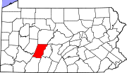
Boroughs Ashville | Brownstown | Carrolltown | Cassandra | Chest Springs | Cresson | Daisytown | Dale | East Conemaugh | Ebensburg | Ehrenfeld | Ferndale | Franklin | Gallitzin | Geistown | Hastings | Lilly | Lorain | Loretto | Nanty Glo | Northern Cambria | Patton | Portage | Sankertown | Scalp Level | South Fork | Southmont | Summerhill | Tunnelhill‡ | Vintondale | Westmont | Wilmore
Townships Adams | Allegheny | Barr | Blacklick | Cambria | Chest | Clearfield | Conemaugh | Cresson | Croyle | Dean | East Carroll | East Taylor | Elder | Gallitzin | Jackson | Lower Yoder | Middle Taylor | Munster | Portage | Reade | Richland | Stonycreek | Summerhill | Susquehanna | Upper Yoder | Washington | West Carroll | West Taylor | White
CDPs Unincorporated
communitiesFlinton | Kaylor | Mountaindale | Oil City | Revloc | Sidman | St. Michael
Footnotes ‡This populated place also has portions in an adjacent county or counties
Categories:- Populated places established in 1893
- Boroughs in Cambria County, Pennsylvania


Wikimedia Foundation. 2010.