- Laurel Ridge State Park
Geobox Protected Area
name = Laurel Ridge State Park
native_name =
other_name =
other_name1 =
category_local = Pennsylvania State Park
category_iucn = III
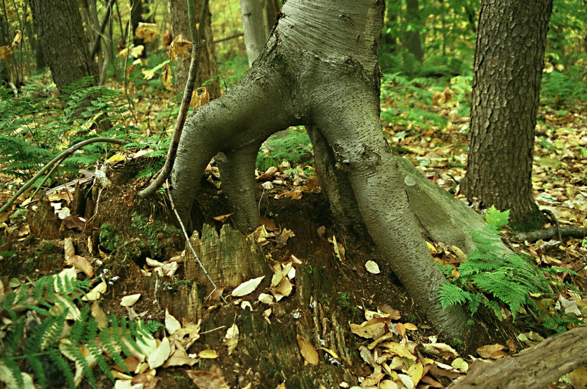
image_caption = One tree grows from the rotting stump of another at Laurel Ridge State Park
etymology_type = Named for
etymology = Laurel Hill
country = United States
state = Pennsylvania
region_type = Counties
region = Cambria
region1 = Fayette
region2 = Somerset
region3 = Westmoreland
district_type =
district =
city =
city1 =
location = Park Office
lat_d = 39
lat_m = 57
lat_s = 21
lat_NS = N
long_d = 79
long_m = 22
long_s = 08
long_EW = W
location_note =cite web
url=Gnis3|1209272
title=Laurel Ridge State Park
date =October 1 1992
work=Geographic Names Information System
publisher=United States Geological Survey
accessdate=2008-06-18]
elevation_imperial = 2759
elevation_round = 1
area_unit = acre
area_imperial = 13625
area_round = 1
area1_imperial =
area1_type =
length_imperial =
length_orientation =
width_imperial =
width_orientation =
highest_type = Northern terminus
highest =
highest_location = St. Clair Township
highest_lat_d = 40
highest_lat_m = 24
highest_lat_s = 48
highest_lat_NS = N
highest_long_d = 79
highest_long_m = 00
highest_long_s = 10
highest_long_EW = W
highest_elevation_imperial = 1310
lowest_type = Southern terminus
lowest =
lowest_location =
lowest_lat_d =
lowest_lat_m =
lowest_lat_s =
lowest_lat_NS = N
lowest_long_d =
lowest_long_m =
lowest_long_s =
lowest_long_EW = W
lowest_elevation_imperial =
biome =
biome_share =
biome1 =
biome1_share =
geology =
geology1 =
plant =
plant1 =
animal =
animal1 =
established_type =
established = 1967
established1_type =
established1 =
management_body = Pennsylvania Department of Conservation and Natural Resources
management_location =
management_lat_d =
management_lat_m =
management_lat_s =
management_lat_NS =
management_long_d =
management_long_m =
management_long_s =
management_long_EW =
management_elevation =
visitation =
visitation_year =
free_type = Nearest city
free =Somerset, Pennsylvania
free1_type =
free1 =

map_caption = Location of Laurel Ridge State Park in Pennsylvania
map_locator =
map_first =
website = [http://www.dcnr.state.pa.us/STATEPARKS/PARKS/laurelridge.aspx Laurel Ridge State Park]Laurel Ridge State Park is a convert|13625|acre|km2|2|adj=on Pennsylvania State Park that passes through Cambria, Fayette, Somerset, and Westmoreland counties,
Pennsylvania in the United States. The park is home to the convert|70|mi|1|adj=onLaurel Highlands Hiking Trail that runs through the park from theYoughiogheny River at Ohiopyle to theConemaugh Gorge near Johnstown. The park was approved by the governor onJuly 10 ,1967 , and construction started on the Laurel Highlands Hiking Trail onJuly 7 ,1970 .Laurel Highlands Hiking Trail
Laurel Highlands Hiking Trail is convert|70|mi|1 long, begins at
Ohiopyle State Park and ends at Conemaugh Gorge near Johnstown. The trail goes through state forests, state parks, state game lands, and some privately owned lands. Laurel Highlands Hiking Trail is open year round. The trail is marked with yellow blazes. Connector trails are marked with blue blazes. These trails connect the main trail with parking and shelter areas. The trail is marked with large wooden signs at every majorhighway crossing. Six parking lots at the highway crossings provide starting points; some have access to drinking water.cite web
url = http://www.dcnr.state.pa.us/stateparks/parks/laurelridge.aspx
title = Laurel Ridge State Park
accessdate = 2006-12-02
publisher =Pennsylvania Department of Conservation and Natural Resources ]helter areas
There are eight overnight shelter areas on the Laurel Highlands Hiking Trail. These shelter areas are located about every convert|6|mi|0 to convert|10|mi|0 along the trail. The shelter areas each have five Adirondack style shelters. There are two
outhouse s at the rest stops and a water supply. There is room for up to 30tent s at each stop. Firewood is provided. Hikers using the shelters are required to make reservations for use of the shelters with the park staff before setting out on their hike. A fee is charged to users of the shelters.Course
The Laurel Highlands Hiking Trail mileage starts from the southern trailhead in Ohiopyle State Park. The trail runs east through the park and parallel to the
Youghiogheny River within Stewart Township in Fayette County for the first convert|6|mi|1.cite map |scale = 1:65,000| publisher= Pennsylvania Department of Transportation, Bureau of Planning and Research, Geographic Information Division | url= ftp://ftp.dot.state.pa.us/public/pdf/BPR_pdf_files/Maps/GHS/Roadnames/fayette_GHSN.PDF | title= 2007 General Highway Map Fayette County Pennsylvania | accessdate= 2006-07-27 "Note: shows Laurel Ridge State Park"] Just past mile 6 the trail comes to the first overnight shelter area (with potable water), where it turns northeast.cite map |scale = 1 inch = 1.3 miles | publisher= Pennsylvania Department of Transportation, Bureau of Planning and Research, Geographic Information Division | url= http://www.dcnr.state.pa.us/stateparks/parks/maps/laurelridgesouth_mini.pdf | title= Laurel Ridge State Park (south park map) | accessdate= 2007-11-12 "Note: shows Laurel Highlands Hiking Trail"] At 7 miles (11 km) the trail leaves the park and Fayette County, and enters Lower Turkeyfoot Township in Somerset County andPennsylvania State Game Lands No. 111. cite map |scale = 1:65,000| publisher= Pennsylvania Department of Transportation, Bureau of Planning and Research, Geographic Information Division | url= ftp://ftp.dot.state.pa.us/public/pdf/BPR_pdf_files/Maps/GHS/Roadnames/somerset_GHSN.PDF | title= 2007 General Highway Map Somerset County Pennsylvania | accessdate= 2006-07-27 "Note: shows small tracts of Laurel Ridge State Park not shown on the DCNR trail map" ] Just before 15 miles (24 km), the trail enters Laurel Ridge State Park for the first time, where it continues northeast. Just past 17 miles (27 km) the trail turns north, and crosses back into Fayette County (now Springfield Township), where the second overnight shelter with potable water is found.The trail runs generally northeast and passes the Laurel Ridge State Park office near convert|19|mi|0, enters Saltlick Township, Fayette County at about convert|23|mi|0, then leaves the park and enters
Forbes State Forest just before convert|24|mi|0. Shortly after this the trail returns to Somerset County (Middlecreek Township) and passes the third overnight shelter area with potable water. Between convert|25|mi|0 and convert|26|mi|0 the trail follows the border between Laurel Ridge State Park and Forber State Forest, then leaves public land for private property. It crosses the borough of Seven Springs and runs just west ofSeven Springs Mountain Resort andLaurel Hill State Park . Just before convert|29|mi|0 the trail crosses into Donegal Township in Westmoreland County, and shortly after enters the state forest and then Laurel Ridge State Park again.cite map |scale = 1:65,000| publisher= Pennsylvania Department of Transportation, Bureau of Planning and Research, Geographic Information Division | url= ftp://ftp.dot.state.pa.us/public/pdf/BPR_pdf_files/Maps/GHS/Roadnames/westmoreland_GHSN.PDF | title= 2007 General Highway Map Westmoreland County Pennsylvania | accessdate= 2006-07-27 "Note: shows Laurel Ridge State Park" ] At about convert|31.5|mi|0, the trail crosses back into Somerset County (Jefferson Township), and just past convert|32|mi|0 passes the fourth overnight shelter area, with potable water. It runs west ofKooser State Park and continues for several miles just east of the county line, crossing thePennsylvania Turnpike (Interstate 70 /76) before convert|37|mi|0. This stretch of trail runs through the state forest and three separate small tracts of Laurel Ridge State Park.At convert|38|mi|0, the trail crosses from the state forest into Laurel Ridge State Park and Lincoln Township in Somerset County, then crosses briefly into Cook Township in Westmoreland County. cite map |scale = 1 inch = 1.3 miles| publisher= Pennsylvania Department of Transportation, Bureau of Planning and Research, Geographic Information Division | url= http://www.dcnr.state.pa.us/stateparks/parks/maps/laurelridgenorth_mini.pdf | title= Laurel Ridge State Park (north park map) | accessdate= 2007-11-12 "Note: shows Laurel Highlands Hiking Trail"] It crosses back into Somerset County and comes to the fifth overnight shelter with potable water, then reaches
Laurel Summit State Park at convert|39|mi|0. Continuing through the state forest, the trail crosses into Jenner Township in Somerset County just past convert|41|mi|0, and back into Laurel Ridge State Park at convert|43.5|mi|0, passing east of Linn Run and Laurel Mountain state parks along this section. The trail crossesU.S. Route 30 just before convert|46|mi|0 and reaches the sixth overnight shelter with potable water just after. It continues through the state park to convert|50|mi|0, then enters State Game Lands No. 42, then crosses into Ligonier Township in Westmoreland County. The trail leaves the Game Lands at convert|53|mi|0, travels through Laurel Ridge State Park for convert|1|mi|1, crosses back into the Game Lands, and into Jenner Township in Somerset County again. Just before convert|55|mi|0 the trail again passes through the state park where it enters Conemaugh Township in Somerset County, then enters private land at about convert|55.5|mi|0. The trail enters another tract of the state park before convert|57|mi|0, where it crossesPennsylvania Route 271 and the seventh overnight shelter with potable water is located. Just after this the trail enters State Game Lands No. 42, then at convert|57.5|mi|0 crosses into Upper Yoder Township in Cambria County.cite map |scale = 1:65,000| publisher= Pennsylvania Department of Transportation, Bureau of Planning and Research, Geographic Information Division | url= ftp://ftp.dot.state.pa.us/public/pdf/BPR_pdf_files/Maps/GHS/Roadnames/cambria_GHSN.PDF | title= 2007 General Highway Map Cambria County Pennsylvania | accessdate= 2006-07-27 "Note: shows Laurel Ridge State Park"] The trail continues through State Game Lands No. 42 and crosses back into Westmoreland County (Fairfield Township) just before convert|59|mi|0. At about convert|60|mi|0 the trail enters St. Clair Township in Westmoreland County, and between here and convert|62|mi|0 it crosses twice into Lower Yoder Township in Cambria County. It finally leaves the State Game Lands and enters Laurel Ridge State park for the final time before convert|63|mi|0, crossing back into Cambria County (Lower Yoder Township) shortly after that. The seventh and final overnight shelter with potable water is past convert|64|mi|0 and the trail continues northeast until just before convert|67|mi|0, where it turns north and then crosses into Westmoreland County (St. Clair Township). The trail now runs parallel to theConemaugh River with several vistas of the river valley, and finally ends at convert|70|mi|0.Other recreation
The park is also open to
hunting ,cross-country skiing and snow mobiling.Hunting is permitted on almost all of Laurel Ridge State Park. The most common game species are
ruffed grouse , turkey andwhite-tailed deer . The hunting ofgroundhog s is prohibited. Hunters are expected to follow the rules and regulations of thePennsylvania Game Commission .There are convert|35|mi|0 of trails open to cross-country skiing during the winter months at Laurel Ridge State Park and over convert|70|mi|0 of trails open to snow mobiles. [cite web
url = http://www.shol.com/featheredprop/lhht_info.htm
title = Laurel Highlands Hiking Trail informational page
accessdate = 2007-07-24]Nearby state parks
The following state parks are within convert|30|mi|0 of Laurel Ridge State Park:cite web
last = Michels
first = Chris
year = 1997
url = http://www2.nau.edu/~cvm/latlongdist.html
title = Latitude/Longitude Distance Calculation
publisher =Northern Arizona University
accessdate = 2008-04-23] [cite web
url = http://www.dcnr.state.pa.us/stateparks/parks/region_pittsburgh.aspx
title = Map Reference for Laurel Ridge State Park
accessdate = 2006-12-02
publisher = Pennsylvania Department of Conservation and Natural Resources]
*Blue Knob State Park (Bedford County)
*Keystone State Park (Westmoreland County)
*Kooser State Park (Somerset County)
*Laurel Hill State Park (Somerset County)
*Laurel Mountain State Park (Westmoreland County)
*Laurel Summit State Park (Westmoreland County)
*Linn Run State Park (Westmoreland County)
*Ohiopyle State Park (Fayette County)
*Yellow Creek State Park (Indiana County)References
External links
*
*
Wikimedia Foundation. 2010.